- Brief description
-
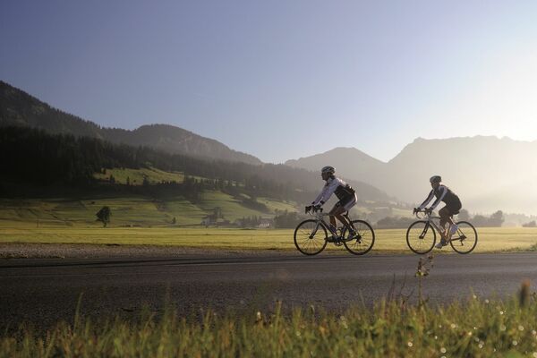
With about 1000 meters of altitude difference the tour is not completely "without". Enjoy the alpine touch around the Tannheimer Tal
- Difficulty
-
medium
- Rating
-
- Starting point
-
Tannheim
- Route
-
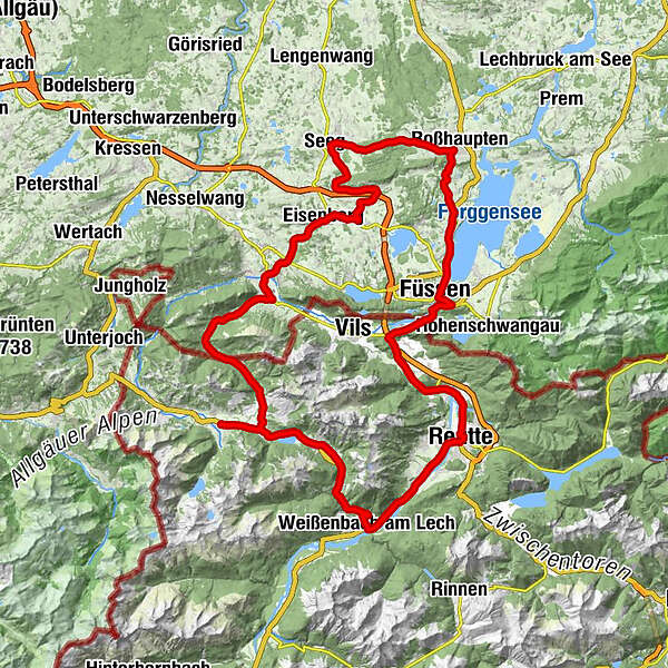
Tannheim (1,097 m)0.0 kmSt. Wendelin3.2 kmGrän (1,138 m)3.2 kmSt. Nepomuk-Kapelle3.9 kmLumberg4.4 kmMichaelskapelle4.5 kmWasserscheide Vils/Steinacher Achen (1145m)4.7 kmEnge5.0 kmSeealp7.2 kmSteinach15.6 kmSt. Koloman16.2 kmÖsch16.2 kmDorf16.6 kmSt. Leonhardskirche16.9 kmHeitlern17.0 kmPfronten17.2 kmRied17.4 kmZell21.0 kmEisenberg22.9 kmLandhotel Gockelwirt23.0 kmSpeiden23.4 kmOsterreuten23.9 kmWeizern-Hopferau24.2 kmOsterreuten24.4 kmHopferau25.3 kmSt. Martin25.3 kmSchlossrestaurant25.4 kmHeimen26.6 kmSieben Schmerzen Mariae26.7 kmLangegg28.1 kmUnterlangegg28.2 kmUnterhalden30.1 kmRoßfallen31.7 kmBerkmühle32.9 kmSeeg34.1 kmRied34.9 kmRiedegg35.1 kmSulzberg37.5 kmVordersulzberg38.8 kmLandhotel Haflingerhof38.9 kmZu den heiligen fünf Wunden46.7 kmGasthof Rössle46.8 kmRieden am Forggensee47.0 kmFilialkirche St. Urban47.9 kmAchmühle49.9 kmFeldkirche St. Ulrich und Afra51.2 kmFüssen (808 m)52.3 kmSt. Sebastian52.6 kmMagnusblick55.2 kmAbschied-Jesu-Kapelle55.4 kmUnsere Liebe Frau am Berg55.4 kmLechfall55.7 kmUnterpinswang58.5 kmRiedle60.9 kmMusau (821 m)61.1 kmLeite61.8 kmBrandstatt (842 m)62.5 kmHl. Antonius62.5 kmMariae Heimsuchung63.2 kmRoßschläg63.2 kmOberletzen64.4 kmChristus an der Geißelsäule (Ortskapelle)65.0 kmUnterletzen65.1 kmKappl65.3 kmKirche Hl. Drei Könige65.5 kmHotel - Gasthof zum Schwanen65.8 kmPflach (840 m)65.9 kmHüttenbichl66.4 kmMoschee67.4 kmEdelweis68.2 kmReutte in Tirol (850 m)68.4 kmReutte (853 m)68.9 kmLechaschauer Kirche69.9 kmLechaschau (846 m)70.2 kmBuchenort70.3 kmGraben71.3 kmPlatten71.6 kmSoyers Sennerland71.7 kmThermic Ranch72.1 kmHöfen (868 m)72.3 kmHornberg73.2 kmWeißenbach am Lech (885 m)77.4 kmDorfkirche77.5 kmRauth82.3 kmStegmühlkapelle82.4 kmGasthof Klausenstüberl82.4 kmMariahilf Kapelle83.4 kmNesselwängle (1,136 m)84.8 kmGasthof Köllenspitze85.0 kmPfarrkirche Mariä Himmelfahrt85.1 kmSchmitte86.1 kmSchmittekapelle86.3 kmHaller87.3 kmSt. Johannes87.4 kmVia Salina Hotel am See87.5 kmHaldensee89.2 kmSt. Jakobus89.2 kmTannheim (1,097 m)92.5 km
- Best season
-
JanFebMarAprMayJunJulAugSepOctNovDec
- Description
-
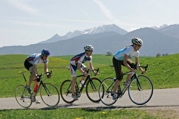
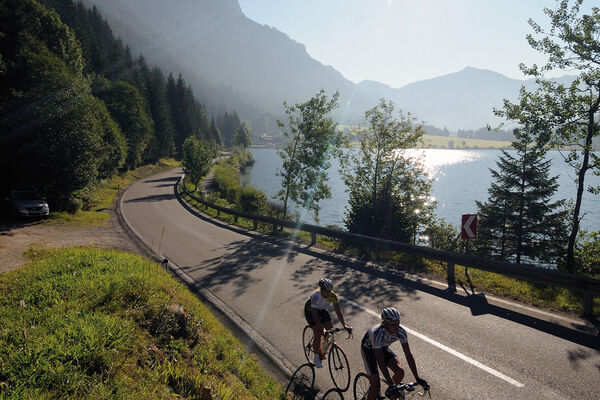
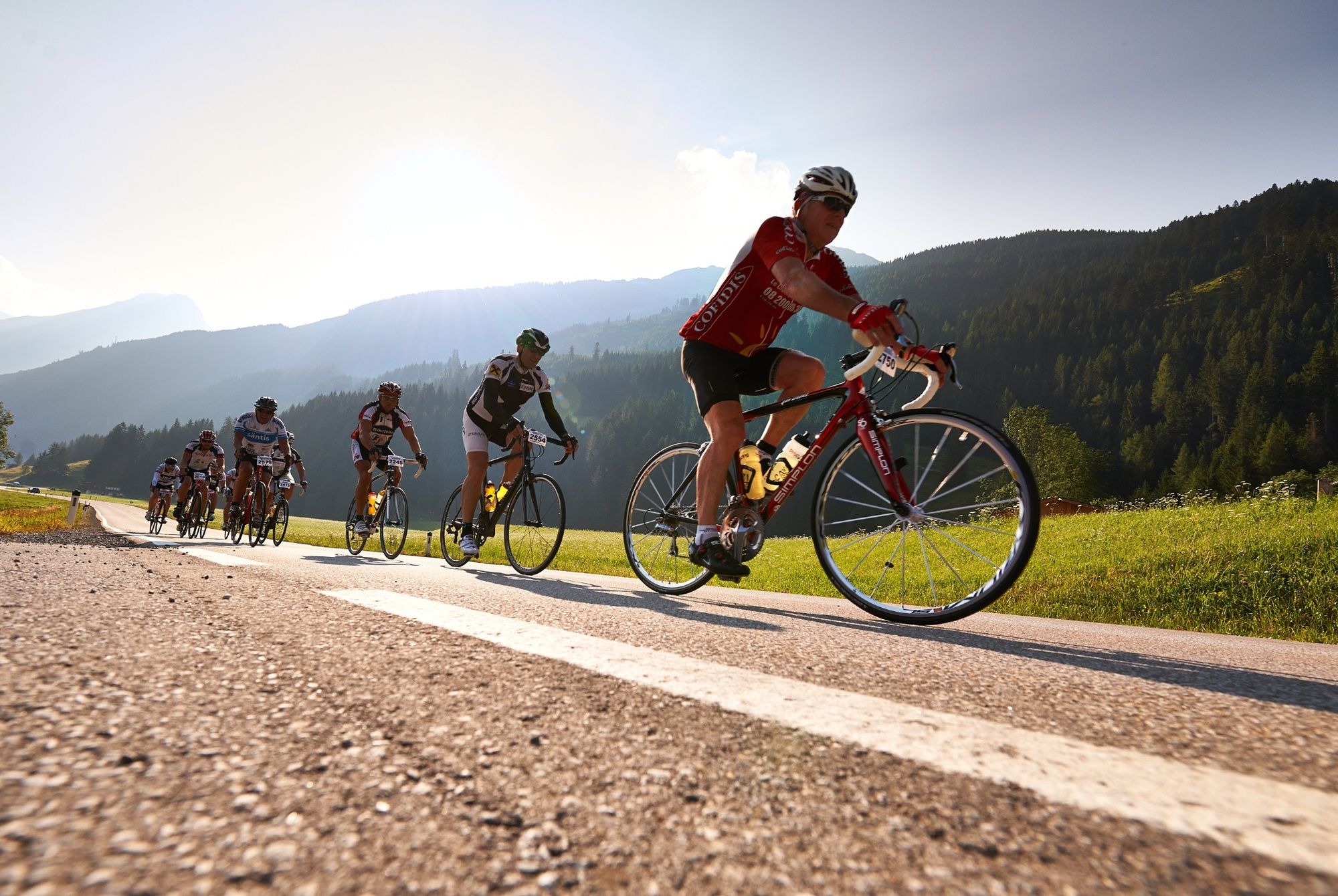
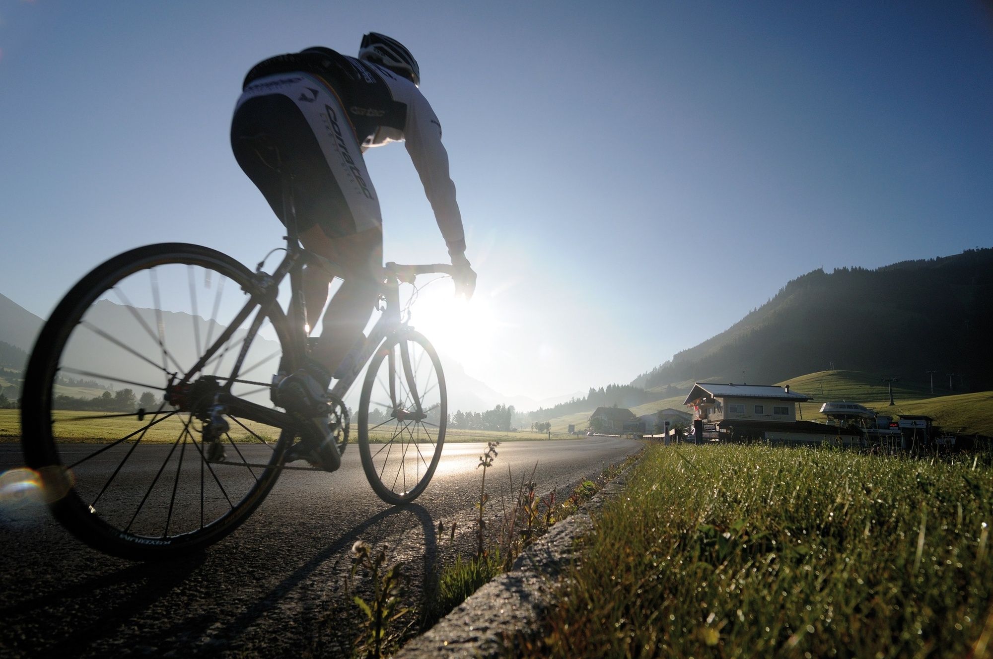
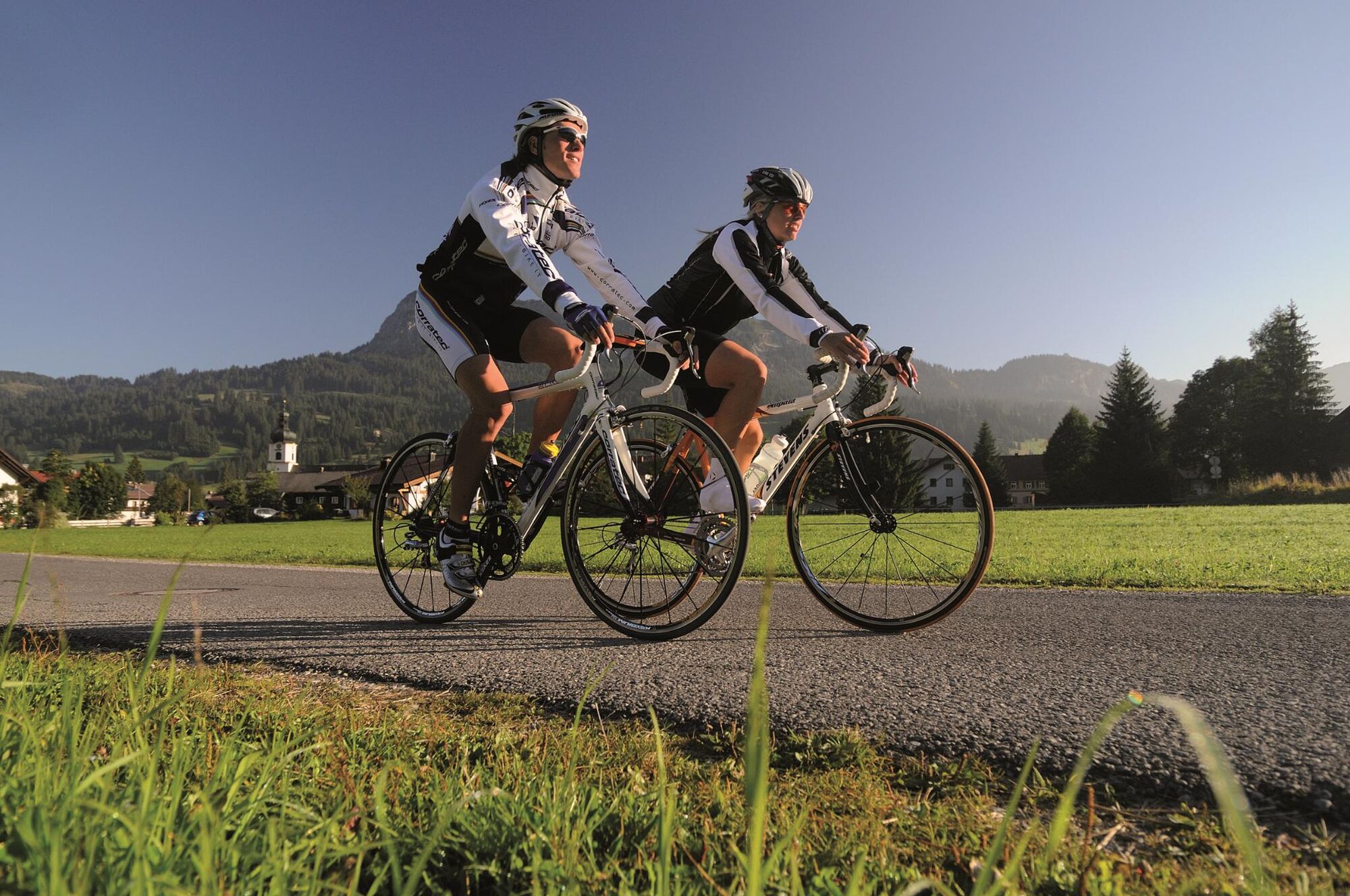
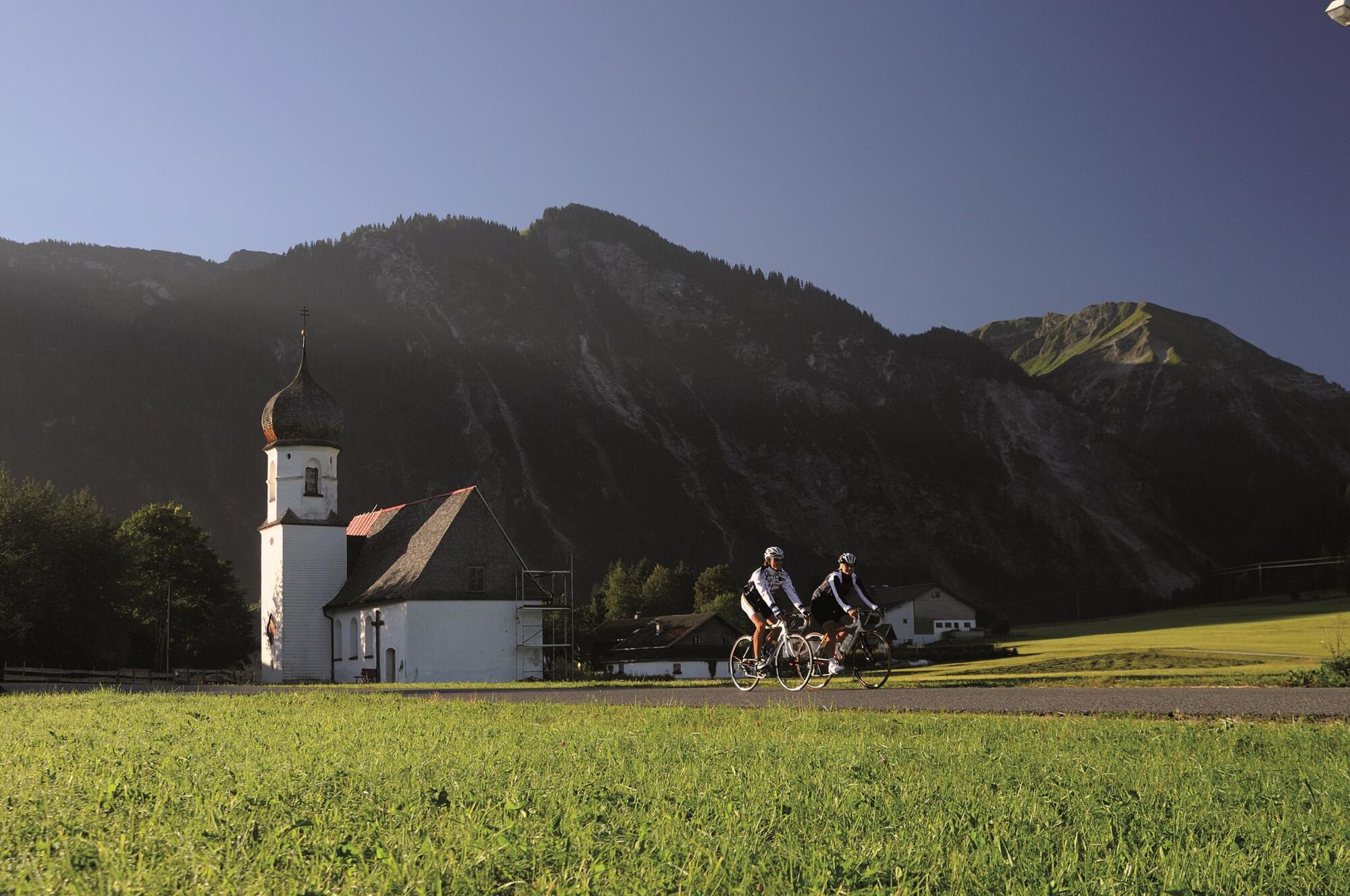
The Tannheimer Tal has been known among cyclists for quite some time, because in 2001 the retinue of the Tour of Austria Bicycle Tour went through the valley. In 2005 the cycling pros of the Tour of Bavaria came to Tyrolean soil at the opening stage and were rewarded with the mountain classification Tannheimer Tal and the mountain classification Jungholz. And even professionals noticed the scenic attractions of the "probably most beautiful high valley in Europe". Lush green meadows, the Haldensee and a beautiful mountain scenery accompanied the cycling pros on their competition kilometres. And thus the Tannheimer Tal has also advertised itself as an ideal region for targeted training or extended tours. "The Tannheimer Tal is an ideal starting point for long racing bike tours to the surrounding regions such as Lake Constance or the Arlberg", says Michael Keller, managing director of the tourism association Tannheimer Tal and former national mountain bike coach of Austria. Cyclists find in the Tannheimer Tal not only the ideal starting point but also a wide range of accommodation. You can choose your accommodation from a 5-star house to a private room. After a nice ride you can relax and recharge your batteries. - The Tannheimer Tal
- Directions
-
Start at the tourist information in Tannheim in eastern direction. At the crossing Grän/Haldensee turn left onto the L261 and through the Engetal valley to the former customs office Fallmühle down to Pfronten until the main road. Turn left and in the centre of the village after a 90 degree left turn turn right towards Füssen. Go straight on at the roundabout and follow the road to the end of Eisenberg. Turn right to Hopferau and in the center of Hopferau turn left to Heinen. In Heinen turn right and follow the road to Lanegg. Further past the well-known excursion destination Beichelstein to Seeg. In the centre of Seeg turn right to Roßhaupten. At the beginning of Roßhaupten turn right and follow the road to Rieden. In Rieden take the cycle path parallel to the main road and continue to the traffic light controlled intersection in the centre of Füssen. Turn left and follow the road. After the Lech bridge turn right and follow the signs to Vils. Straight ahead over the roundabout and after the railway crossing turn left and follow the road via Musau, Pflach to Reutte. Follow the road to the left in the direction of the railway station. At the roundabout take the first exit right, next roundabout straight on. At the main roundabout again straight on towards Lechtal, continue through Lechaschau and Höfen to Weissenbach. At the roundabout turn right into the Tannheimer Tal and back to the starting point
- Highest point
- 1,152 m
- Endpoint
-
Tannheim
- Height profile
-

- Equipment
-
The personal equipment must be safe and serviceable and meet the relevant technical standards. Every racing cyclist is recommended to obtain information about the planned tours from specialist literature or on site. Complete racing bike equipment is strongly recommended, even for experienced cyclists!
- Safety instructions
-
The StVO applies. General valid and customary rules of conduct.
It should be noted that in road cycling there is an increased risk of accidents and injuries. Despite careful tour planning, a basic risk always remains. Tour preparation through endurance sports, appropriate training and further education as well as personal prudence reduces the risk of accidents and injuries.
- Additional information
-
Tourismusverband Tannheimer Tal
Rennradfahren im Tannheimer Tal
- Directions
-
On the motorway A7 at the exit "Oy-Mittelberg" on the B310 towards Wertach and to Oberjoch. There follow the signposting "Tannheimer Tal" B199, exit Tannheim. From the Tyrolean side via Reutte on the B198 towards Lechtal until Weißenbach, over the Gaichtpass along the B199 until exit Tannheim.
- Public transportation
-
By train to Sonthofen, Pfronten/Ried or Reutte, then by bus to Tannheim.
- Parking
-
Parking spaces at the Neunerköpfle gondola lift in Tannheim - subject to charges

- Author
-
The tour Forggensee round is used by outdooractive.com provided.