
- Brief description
-
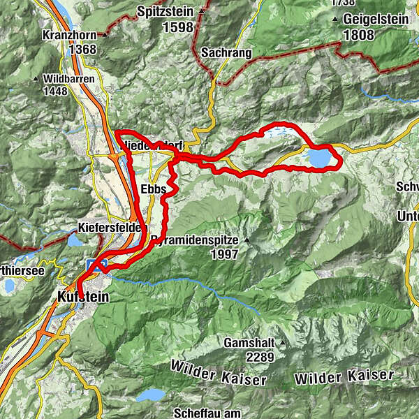
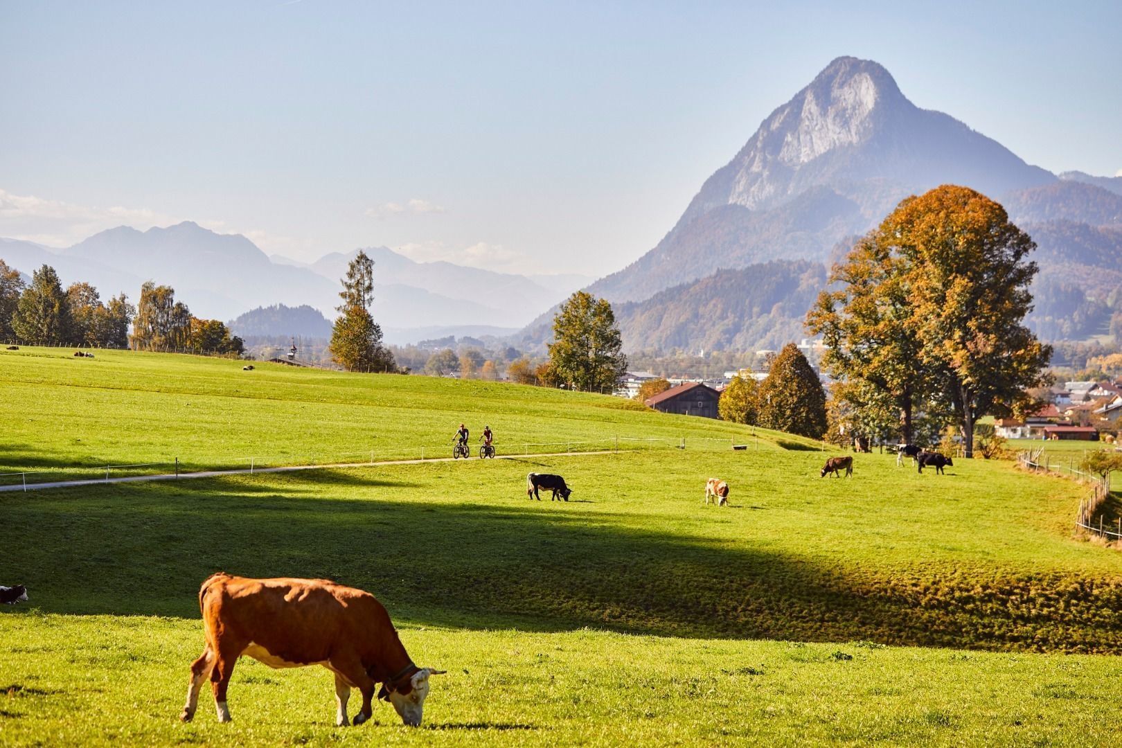
Those who would like to explore the Untere Schranne more closely, can take the extension past Lake Walchsee and the Schwemm Moorlands. The additional metres of elevation gain are rewarded by scenic eye-candy.
- Difficulty
-
medium
- Rating
-
- Starting point
-
Fischergries Kufstein
- Route
-
KufsteinEbbs8.5 kmMühltal10.4 kmWagrain-Mühltal10.4 kmWagrain10.7 kmPoint11.2 kmSebi11.9 kmBrand12.8 kmAsching14.4 kmBrandauerhof16.4 kmDurchholzen (690 m)16.5 kmKapelle Durchholzen16.8 kmLiftstüberl17.3 kmLiesfeld (686 m)17.5 kmAmberg18.0 kmBichl (705 m)18.6 kmOed (670 m)19.2 kmCafe am See19.7 kmWalchsee22.9 kmSchwaigs (664 m)25.0 kmGolf- u. Sporthotel Moarhof25.3 kmPötting (646 m)26.9 kmRettenschöss (685 m)27.2 kmBrand29.8 kmSebi30.6 kmGasthof Gradlwirt32.6 kmNiederndorf32.6 kmPfarrkirche St. Georg32.7 kmHölzelsau34.2 kmOberndorf39.8 kmFährstelle Ebbs41.8 kmKufstein45.4 km
- Best season
-
JanFebMarAprMayJunJulAugSepOctNovDec
- Description
-
For this extension, plan in about 1.5 hours more time and some additional climbs. Instead of beginning the return leg at Brand, turn to the right and follow the Kaiserwinkl cycle touring route onto Buchberg and Durchholzen. At the Amberglift, turn off to the right and cycle along idyllic trails all the way to beautiful Lake Walchsee. Circling the lake marks the turning point of the route. At Seehotel Brunner, join the main road to the left. It's only a couple of hundred metres until you'll get back onto quieter roads in the centre of Walchsee. The route leads past the Schwemm Moorlands and the Golfclub Walchsee-Moarhof. Further in a western direction, cycle steadily downhill along the Staudinger stream. Not far now, and the extension route rejoins the tour "Enjoyment in the Untere Schranne" again.
- Highest point
- 692 m
- Endpoint
-
Fischergries Kufstein
- Height profile
-

- Equipment
-
Cycling helmet, comfortable cycling clothing, change of clothes, wind protection, cycling gloves, possibly rucksack with water bottle and food, first aid equipment, possibly service/repair kit, cycling map, tour description and information material (GPX track), ID card, insurance card, cash
- Arrival
-
From the Inntal motorway A12, take the Kufstein Nord exit.
- Public transportation
-
Kufstein main railway station is only a few minutes' walk from the starting point.
- Parking
-
Kufstein centre
- Author
-
The tour A1 - Relaxed cycling to lake Walchsee is used by outdooractive.com provided.


-
Kufsteinerland
103
-
Ebbs
33