


- Brief description
-
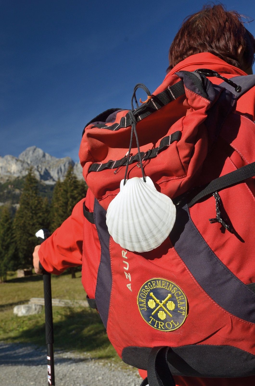
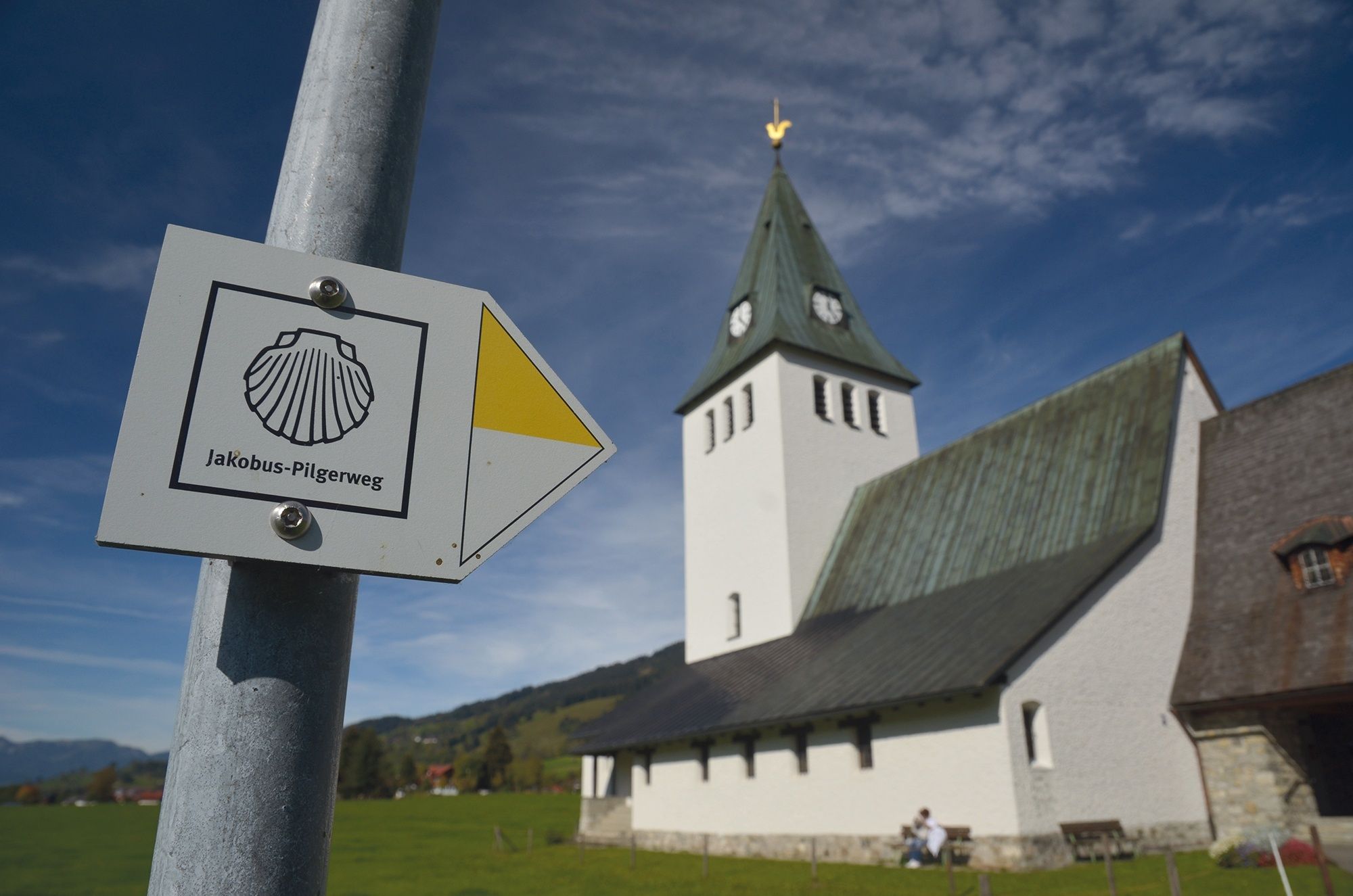
The Tyrol-Allgäu Way of St James
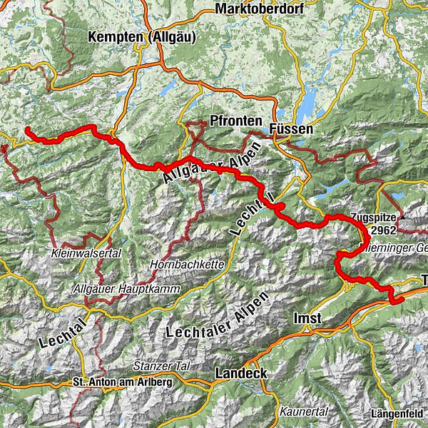
This Alpine Route of St. James, which is both scenically and culturally very attractive, leads off the main roads over three Alpine passes, namely the Fernpass, the old Gaichtpass and the Jochpass. It crosses some of the most attractive hiking and holiday regions of Tyrol and southern Upper Allgäu on ancient Roman, trade and pilgrim paths.
- Difficulty
-
medium
- Rating
-
- Starting point
-
Stams in the Inn Valley
- Route
-
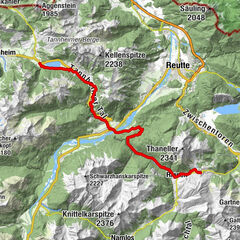
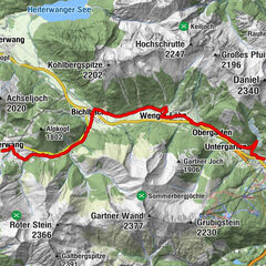
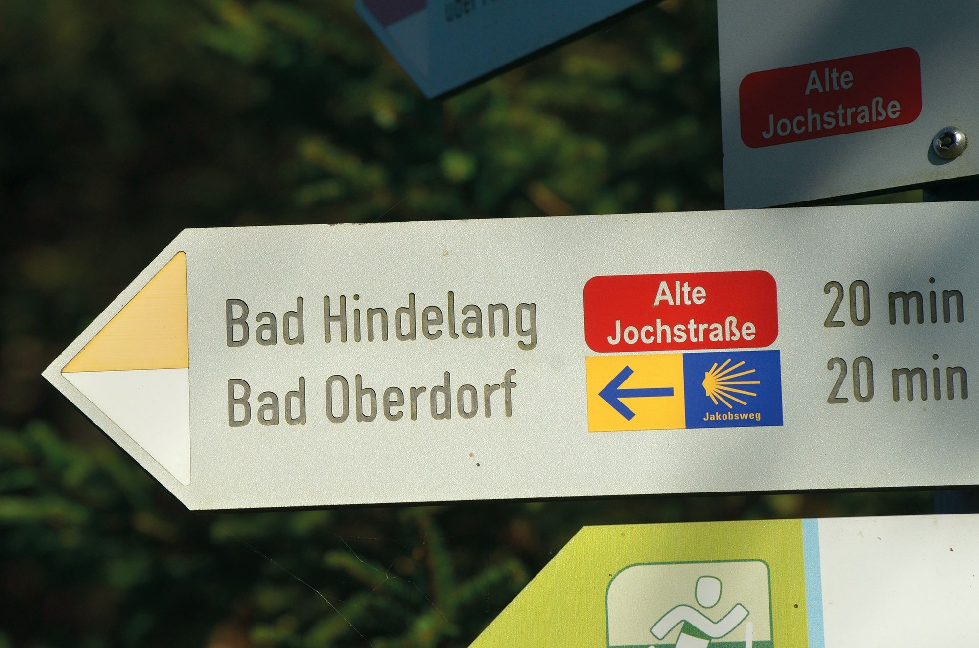
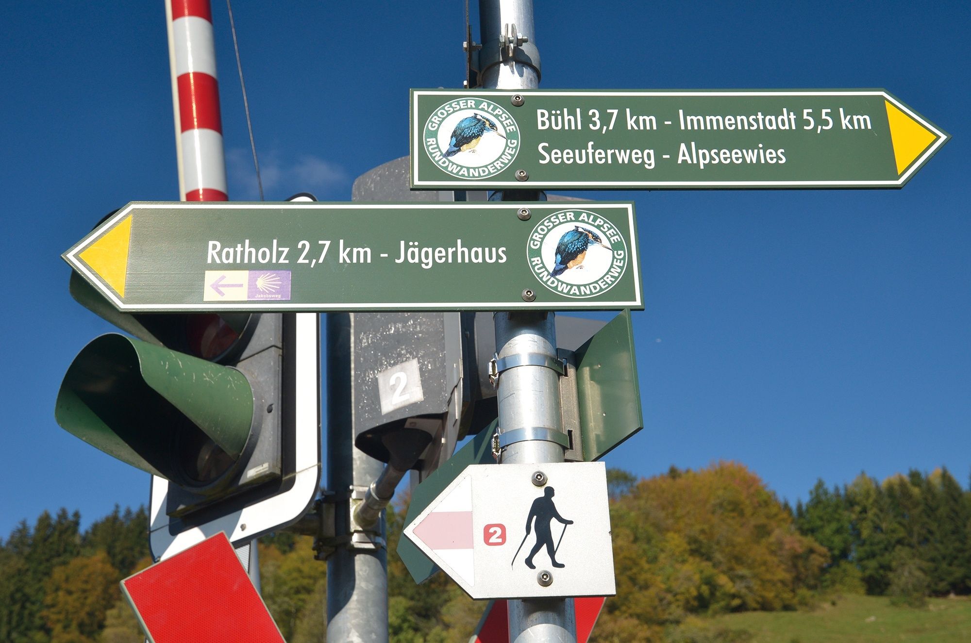
Orangerie Stift Stams0.0 kmStams (672 m)0.4 kmMötz (654 m)3.4 kmKlamm5.9 kmKlammer Mühle7.3 kmSt.Josef7.8 kmObsteig (991 m)7.9 kmSturl9.7 kmArzkasten10.6 kmGasthaus Arzkasten10.7 kmWeisland11.1 kmHolzleiten12.2 kmGasthof Panorama12.4 kmWiesenruh14.7 kmSeebua17.5 kmNassereith (838 m)17.8 kmVierzehn Nothelfer Kapelle22.2 kmBrabander Alm31.7 kmBiberwier (989 m)32.6 kmMösle-Kapelle32.7 kmPfarrkirche zum Heiligen Josef33.0 kmLermoos (1,004 m)35.1 kmHl.Kathrina35.3 kmLermoos (1,004 m)36.4 kmUntergarten38.6 kmObergarten39.3 kmDorfstüberl41.0 kmLähn41.1 kmWengle41.7 kmPfarrkirche St. Laurentius45.4 kmBichlbach (1,079 m)45.5 kmTal49.2 kmBerwang (1,342 m)50.2 kmKirche Berwang50.3 kmKaminstube Thanellerkar51.1 kmSankt-Sebastian Kapelle52.9 kmStadl Bräu52.9 kmRotlechwasserfall53.2 kmRinnen53.2 kmRieden62.0 kmKapelle zum hl. Georg62.0 kmGasthaus Kreuz62.1 kmWeißenbach am Lech (885 m)64.3 kmDorfkirche64.3 kmFriedhofskapelle64.6 kmUntergaicht65.9 kmGaichtkapelle66.1 kmWeidekapelle67.5 kmGasthof Gaichtspitze67.8 kmGaicht67.8 kmKapelle auf der Gaicht67.9 kmNesselwängle (1,136 m)71.1 kmKrinnenalpe71.3 kmSchmitte72.1 kmTauscher's Alm74.8 kmSt. Jakobus75.3 kmHaldensee75.4 kmGrän (1,138 m)76.7 kmSt. Wendelin76.9 kmInnergschwend78.8 kmSt. Martin78.9 kmBerg79.6 kmSt. Sebastian79.6 kmTannheim (1,097 m)80.8 kmSt. Leonhard82.1 kmUntergschwend82.6 kmZöblen (1,087 m)84.5 kmFricken85.5 kmSchattwald (1,072 m)85.7 kmPfarrkirche St. Wolfgang85.9 kmWies86.0 kmSteig87.2 kmKaminstube90.0 kmSpielplatz Oberjoch91.4 kmOberjoch91.5 kmBad Oberdorf95.1 kmSt. Jodokus95.1 kmPfarrkirche Johannes der Täufer96.7 kmBad Hindelang (825 m)96.8 kmSt. Sylvester98.1 kmGailenberg98.2 kmVorderhindelang99.5 kmReckenberg100.7 kmTiefenbach102.0 kmSt. Sebastian102.0 kmStaig103.1 kmBinswangen103.6 kmSonthofen (741 m)104.9 kmErzflöße105.9 kmMaria Trost107.2 kmOrtwang107.4 kmSteakhouse108.7 kmBlaichach109.4 kmHofen110.1 kmAltmummen111.5 kmÖlbergkapelle113.8 kmSankt Nikolaus113.8 kmImmenstadt i.Allgäu (729 m)113.8 kmGasthaus zum Alpsee116.2 kmBühl a.Alpsee116.2 kmTrieblings119.9 kmKonstanzer124.9 kmSt. Jakobus125.0 kmOsterdorf125.5 kmSt. Johannes Baptist126.6 kmDorfhaus126.7 kmThalkirchdorf126.8 kmSt. Georg129.5 kmKnechtenhofen129.8 kmWengen130.7 kmSt. Maria Immaculata131.9 kmKalzhofen131.9 kmBuflings133.1 kmZell133.6 km
- Best season
-
JanFebMarAprMayJunJulAugSepOctNovDec
- Description
-
The Tyrol-Allgäu Way of St James
This Alpine Route of St. James, which is both scenically and culturally very attractive, leads off the main roads over three Alpine passes, namely the Fernpass, the old Gaichtpass and the Jochpass. It crosses some of the most attractive hiking and holiday regions of Tyrol and southern Upper Allgäu on ancient Roman, trade and pilgrim paths.
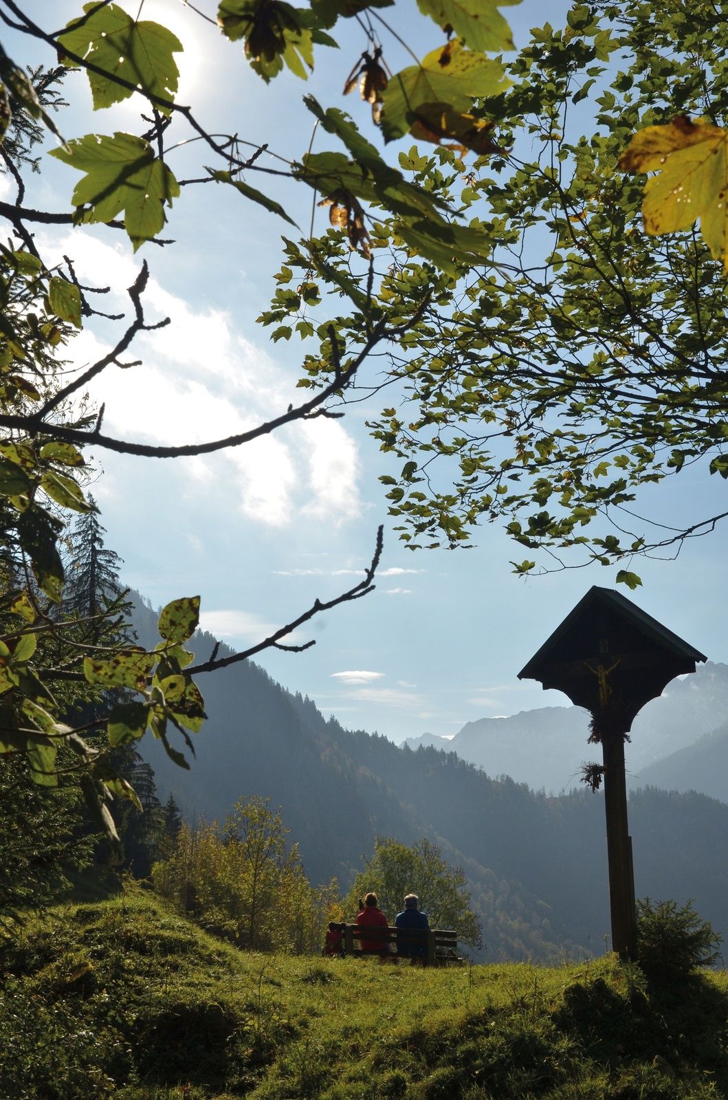
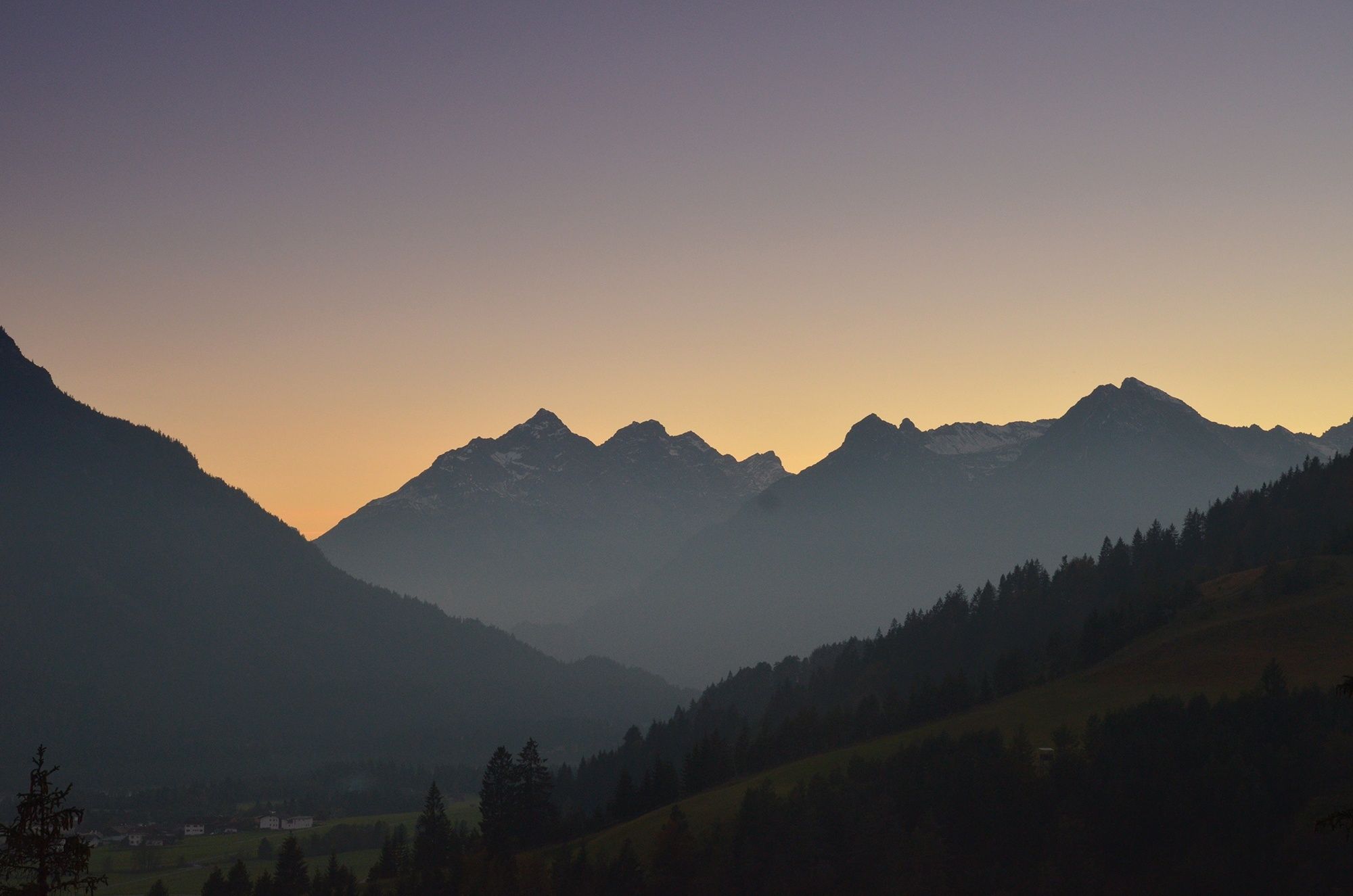
The pilgrims to St. James can undoubtedly look forward to a particularly impressive route here. All the more so, as it mostly leads through rural, tranquil mountain regions, where people have been deeply influenced by faith and fear of the forces of nature for centuries. These regions are therefore particularly rich in churches and chapels with numerous art-historical gems, often from very different eras. In combination with the magnificent panoramic views, the constantly changing perspectives and the meditative, but now and then strenuous hiking in wind and weather through these alpine natural landscapes, this "camino" becomes an unforgettable path that demands all the senses, rich in intense experiences, encounters, experiential and perhaps also new insights about oneself.
Integration into the Jakobwegenetz of Austria and Germany
The Tyrol-Allgaeu Way of St. James connects in Stams to the German-Austrian Way of St. James from Munich along the Isar, Loisach, Leutascher Ache and Inn rivers, as well as to the two Austrian ways of St. James which unite in Innsbruck: the route from Lofer/Salzburg to Innsbruck and the route from Lienz to Innsbruck. From Innsbruck, this bundled stream of St. James' Way leads on via Stams to the Arlberg or even from Stams on the Tyrol-Allgaeu route.
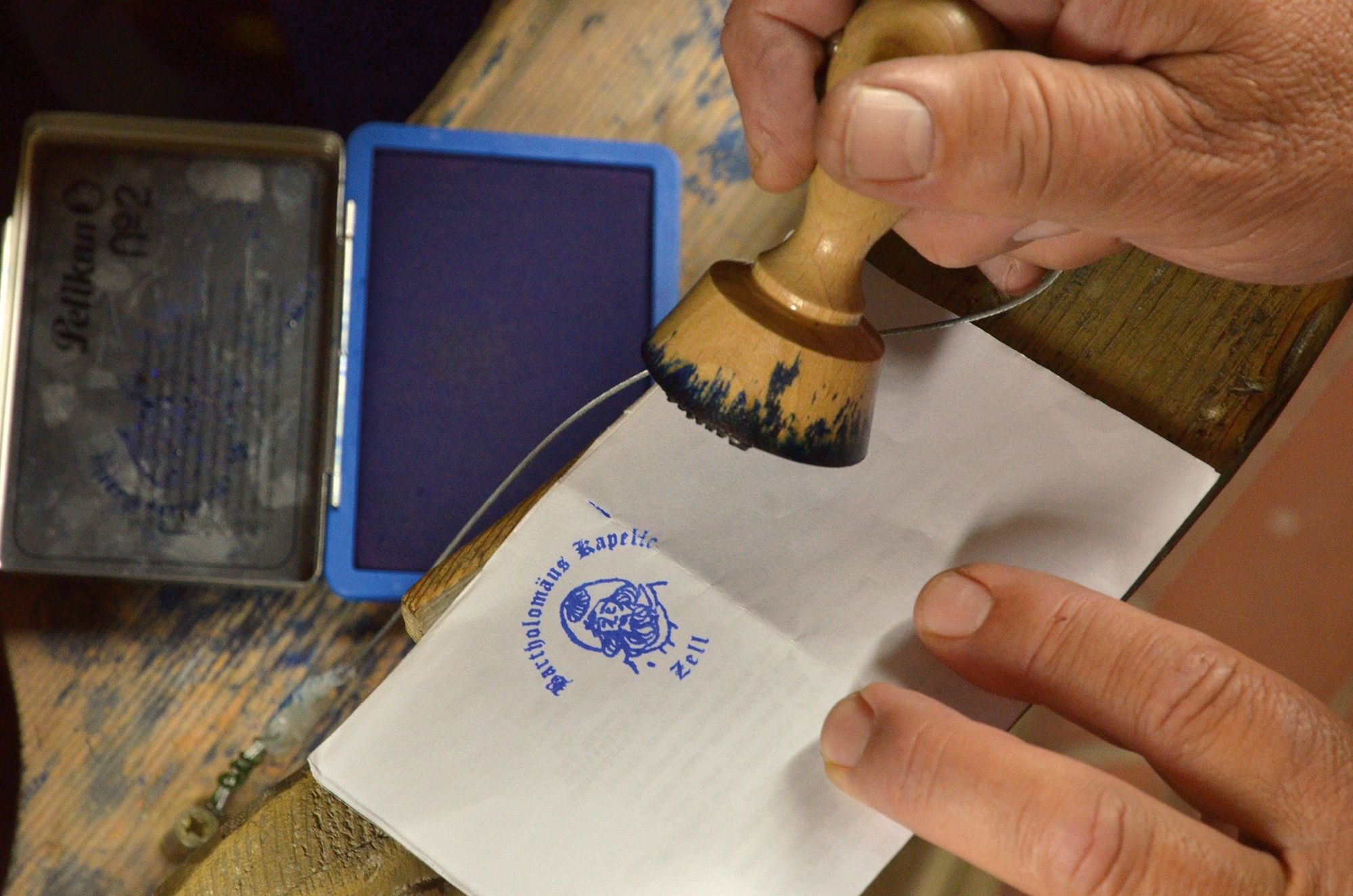
Pilgrim's stamp and pilgrim's identity card
In the chapels of St. James and in the churches mentioned in the text there are stamped places along the St. James' Way. These pilgrim's stamps are nice memories in your own pilgrim's diary. In the intrnat. recognised pilgrim's identity card they serve as proof of the route completed. As an official document, the pilgrim's identity card also enables the pilgrim to stay overnight in special pilgrim accommodation, of which there are still few on this route. It can be obtained from the St. James pilgrim associations for a processing fee.
- Directions
-
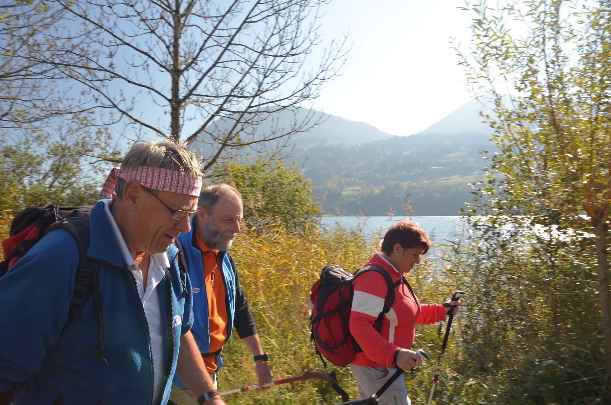
Although the Tyrol-Allgaeu Way of St James is divided into daily stages here, each pilgrim should put together his own individual route. One stage may be longer, the other shorter, depending on your wishes, fitness and cultural or tourist interests on the way. Adventurous pilgrims set off and simply spend the night where they arrive in the late afternoon, at the risk of not being able to get a cheap room for one night, but having to pay more in a hotel. Others plan their own route including overnight stays already at home. Those who, for example, want to visit the basilica and monastery in Stams as well as the pilgrimage place Maria Locherboden high above Mötz in peace and quiet should arrive in time the day before. Or plan an overnight stay in Obsteig or Holzleiten. Also at the end of the route in Oberstaufen-Zell it would be worthwhile to add another day. Then you could hike from Oberstaufen- Zell to Oberstaufen, get on the bus to the Hochgratbahn at the station and drive up to the top station in the late afternoon. Only a few metres below is the Staufner Haus, an alpine club hut in a splendid panoramic location with good food and cheap accommodation. The next day you could hike directly from the hut over the Nagelfluh mountain range with views as far as Lake Constance, the next destination on the long way to Spain, before taking the bus from Steibis to the train station in Oberstaufen for the journey home. Information: www.bahn.de, www.oberstaufen.de
The pilgrims to St. James can undoubtedly look forward to a particularly impressive route here. All the more so as it mostly leads through rural, tranquil mountain regions where people have been deeply influenced by faith and fear of the forces of nature for centuries. These regions are therefore particularly rich in churches and chapels with numerous art-historical gems, often from very different eras. In connection with the magnificent panoramic views, the constantly changing perspectives and the meditative, now and then strenuous hiking in wind and weather through these alpine natural landscapes, this "camino" becomes an unforgettable path that demands all the senses, rich in intense experiences, encounters, sensations - and perhaps also new insights about oneself. The Tyrol-Allgaeu Way of St. James connects in Stams to the German-Austrian Way of St. James from Munich along the Isar, Loisach, Leutascher Ache and Inn rivers, as well as to the two Austrian ways of St. James which unite in Innsbruck: the route from Lofer/ Salzburg to Innsbruck and the route from Lienz to Innsbruck. From Innsbruck, this bundled Tyrolean St. James' Way continues via Stams to the Arlberg or even from Stams on the Tyrol-Allgaeu route. Pilgrim's stamp and pilgrim's identity card There are stamp sites along the Way of St. James in the chapels of St. James and the churches mentioned in the text. These pilgrim's stamps are nice memories in your own pilgrim's diary. In the internationally recognised pilgrim's identity card they serve as proof of the completed route. As an official document, the pilgrim's identity card also enables the pilgrim to stay overnight in special pilgrim accommodation, of which there are still few on this route. It can be obtained from the St. James pilgrims' associations for a processing fee.
- Highest point
- 1,349 m
- Endpoint
-
Stams in the Inn Valley
- Height profile
-

- Equipment
-
The personal pilgrim's equipment must be safe and serviceable and must meet the relevant technical standards. The rucksack should not exceed the weight of 15 kg. Every pilgrim is recommended to inform and prepare himself in detail in technical literature or on the Internet.
Note for cyclists and wheelchair users
This route is not suitable for wheelchair users. Mountain bikers and cyclists with robust touring bikes, appropriate fitness and equipment will be delighted with this route. Exception: the first stage from Mötz through the gorge to the Mieminger Plateau must be avoided - preferably on the little used direct road from Mötz to Finsterfiecht/Obsteig, west of the Route of St. James. The old long-distance pass route is technically difficult in the upper section, especially when wet (push route). For the descent from Oberjoch to Bad Oberdorf/Bad Hindelang it is best to use the pass road from the chapel of St. James. The lakeside path along the Großer Alpsee near Immenstadt-Bühl is closed to cyclists. Parallel to the hiking trail, the cycle path leads along a quiet little road behind the railway tracks.
- Safety instructions
-
It should be noted that there is an increased risk of accidents and injuries on pilgrim paths. Despite careful route planning, a basic risk always remains. Tour preparation through endurance sports, appropriate technical training and mental preparation reduces the risk of accidents and injuries. But please never forget that the weather in the mountains can change very quickly.
- Tips
-
The walking times given (without breaks) are generously calculated and serve as a guideline. Group size, culture and photo stops etc. influence the time required.
- Additional information
-
Tourism information Tannheimer Tal
- Directions
-
Either via Innsbruck on the toll Inntal motorway towards Imst to Stams or via Reutte and the Fernpass to Nassereithb or via Obsteig/Miemiger sonnenplateau to Stams. From Munich via Seefeld/Tyrol to Telfs and on the Inntal motorway towards Haiming/Imst to Stams
- Public transportation
-
Take the train to Innsbruck and continue with the regional express in the direction of Zams to Stams. Or via Lindau Bregenz, Feldkirch to Landeck-Zams and further with S2 direction Wattens to Stams. It is possible to take your bike with you, cheap bike ticket for Tyrol. Regional timetable under www.vvt.at
- Parking
-
Public parking spaces in Stams partly with costs


- Author
-
The tour Tyrol-Allgäu way of St. James is used by outdooractive.com provided.


General info
-
Allgäu
2362
-
Tannheimer Tal
1453
-
Forchach
398