Rabland - Panzendorf - Fatima Kapelle - Kapelle Sankt Katharina
medium
Navigate
Navigate
Get this tour on your mobile
Rabland - Panzendorf - Fatima Kapelle - Kapelle Sankt Katharina
medium
Mountainbike
32,48
km
Scan the QR code and start navigation in the bergfex app

Hiking & Tracking


Distance
32,48
km
Duration
02:53
h
Ascent
886
m
Sea level
1.074 -
1.823
m
Track download
Rabland - Panzendorf - Fatima Kapelle - Kapelle Sankt Katharina
medium
Mountainbike
32,48
km


Route
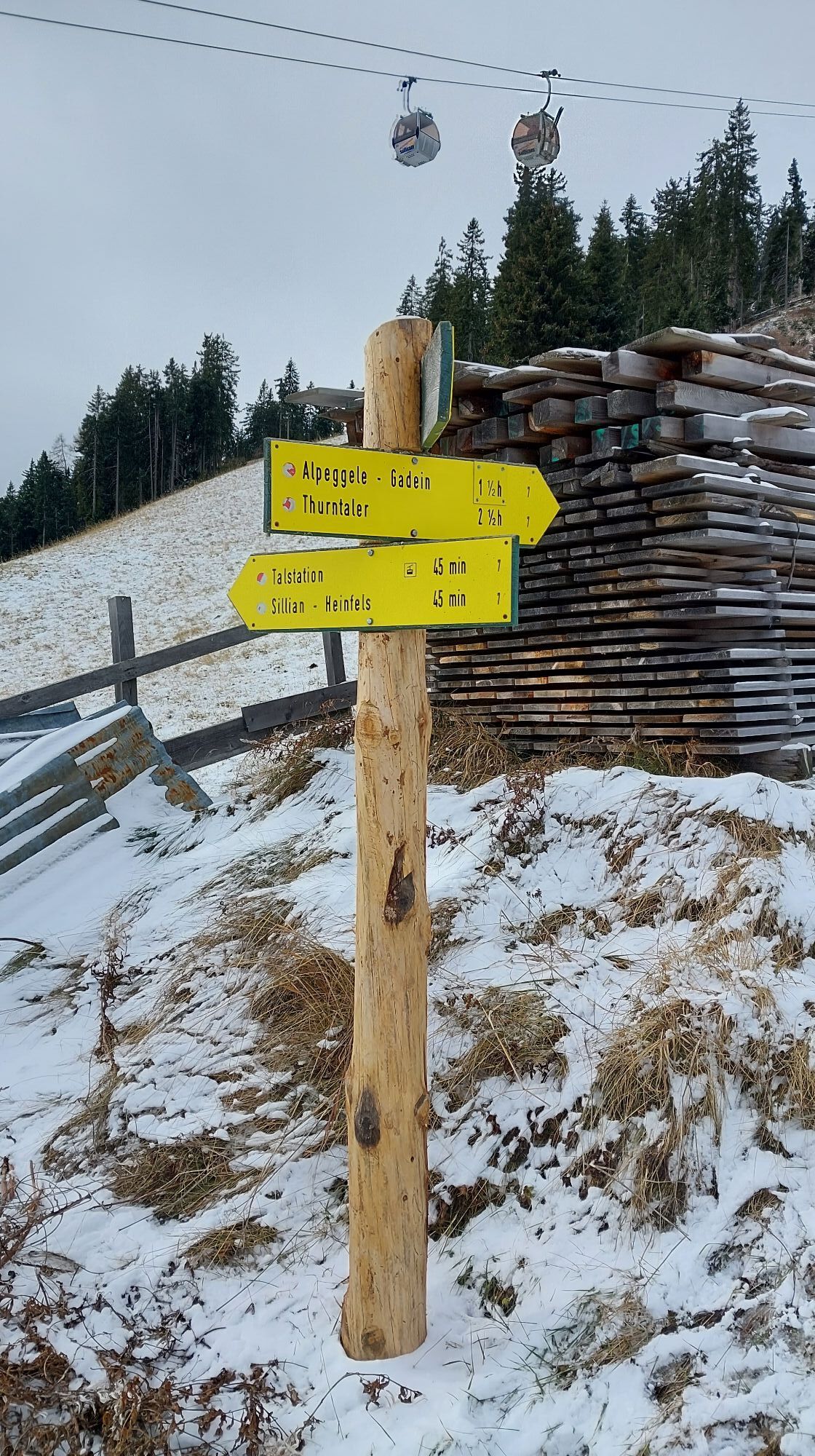
Rabland
(1.075 m)
Settlement
0,0 km
Heinfels
(1.131 m)
Village
1,2 km
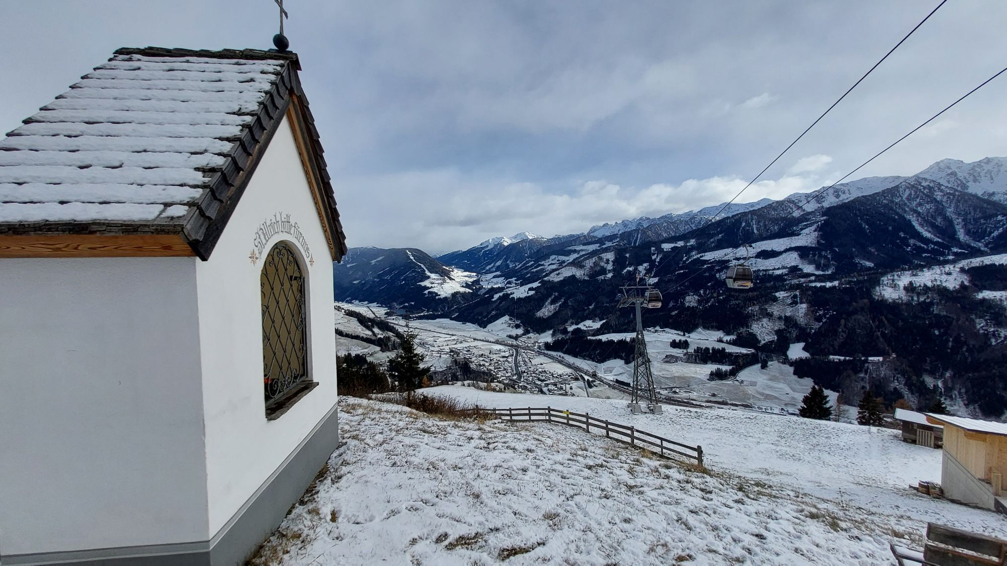
Fatima Kapelle
(1.348 m)
Place of worship
6,9 km
Kapelle Sankt Katharina
(1.378 m)
Place of worship
7,9 km
Fatima Kapelle
(1.348 m)
Place of worship
25,3 km
Rain
(1.311 m)
Settlement
30,3 km
Rabland
(1.075 m)
Settlement
32,4 km
Route
Rabland - Panzendorf - Fatima Kapelle - Kapelle Sankt Katharina
medium
Mountainbike
32,48
km
Rabland
(1.075 m)
Settlement
0,0 km
Panzendorf
(1.075 m)
Village
0,5 km
Heinfels
(1.131 m)
Village
1,2 km
Außervillgraten
(1.255 m)
Village
5,4 km
Fatima Kapelle
(1.348 m)
Place of worship
6,9 km
Kapelle Sankt Katharina
(1.378 m)
Place of worship
7,9 km
Kapelle Sankt Katharina
(1.378 m)
Place of worship
24,3 km
Fatima Kapelle
(1.348 m)
Place of worship
25,3 km
Außervillgraten
(1.255 m)
Village
26,8 km
Rain
(1.311 m)
Settlement
30,3 km
Hinterheinfels
(1.148 m)
Settlement
31,2 km
Heinfels
(1.131 m)
Village
31,4 km
Panzendorf
(1.075 m)
Village
31,8 km
Restaurant 4Eck Heinfels
(1.077 m)
Restaurant
32,3 km
Rabland
(1.075 m)
Settlement
32,4 km
No reviews yet
Popular tours in the neighbourhood
- 4,7
Von Kalkstein auf das Toblacher Pfannhorn (2.663 m) und Marchkinkele
mediumHiking14,2 km - 4,8
Sillianer Hütte 2.447 m
mediumHiking16,8 km - 5,0
Pfannspitze, 2678 m
mediumHiking15,6 km - 5,0
Heimkehrer Kreuz - Hornischegg - Sillianer Hütte
mediumHiking9,43 km - 4,0
Innervillgraten - Kalkstein - Alfenalm - Schönegg
mediumHiking12,6 km - 4,5
Thurntaler Rundweg - Parggenspitze - Hochrast
mediumHiking18,0 km - 5,0
Schwarzsee
mediumHiking7,38 km - 5,0
Oberstalleralm - Weisse Spitze - Rote Spitze - Oberstalleralm
heavyHiking10,2 km - 5,0
Toblacher Pfannhorn
lightSki tour11,0 km - 3,5
Degenhornsee Tour
mediumHiking11,2 km
Hiking & Tracking

Over 550.000 tour suggestions, detailed maps and an intuitive route planner make the app a must-have for all nature enthusiasts.

Don't miss out on offers and inspiration for your next holiday
Subscribe to the newsletter
Error
An error has occurred. Please try again.Thank you for your registration
Your e-mail address has been added to the mailing list.
Tours throughout Europe
Austria Switzerland Germany Italy Slovenia France Netherlands Belgium Poland Liechtenstein Czechia Slovakia Spain Croatia Bosnia and Herzegovina Luxembourg Andorra Portugal Iceland United Kingdom Ireland Greece Albania North Macedonia Malta Norway Montenegro Moldova Kosovo Hungary San Marino Romania Estonia Latvia Belarus Cyprus Lithuania Serbia Bulgaria Monaco Denmark Sweden Finland