- Brief description
-
Professionals and amateurs stage a thrilling race here every year. Now it’s the turn of biking fans! Excellent views and an enchanting alpine hut on the Thaurer Alm
- Difficulty
-
difficult
- Rating
-
- Route
-
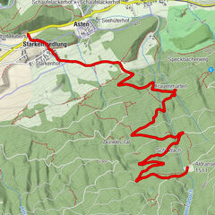
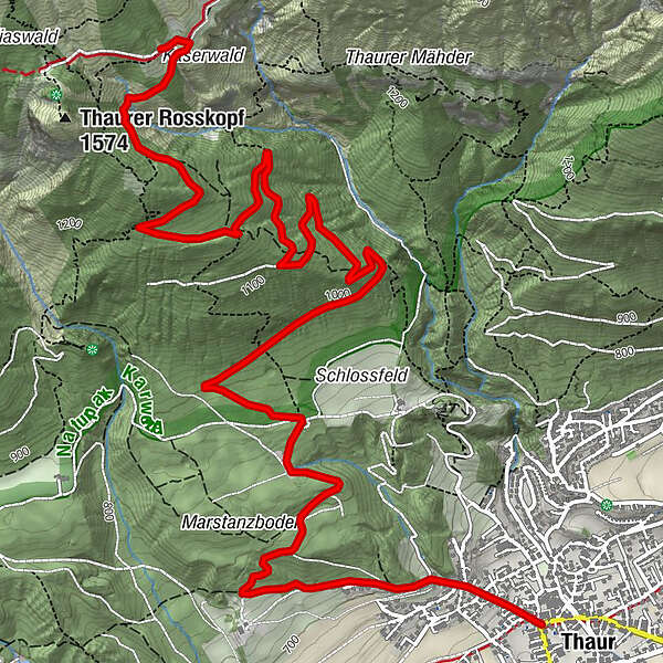
Thaur (633 m)Pizzeria Da GiuseppePartscheil5.6 kms`hoache Egg6.2 kmSchihütte WSV Thaur7.3 kmThaurer Alm7.3 km
- Best season
-
JanFebMarAprMayJunJulAugSepOctNovDec
- Description
-
From Thaur up to the Thaurer Alm with beautiful views down to the Inntal.
- Directions
-
Starting from the fountain outside Gasthof Stangl in the centre of Thaur, follow the "Thaurer Alm" route west to Marstanzboden where the asphalt road becomes a gravel track. This trail ends at the junction with the Adolf Pichler Trail, where the route is then signposted.
With a gradient of approximately 10% to 12%, the route now twists and turns through the forest, heading steadily uphill until you reach a barrier. This section will really put you to the test, with a gradient of up to 21%. But a reward is in store at the Thaurer Alm (1,464 m), with a refreshing drink and spectacular views! The return journey follows the same route.
- Highest point
- 1,457 m
- Endpoint
-
Thaurer Alm
- Height profile
-

- Tips
-
Evening tour with a sunset hike to the Kaisersäule or Thaurer Rosskopf!
- Author
-
The tour Thaurer Alm is used by outdooractive.com provided.
GPS Downloads


General info
Refreshment stop
A lot of view
Other tours in the regions

")