
- Brief description
-
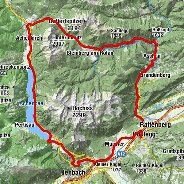
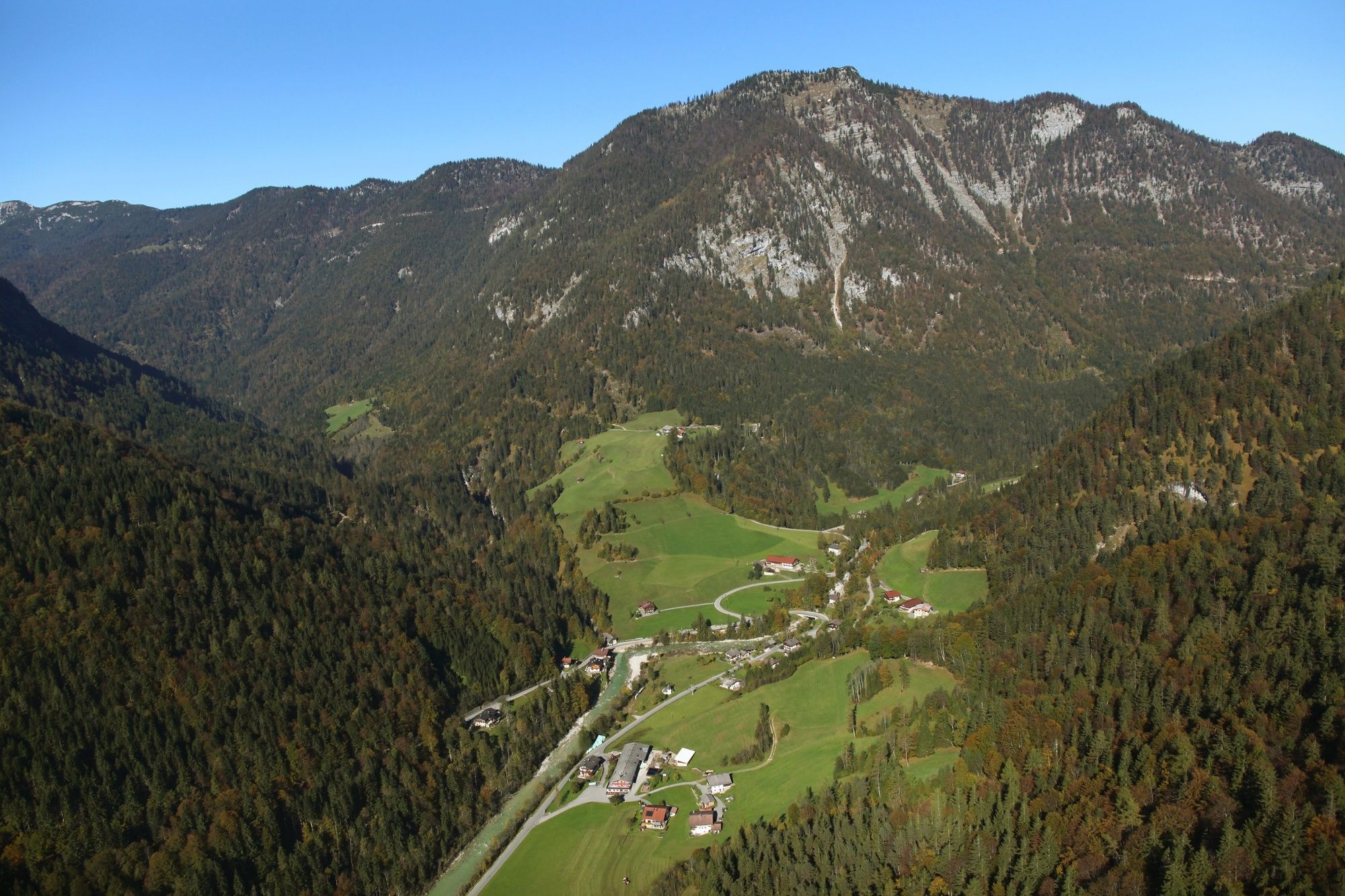
Day 3 – moderate: Alpbachtal Seenland Mountain Bike Loop – from Kramsach – Aschau – Pinegg – Steinberg am Rofan – Achensee – Maurach – Eben – Wiesing – Münster Kramsach – Brixlegg (starting point)
overnight in Kramsach
- Difficulty
-
medium
- Rating
-
- Starting point
-
Kramsach
- Route
-
KramsachLändbühelWittberg (526 m)0.3 kmEbnat0.5 kmLiftstüberl0.8 kmRadetzkyweg0.9 kmMariatal (533 m)1.1 kmAschau9.8 kmPinegg11.2 kmHinterberg (824 m)17.4 kmSteinberg am Rofan (1,010 m)20.9 kmObere Bergalm24.3 kmHotel Beretta29.5 kmHeiliger Johannes der Täufer31.3 kmAchenkirch (916 m)31.4 kmScholastika / Achenkirch35.0 kmMaurach46.6 kmPfarrkiche Eben am Achensee48.2 kmKirchenwirt48.2 kmStangleggerhof -Kapelle49.8 kmFischl50.8 kmJenbach (563 m)51.0 kmErlach52.4 kmSonnhof53.2 kmPfarrkirche Wiesing53.3 kmWiesing53.4 kmDorfwirt53.4 kmBus-Stop54.1 kmBradl54.6 kmHaus56.0 kmEntgasse56.8 kmMünster (535 m)57.2 kmPizzeria Buongiorno58.2 kmHagau (517 m)61.1 kmBrixlegg61.6 kmWeng (526 m)62.1 km
- Best season
-
JanFebMarAprMayJunJulAugSepOctNovDec
- Description
-
From your accommodation cycle towards the Sonnwendjochbergbahn (defunct chairlift) and up the valley to Aschau, down to Pinegg, on towards the Kaiser Gorge. Turn left after the uphill and cycle downhill along the mountain bike route no. 465 to Steinberg am Rofan.
The route now leads along a short stretch of main road, shortly you will need to turn left onto the bike route no. 433 leading down to the Achensee.
A cycling route leads alongside the lakes eastern shore towards Maurach, Eben and down to Wiesing. Follow the L211 through Münster to your accommodation in Kramsach.
- Directions
-
Day 1 – moderate: Alpbachtal Seenland Mountain Bike Loop – from Brixlegg via Reith im Alpbachtal – Hygna - Inneralpbach and via the Oberer Höhenweg to Alpbach
Day 2 - difficult: Alpbachtal Seenland Mountain Bike Loop - from Alpbach via the Holzalm to Thierbach – Mühltal – Oberau in the Wildschönau Valley and via the Kragenjoch to Kundl - Breitenbach – Kramsach
Day 2 – moderate: Alpbachtal Seenland Mountain Bike Loop – from Alpbach via the Holzalm to Thierbach (chapel) in the Wildschönau Valley – Kundl – Breitenbach – Kramsach
Day 3 – moderate: Alpbachtal Seenland Mountain Bike Loop – from Kramsach – Aschau – Pinegg – Steinberg am Rofan – Achensee – Maurach – Eben – Wiesing – Münster Kramsach – Brixlegg (starting point)
Day 3 – easy: Alpbachtal Seenland Mountain Bike Loop – from Kramsach – Aschau - Pinegg – to the Kaiserhaus and back via Pinegg and Brandenberg to the starting point
- Highest point
- 1,080 m
- Endpoint
-
Kramsach / Bike stop Brixlegg
- Height profile
-

- Equipment
-
Helmet, sun glasses, bike shorts, pullover, rain proof jacket, hat, 30-40 ltr backpack, drinking bottle, map, first aid kit, mobile phone, camera, bike lock, replacement inner tube, mini tool kit, bike pump, puncture repair kit, sealing (repair) tape, sun cream, energy food (muesli bar), snack, ...
- Safety instructions
-
Closed in winter! All MTB and bike routes are closed for safety reasons from 1st November until 1st April of the following year.
These routes are not cleared and many MTB routes are exposed to avalanches. Depending on snow conditions, some routes may need to remain closed beyond 1st April. For more information and details please contact your local tourist office.
- Additional information
- Directions
-
A12, motorway exit Kramsach/Brixlegg
- Public transportation
- Parking
-
Brixlegg bikestop / accommodation in Kramsach
- Author
-
The tour Day 3 - Alpbachtal Seenland Mountain Bike Loop - moderate is used by outdooractive.com provided.


General info
-
Achensee
254
-
Steinberg am Rofan
68