
- Brief description
-
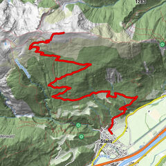
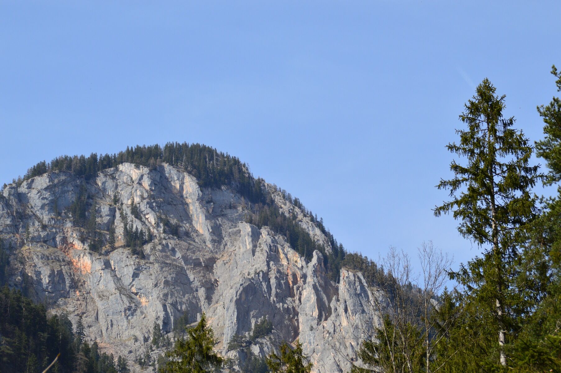
Day 3 – difficult:
from Reith to Brixlegg – crossing the Montanwerk bridge to Kramsach/Hagau and via the route no. 357 to the Sonnwendjochbergbahn (defunct chairlift) – Kaltwasserbründl – Hergottstein – turn-off Pletzachalm – Bayreuther Hütte – descend via the mountain bike route no. 332 to Münster/Grünsbach and via Brixlegg back to Reith im Alpbachtal
- Difficulty
-
difficult
- Rating
-
- Starting point
-
Reith im Alpbachtal
- Route
-
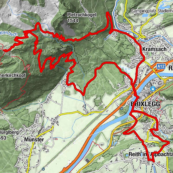
Reith im Alpbachtal (638 m)0.2 kmBischofsbrunn0.8 kmPestkapelle1.4 kmMehrn (560 m)2.0 kmBrixlegg2.7 kmWeng (526 m)2.9 kmHagau (517 m)4.0 kmAmerling4.9 kmKramsach5.0 kmLändbühel5.1 kmWittberg (526 m)5.6 kmEbnat5.9 kmLiftstüberl6.2 kmRadetzkyweg6.2 kmMariatal (533 m)6.9 kmBayreuther Hütte (1,560 m)14.4 kmGrünsbach (535 m)23.1 kmLandgasthof Astner23.2 kmHagau (517 m)26.4 kmBrixlegg27.0 kmWeng (526 m)27.6 kmPercha (568 m)28.7 kmSonnbichl29.5 kmDekanatspfarrkirche St. Petrus29.6 kmReith im Alpbachtal (638 m)29.8 km
- Best season
-
JanFebMarAprMayJunJulAugSepOctNovDec
- Description
-
From Reith im Alpbachtal village centre to Brixlegg. At the roundabout take the first exit and turn left passing the Montanwerk cycling towards Kramsach, Hagau. Turn right onto the L211 and take the second exit at the roundabout following the signs for the Sonnwendjochbergbahn.
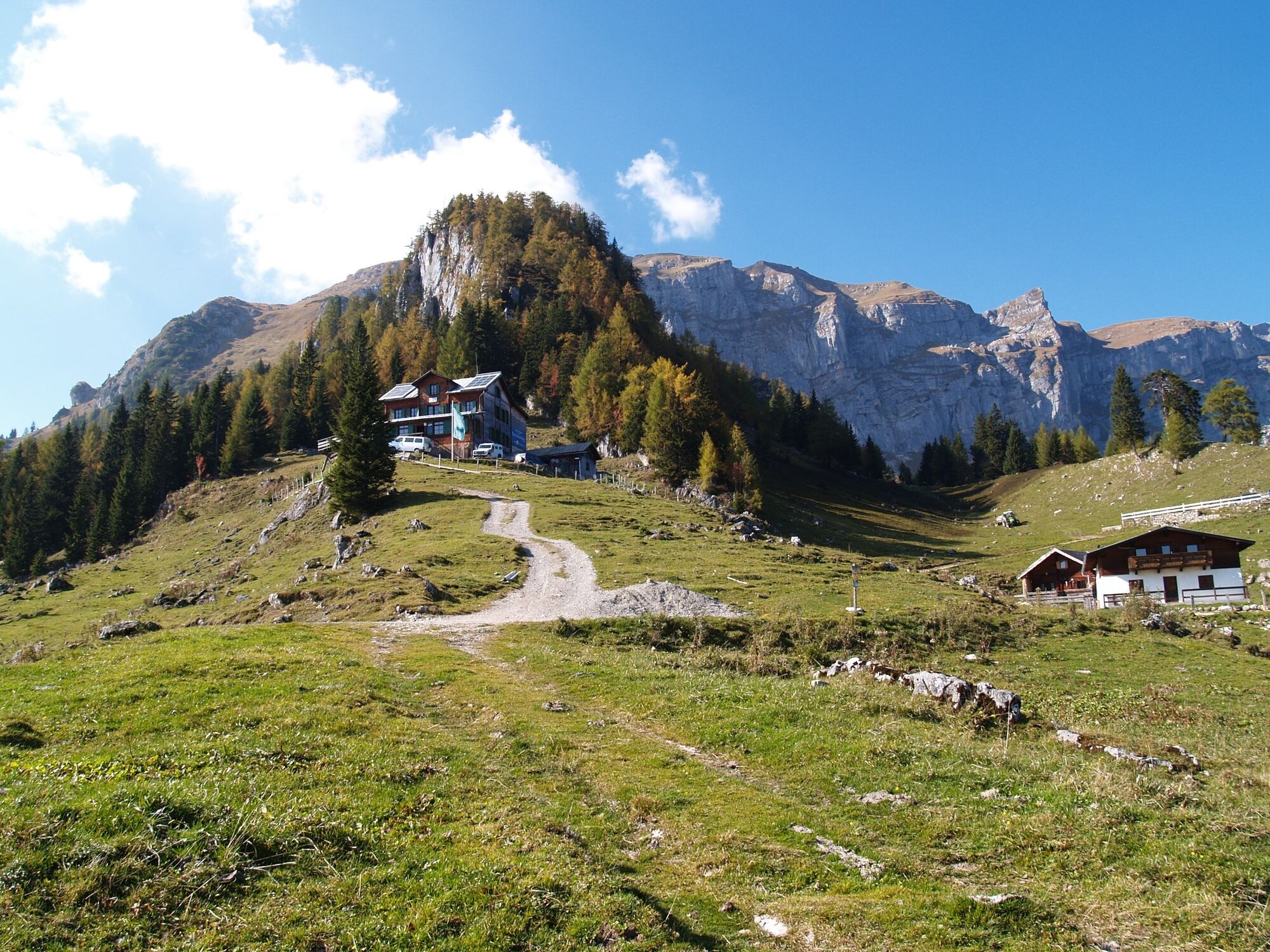
At the Sonnwendjochbergbahn (defunct chairlift) turn left onto the mountain bike route no. 357. Follow the route, in parts a steep climb, to "Kaltwasserl", the "Hergottstein" and to the cross section with the mountain bike route no. 332. Turn right and cycle to the Bayreuther Hütte.
Cycle back to the cross section (cattle grid) and continue straigth along the route no. 332 along a winding downhill track towards Grünsbach (Münster). Turn left at the Grünsbach bus stop and follow the route to Kramsach/roundabout.
Cycle back to your starting point the same way you came.
- Directions
-
Day 1 – difficult: Mountain Bike-Feeder Ride
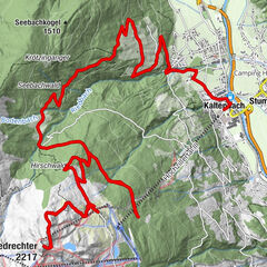
Seenland/Alpbachtal – from Reith im Alpbachtal via the panorama path, mountain bike route no. 320 to the Kerschbaumer saddle – Hochlindalm – Kohlgrubenalm to the Wiedersbergerhornbahn top station – descend via the route no. 307 through the Greiter Valley and Inneralpbach – back to Reith im Alpbachtal along the mountain bike route no. 321 via Alpbach and Naschberg.
Day 2 – difficult: Mountain Bike-Feeder Ride
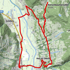
Seenland/Wildschönau/Alpbachtal – from Reith im Alpbachtal to Brixlegg along the Innradweg – bear right towards Rattenberg – Radfeld and Kundl – entrance to the Kundl Gorge/bridge and follow the mountain bike route no. 361 to the Kragenalm – Kragenjoch – Oberau – Mühltal – Auffach, continue along the route no. 351 to the Gernalm – route no. 360 through the Lueger Valley to Inneralpbach – back to Reith im Alpbachtal on the main road (L5)
Day 3 – difficult: Mountain Bike-Feeder Ride
Seenland/Rofangebirge/Bayreuther Hütte – from Reith to Brixlegg – crossing the Montanwerk bridge to Kramsach/Hagau and via the route no. 357 to the Sonnwendjochbergbahn (defunct chairlift) – Kaltwasserbründl – Hergottstein – turn-off Pletzachalm – Bayreuther Hütte – descend via the mountain bike route no. 332 to Münster/Grünsbach and via Brixlegg back to Reith im Alpbachtal
- Highest point
- 1,563 m
- Endpoint
-
Reith im Alpbachtal
- Height profile
-

- Equipment
-
Change of clothes, helmet, sun glasses, bike shorts, pullover, rain proof jacket, hat, 30-40 ltr backpack, drinking bottle, map, first aid kit, mobile phone, camera, bike lock, replacement inner tube, mini tool kit, bike pump, puncture repair kit, sealing (repair) tape, sun cream, energy food (muesli bar), snack, ...
- Safety instructions
-
Closed in winter! All MTB and bike routes are closed for safety reasons from 1st November until 1st April of the following year.
These routes are not cleared and many MTB routes are exposed to avalanches. Depending on snow conditions, some routes may need to remain closed beyond 1st April. For more information and details please contact your local tourist office.
- Tips
-
Kramsach, Hagau is home to the "Museumsfriedhof"/"Lustiger Friedhof" (garden display of cast iron grave markers) and museum shop.
- Additional information
- Directions
-
A12, motor way exit Kramsach/Brixlegg
- Public transportation
- Parking
-
your accommodation in Reith im Alpbachtal
- Author
-
The tour Day 3 - Alpbachtal Mountainbike-Feeder Ride is used by outdooractive.com provided.


General info
-
Alpbachtal
301
-
Kramsach
118