
- Brief description
- Difficulty
-
medium
- Rating
-
- Route
-
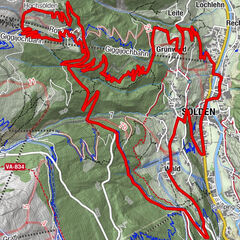
Mariä Heimsuchung0.3 kmSölden (1,368 m)0.4 kmSee1.4 kmWald2.2 kmKehre 12.9 kmKehre 23.1 kmInfang3.1 kmAlpengasthof Sonneck7.0 kmGaislachalm7.6 kmFalcon10.2 kmGoldegg Alm12.2 kmKehre 115.1 kmMariä Heimsuchung17.1 kmSölden (1,368 m)17.1 km
- Best season
-
JanFebMarAprMayJunJulAugSepOctNovDec
- Description
-
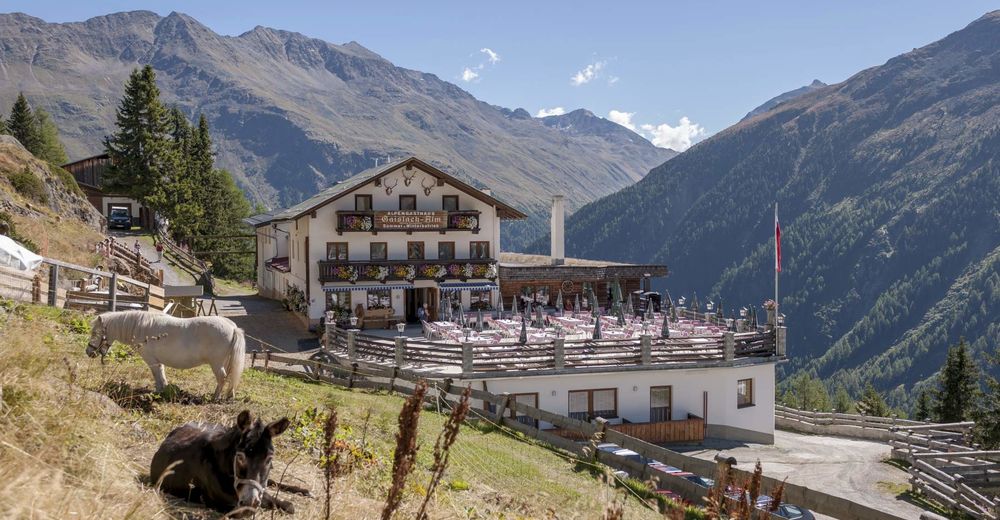
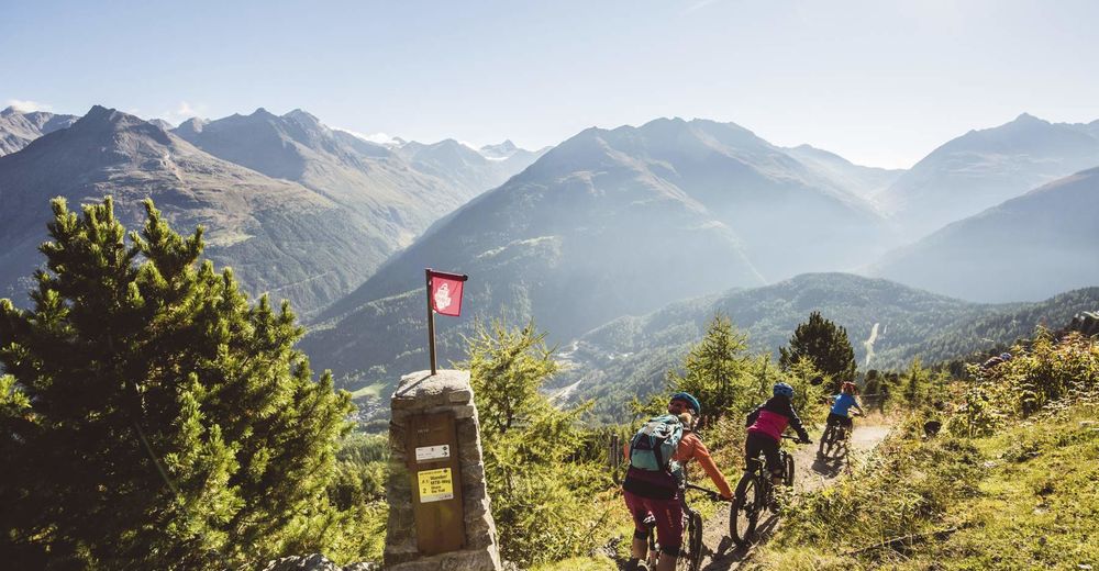
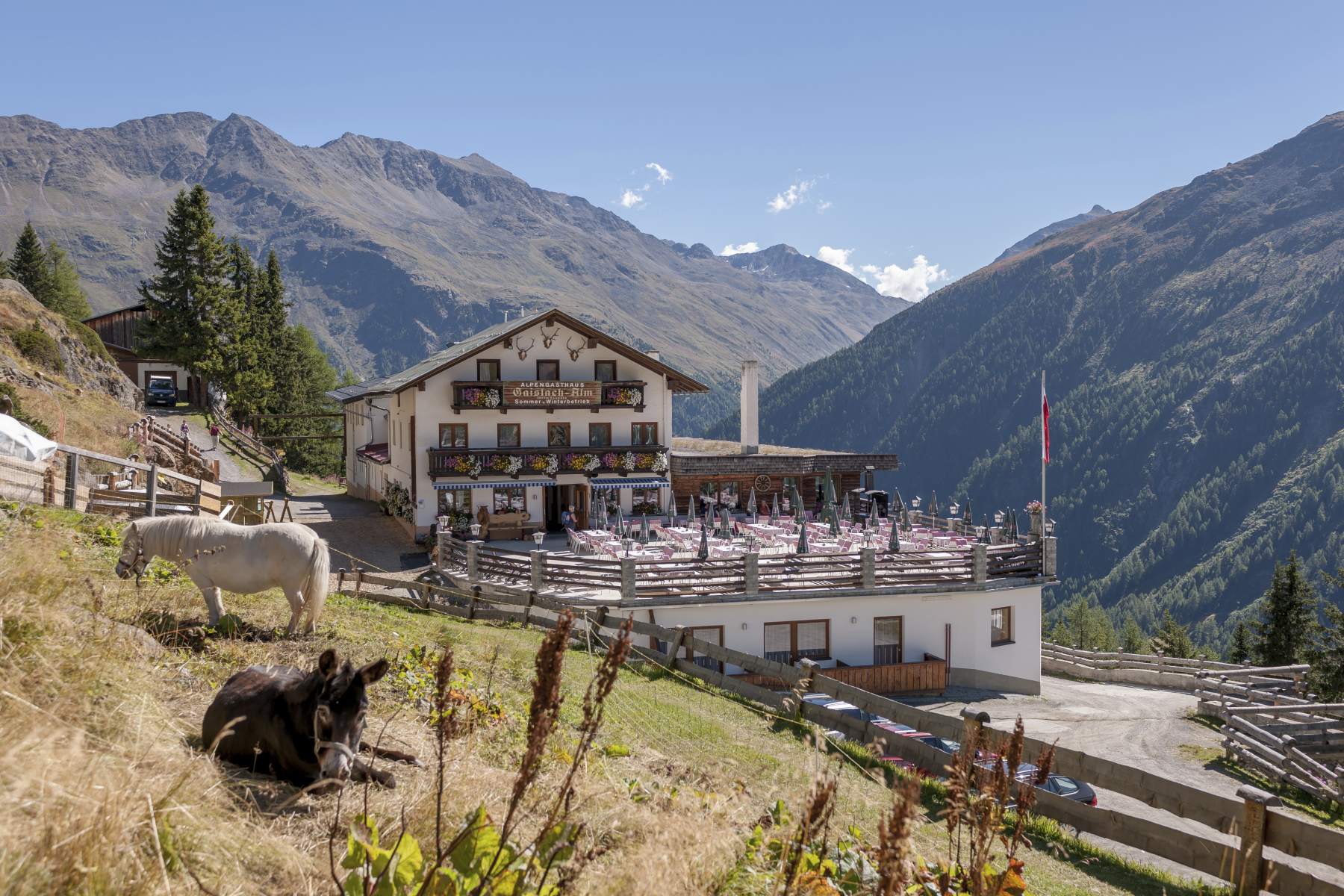
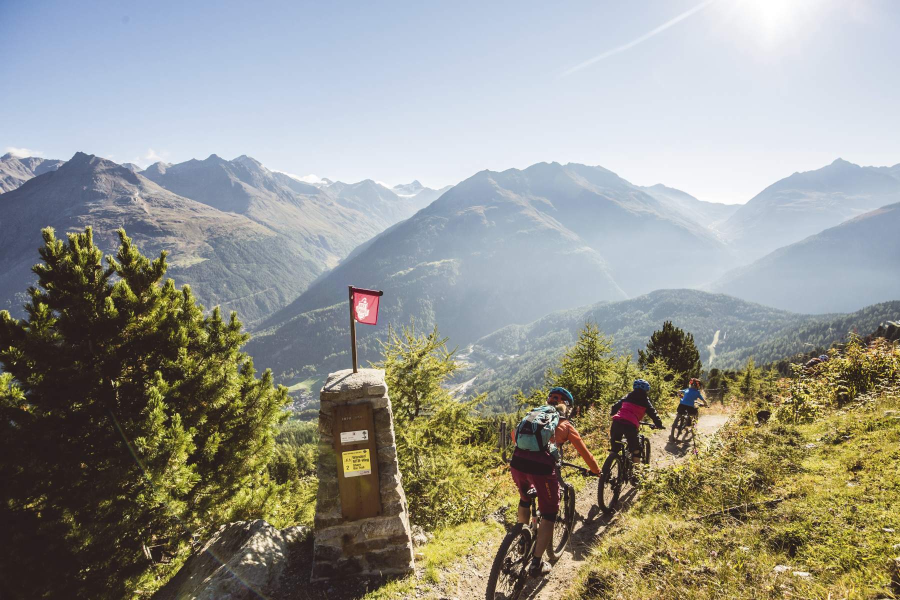
Start in the center of Sölden and pedal up to the glacier road via Außerwald and Innerwald. Continue for about 700 meters, before taking the forest road to Gaislach/Silbertal. It's a beautiful, lond and partly steep climb up towards the culinary stops Sonneck, Silbertal and Gaislachlam and further to the entry of the Nene Trail just before the mid-station Gaislachkogl.
The black Nene is superfun – for those who really know how to handle their bikes! It's rocky and slippery in the first, open part, and then, when you enter the forest it gets even more challenging with massive routes and tight sections. It finally threads into the Broate Line or the Schteckler Trail that you take you back into the valley.
Please yield to hikers!
- Highest point
- 2,179 m
- Endpoint
-
Freizeit Arena
- Height profile
-

- Equipment
-
Good equipment rules in the BIKE REPUBLIC! We strongly recommend to wear protective bike gear (knee and elbow protection, helmet, back protector, ...) on all lines, trails, enduro tracks and mountain bike routes in the BIKE REPUBLIC SÖLDEN. The entire REPUBLIC is designed exclusively for good quality, modern standard mountain bikes.
- Safety instructions
-
The Nene Trail is a black natural track – and pretty tricky and challenging. Only for technically skilled riders!
The BIKE REPUBLIC SÖLDEN is all about coming together and having the best time on your mountain bike – no matter what your skill level is. So always take care of each other, show respect and support – also towards nature and all other people out there in the mountains and the valley.
> Please only ride existing, signposted trails and never trespass open meadows.
-> Avoid skidding, don’t cut switchbacks & leave no trace.
-> Stay alert, never scare animals and always close the pasture gates. In the REPUBLIC there’s always a chance of cattle on the trails and lines. Ride carefully and give them enough room.
-> Please note that the natural trails in the BIKE REPUBLIC are all shared trails. Always yield to hikers and give a friendly greeting.
- Tips
-
There are so many culinary options on this route – make sure to take your time!
- Additional information
-
More info about biking & cycling in Ötztal: https://www.oetztal.com/biken
More info about the flowiest nation in the Alps, the BIKE REPUBLIC SÖLDEN: https://bikerepublic.soelden.com
And more to see: https://www.youtube.com/c/BikeRepublicSöldenSoeldenSolden
- Directions
-
WHERE IS SÖLDEN?
Sölden is located in the West of Austria, more exactly in the Province of TIROL. It nestles amidst the ÖTZTAL Valley, a south-facing side valley of the Inntal.
Best travel route from the West:
From Vorarlberg to Tirol via Arlberg Pass or through Arlberg Tunnel (S 16 Federal Road) - direction Landeck - change to A 12 Autobahn (direction Innsbruck) - exit: Ötztal after driving through Roppener Tunnel - on B 186 Federal Road (35 km) to Sölden
From the North:
- Bad Tölz - Achen Pass - B 181 Federal Road - Jenbach - A 12 Autobahn towards Innsbruck (direction Bregenz) - exit: Ötztal - B 186 Federal Road (35 km) to Sölden
- Pfronten - Reutte - Fernpass - Imst - A 12 Autobahn (direction Innsbruck) - exit: Ötztal after driving through Roppener Tunnel or on B 171 Federal Road to Ötztal (no Vignette toll-sticker required!) - B 186 Federal Road (35 km) to Sölden
- Garmisch Partenkirchen - Ehrwald - Lermoos - Fernpass - Imst - A 12 Autobahn (direction Innsbruck) – exit: Ötztal after driving through Roppener Tunnel or on B 171 Federal Road to Ötztal (no Vignette toll-sticker required!) - B 186 Federal Road (35 km) to Sölden
- Garmisch Partenkirchen - Mittenwald - Scharnitz - Seefeld - Telfs - A 12 Autobahn (direction Bregenz) - exit: Ötztal or on B 171 Federal Road to Ötztal (no Vignette toll-sticker required!) - B 186 Federal Road (35 km) to Sölden
From the East:
Munich or Salzburg - A 93 Autobahn to Kufstein - A 12 Autobahn (direction Bregenz) via Innsbruck – exit: Ötztal - B 186 Federal Road (35 km) to Sölden
From the South:
From Bozen/Bolzano towards Brenner Pass (toll road) – on Brenner Autobahn via Schönberg toll station (direction Innsbruck) to Innsbruck - then change to A 12 Autobahn (direction Bregenz) – exit: Ötztal - B 186 Federal Road (35 km) to Sölden
- Public transportation
-
Arriving by Train
Enjoy a comfortable and relaxing train ride to the train station in Ötztal Bahnhof. The public bus lines to all holiday resorts in the valley (direction Obergurgl) leave directly in front of the train station. The bus ride to Sölden takes about 1 – 1.5 hours.
All important details on bus timetables, direct connections and taxi services are available here.
- Parking
-
There are ample parking areas and covered parking garages at the base stations of Gaislachkogl and Giggijoch Mountain Gondolas. Parking is free of charge between 8.00 am and 7.00 pm!
Night-time parking of motor cars is subject to a charge and allowed only in the parking garage next to Gaislachkogl Mountain Gondola:

-

-
AuthorThe tour Enduro Goldegg - K is used by outdooractive.com provided.


Surfaces
General info
-
Meraner Land
155
-
Ötztal
155
-
Sölden
62


")