- Brief description
-
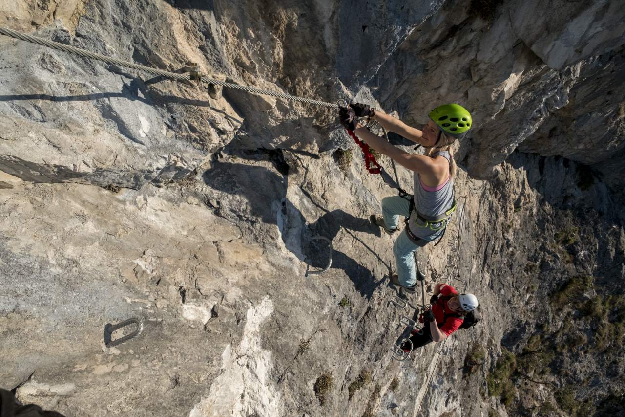
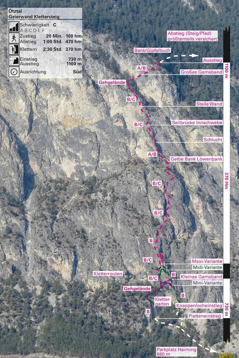
Intermediate via ferrata tour in a limestone rock wall, which hast a high of almost 400 meter.
Due to maintenance work and a mountain rescue exercise, the via ferrata Haiming-Geierwand is closed on 1st of May 2024, from 06:00 to approximately 13:00 for safety reasons. We apologize for any inconvenience and appreciate your understanding.
- Difficulty
-
mediumDifficulty level B/C
- Rating
-
- Starting point
-
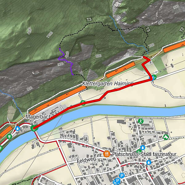
Haiming
- Route
-
Magerbach0.0 kmApfelmeile Haiming0.8 km
- Best season
-
JanFebMarAprMayJunJulAugSepOctNovDec
- Description
-
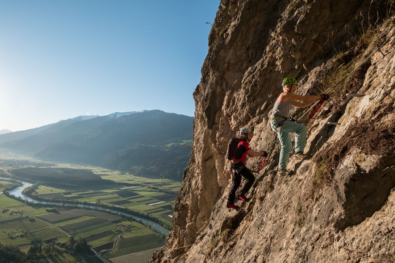
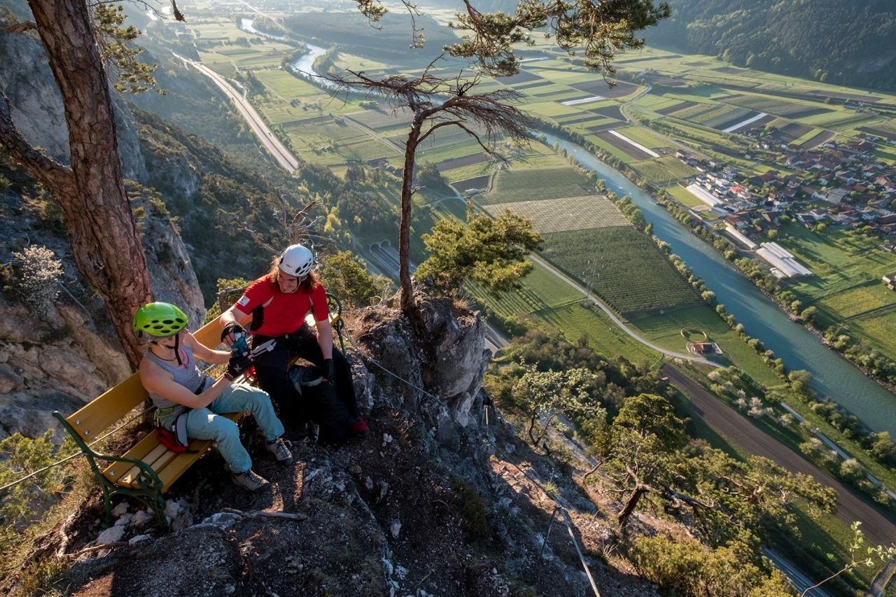
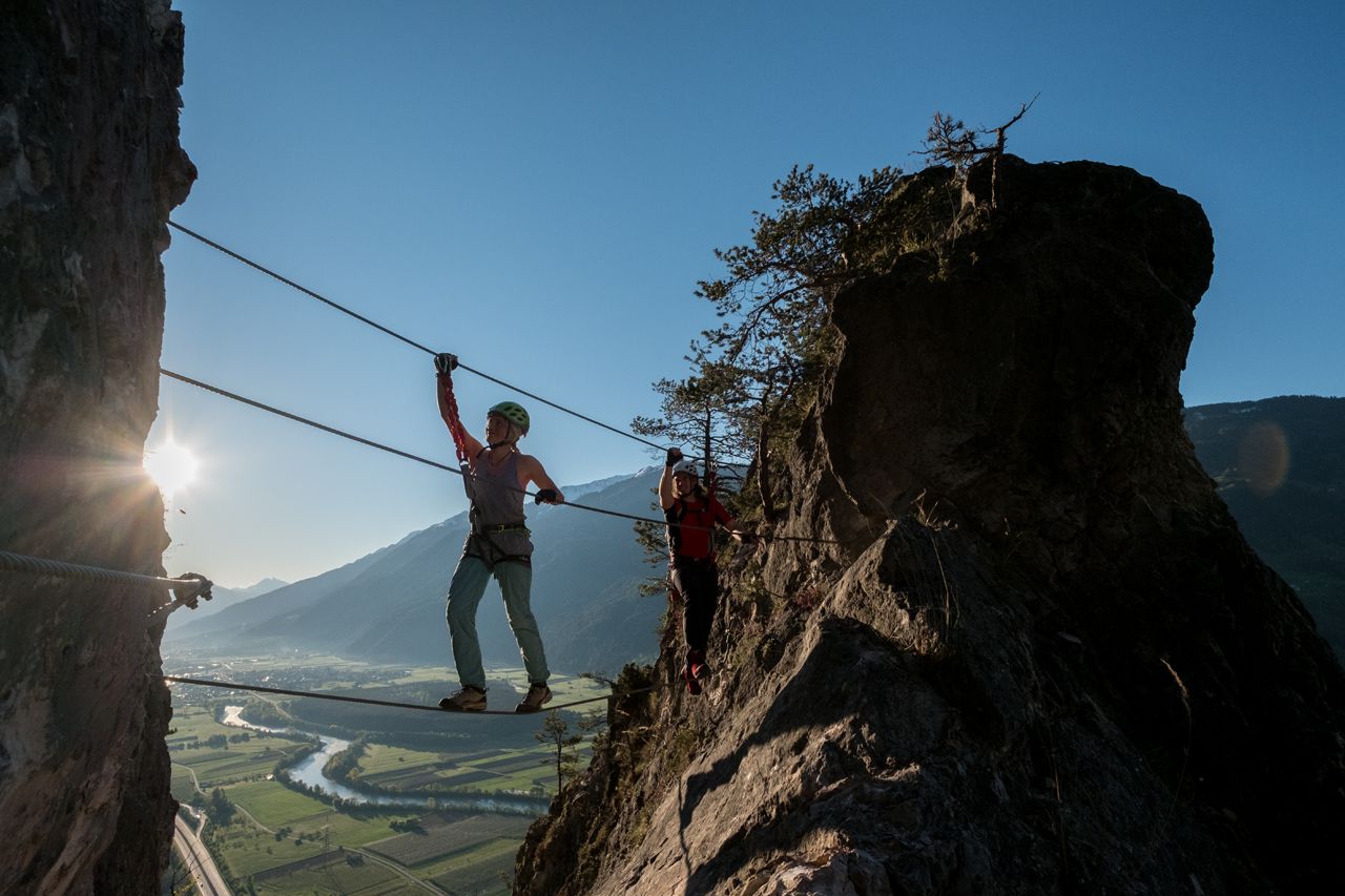
Intermediate via ferrata tour in a limestone rock wall, featuring a height of about 400 meters. Most parts of the tour are grade B but you shouldn't underrate the height and the time required as you need about 2.5 hours for the ascent. Bring enough to drink especially on warm days! There is a mini and a midi variant with several exit points, therefore this via ferrata route is also suitable for skilled beginners. There is no other emergency exit! A small rope suspension bridge, "Innschwebe", and the uninterrupted panoramic view of the lnntal Valley promise rewarding moments. Due to the very sunny location this route is accessible almost all year round.
Trail length / Time required
Almost 400 meters of altitude gain on a total rope length of about 800 meters. Ascent 2.5 hours, descent 0.5 hour.
- Directions
-
Grade B access (only via ledges, parallel), the narrow Gamsband features one B/C section, after reaching the "Innschwebe" rope bridge you also find some grade C steps. The last part is a bit easier – apart from the height – and graded A/B and A.
Descent
At the end of the route you take the slightly descending, signposted trail on the right (east) – which becomes much steeper after a while. Continue down to the access point of the Simmering climbing garden. Back to the car park on the Apple Road.
- Highest point
- 669 m
- Endpoint
-
Haiming
- Exposition
- Height profile
-

- Equipment
-
Helmet, climbing harness and complete via ferrata climbing set, via ferrata gloves, appropriate climbing shoes, enough to drink!
- Safety instructions
-
SAFETY ON THE VIA FERRATA
The Austrian Alpine Club has published 10 recommendations for climbing on via ferratas in order to increase safety:
Plan carefully Destination should correspond to personal abilities Use complete set of professional climbing equipment Don’t access the route in the event of a thunderstorm Check wire rope and anchors accurately and critically Partner check at the access point Maintain sufficient distance Talk clearly when overtaking someone Watch out for falling rocks Respect nature and environment - Additional information
- Directions
-
The car drive to the Ötztal valley. Situated in Tirol, the Ötztal valley set off in southerly direction and is the longest side valley in the Eastern Alps. The journey with the car leads you through the Inntal valley to the entrance of the valley and further on through the valley. Among the toll motorways you can also use the country roads. A route planner will show you the easiest and most convenient way: https://www.google.at/maps
- Public transportation
- Parking
-
The following parking facilities are available in Haiming:
- car park Magerbach ( Parking area behind Rafting Alm and rafting exit point); free of charge
- Author
-
The tour Viea ferrata Geierwand | Haiming is used by outdooractive.com provided.


")