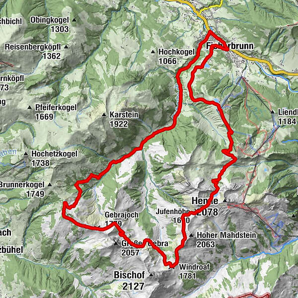
Fieberbrunner Höhenweg
High tour
Which problem do you want to report on this tour?

Österreichs Wanderdörfer
Tour data
30.21km
765
- 1,958m
1,399hm
1,353hm
10:12h
Österreichs Wanderdörfer
GPS Downloads


General info
Refreshment stop
A lot of view
Other tours in the regions
-
Pillerseetal
15
-
Fieberbrunn
3