- Brief description
-
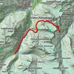
Hildesheimer Hütte (2.900 m) -> Gamsplatzl (3.018 m) -> Siegerlandhütte (2.710 m)
- Difficulty
-
medium
- Rating
-
- Starting point
-
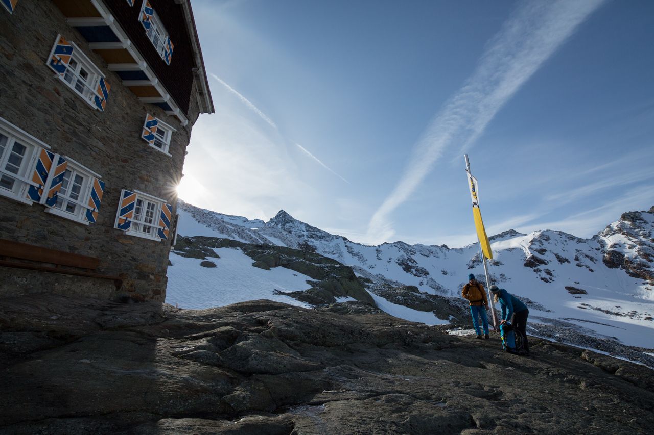
Hildesheimer Hütte
- Route
-
Gamsplatzl (3,019 m)2.2 kmSiegerlandhütte5.3 km
- Best season
-
JanFebMarAprMayJunJulAugSepOctNovDec
- Description
-
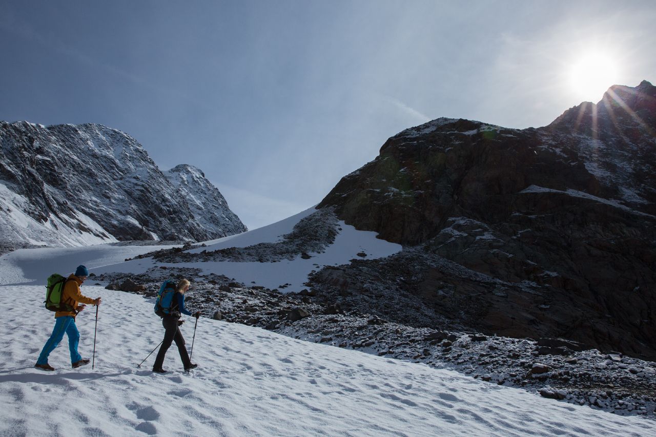
Route: Climbing, Path Requirements: Step safety, dizziness; Mountain route red Difficulties: no special difficulties Equipment: normal hiking equipment Huts: Hildesheimer Hut, Siegerland Hut Acess / exit point: from Sölden through the Windach Valley and via Aschenbrenner- or Gaiskarweg (steep) to Hildesheimer Hütte (about 5 h ascent, approx. 4 h descent);
from Sölden through the Windachtal to Siegerlandhütte (about 5 h ascent, approx. 4 h descent);
alternatively bus from Sölden to Fiegl's Gasthaus in the Windach Valley - approx. 3 h ascent to Hildesheimer Hütte and Siegerlandhütte (approx. 2 h descent) - Directions
-
SPELLBOUND BY MAJESTIC ZUCKERHÜTL
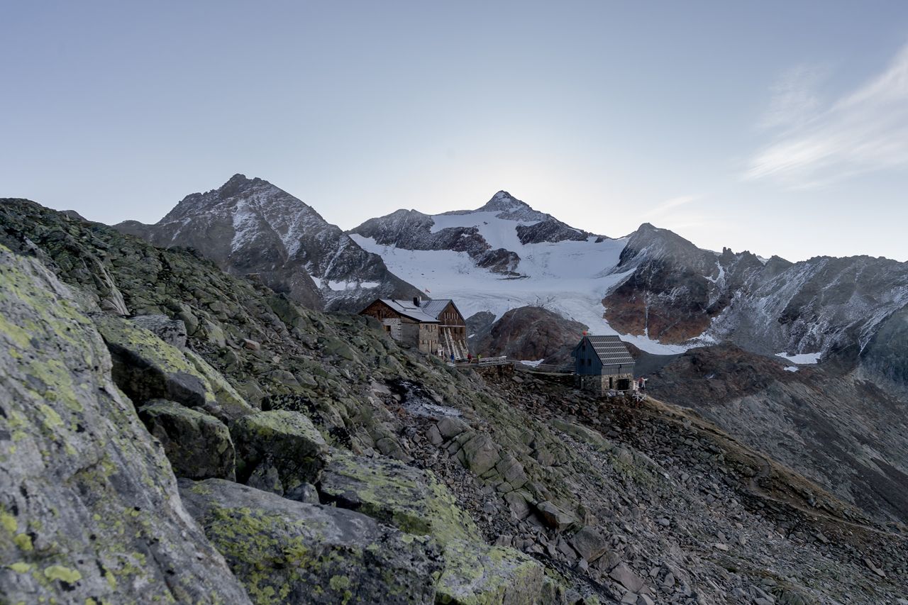
From the hut you walk down Windachtal valley until a trail branches off to the left, towards the rushing Gaiskarbach mountain brook. Continue across the moraine of famous Pfaffenferner glacier and – steeply ascending in part – through boulders and rubble to Gamsplatzl area. There is a short section with fixed cables for your safety. This small plateau provides marvelous views of the Stubai Alps with Zuckerhütl at 3507 meters and the breathtaking Ötztal Alps.The trail switchbacks steeply down to lake Triebenkarsee below the glaciers nout of Triebenkarlasferner. The next stretch is easy and has only little elevation change. The trail crosses the precipitous slopes of Scheiblehn area and then gently climbs up to Siegerlandhütte. - Highest point
- 3,011 m
- Endpoint
-
Siegerlandhütte
- Height profile
-

- Equipment
-
It is recommended to wear hiking equipment such as breathable and weather-adapted outdoor clothing, ankle-high mountain boots, wind, rain and sun protection, cap and possibly gloves. It is also important to have enough food, as well as a first-aid package, a cell phone and a hiking map.
- Additional information
- Directions
- Public transportation
- Parking
-
The following parking facilities are available in Sölden:
- Parking lot
- parking lot Stiegele
- stair parking
- Giggijochbahn + underground garage
- Gaislachkoglbahn + underground garage
- Parking Hochsölden
- parking garage Hochsölden 1. parking lot
- parking Zwieselstein
- parking Zwieselstein / sports ground
All parking is free during the day.
Parking for several days (eg hike tour):
- Postplatz, Parkticket available at the information Sölden Parkgarage Gaislachkoglbahn
- Parkticket either online or directly at the cash desk of the Gaislachkoglbahn


- Author
-
The tour Ötztal Trek Stage 7 is used by outdooractive.com provided.


General info
-
Ötztal
1109
-
Stubaier Gletscher
288