- Brief description
-
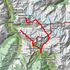
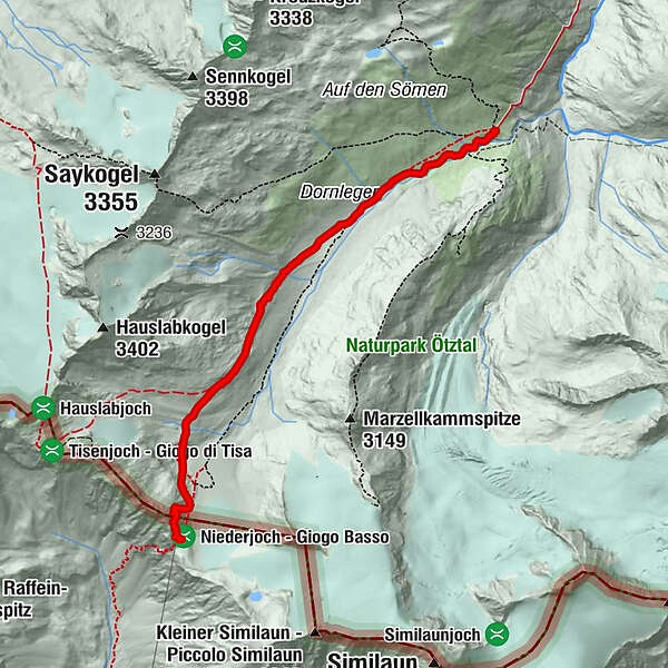
Martin-Busch-Hütte (2.501 m) –> Similaunhütte (3.017 m)
- Difficulty
-
medium
- Rating
-
- Starting point
-
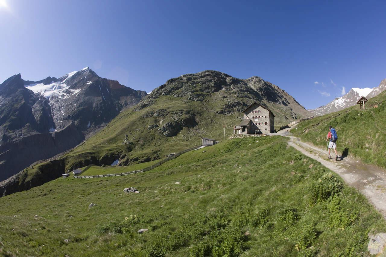
Martin-Busch-Hütte
- Route
-
Niederjoch (3,012 m)4.9 kmSimilaunhütte4.9 km
- Best season
-
JanFebMarAprMayJunJulAugSepOctNovDec
- Description
-
Course: Climbing
Requirements: Basic level of tread safety;
Mountain route red Difficulty:
no special difficulties
Equipment: normal hiking equipment
Huts: Martin-Busch Hut, Similaun Hut
Acess / exit point: from Vent through the Niedertal to the Martin-Busch-Hütte (about 2,5 h ascent, approx. 2 h descent) - Directions
-
A SIDE TRIP TO SOUTH TYROL
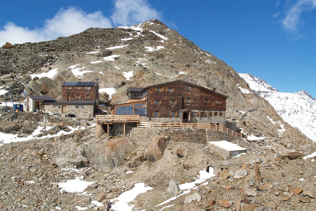
Similaunhütte is located at 3017 meters above sea level on the South Tyrolean side of Niederjoch, a mountain pass between Tirol’s Ötztal and South Tyrol’s Schnalstal. Similaunhütte and Similaun owe their fame to Ötzi - The Iceman who was discovered at nearby Tisenjoch saddle (about 1.5 walking hours). The tour to Similaunhütte runs uphill through Niedertal valley. From Martin-Busch-Hütte you follow the signs towards Similaunhütte. Shortly before you reach Saybach mountain brook, continue along Niedertalbach brook to the left in the direction of Niederjochferner. A marked route then takes you to Similaunhütte. - Highest point
- 3,059 m
- Endpoint
-
Similaunhütte
- Height profile
-

- Equipment
-
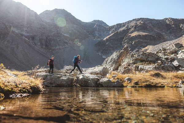
It is recommended to wear hiking equipment such as breathable and weather-adapted outdoor clothing, ankle-high mountain boots, wind, rain and sun protection, cap and possibly gloves. It is also important to have enough food, as well as a first-aid package, a cell phone and a hiking map.
- Tips
-
TIP OF THE DAY
Similaunhütte – Similaun (3.599 meter) – Similaunhütte
Similaun peak from Similaunhütte: glacier tour, surefootedness, goodhead for heights, high Alpine experience; rope is a must on the glacier (crevasses!) and ridges. Ice pick and crampons required!
Level, walking time: difficult hike via glacier (mountain guide recommended), about. 4 h
Altitude meters: 580 hm descent and ascent - Additional information
- Directions
- Public transportation
- Parking
-
In Obergurgl-Hochgurgl the following parking facilities are available:
- Car park Village center Obergurgl (in front of the church on the right, behind the multi-purpose building where the information office is located)
- Parking lot with coin entrance Parking Place entrance - valley station Festkoglbahn, free of charge
- Parking Hochgurglbahn valley station, free of charge - no parking at night
- Parking Top Mountain Crosspoint, free of charge
- Parking Hochgurgl, free of charge (very small parking)
- Author
-
The tour Ötztal Trek Stage 12 is used by outdooractive.com provided.


General info
-
Vinschgau
1285
-
Schnalstal
596
-
Vernagt am See
110