- Brief description
-
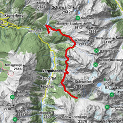
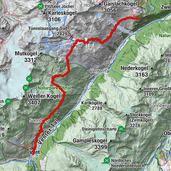
STAGE 7:
VENT –> Weißenkar –> Tiefenbach –> Gaislachalmen –> GAISLACH
- Difficulty
-
medium
- Rating
-
- Starting point
-
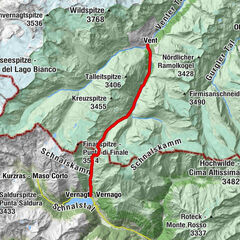
Vent
- Route
-
Vent0.0 kmGaislachalm14.8 km
- Best season
-
JanFebMarAprMayJunJulAugSepOctNovDec
- Description
-
THE MOUNTAINEERING VILLAGE AT THE REAR END OF THE VALLEY
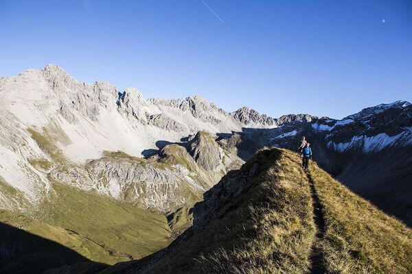
The lovely mountaineering village of Vent is encircled by several three thousand meter high summits and surrounded by a splendid mountain scenery. In midsummer, you can watch numerous hikers with large backpacks and climbing equipment in this little mountain hamlet. The main hiking destinations are either Wildspitze peak or "Ötzi's" place of finding!
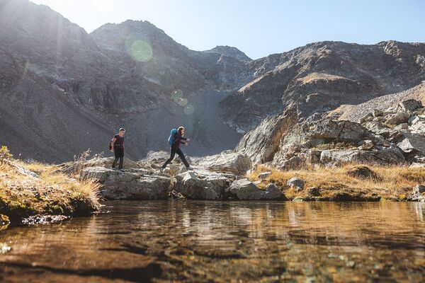
Not far from the village center a narrow path travels across lush Alpine meadows, along rushing mountain brooks which make their way out of the valley towards the Venter Ache brook. The higher you climb the more bizarre is the panorama: glacier-covered mountains higher than 3000 meters are already in sight.
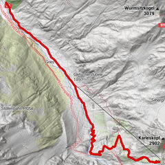
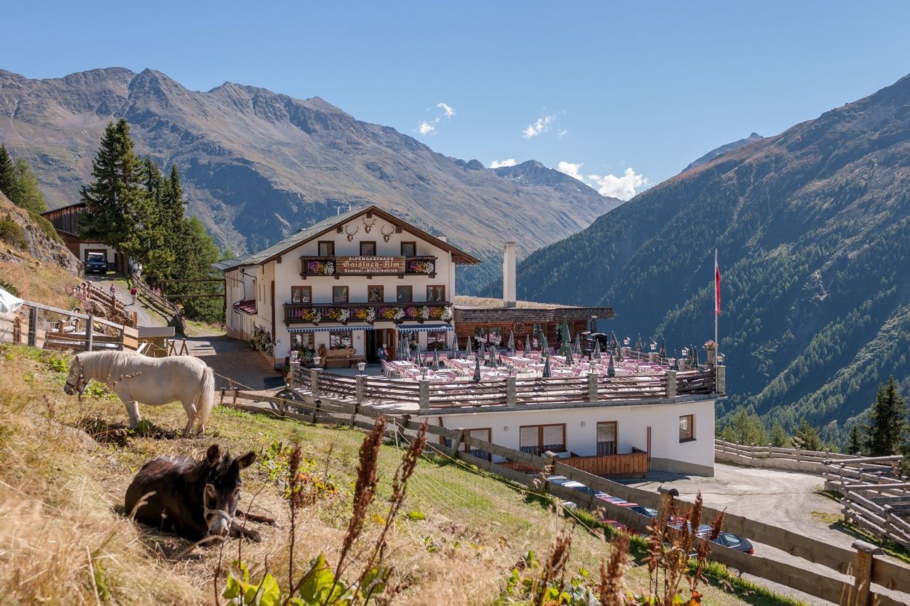
The route leads past Tiefenbach Glacier where countless sportsmen improve their snow sport skills. On the descent to the Gaislachalmen pastures you can immerse yourself in a wonderful feeling of being away from everyday worries. Take a deep breath and enjoy the marvelous high Alpine plateau of Gaislachalmen. Fresh mountain flowers, rich colors and lovely pastures and meadows line your way to the valley floor near Bodenegg and further on to Zwieselstein.
- Directions
-
At the P9 Rofenhöfe junction you keep to the right, following the wide forest trail in the direction of Stableinalm towards the access point to the high Alpine Panorama Trail. At the beginning you will quickly gain altitude as the ascent is very steep. Continue hiking on the trail, past the slopes of Weißkar and Mutboden.
On the whole route you enjoy a magnificent view of the valley basin encircled by majestic mountain peaks. The slightly ascending route takes you to the huge car park of Tiefenbach mountain gondola.
This also means that you have reached the highest point of this stage, the base station of Tiefenbach gondola in the foothills of Tiefenbach Glacier at 2800 meters. Leaving behind the rocky high Alpine terrain, you turn right at the entrance to parking area of Tiefenbach gondola and follow the PanoramaTrail down to Gaislach. Again you enjoy the picture-book mountain panorama offering memorable views of Ventertal. - Highest point
- 2,798 m
- Endpoint
-
Gaislach
- Height profile
-

- Equipment
-
Standard hiking equipment, sturdy hiking boots
- Safety instructions
-
Surefootedness, a good physical shape, stamina
It's a long walking time!
- Additional information
- Directions
- Public transportation
- Parking
-
The following parking facilities are available in Vent:
In front of the village and at the valley station from the chair lift (payable)


- Author
-
The tour Ötztaler Urweg E7 Vent - Gaislach is used by outdooractive.com provided.


General info
-
Meraner Land
1736
-
Ötztal
1111
-
Vent
293