Goldtoni - Alpenbogen A028 Prettau-Mayrhofen

long-distance walking trail

© Anton_S

© Anton_S

© Anton_S
Tour data
33.7km
676
- 2,553m
1,655hm
2,433hm
08:34h
- Brief description
-
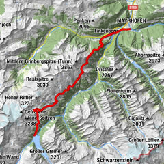
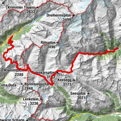
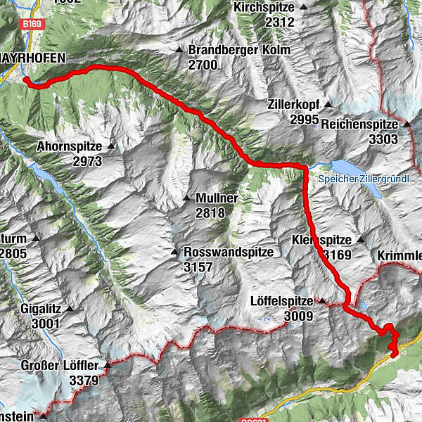
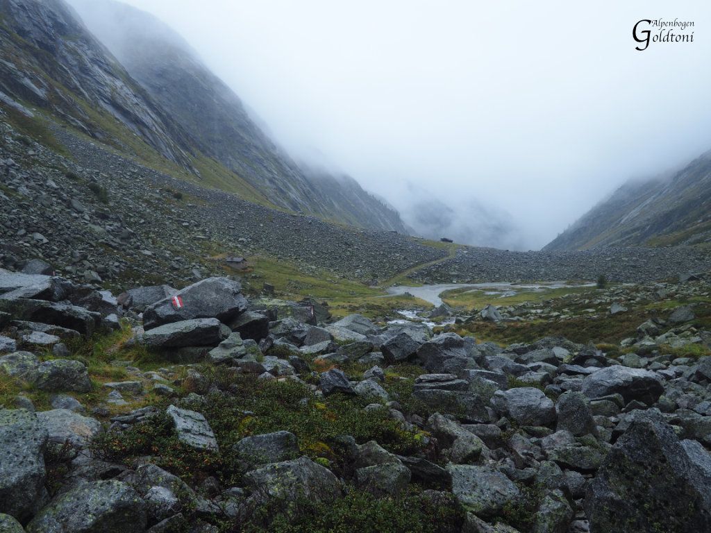
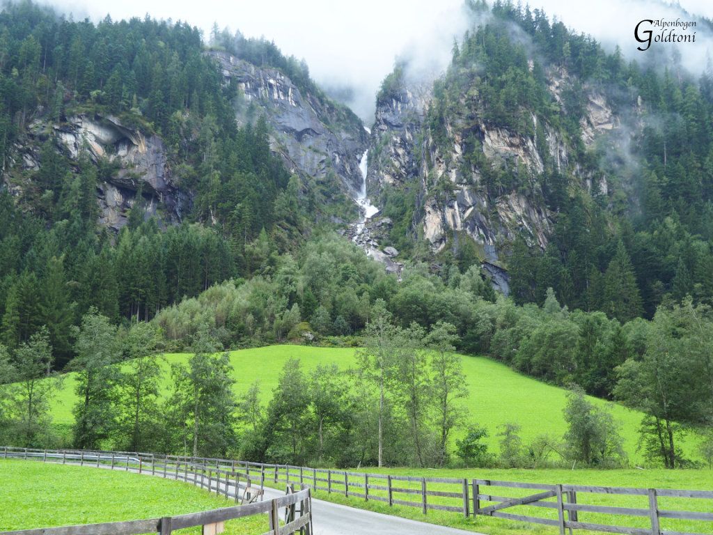
Prettau in Südtirol(1475)-Hundskehljoch(2557)-Hundskehlgründl-Hundskehle-Sulzenalm-Bärnbadhütte(1450)-Zillergrund-Ahüttenalm(1391)-Schattenseiteggalm(1224)-Siegeleralm(1114)-Mayrhofen(650)
- Difficulty
-
medium
- Rating
-
- Route
-
Predoi0.8 kmWaldneralm (2,068 m)4.1 kmHundskehljoch (2,557 m)6.9 kmJausenstation Bärenbadalm15.7 kmGasthof Au18.6 kmIn der Au18.7 kmHäuslingkapelle23.7 kmAlmgasthof Häusling23.7 kmBrandberg29.6 kmMayrhofen (633 m)33.4 kmKumbichl33.5 km
- Best season
-
JanFebMarAprMayJunJulAugSepOctNovDec
- Highest point
- Hundskehljoch (2,553 m)
- Rest/Retreat
-
Bärenbadhütte (sehr empfehlenswert)
- Source
- Toni Sommer
GPS Downloads


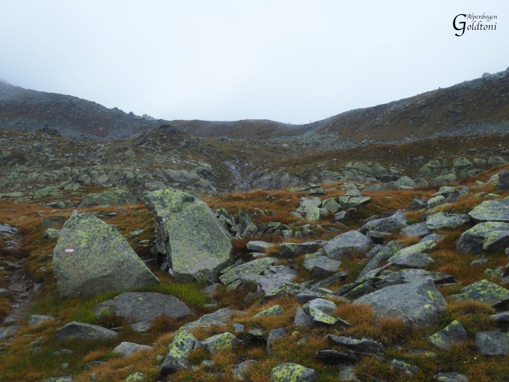
Trail conditions
Asphalt
Gravel
(40%)
Meadow
(20%)
Forest
(10%)
Rock
(30%)
Exposed
Other tours in the regions