Kaiserkrone - alternative route descent via Schleier Waterfall

long-distance walking trail

© TVB Wilder Kaiser - TVB Wilder Kaiser/Simon Oberleitner

© TVB Wilder Kaiser - TVB Wilder Kaiser/Andreas Handl

© TVB Wilder Kaiser - TVB Wilder Kaiser/Andreas Handl

© TVB Wilder Kaiser

- Brief description
-
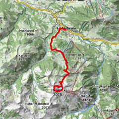
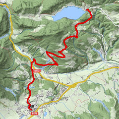
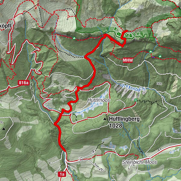
Turnoff to Granderalm – Schleier Waterfall – Going, Hüttling
- Difficulty
-
medium
- Rating
-
- Starting point
-
First turnoff after the Granderalm
- Route
-
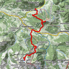
Schleierwasserfall0.7 kmAschingerkapelle3.1 km
- Best season
-
JanFebMarAprMayJunJulAugSepOctNovDec
- Description
-
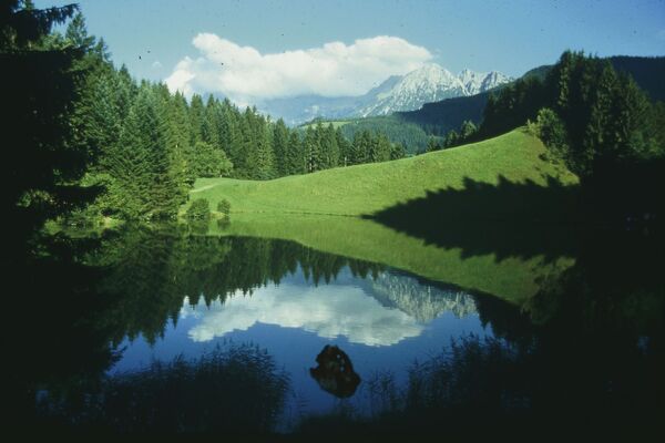
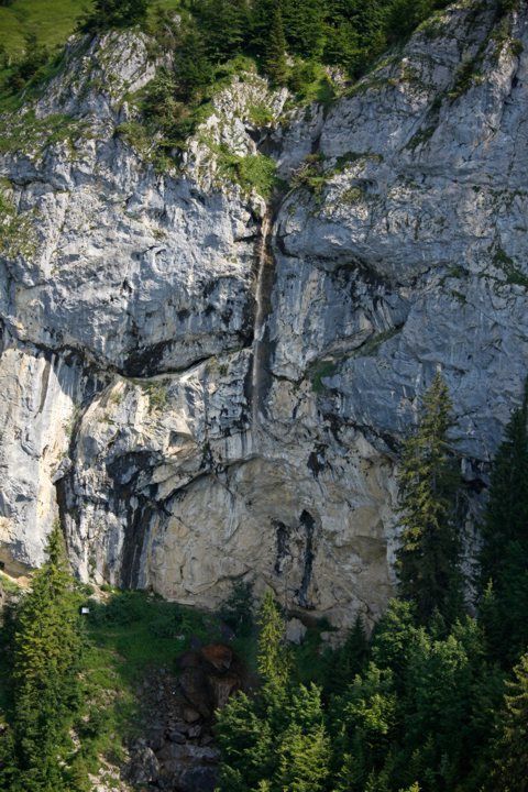
At the first turnoff after the Granderalm mountain hut, take path 819/824 heading south towards the Schleier Waterfall. After crossing a brief exposed section, you will need to climb down via a rigid ladder around six metres in length. This is followed by a steep descent through the forest until you reach the nature and climbing oasis that is the Schleier Waterfall.
You will be able to enjoy the soothing rushing of the water and also watch some climbers in action on the rock faces if you’re lucky.
Heading from the Schleier Waterfall, walk along the path and subsequently take forest road 818 heading south to the hiking starting point Hüttling in Going.
Requirements: surefootedness and a good head for heights (long ladder)! - Directions
-
At the first turnoff after the Granderalm mountain hut, take path 819/824 heading south towards the Schleier Waterfall. After crossing a brief exposed section, you will need to climb down via a rigid ladder around six metres in length. This is followed by a steep descent through the forest until you reach the nature and climbing oasis that is the Schleier Waterfall.
You will be able to enjoy the soothing rushing of the water and also watch some climbers in action on the rock faces if you’re lucky.
Heading from the Schleier Waterfall, walk along the path and subsequently take forest road 818 heading south to the car park in Going, Hüttling.
Requirements: surefootedness and a good head for heights (long ladder)! - Highest point
- 1,277 m
- Endpoint
-
Hiking starting point Hüttling, Going (820 m)
- Height profile
-

- Equipment
-
Rucksack, sturdy hiking/mountaineering boots with anti-slip treaded soles, weather-appropriate hiking gear (breathable), a change of clothes, sun protection (sunglasses, sun cream, lip protection, headgear), waterproofs (rain jacket/poncho, pocket umbrella, rucksack protector), cold protection (hat, gloves), sufficient food and drink, hiking poles (height adjustable) if required, first aid kit incl. rescue blanket and bivouac sack, mobile phone with fully charged battery, headlamp, plastic bag for waste, hiking map, route description and information materials (GPX track), ID, insurance card, cash
Additions for overnight stay at mountain hut:
Mountain hut sleeping bag, indoor shoes, toiletries and towel, personal medication, headlamp, Alpine Club ID Card, cash, charger for mobile phone
The hiking routes between the huts are often rather long, we recommend taking plenty of food and drink and booking your overnight stays well in advance. - Directions
-
At the first turnoff after the Granderalm mountain hut, take path 819/824 heading south towards the Schleier Waterfall. After crossing a brief exposed section, you will need to climb down via a rigid ladder around six metres in length. This is followed by a steep descent through the forest until you reach the nature and climbing oasis that is the Schleier Waterfall.
You will be able to enjoy the soothing rushing of the water and also watch some climbers in action on the rock faces if you’re lucky.
Heading from the Schleier Waterfall, walk along the path and subsequently take forest road 818 heading south to the car park in Going, Hüttling.
Requirements: surefootedness and a good head for heights (long ladder)!


- Author
-
The tour Kaiserkrone - alternative route descent via Schleier Waterfall is used by outdooractive.com provided.
GPS Downloads


General info
Insider tip
Flora
Fauna
A lot of view
Other tours in the regions


 Toni Niederwieser")