Kaiserkrone - Kufstein approach, Kaiserlift


- Brief description
-
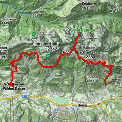
Kufstein – Brentenjoch – Kaindlhütte
- Difficulty
-
easy
- Rating
-
- Starting point
-
Kaiserlift summit station, Kufstein (1,255 m)
- Route
-
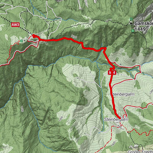
Jahnhügel (1,273 m)0.1 kmBrentenjoch-Alm0.2 kmSteinbergkapelle2.8 kmKaindlhütte2.8 km
- Best season
-
JanFebMarAprMayJunJulAugSepOctNovDec
- Description
-
Starting from the district of Sparchen in Kufstein, take the Kaiserlift chairlift to the Brentenjoch mountain. Alternatively, you can take hiking trail 814. From the Brentenjoch, keep walking along trail 814 until you come to the Kaindlhütte mountain hut.
- Directions
-
Starting from the district of Sparchen in Kufstein, take the Kaiserlift chairlift to the Brentenjoch mountain. Alternatively, you can take hiking trail 814. From the Brentenjoch, keep walking along trail 814 until you come to the Kaindlhütte mountain hut.
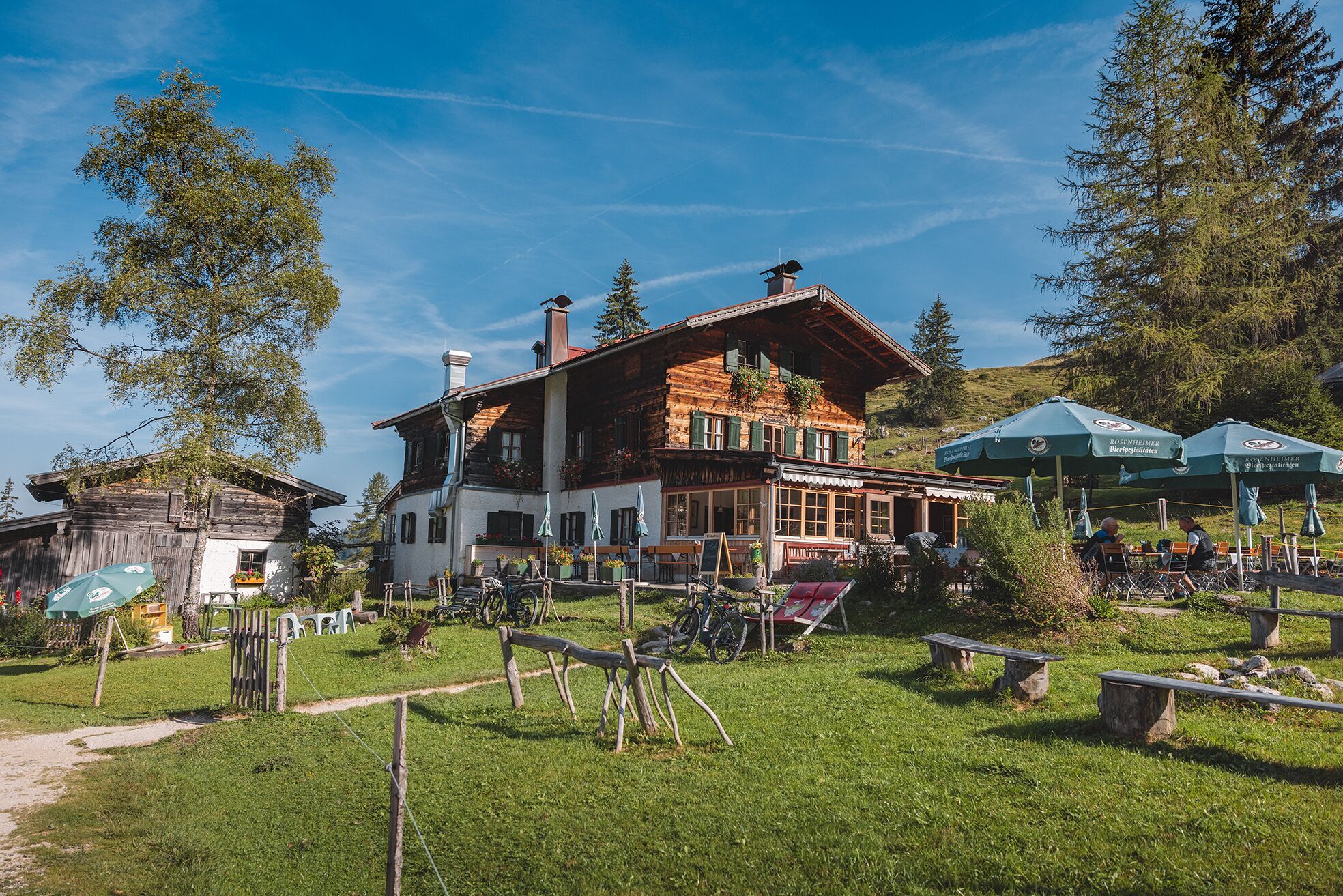
- Highest point
- 1,287 m
- Endpoint
-
Kaindlhütte, Scheffau (1,293 m)
- Height profile
-

- Equipment
-
Rucksack, sturdy hiking/mountaineering boots with anti-slip treaded soles, weather-appropriate hiking gear (breathable), a change of clothes, sun protection (sunglasses, sun cream, lip protection, headgear), waterproofs (rain jacket/poncho, pocket umbrella, rucksack protector), cold protection (hat, gloves), sufficient food and drink, hiking poles (height adjustable) if required, first aid kit incl. rescue blanket and bivouac sack, mobile phone with fully charged battery, headlamp, plastic bag for waste, hiking map, route description and information materials (GPX track), ID, insurance card, cash
Additions for overnight stay at mountain hut:
Mountain hut sleeping bag, indoor shoes, toiletries and towel, personal medication, headlamp, Alpine Club ID Card, cash, charger for mobile phone
The hiking routes between the huts are often rather long, we recommend taking plenty of food and drink and booking your overnight stays well in advance. - Directions
-
Coming from the Inntalautobahn A12 you take the exit "Kufstein-Nord" and at the first roundabout the second exit onto Rosenheimer Straße. At the second roundabout you take the fourth exit and at the third roundabout the third exit onto Willy-Graf-Straße. At the fourth roundabout you take the first exit and after approx. 100 metres you turn right into Meranter Straße. Follow Meraner Straße for approx. 500 metres to the east, drive through the underpass and follow the signs to Kaiserlift.
- Public transportation
-
At Kufstein train station take city bus line 1 (direction Ebbs Kaisertal) and get off at the stop Kufstein Meraner Straße. From here, walk through the underpass and follow the signs for about 10 minutes to the valley station of the Kaiserlift.
Alternative:
Take the regional bus 4030 (direction Kössen Hüttwirt) to the Ebbs Kaisertal stop and from here walk for about 12 minutes to the Kaiserlift. (Take the Sparchner Straße back in the direction of Kufstein until you come to the left fork in the road Obere Sparchen. Follow this street to the valley station of the Kaiserlift). - Parking
-
Private car park at the valley station of the Kaiserlift - pay & display (max. 5 days)
- Author
-
The tour Kaiserkrone - Kufstein approach, Kaiserlift is used by outdooractive.com provided.
General info
-
Kufsteinerland
2125
-
Scheffau am Wilden Kaiser
614