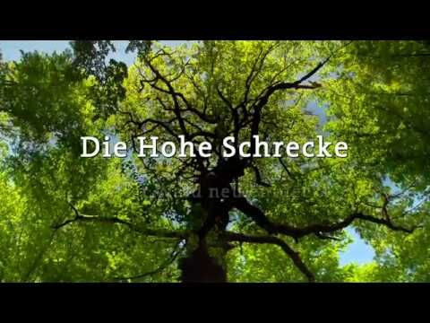
- Brief description
-
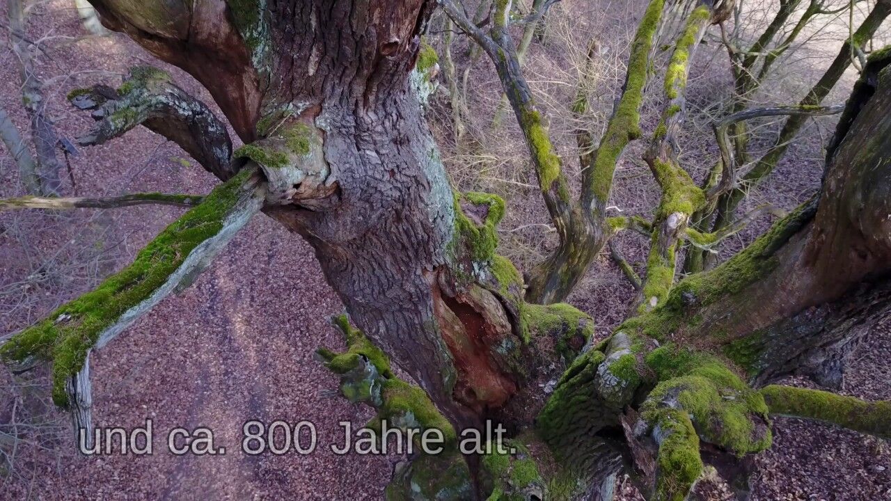
In addition to beautiful nature and a varied relief, the Rabenswald family trail also offers a journey through time through the history of the unspoilt beech forest.
- Difficulty
-
easy
- Rating
-
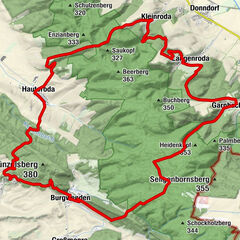
- Route
-
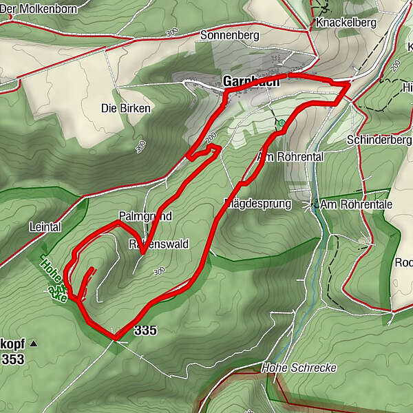
Zum Fröhlichen WandererHorn´s Heuherberge & Erlebnisgastronomie0.2 kmGarnbach0.2 kmPalmgrund1.6 kmPalmberg (335 m)3.6 kmZum Fröhlichen Wanderer5.8 kmGarnbach5.9 km
- Best season
-
JanFebMarAprMayJunJulAugSepOctNovDec
- Description
-
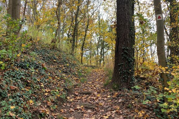
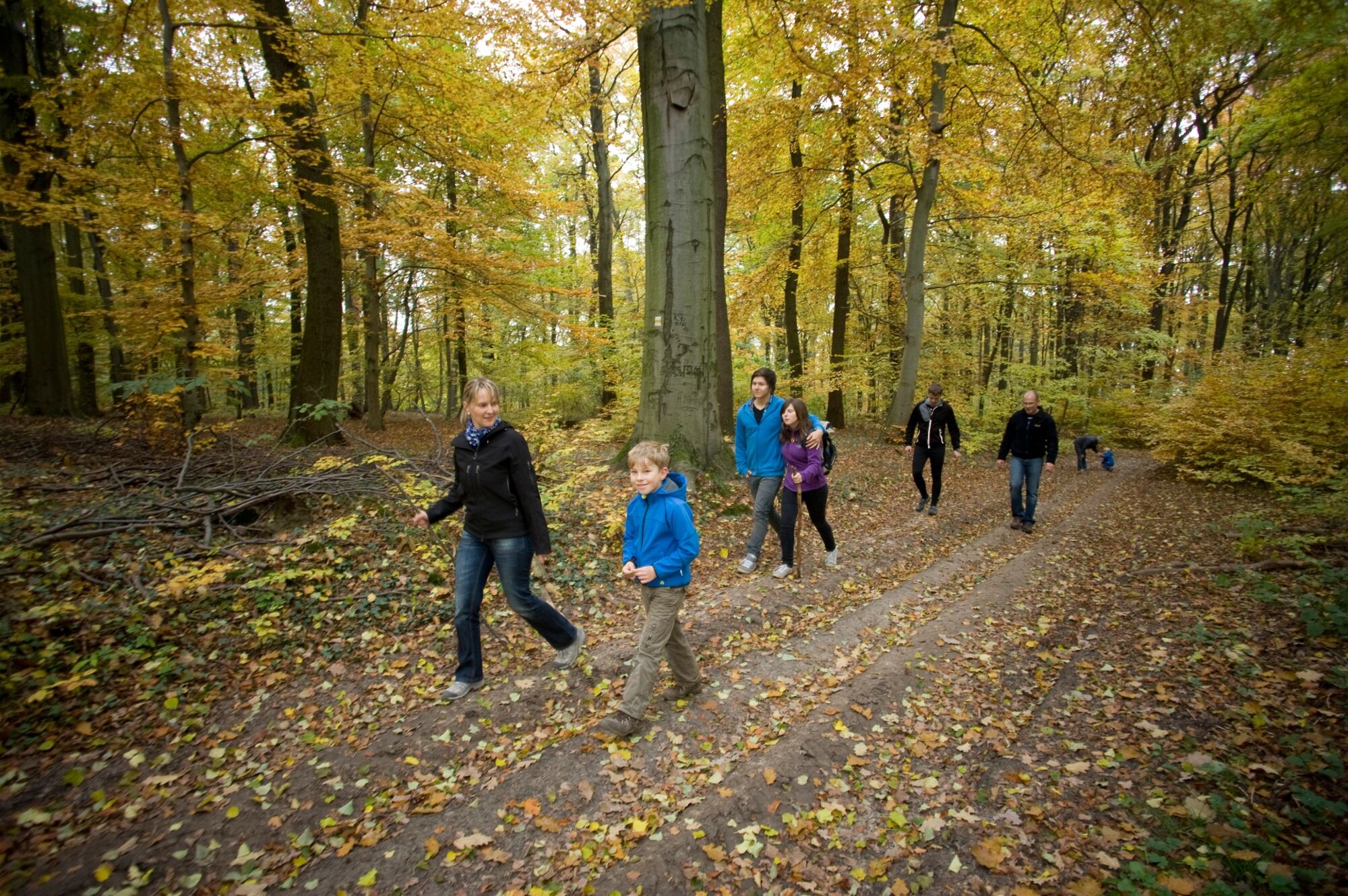
On a length of approx. 6 km you hike on natural paths over a slight ridge through an impressive deciduous forest. The path has been developed as a nature adventure trail with numerous elements and also offers enough resting points.
Plan 3 hours with breaks.
The adventure stations give children the chance to approach nature with all their senses. A green classroom can be used for an impromptu lesson. Sufficient teaching material can be found everywhere. Contemporary history topics such as a charcoal burner and glassworks are also part of the tour. Parents and grandparents have the opportunity to go on a journey of discovery together with the children.
Unfortunately, the path could not be made barrier-free due to the natural conditions.
Please hike only with appropriate clothing and sturdy shoes. Especially in wet weather, the floor covering is not only slippery on inclines. On many sections you have the opportunity to avoid wet spots on a wood chip path.
The family trail is part of the WWF project Thuringian jungle trails and is aimed at all age groups.
- Directions
-
Have you spotted the raven at the information point at the hiking car park? He is the symbol of this circuit.
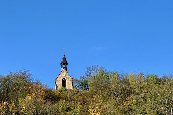
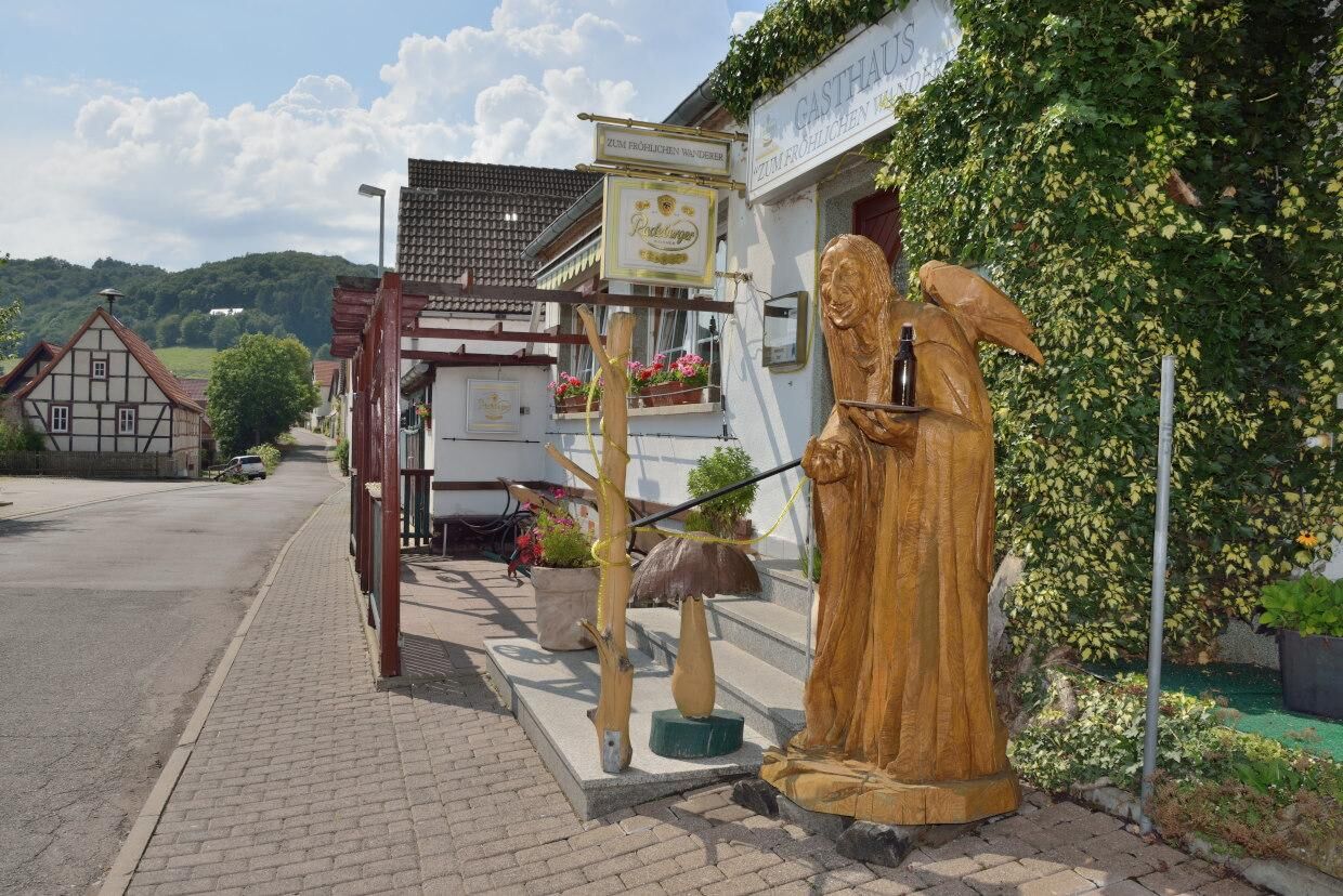
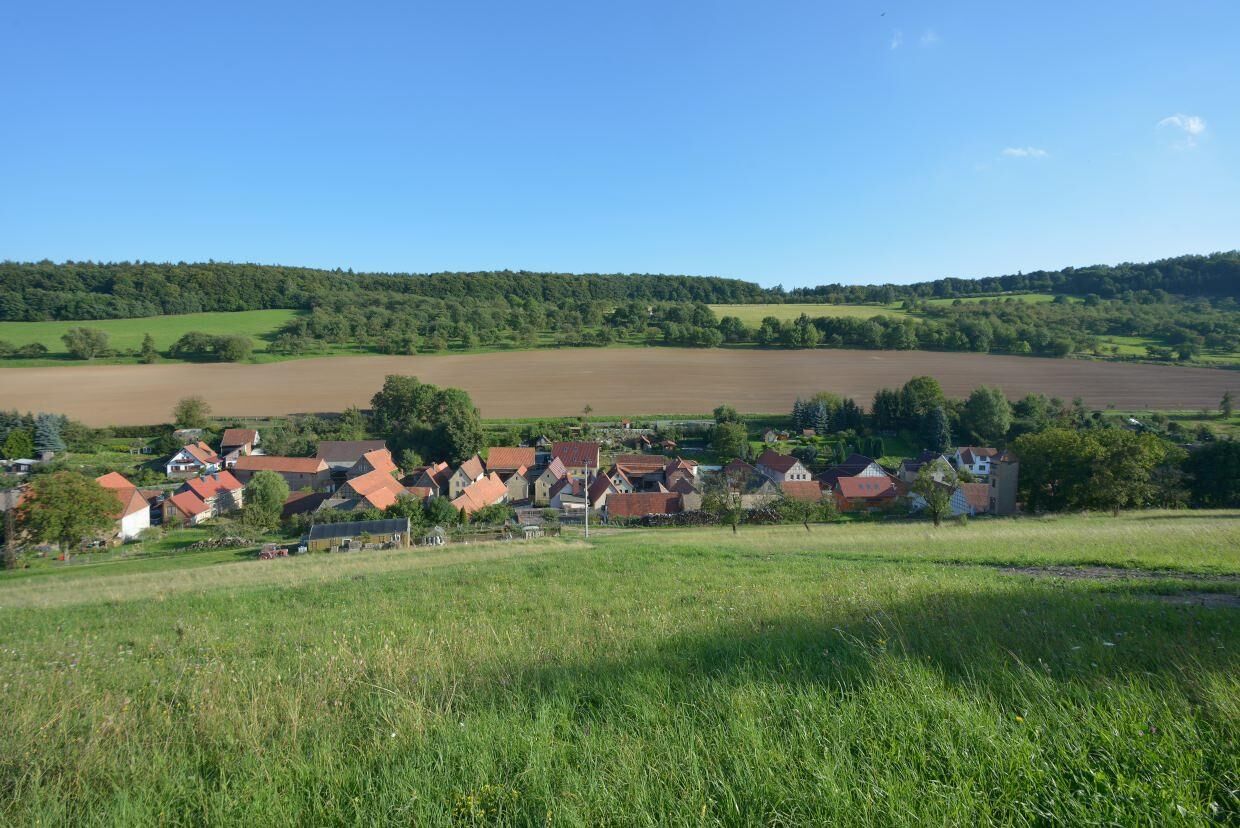
Our tour starts in Garnbach at the hiking car park opposite the “Zum Fröhlichen Wanderer” inn. A hiking board provides information about the network of paths in the Hoher Schrecke. The starting point Garnbach has around 100 residents and is idyllically situated on the south-eastern slope of the Sommerberg in one of the most beautiful entrance valleys to the ancient forests of the Hoher Schrecke.
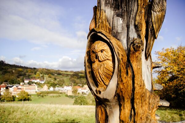
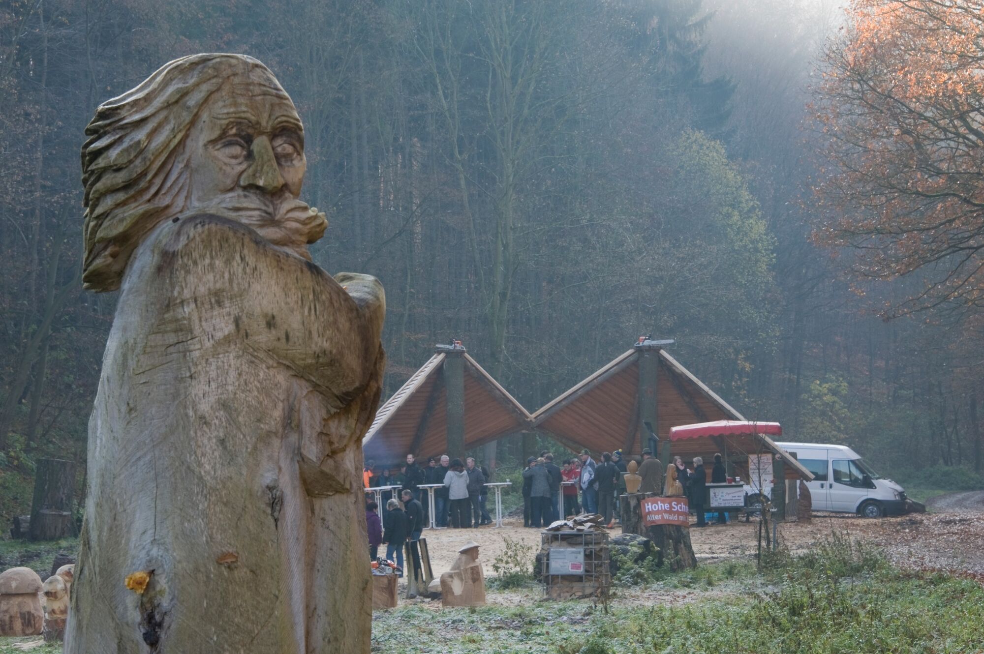
We first follow the Great Hohe Schrecke Circular Trail towards the village. The path through this small town leads past well-kept houses. Wooden sculptures show that artists are at home here.
Behind the bus turning loop, the path leads past other impressive wooden sculptures that were and are created by the Garnbach artist Dieter Krüger and his sons Michael and Sebastian as part of the annual sculpture symposium.
Directly in front of Krüger's open-air studio, also known as the "witchmaker's pavilion", we turn left into the forest and separate ourselves from the Great Hohe Schrecke circular route. But before that, a visit to the open-air pavilion is worthwhile.
An information board shows the 22 stations of the hike. Although the hiking distance is only six kilometers, you should plan a lot of time for this interesting round.
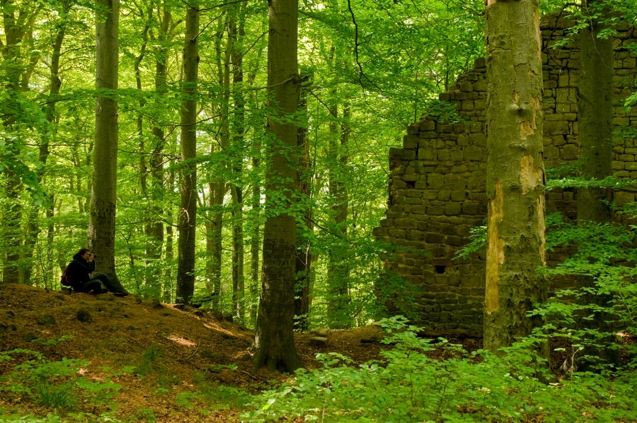
The path dips into the forest at the studio and you are in a fairytale place: an old sandstone quarry, surrounded by ferns, beeches and birches. Uphill you pass two hornbeams whose trunks are intertwined like a strand of DNA. The path continues around the Palmtal (also Palmgrund), past fallen trees, dead wood and roots that look like enchanted animals. Lots of real animals such as red deer, wild boar and badgers populate this part of the forest, whose tracks can sometimes be seen directly on the hiking trail.
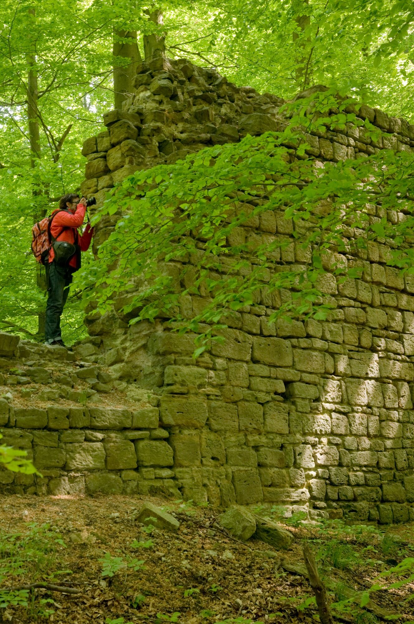
Halfway along the trail, it turns off and leads you to a special piece of forest wilderness: Surrounded by majestic beech trees and two moats, there is still a very well-preserved remains of the wall of the medieval Rabenswald Castle. Nature has taken over here and the forest is so unspoilt that even very rare jungle relict beetle species have found a retreat in it. On the further path you will pass the remains of an old forest glassworks from the 17th century and the "legendary" Mägdesprung. At the end of a regeneration area, a ravine leads out of the forest. Where the forest is replaced by an orchard, you can already see how idyllic the small town of Garnbach is. A few meters to the left of the path, at station 22, a weather shelter invites you to take a break. From here you also have a wonderful view of Garnbach and, so to speak, the goal in front of your eyes.
Then we make the descent into the place that has been visible for a long time. In front of the local connecting road Wiehe - Garnbach we first follow a field path, which a little later leads to this road with little traffic. After a few minutes we have reached our starting point at the Garnbach hiking car park.
- Highest point
- 348 m
- Endpoint
-
Garnbach
- Height profile
-
 © outdooractive.com
 - Tips
-
After the hike, you can visit the Wiehe model railway, which houses the Hohe Schrecke information center and a place to stop for refreshments.
Tourist Information Unstruttal, August-Bebel-Allee 1, 06571 Roßleben Wiehe Tel. 034672 - 69807.
- Directions
-
If you are coming from the A71 motorway, you should use the Heldrungen or Artern exits. The B86 leads from both Heldrungen and Artern to neighboring Reinsdorf. From there you can take the L1215 via Gehhofen, Nausitz and Donndorf to Wiehe. There a signpost branches off to the right towards Garnbach. Alternatively, you can also drive from Artern to Wiehe via Kalbsrieth, Schönewerda, Bottendorf and Roßleben.
- Parking
-
Garnbach hiking car park
-

-
AuthorThe tour Hohe Schrecke: Rabenswald-Familienweg - Thüringer Urwaldpfade is used by outdooractive.com provided.


General info
-
Kyffhäuser
360
-
Kaiserpfalz
30