
- Brief description
-
The former Meuselwitz-Rositz lignite mining area is one of the cradles of the entire Central German lignite mining industry.
- Difficulty
-
medium
- Rating
-
- Starting point
-
Meuselwitz bus station
- Route
-
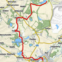
Meuselwitz0.5 kmWeißen Berge2.0 kmFalkenhain3.6 kmPrößdorf6.4 kmHemmendorf7.7 kmGaststätte „Zur Birke“8.2 kmLucka9.8 kmHagenest11.8 kmWildenhain13.0 kmWaltersdorf26.1 kmPflichtendorf28.8 kmHeukendorf29.7 kmMeuselwitz32.5 km
- Best season
-
JanFebMarAprMayJunJulAugSepOctNovDec
- Description
-
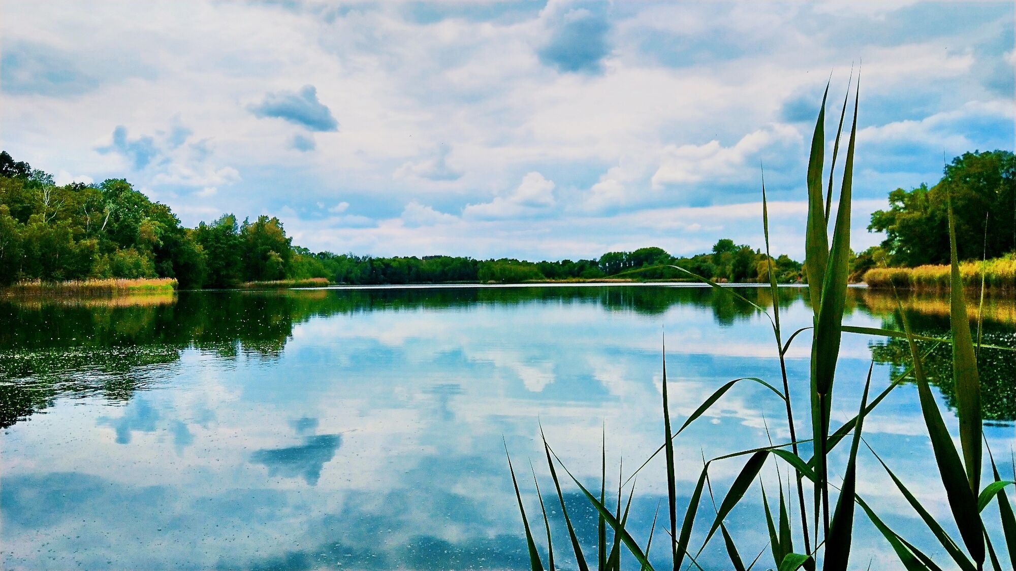
Today, after the recultivation of the former opencast mines, the local mining community provides information on various display boards about the individual sites of the once powerful, but now almost completely disappeared lignite industry. From Lucka and past the former Phoenix slag heap, the tour leads around Haselbacher See and through Kammerfort to Prößdorfer See.
Signposting: orange plaque on signpost trees
- Directions
-
Signage
orange plaque on signpost trees
Start
Bus station in Meuselwitz
Route - complete section of the route with alternative routes to shorten the tour.
in Meuselwitz from the bus station at the Schloßplatz to the Altenburger Straße on the B 180 follow the signs to the intersection Luckaer Straße, at the traffic lights cross the street and turn left "am Ententeich", street ends after approx. 500m, as a driving and forest path through small woods at the slag heapafter approx. 2km there is a memorial stone for the village Rusendorf on a clearing, dredged because of brown coal open-cast mining, here you can still see the residual hole "Rusendorfer See" (fenced), afterwards on the old Rusendorf road, this road leads into the country road to Falkenhain
At the entrance to Falkenhain go straight ahead into the village to Karl-Marx-Straße, turn right into Karl-Liebknecht-Straße and continue straight ahead to the end of the village, here turn left onto the country road, after approx. 1km turn left onto the junction with country road L 1361 and after the railroad bridge (former mine railroad) turn right in the direction of Prößdorf. in Prößdorf after approx. 500m on country road turn left to the Prößdorfer See, on nature round path around the lake to the Prößdorfer Straße in the district Lucka- Hemmendorf, after approx. 1,5 km Lucka is reached in Lucka at the junction of Prößdorfer Weg in Meuselwitzer Straße turn left onto the cycle path and footpath, after 200m the cycle path ends, cross the road and turn into Waldallee, in Waldallee there is the possibility to change to the alternative route: to Schnauderhainichen and Meuselwitz otherwise continue left through Eigenheim-Siedlung to the development area in Clara-Zetkin-Straße and turn right at the intersection into Bischofsweg, at the end of the village turn left into Altenburger Straße in the direction of Hagenest in Hagenest straight ahead on the main road through the village to Wildenhain, in the center of the village turn left to the end of the village and to the road Ramsdorf-Wintersdorf, here turn right, then left to the Haselbacher See, on the circular route turn left to the Saxon side at Haselbacher See on roadway at turnoff to Ramsdorf turn right on natural forest road (at a sloping spot a new bike path was built and paved, so that the steep road section was lowered, the path was made straight and in best path condition), then over a short piece of asphalted factory road to the forest road, straight ahead to the turnoff in front of bathing area on Thuringian side, turn left on forest road into Kammerforst on good forest roads through the Kammerforst to the crossroads "Breitinger Weg", turn left and continue to the forest border at the Wintersdorfer Straße, cross the coal railroad track and after a short cycle path cross the country road L 1355 and then on the road to Waltersdorf in Waltersdorf turn right onto Wintersdorfer Straße, at the municipal office there is a signpost, continue straight on Feldstraße, after the end of the village take the driveway and unpaved dirt road, after approx. 2km take the Plattenweg, Gormaer Weg past the former mine, then take the asphalt road to Plichtendorf in Plichtendorf turn right onto Kriebitzscher Straße, at car dealership turn left onto farm road through town to junction with Heukendorfer Straße, after Heukendorf turn left to fork in Rositzer Straße, follow signpost half-left to Meuselwitz on new cycle path, in Meuselwitz to Weinbergstraße and then in Altenburger Straße back to starting point of tourAlternative route:
Heukendorf: at the fork Rositzer Straße follow the signpost to Schnauderhainichen, on partly unpaved road to "Auholz", cross the coal railroad tracks at the stop "Schnaudertal", continue to the junction of Straße der Einheit, there turn left and through the village to the road L 2174, cross this to the road to Lucka - at the slag heap "Phoenix II" Phoenix" slag heap: on old open-cast mining road through reforestation forest to junction with new cycle path near Breitenhain, turn right here, cycle path ends in Lucka on forest avenueTotal distance: 32,5km
- Highest point
- 202 m
- Endpoint
-
Meuselwitz Altenburger Street
- Height profile
-
 © outdooractive.com
 - Equipment
-
Bike tour: roadworthy bike, bike helmet, day bike backpack (approx. 20 liters) with rain cover, comfortable sports shoes, if necessary bike shoes, weather-adapted and durable clothing in multi-layer principle, if necessary bike jersey, if necessary bike gloves, air pump bike tools, sun and rain protection, provisions and drinking water, water bottle and suitable holder, first aid kit, pocket knife, cell phone, if necessary cell phone holder for the handlebars, if necessary headlamp and reflectors, maps
- Additional information
-
Tip
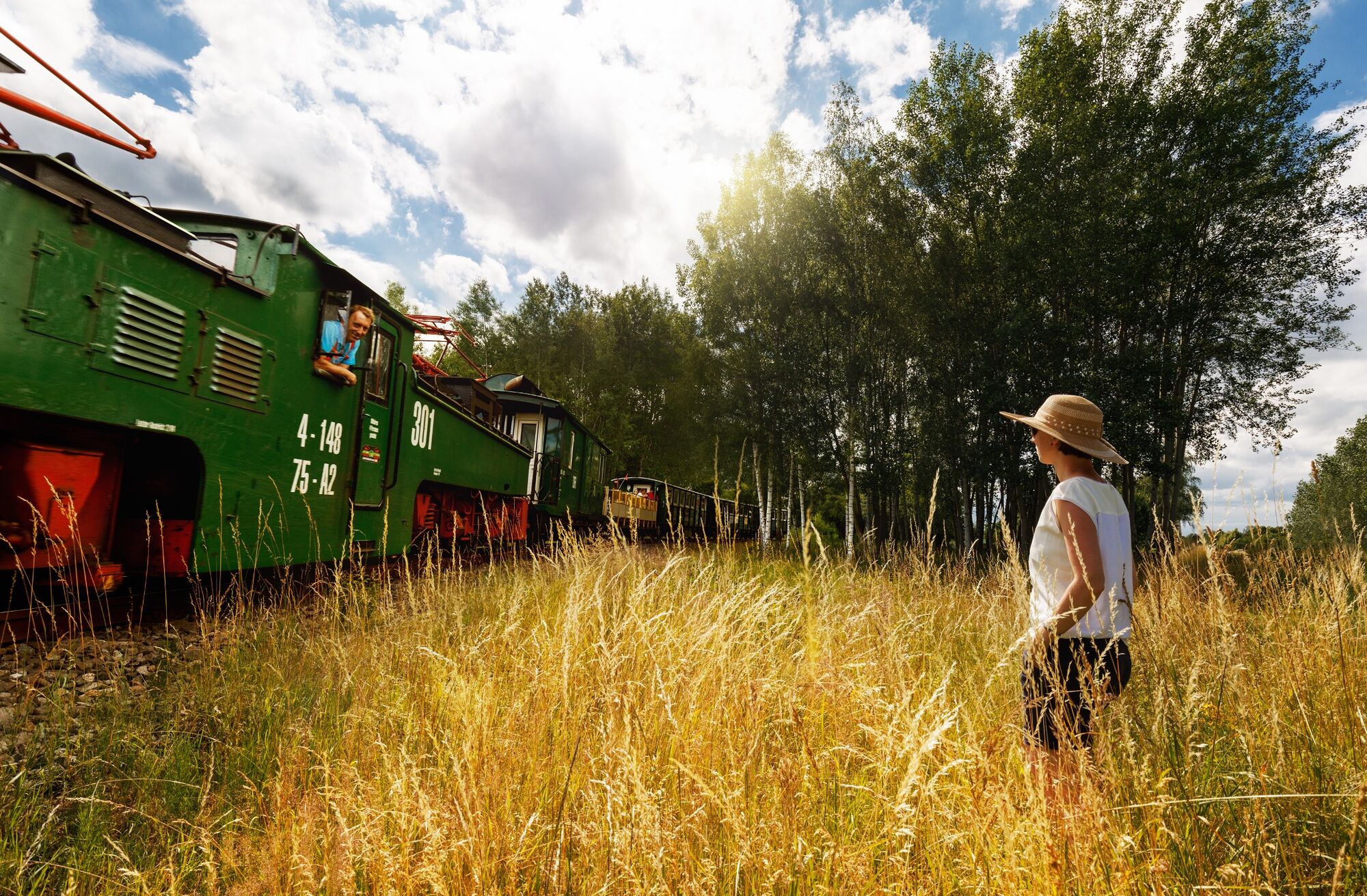
They used to crisscross the region like a spider's web: the 900-milimeter tracks of the coal railroads that transported lignite and excavated material from the opencast mines. These historic constructions are still alive on a good 15 kilometers of track between Meuselwitz and Regis-Breitingen.
Since 1996, the trains have once again been twitching through the Kammerforst. The Meuselwitz train station became a cultural station.
- Author
-
The tour Bike tour "On the tracks of lignite" is used by outdooractive.com provided.