
- Brief description
-
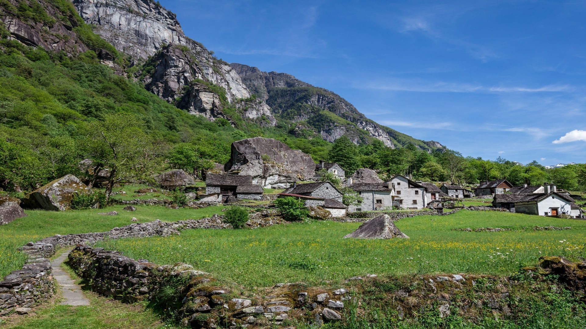
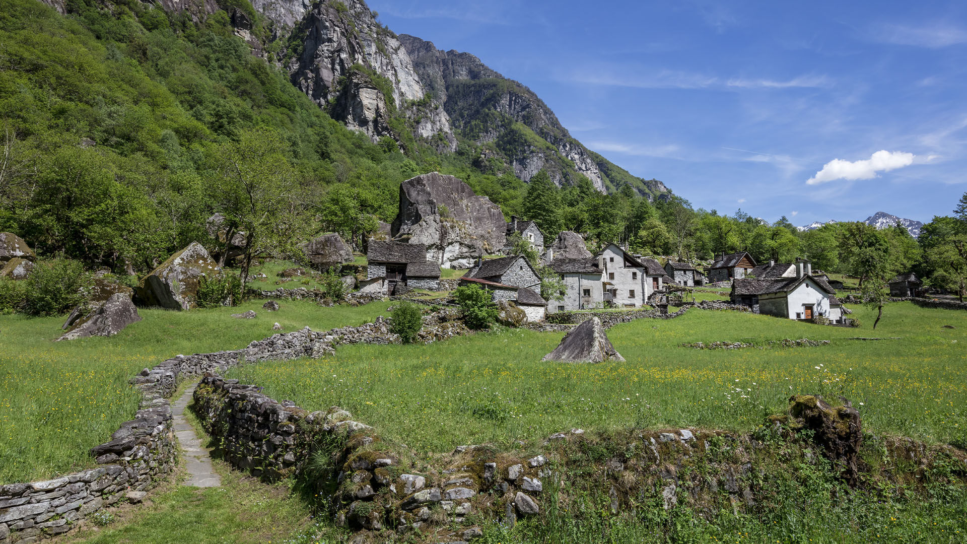
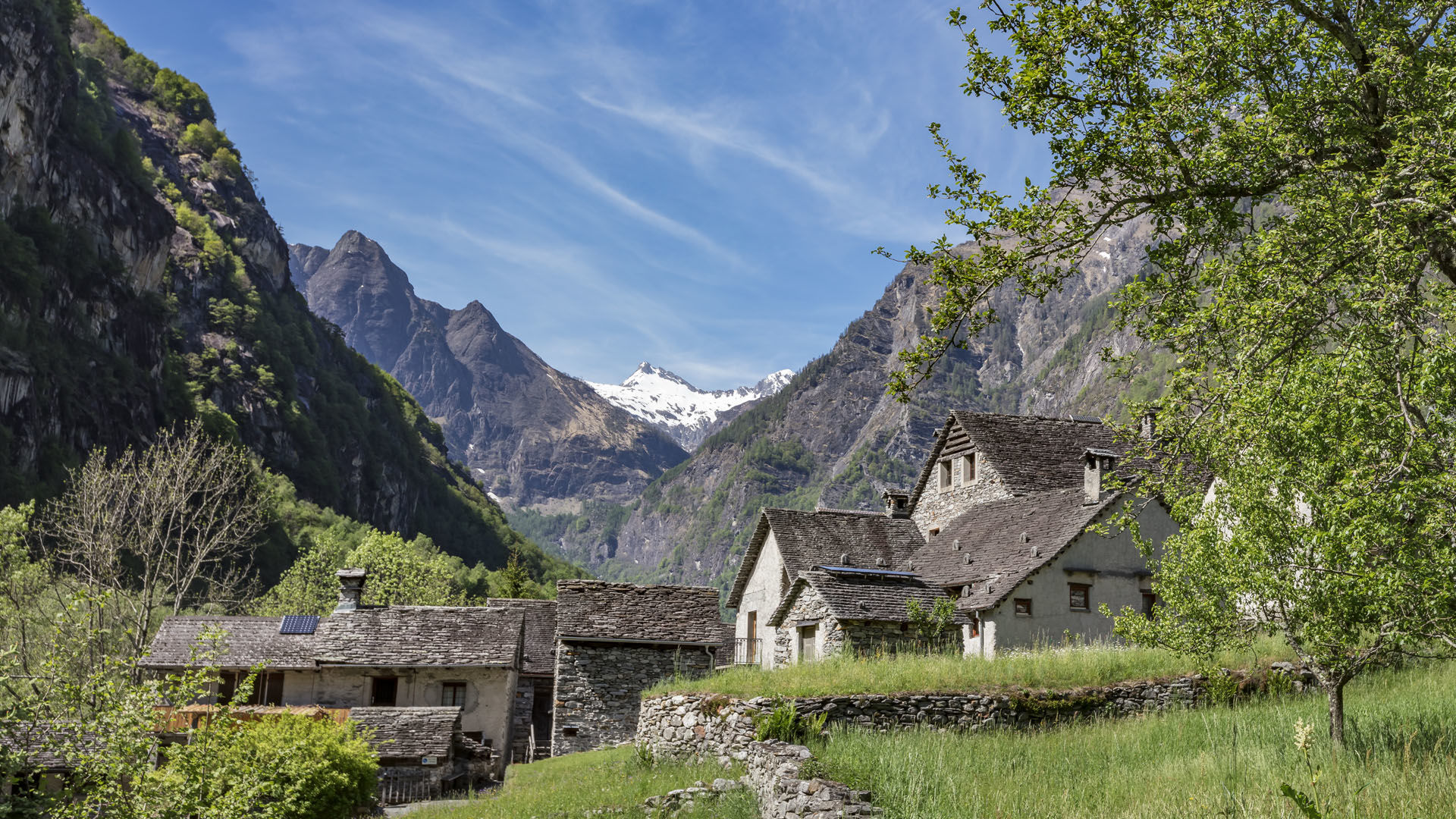
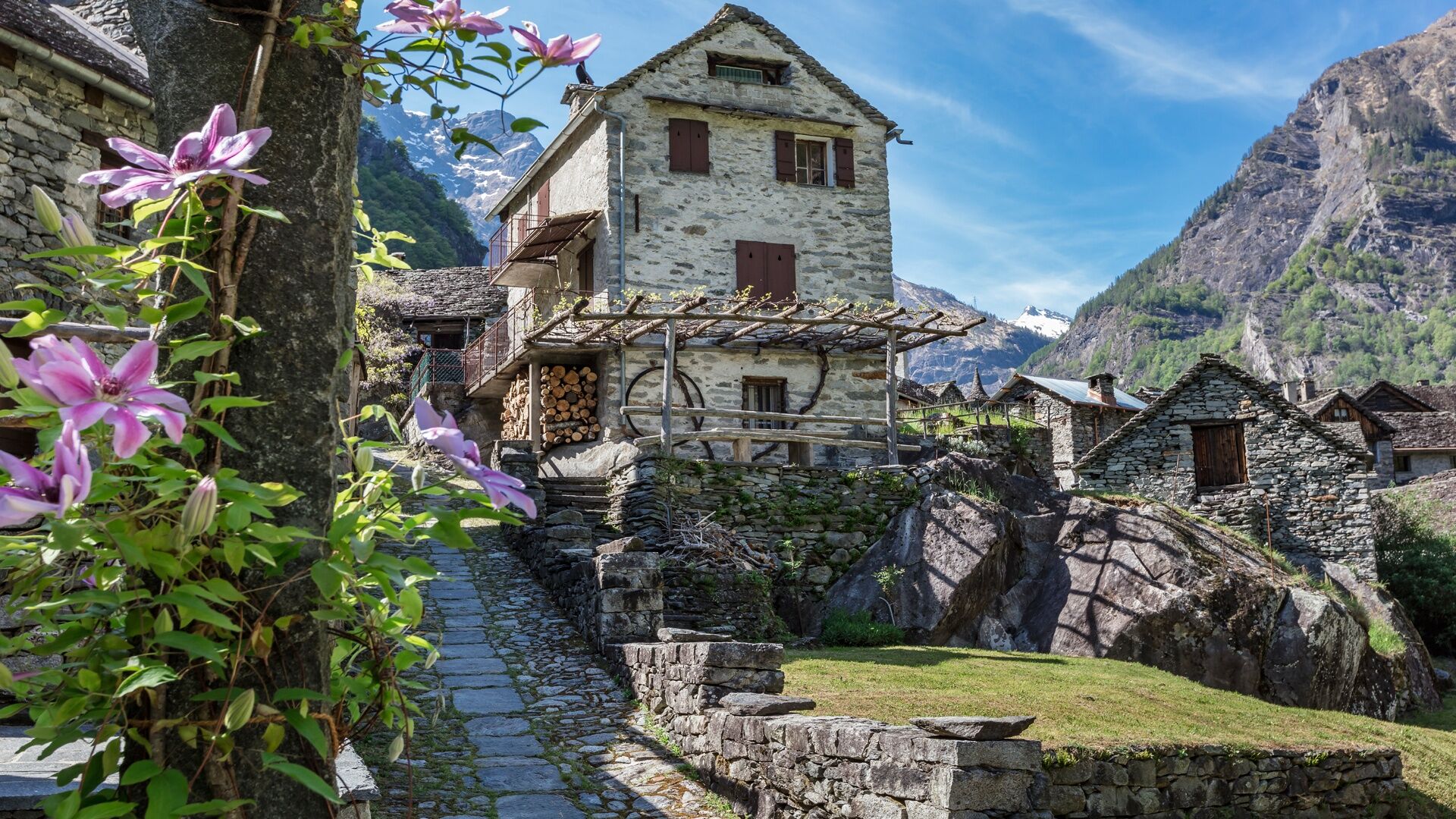
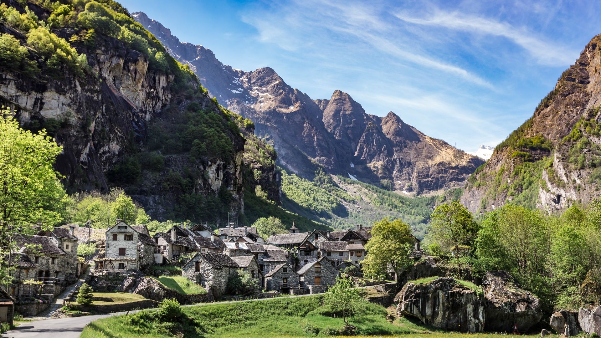
On the trail of transhumance through the Bavona valley. The 12 hamlets bear witness to the humble life of the local population, both then and now.
- Difficulty
-
medium
- Rating
-
- Starting point
-
Bignasco
- Route
-
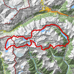
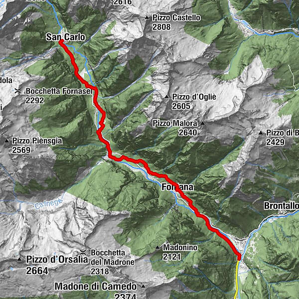
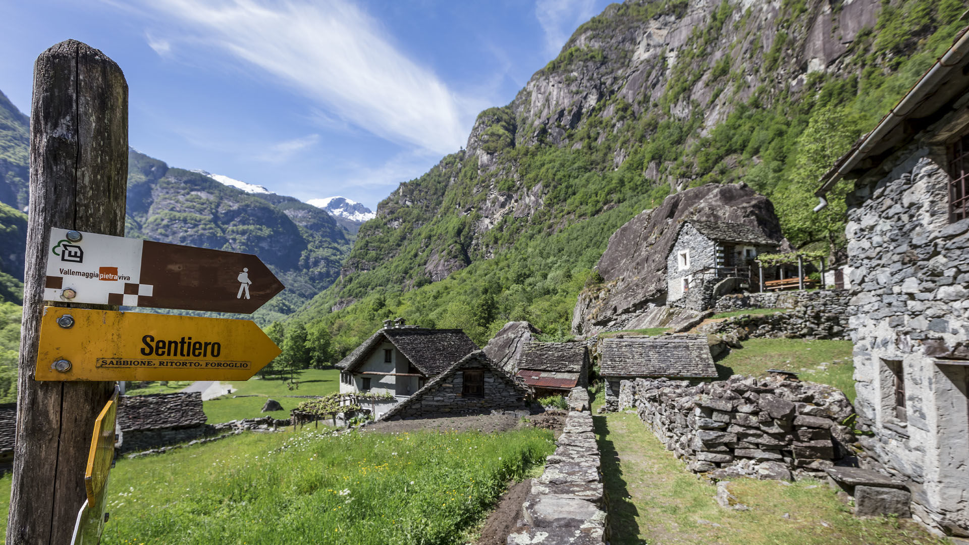
Bignasco (442 m)0.1 kmCavergno (456 m)0.6 kmMulini2.2 kmCappella2.4 kmFontana3.8 kmOratorio di Sabbione5.3 kmSabbione5.3 kmCappella6.2 kmOratorio di Ritorto6.3 kmCappella6.6 kmRistorante La Froda7.4 kmForoglio7.5 kmOratorio di Roseto8.4 kmRoseto8.4 kmCappella8.6 kmFontanellata9.4 kmOratorio di Faedo9.5 kmFaedo9.6 kmSerta9.9 kmSonlerto10.6 kmOratorio di Sonlerto10.7 kmOratorio di Gannariente11.6 kmSan Carlo12.6 kmAlbergo Basodino12.7 km
- Best season
-
JanFebMarAprMayJunJulAugSepOctNovDec
- Description
-
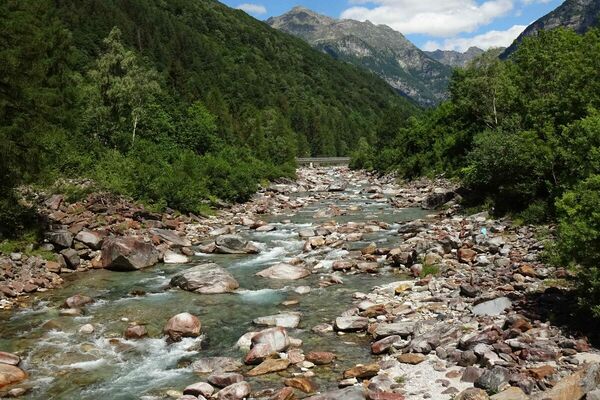
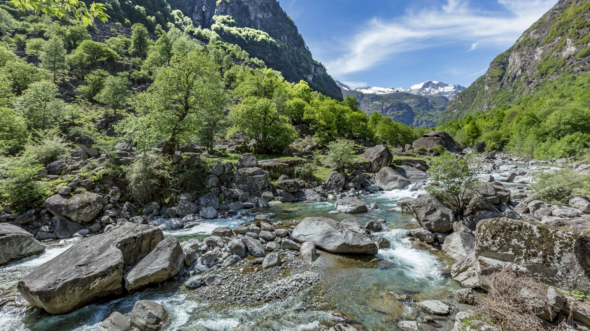
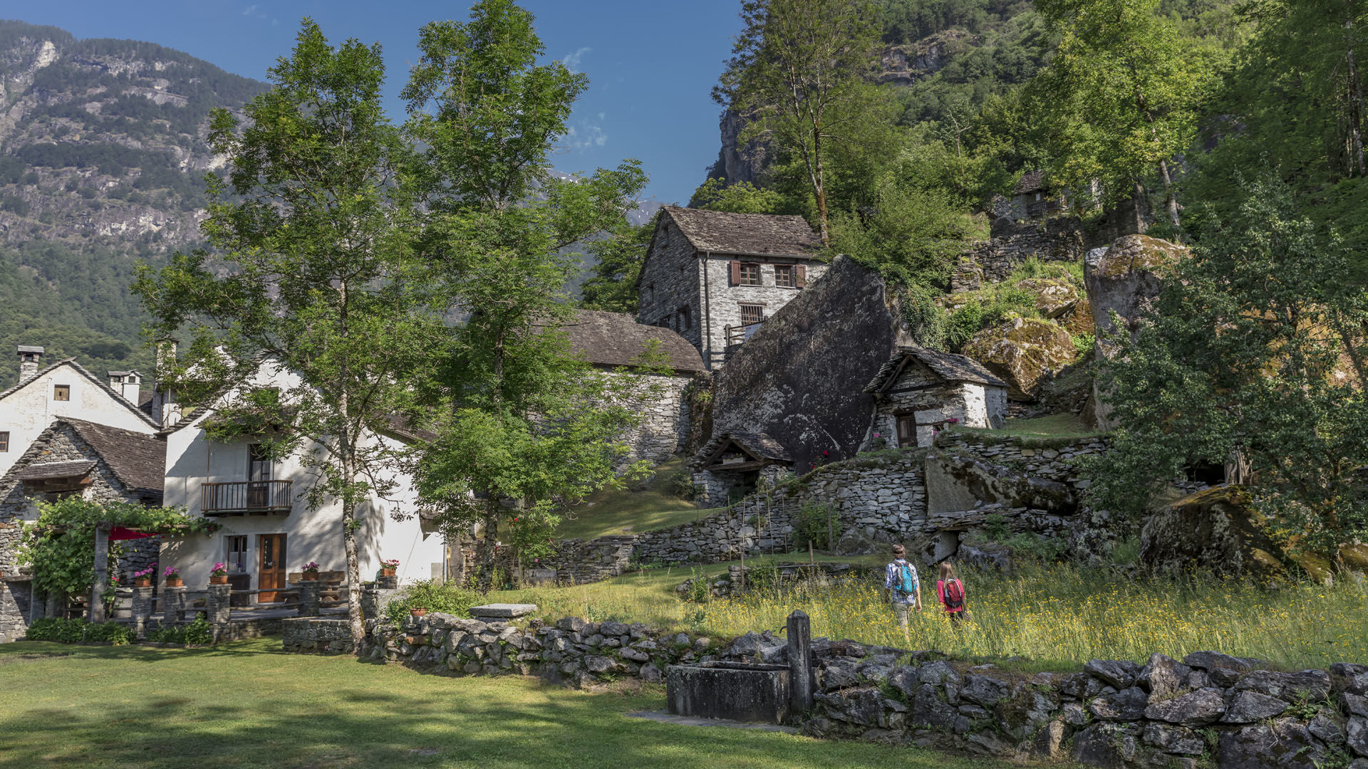
There's much to see along the entire route, including nested village centres, votive chapels, splüi (shelters beneath boulders), "hanging meadows" on boulders, traditional rustici, and grotti serving refreshments. Although electricity is produced in the Bavona valley, there's none here, except in San Carlo: one of the reasons why the valley is uninhabited in winter.
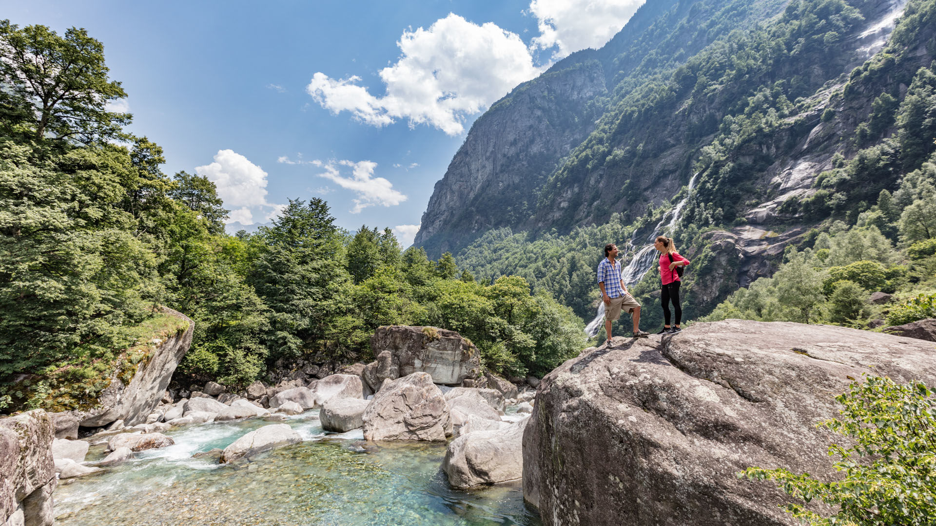
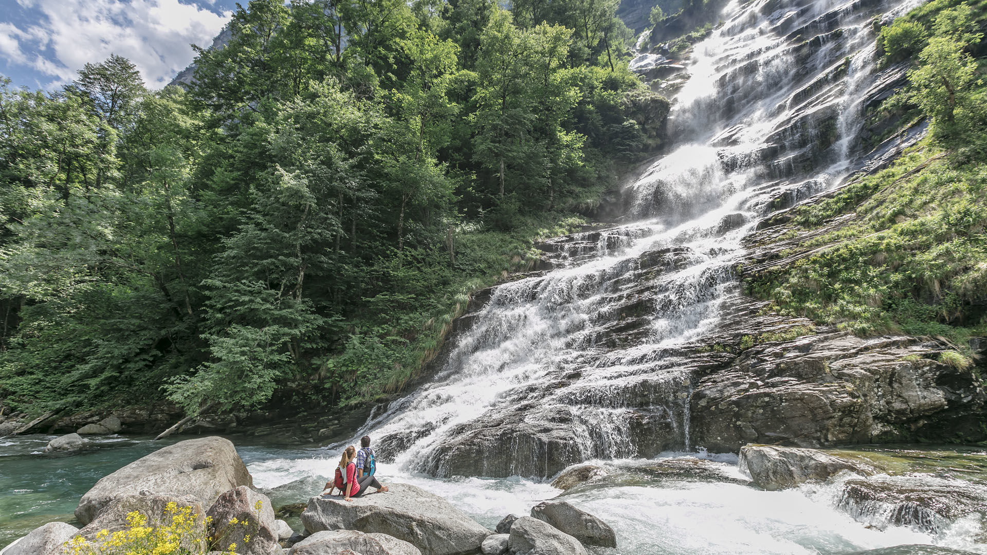
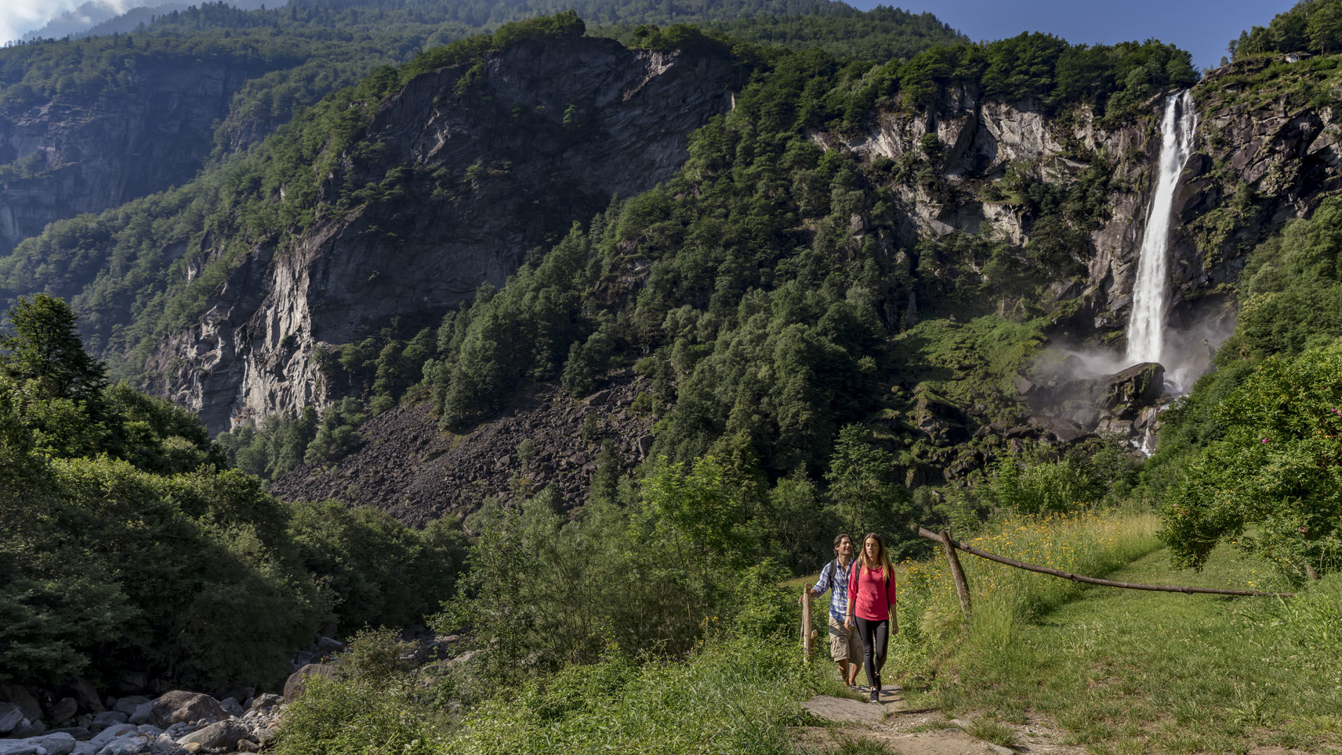
From Bignasco (on the bus route) the red-and-white waymarked path leads to Fontana (look for the arched bridge over the stream). Penetrating further into the valley, you can see, from afar, the la Froda waterfall in Foroglio, tumbling over 100 metres out of the Calnègia valley.
After crossing the wood to Roseto, sections of the path then pass through colourful flowering meadows. The path to Sonlerto is almost flat. You then climb again to reach San Carlo.
Make a note of the bus times for the return journey. San Carlo is at the lower end of the Robièi aerial cableway.
- Directions
-
Bignasco-Cavergno-Fontana-Sabbione-Ritorto-Foroglio-Roseto-Faedo-Sonlerto-San Carlo
- Highest point
- 937 m
- Endpoint
-
San Carlo
- Height profile
-
 © outdooractive.com
 - Equipment
-
Hiking daypack (approx. 20 liters) with rain cover
Comfortable and sturdy footwear
Adequate and durable outdoor clothing in multiple layers
Telescope sticks if necessary,
Sun and rain protection
Snacks and drinking water
First aid kit
Penknife
Mobile phone, headlight if necessary
Maps - Safety instructions
- Public transportation
-
From Locarno railway station: bus 315 towards Cavergno, Paese. Alight at the bus stop Bignasco, Posta.
Return from San Carlo: Bus 333 to Bignasco, Posta. Change bus and take no. 315 towards Locarno Stazione. Alight at Locarno station. Further information:
- Author
-
The tour Bignasco-San Carlo is used by outdooractive.com provided.