

- Difficulty
-
medium
- Rating
-
- Starting point
-
Cardada
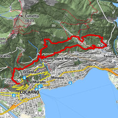
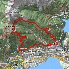
- Route
-
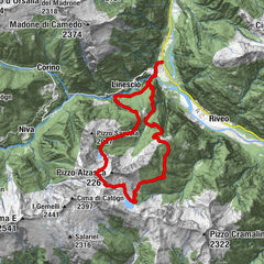
Albergo Ristorante CardadaCardada (1,340 m)0.1 kmCardada0.3 kmCasa Colmanicchio0.4 kmCapanna Cardada1.5 kmCapanna Ristorante Lo Stallone1.9 kmCapanna Ristorante Cimetta3.0 kmCima della Trosa (1,869 m)5.1 kmBusada12.3 kmMergoscia (735 m)13.0 kmOsteria della Posta13.0 km
- Best season
-
JanFebMarAprMayJunJulAugSepOctNovDec
- Description
-
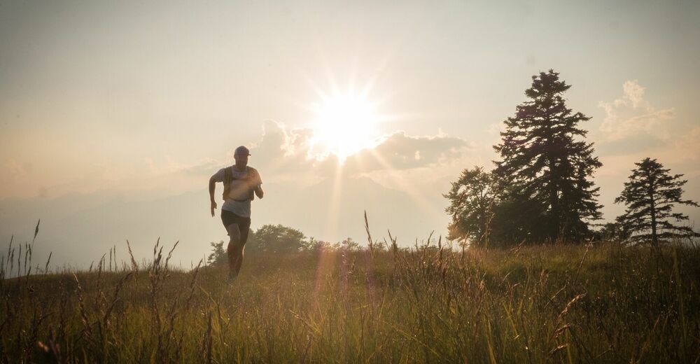
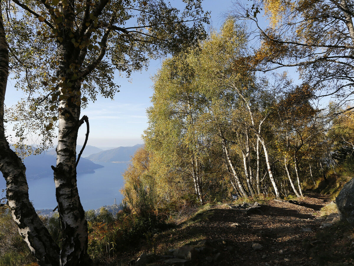
Take the five-minute suspended cable car ride from Orselina to Cardada and find yourself immersed in a striking alpine setting. Follow the short paved path through the pines until the chairlift departure to Cimetta.
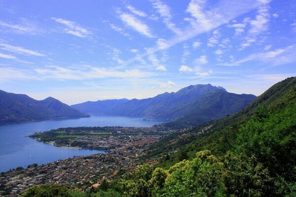
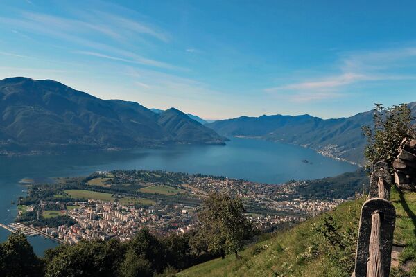
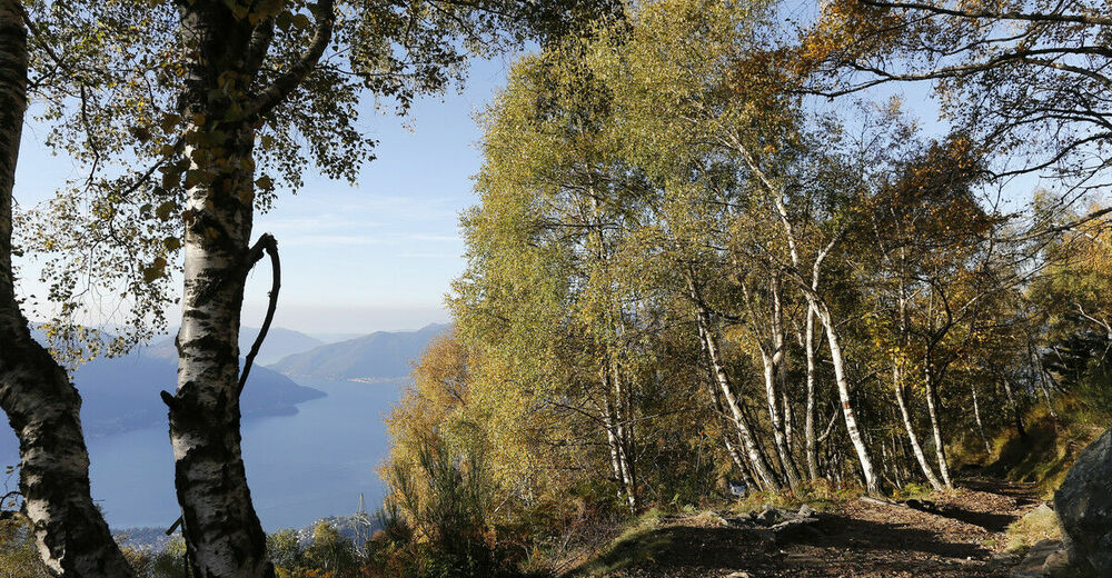
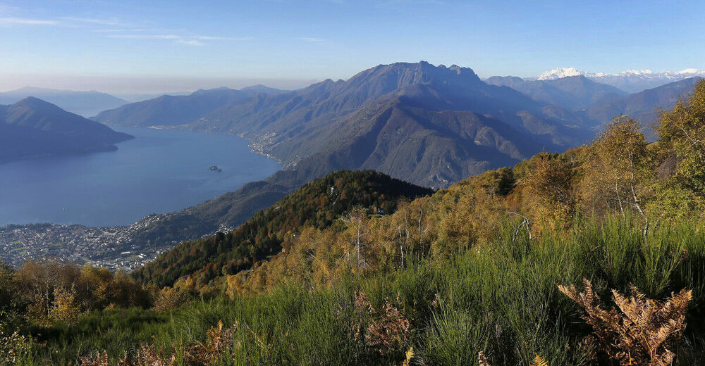
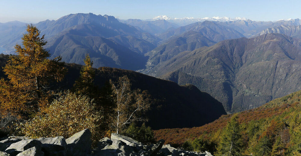
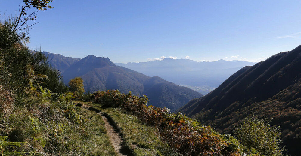
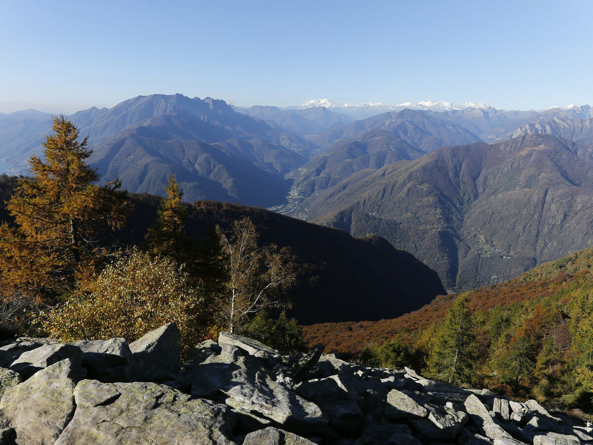
In Cimetta, at an altitude of 1'670 meters (ideal starting point for this trail), there are an alpine hut and the geological observatory, with a red line that symbolizes the Periadriatic Seam. From here you can enjoy a stunning 360° view of the lake, the Magadino Plain, and the surrounding mountains, including several Alpine peaks.
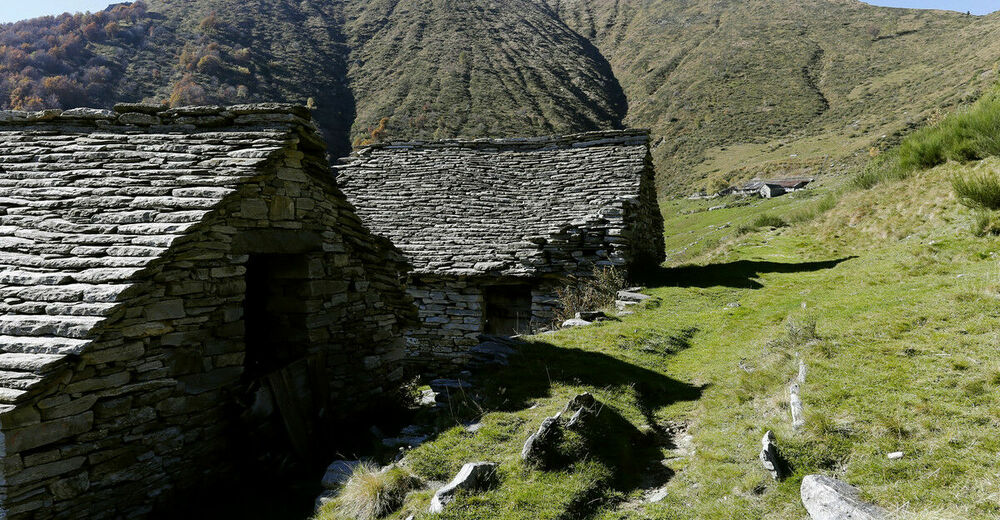
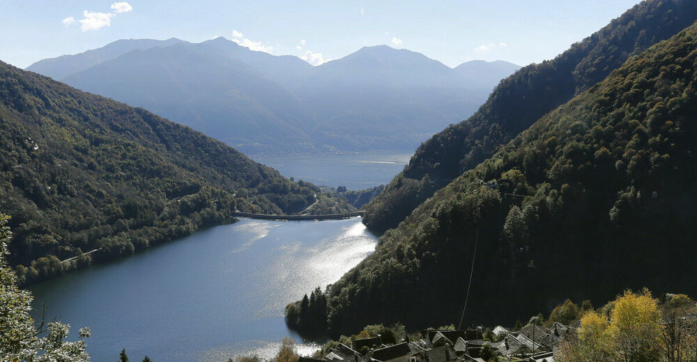
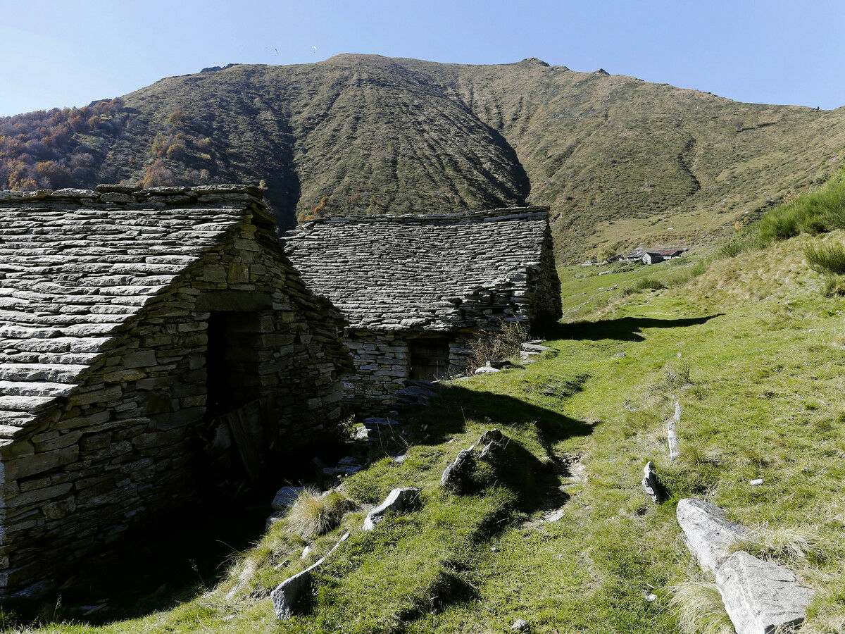
Leave Cimetta to ascend until Cima della Trosa on a leisurely path with a steady gradient. After admiring the view, take the same path back to Cimetta and then Cardada. Alternatively, continue the hike down to the beautiful village of Mergoscia, in Valle Verzasca (more than 1'100 meters of altitude gap). Going down the sunny side of Valle di Mergoscia, pass by Alpe di Bietri (known for its fresh cheeses) as well as a few small clusters of stone houses. The last stretch is mostly wooded until you reach the village of Mergoscia, nestled above Lake Vogorno and known for its beautiful church of the Saints Gottardo e Carpoforo.
From Mergoscia you can take the bus back to Locarno.
- Directions
-
Cardada-Capanna Cardada-Capanna Lo Stallone-Cimetta-Bassa di Cardada-Cima della Trosa-Alpe di Bietri-Faed-Mergoscia
- Highest point
- 1,862 m
- Endpoint
-
Mergoscia
- Height profile
-
 © outdooractive.com
 - Equipment
-
Light running backpack (approx. 5 to 10 liters) with rain cover if necessary
Trail running shoes
Special running socks if necessary
Adequate and breathable clothing in multiple layers
Trail running sticks if necessary
Sun and rain protection
Snacks and drinking water
First aid kit
Penknife
Mobile phone
Headlight and reflectors if necessary
Maps - Additional information
-
www.cardada.ch


- Author
-
The tour Cimetta Trail is used by outdooractive.com provided.