
- Brief description
-
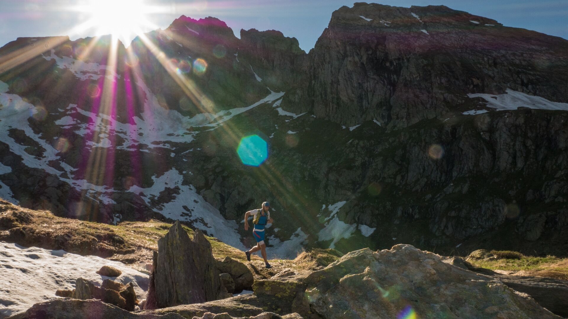
It's only a short tour, but worth every minute. It's rare to be able to enjoy breathtaking views of high mountains (Pizzo Basodino) near crystal clear mountain lakes on the same day.
- Difficulty
-
medium
- Rating
-
- Starting point
-
S.Carlo (Bavona), Funivia - Robiei
- Route
-
Capanna Basodino CAS (1,856 m)11.6 km
- Best season
-
JanFebMarAprMayJunJulAugSepOctNovDec
- Description
-
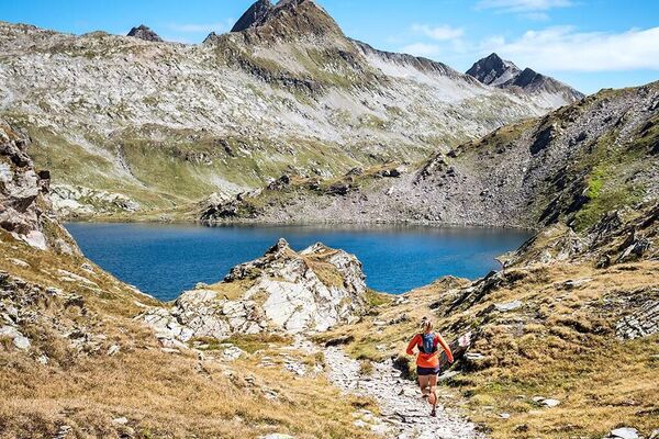
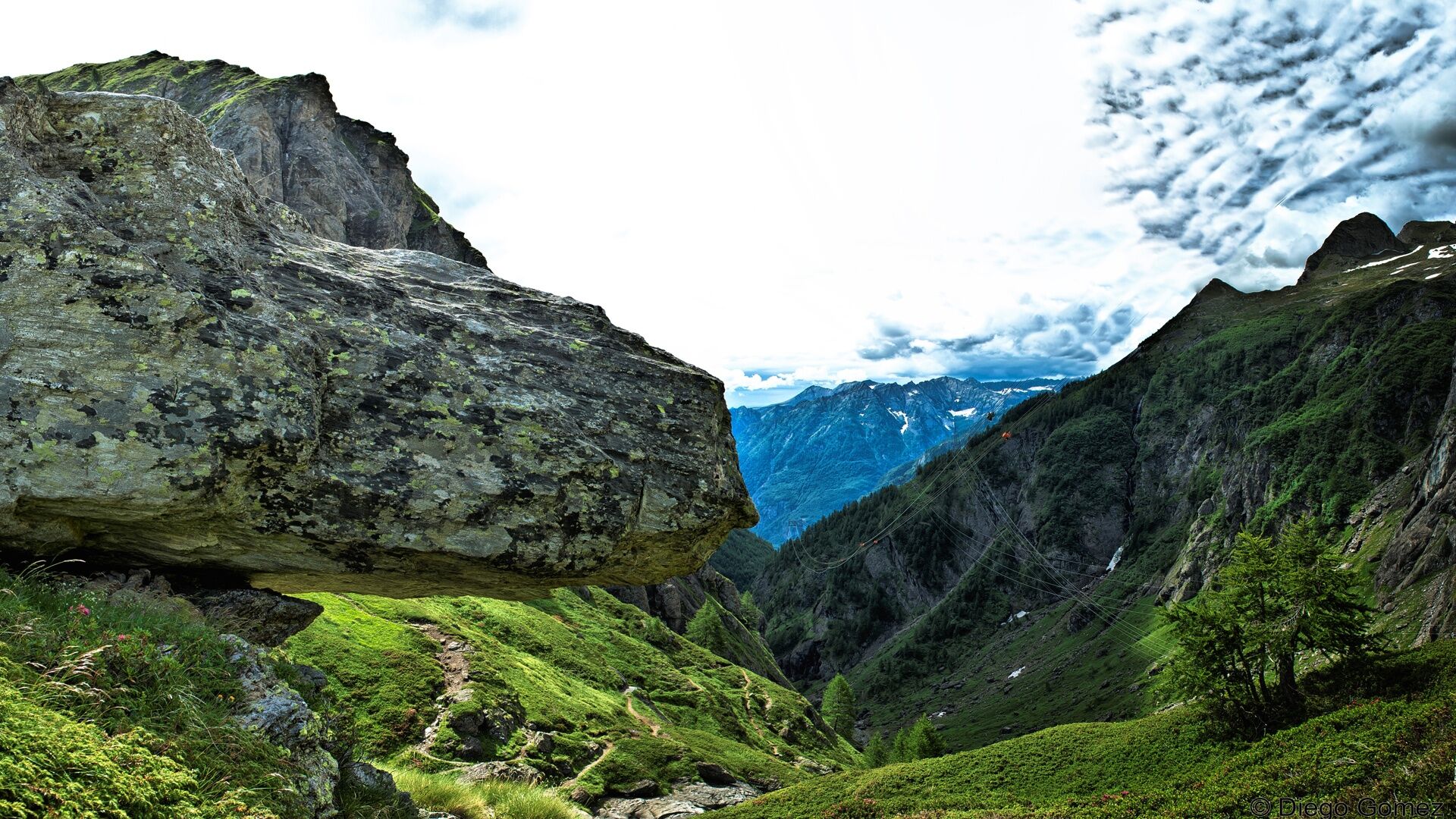
Nestled in spectacular mountain scenery characterised by rocks, cliffs and wild nature, San Carlo in the Bavona valley is where you'll find the lower terminus of the aerial cableway that ascends to Robièi, the starting point of this tour.
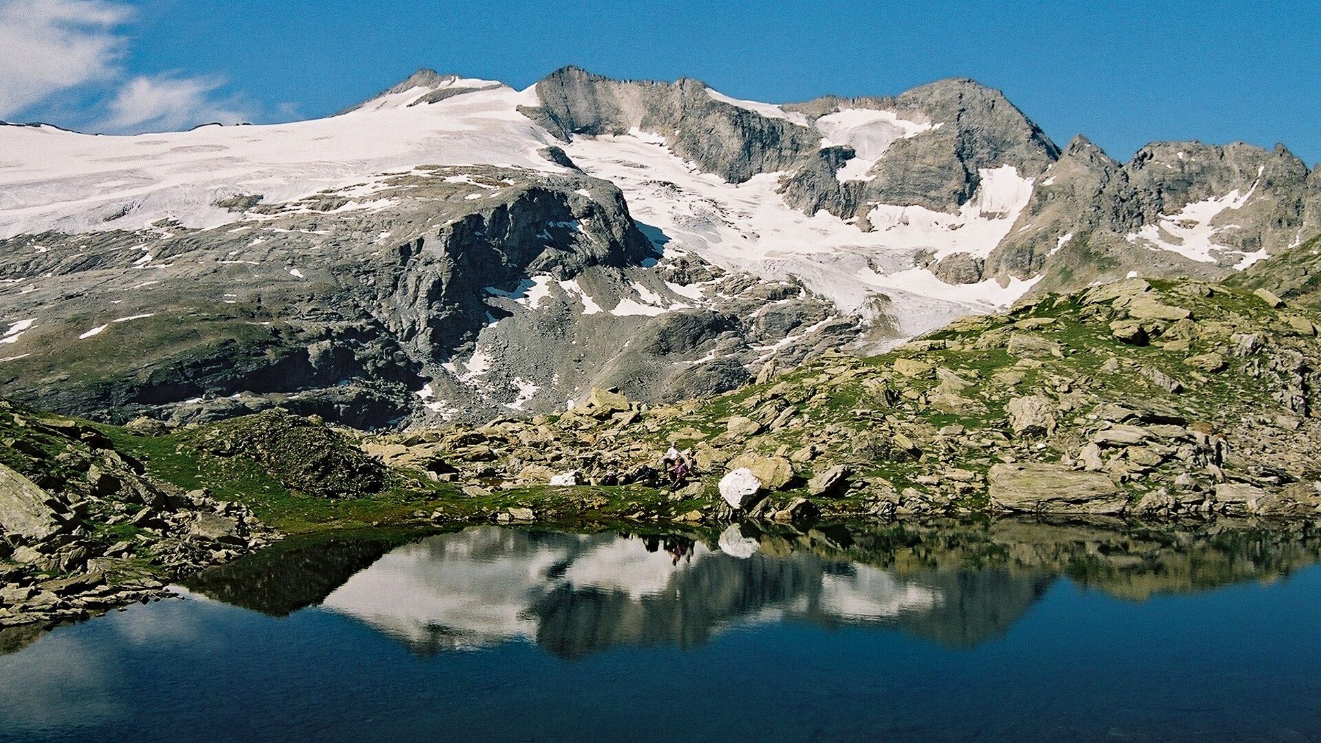
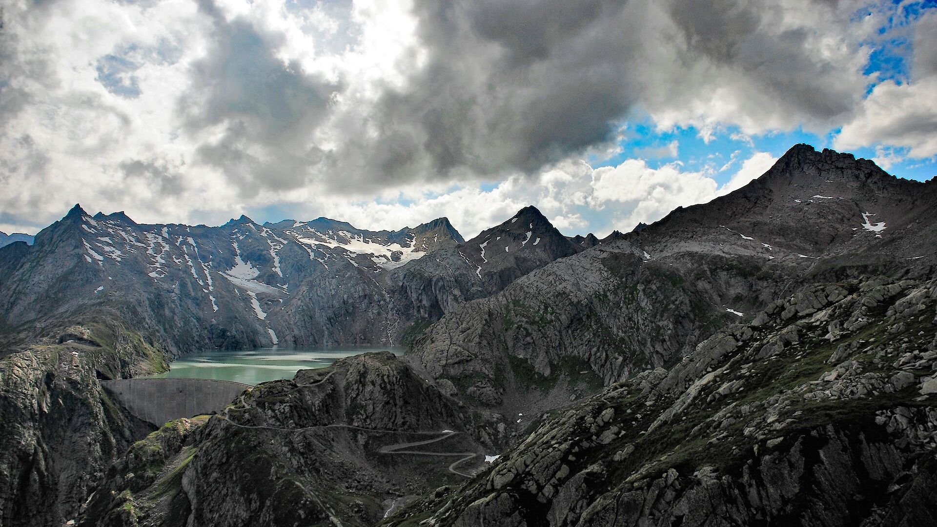
Certainly the most convenient and energy-saving way of reaching Robièi, the cableway offers a chance to view this fascinating tract of nature from the air. It takes just 15 minutes to reach the altitude of 1900 m: delightful Robièi is at the foot of the Basodino glacier and near the Basodino dam, which affords a wonderful view of the Ticino Alps. The Basodino Glacier, the most impressive and important glacier in Canton Ticino, has a shimmering white peak that reaches up to 3273 m before a magnificent arena of granite and gneiss.
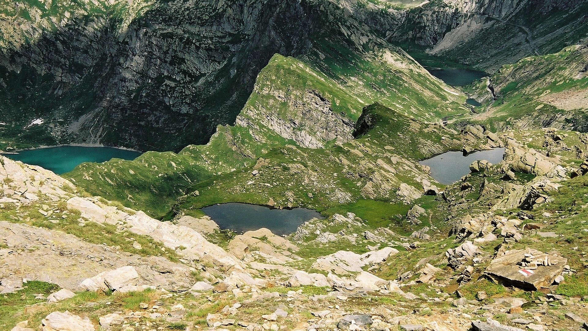
The trail starts at the upper terminus of the cableway and follows the left-hand bank of Lake Robièi. Right at the beginning there’s a lengthy ascent with an altitude gain of 500 metres, followed by a slight descent to the lake. A long section of asphalted road leads past the lake. At the fork, take the unsurfaced path that rises slightly again instead of following the road to Lake Bianco. The lake glistens in the sun and crystals sparkle on the path.
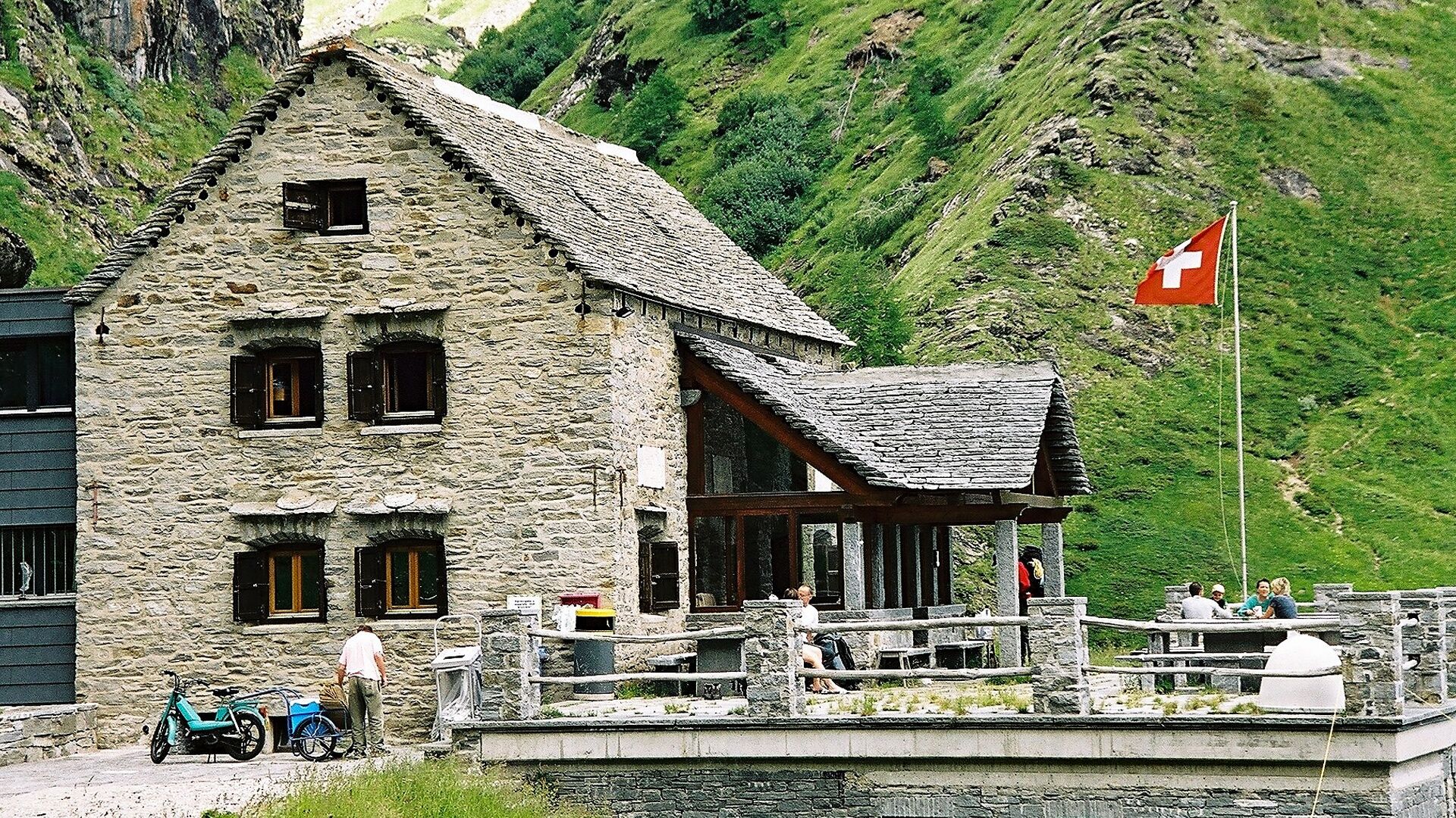
Robièi is known for its mineral wealth. Navigating gentle ups and downs, you follow partially exposed passages past Lake Nero before tackling the short ascent to the highest point of the tour. On reaching the end of the lake, the path turns off to the Alpe Lielp, where you encounter cows, goats and pigs: this is where the excellent Vallemaggia cheese, butter and ricotta are produced. From Alpe Lielp you can continue downhill to the Basodino hut, looking out for marmots, ibexes and chamois as you go. At the upper terminus station, take the cableway back down to San Carlo.
- Directions
-
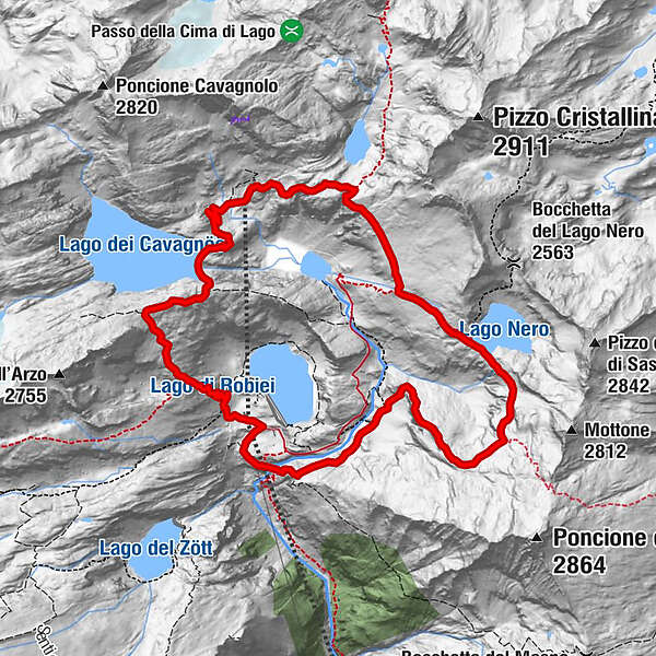
Robiei-Lago dei Cavagnöö-Lago Nero-Capanna Basodino-Robiei
- Highest point
- 2,456 m
- Endpoint
-
S.Carlo (Bavona), Funivia - Robiei
- Height profile
-
 © outdooractive.com
 - Equipment
-
Light running backpack (approx. 5 to 10 liters) with rain cover if necessary
Trail running shoes
Special running socks if necessary
Adequate and breathable clothing in multiple layers
Trail running sticks if necessary
Sun and rain protection
Snacks and drinking water
First aid kit
Penknife
Mobile phone
Headlight and reflectors if necessary
Maps - Additional information
-
www.robiei.ch
- Public transportation
-
From Locarno railway station: bus 315 towards Cavergno, Paese. Alight at Bignasco, Posta and change to PostBus 333 to San Carlo (Bavona), where you'll find the aerial cableway to Robièi (hours of operation and information at www.robiei.ch )
Return from San Carlo (Bavona): PostBus 333 to Bignasco, Posta. At Bignasco change to bus 315 towards Locarno Stazione. Alight at Locarno station.

- Author
-
The tour Robiei Trail is used by outdooractive.com provided.


General info
-
Aletsch Arena
72
-
Bavonatal
12