

- Brief description
-
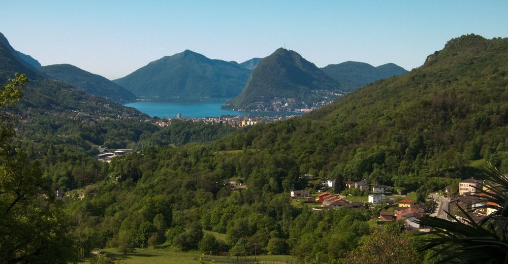
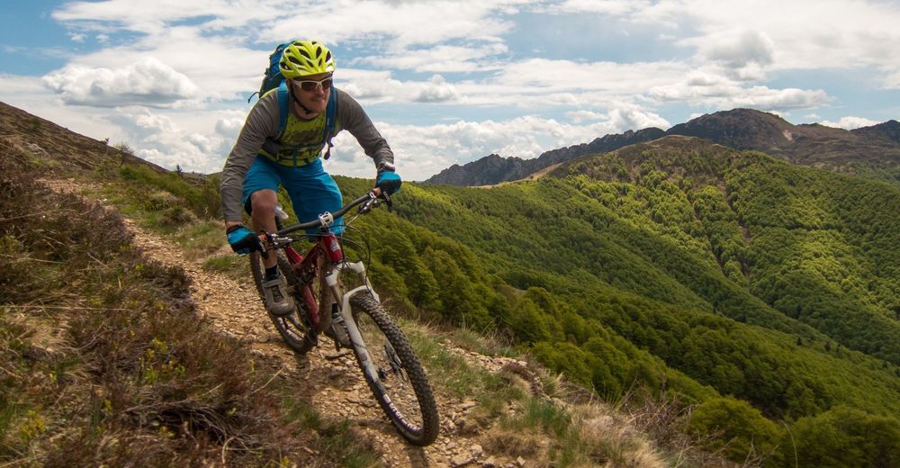
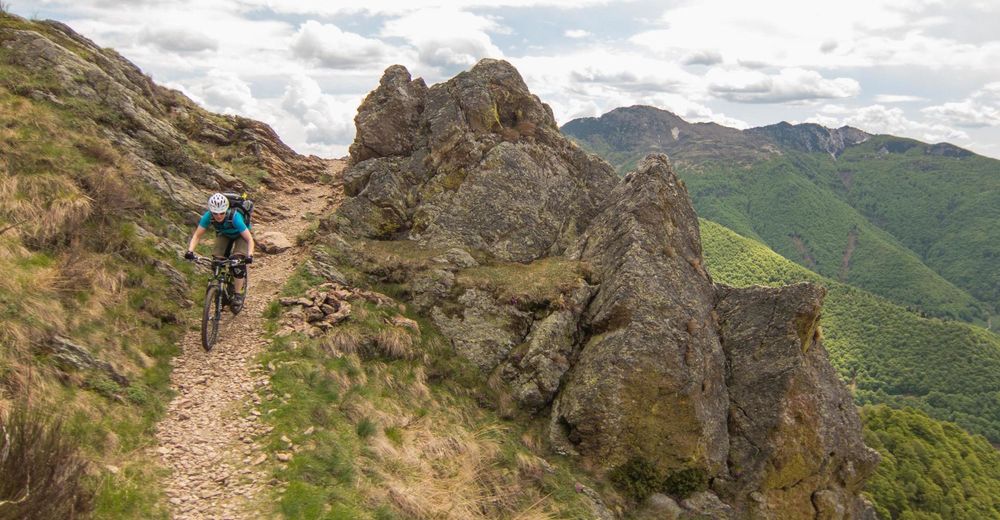
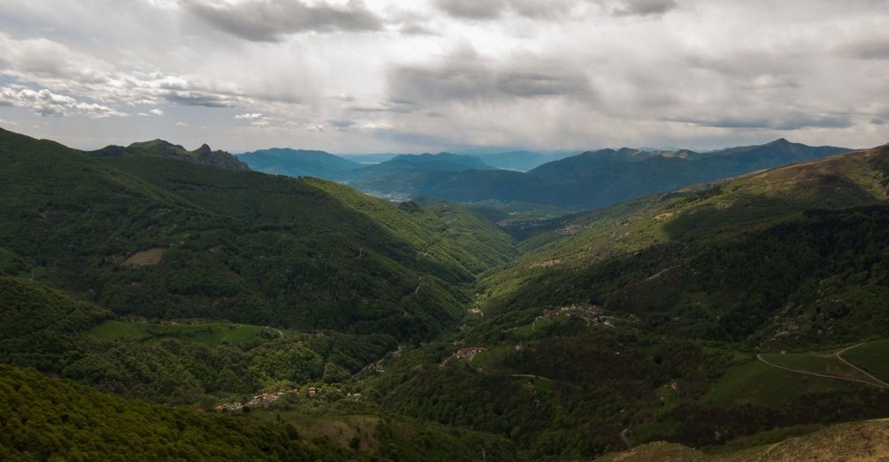
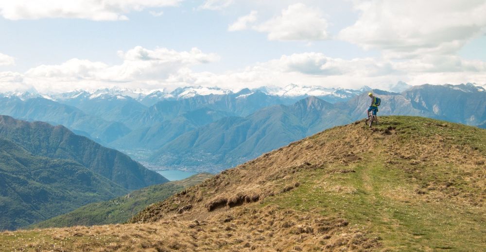
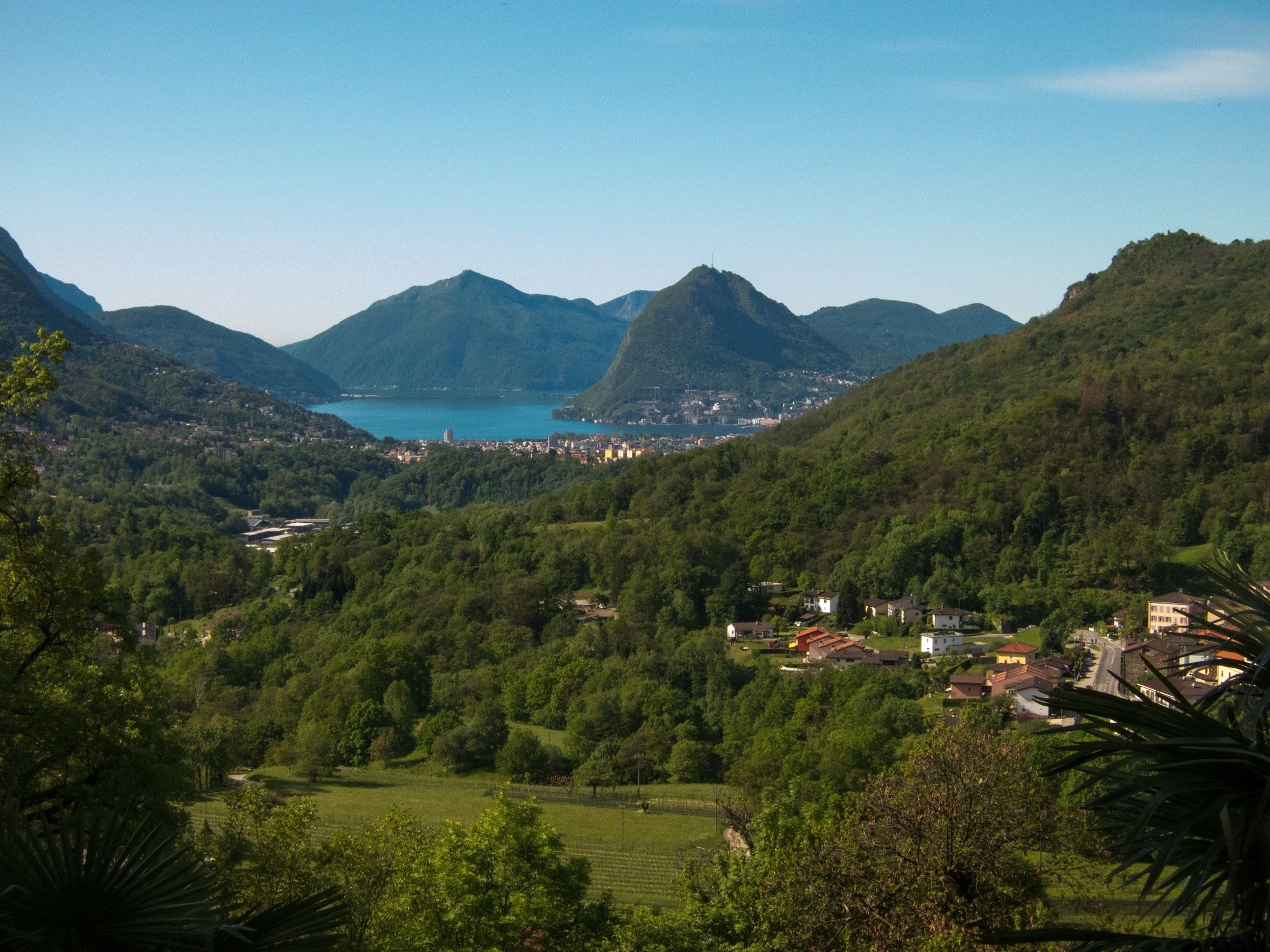
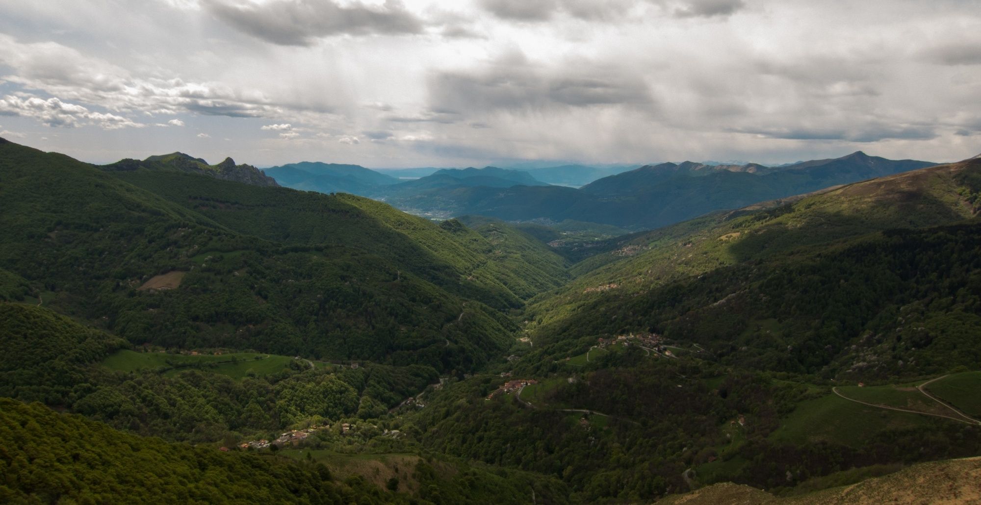
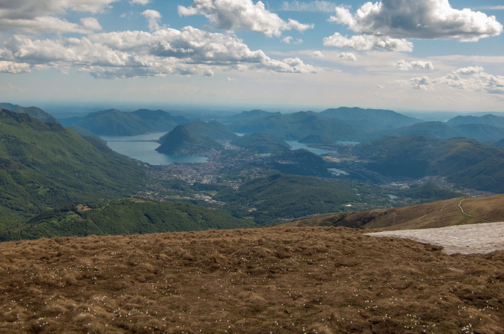
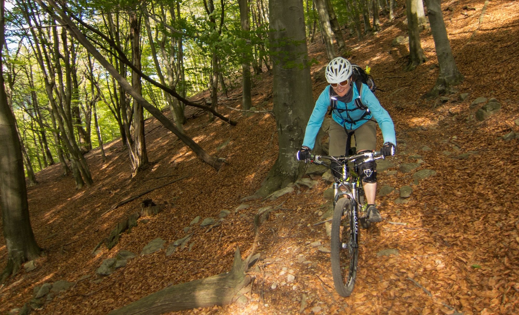
This is a physically and at times technically challenging tour with some beautiful views over the Ticinese countryside.
- Difficulty
-
difficult
- Rating
-
- Starting point
-
Tesserete
- Route
-
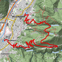
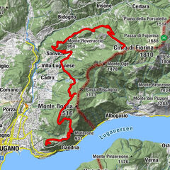
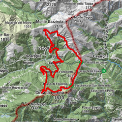
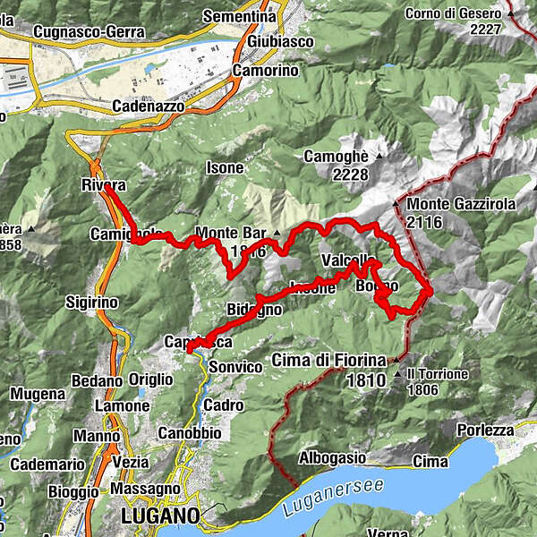
Tesserete (522 m)0.2 kmAlmatro0.8 kmCagiallo (522 m)0.8 kmCapriasca (529 m)0.8 kmCampestro0.9 kmChiesa di Sant'Andrea1.0 kmLopagno (598 m)1.5 kmRoferit2.8 kmTreggia3.4 kmSomazzo3.7 kmLupo (706 m)3.8 kmMalpensata3.8 kmPièd4.0 kmChiesa parrocchiale di San Barnaba4.3 kmBidogno4.3 kmOratorio di Santa Maria delle Grazie5.1 kmGromo5.4 kmGrotto al Mulino5.6 kmAlbumo7.0 kmCorticiasca (1,060 m)7.2 kmStella8.1 kmInsone (890 m)8.1 kmTeciall8.1 kmScareglia (986 m)8.6 kmSignôra (994 m)9.8 kmChiesa di San Giuseppe9.9 kmValcolla (972 m)10.4 kmColla (996 m)11.3 kmOratorio della Madonna del Carmelo12.3 kmCozzo12.4 kmBugertone13.2 kmBogno (960 m)13.4 kmBascomuni13.8 kmCertara (1,025 m)15.4 kmCima Fronte15.5 kmFrecc15.7 kmCapanna San Lucio19.8 kmChiesa di San Lucio19.9 kmRifugio San Lucio20.1 kmCiapelon24.7 kmMoncucco27.2 kmCapanna Monte Bar29.7 kmMotto della Croce (1,380 m)32.9 kmZalto35.9 kmGola di Lago36.9 kmAlpe Santa Maria di Lago37.5 kmCamignolo (449 m)40.1 kmChiesa dei SS. Pietro e Paolo40.2 kmBironico (465 m)41.3 kmIl Veliero42.8 kmRivera (554 m)42.8 kmAlpino42.9 kmRivera-Bironico (472 m)42.9 km
- Best season
-
JanFebMarAprMayJunJulAugSepOctNovDec
- Description
-
The route described differs from the "normal" Monte Bar/Val Colla tour that is often talked about in that we do the tour in an anti-clockwise rather than clockwise direction. The tour can be done both ways, but we prefer doing it this way because of the singletrail descent the whole way to the valley at the end and the easier public transport connections from Rivera at the end of the day.P
- Directions
-
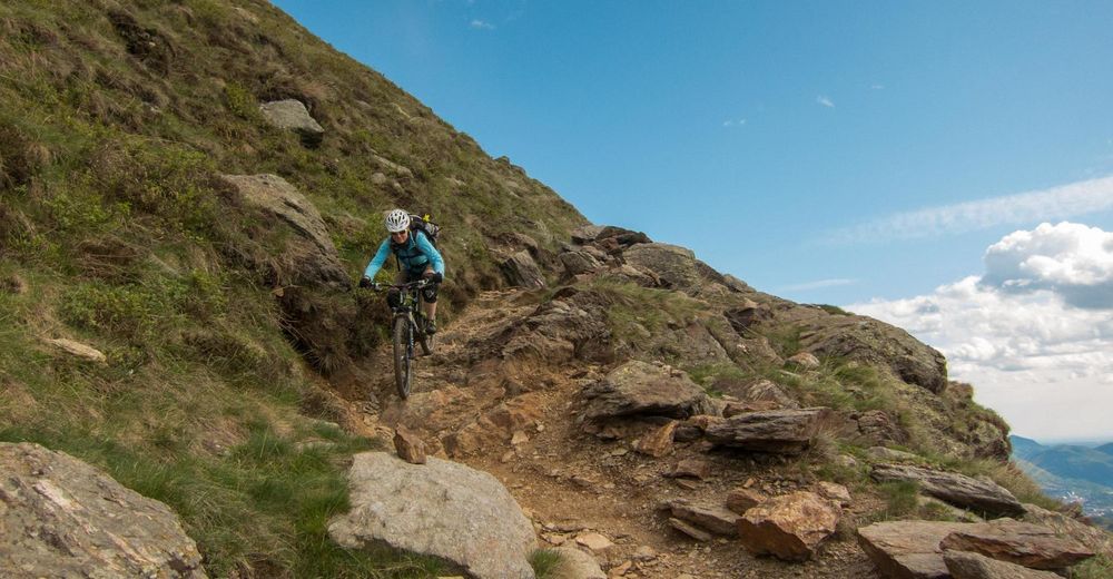
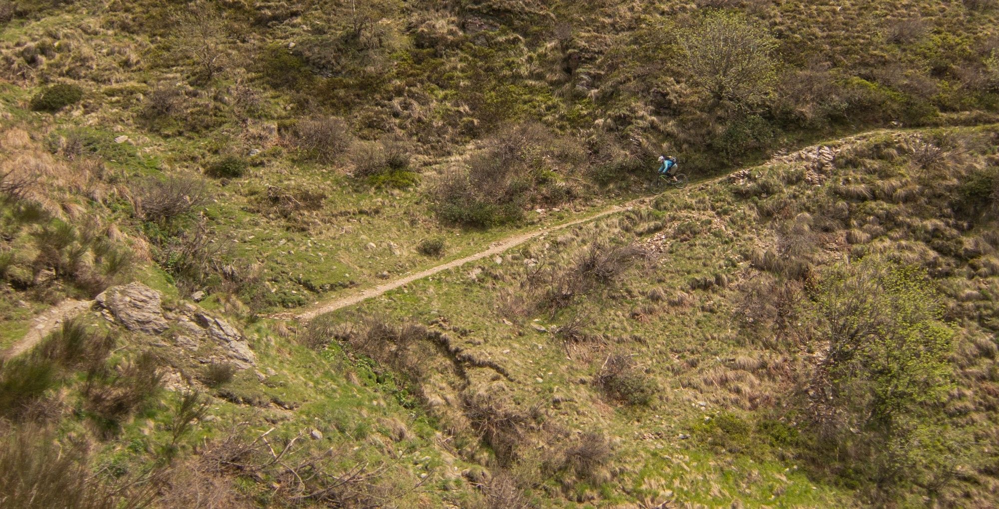
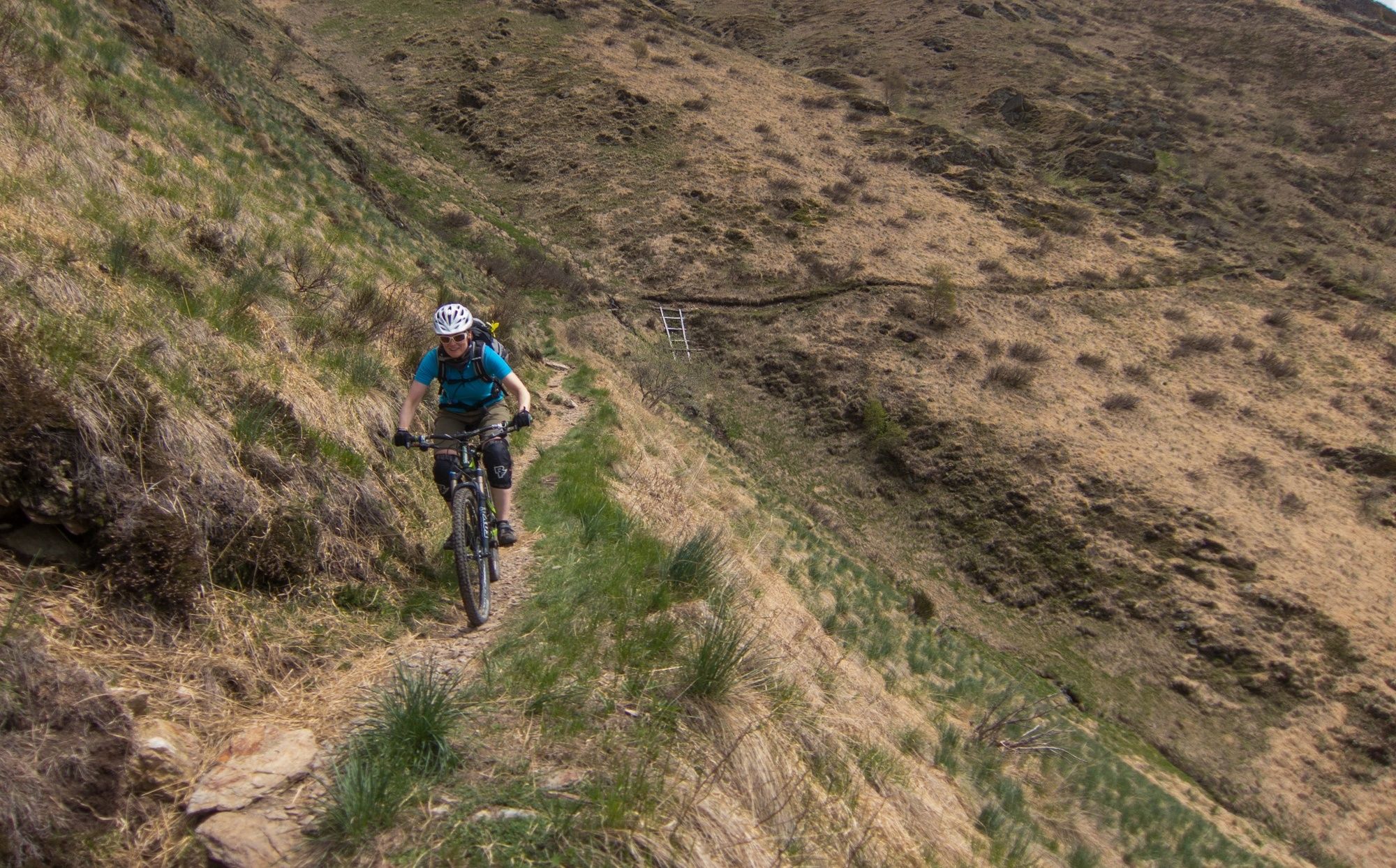
From Tesserete take the main road back Val Colla through Roveredo, Albumo, Colla and Bogno. This road is paved the whole way and there may be some traffic on it, but in our experience it is not too bad. In Bogno ride through the town and at the exit of the village (the first right hand switchback in the road) keep going straight ahead. Follow the road as it first becomes unpaved then becomes singletrail until it joins into the unpaved fire road climb up to the Hut on the Italian border at St. Lucio.
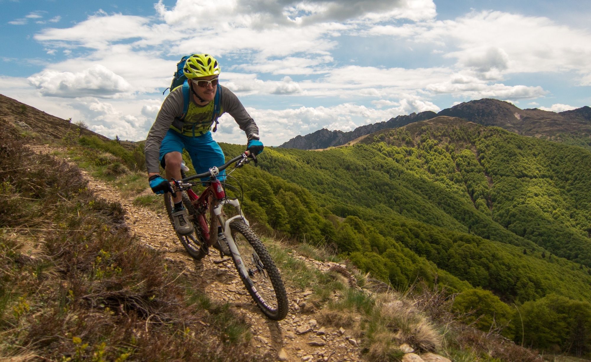
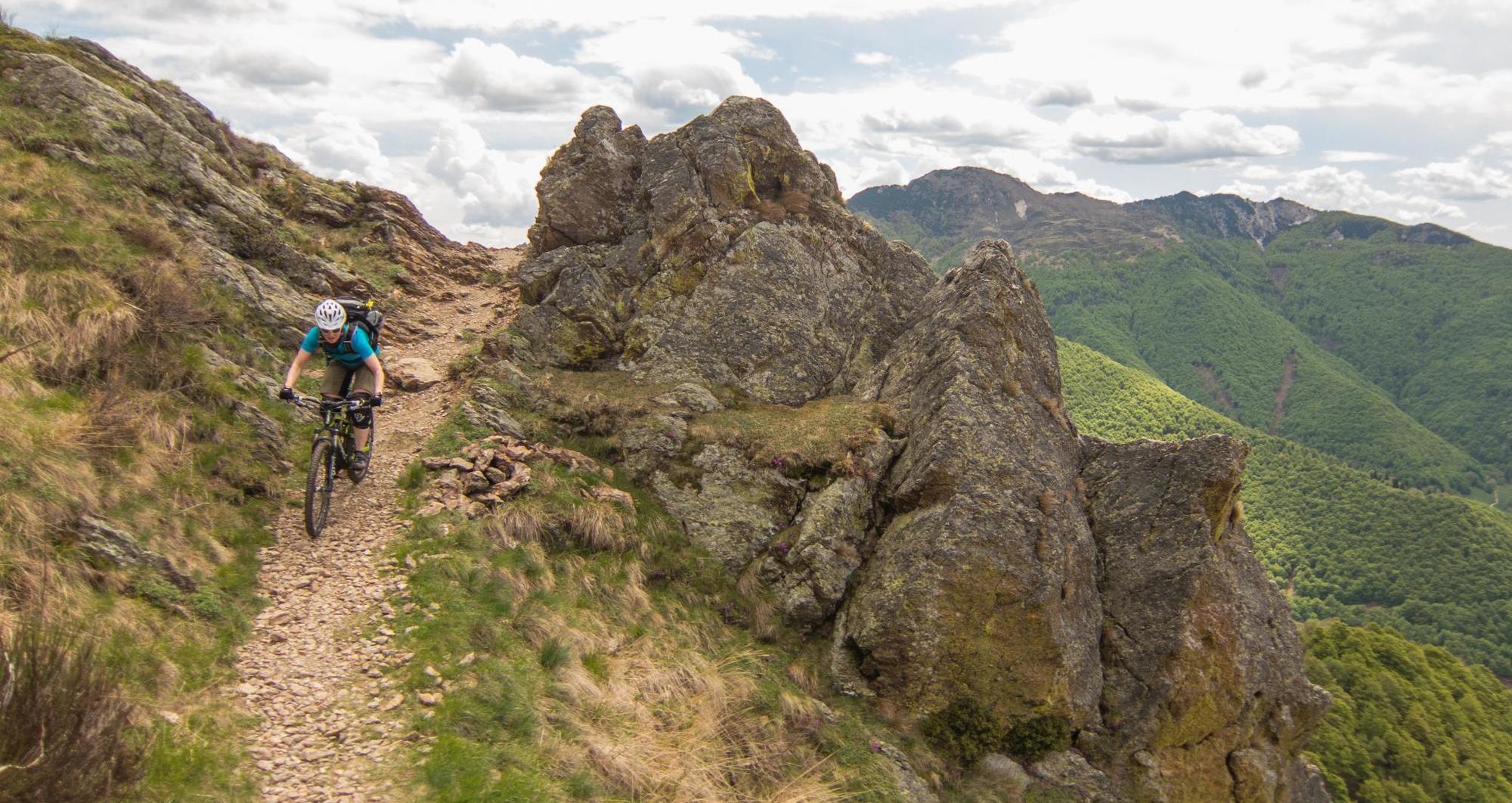
In St. Lucio take the singletrail which traverses the mountain towards Alp Pietrarossa. At Alp Pietrarossa you have two choices. You can traverse around the front of the mountain past Moncucco and on to Piandanazzo (as shown in our GPX file) or climb over Passo di Pozzaiolo (short hike-a-bike) and descend towards Alpe Matro before once again climbing over the pass and rejoining the main route at Piandanazzo.
The hike-a-bike to the top of Monte Bar itself is not really worth it from a trail riding point of view unless you want to just go up to enjoy the scenery.
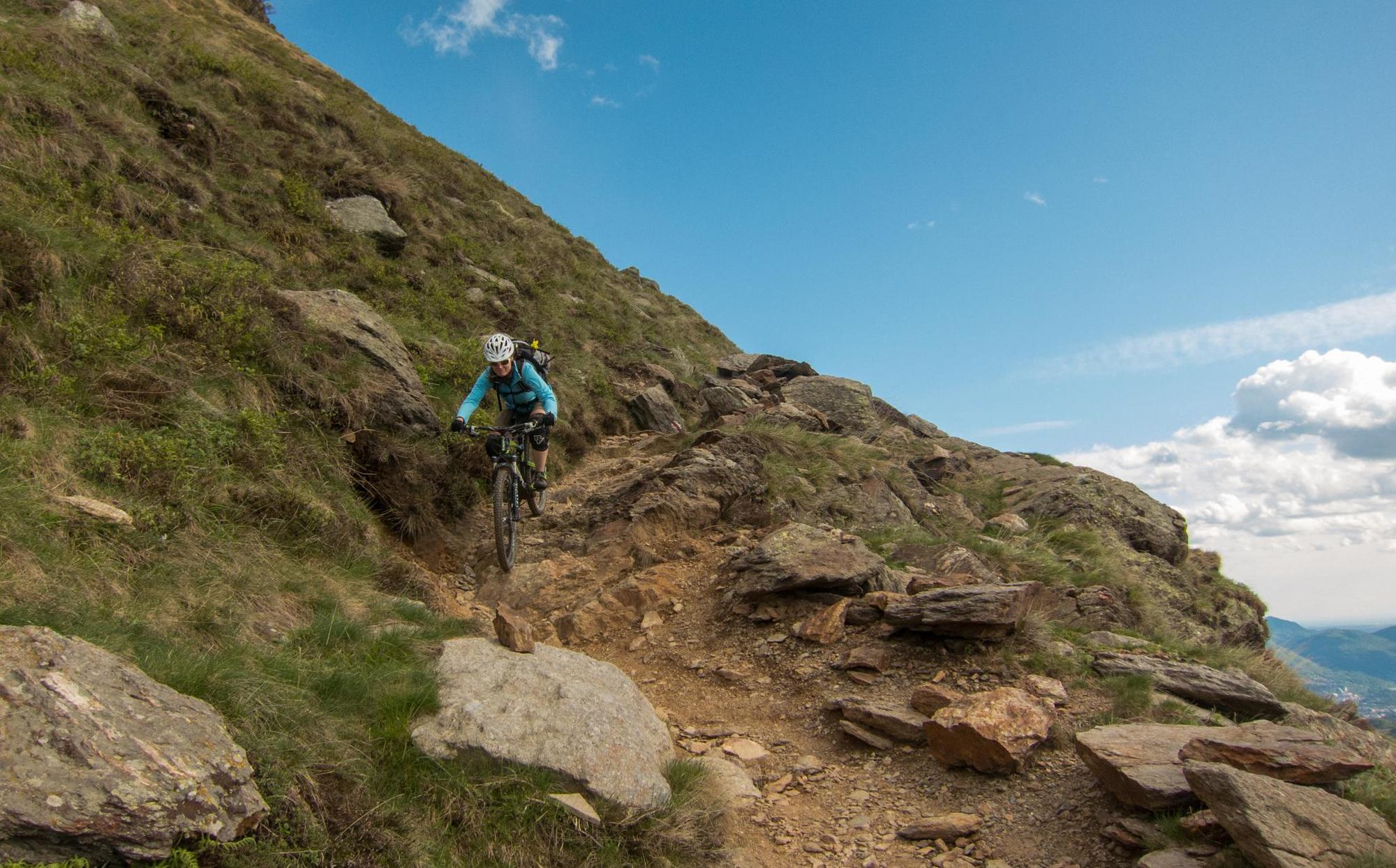
In Piandanazzo take the road towards Cap. Monte Bar and then continue down the paved road to Motta della Croce (leaving the road at a left hand switchback). Here take the singletrail down to Motta della Croce and then turn left towards Davrosio. The trail here has a few interesting technical sections.
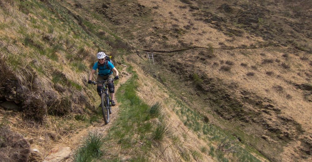
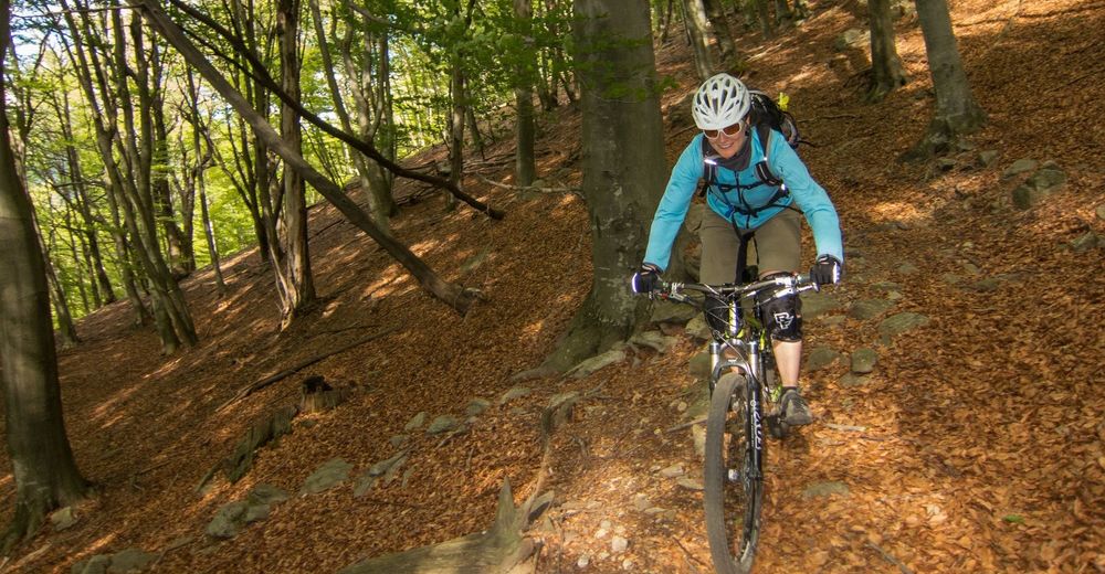
In Davrosio take the road (with one short singletrail shortcut) to Gola di Lago and continue to Alpe St. Maria di Lago. Here there is a steep and somewhat technical singletrail descending in the woods first towards Monti di Camignolo and then staying left and traversing from Busio to Camignolo itself.
In Camignolo take the road back to Rivera where you can get the train back to either Lugano or elsewhere.
Doing the tour the other direction has a slightly easier climb at the start and an option for an easier descent towards Lugano at the end.
- Highest point
- 1,614 m
- Endpoint
-
Rivera
- Height profile
-
 © outdooractive.com
 - Equipment
-
An "All-Mountain" style bike is best recommended for this tour.
- Safety instructions
-
There are some small bits of exposure on the trail as it traverses from St. Lucio to Cap. Monte Bar. The descent to Camignolo is at times moderately technical and in spring and autumn can have very deep leaf cover. (When we did it our wheels were almost completely covered in leaves).
- Tips
-
In May when many high Alpine tours are not yet possible this can be a really nice day out.
- Additional information
- Directions
-
Take the A2 to Rivera. Leave A2 and follow the main road through Torricella and follow signs for Origlio. Continue along Via Cantonale and at the roundabout in Origlio take the fourth exit onto Via Tesserete. Continue on Via Tesserete to Tesserete.
- Public transportation
-
There are busses from Lugano Stazione Nord to Tesserette at 08 and 38 past each hour.
- Parking
-
Parking is available in Tesserete, but if doing this tour the way we describe it's probably best to drive to and park in Lugano as the tour does not end in Tesserete itself.

-

-
AuthorThe tour Val Colla is used by outdooractive.com provided.