
- Brief description
-
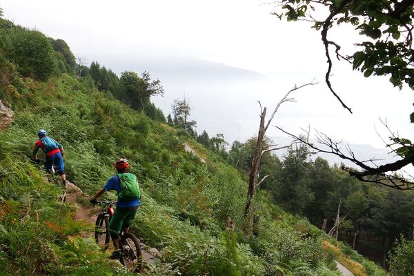
One of the most attractive trails in the Ticino winds its way as a high trail around the Val Colla above Lugano and leads through the imposing Monte Tamaro to the hilly forest of Malcantone. A fantastic tour with spectacular panoramic views.
4 stages.
- Difficulty
-
difficult
- Rating
-
- Starting point
-
Lugano (Monte Brè)
- Route
-
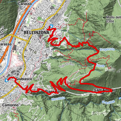
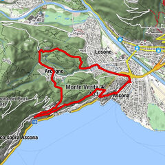
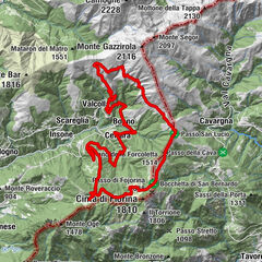
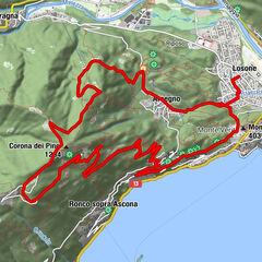
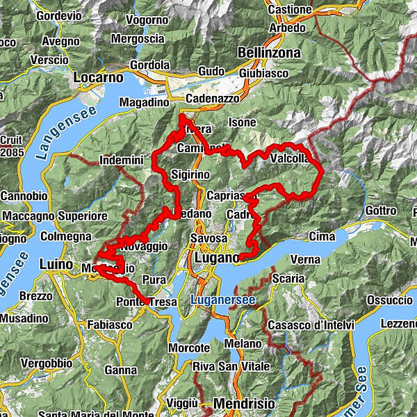
Osteria FunicolareLugano (273 m)0.5 kmChiesa dei Santi Fedele e Simone Martiri1.7 kmBrè1.8 kmMaterone3.3 kmMaterone (931 m)3.5 kmCarbonera4.9 kmAlpe Bolla7.9 kmPrato della Chiesa11.1 kmVilla Luganese (603 m)11.3 kmSonvico (603 m)13.9 kmSan Martín14.8 kmMonte Roveraccio (904 m)15.9 kmFié16.5 kmArla17.5 kmAlpe Pairolo22.8 kmCapanna del Pairolo22.8 kmCapanna Pairolo22.8 kmCima alla Pianca (1,599 m)25.7 kmPiano della Forcoletta (1,514 m)28.2 kmChiesa di San Lucio29.2 kmCapanna San Lucio29.2 kmRifugio San Lucio29.3 kmCiapelon33.9 kmMoncucco36.4 kmCapanna Monte Bar38.8 kmMotto della Croce (1,380 m)42.1 kmZalto45.1 kmGola di Lago46.0 kmAlpe Santa Maria di Lago46.6 kmCamignolo (449 m)50.7 kmChiesa dei SS. Pietro e Paolo50.8 kmBironico (465 m)51.9 kmBar Lagacci53.2 kmIl Veliero53.3 kmRivera (554 m)53.3 kmAlpino53.4 kmRivera-Bironico (472 m)53.4 kmRistorante delle Alpi55.9 kmGrotto al Ceneri56.2 kmAi Monti di Tornago57.8 kmIn Spina de sott de Sura58.7 kmPiano di Mora60.6 kmAlpe Foppa65.6 kmRistorante Alpe Foppa65.6 kmLa Manèra (1,858 m)67.9 kmCapanna Tamaro68.2 kmMotto Rotondo (1,928 m)68.7 kmBassa di Indemini (1,723 m)70.0 kmAlpe di Pozzo72.4 kmLa Bassa (1,367 m)75.1 kmAlpetto78.7 kmAlpe Barco78.8 kmTèra d'Sóra81.2 kmArosio (864 m)81.5 kmArosio di Sotto81.7 kmTèra d'Sóra81.8 kmPiano di Piem82.5 kmMugena (815 m)83.5 kmAlto Malcantone (810 m)84.9 kmOratorio di Santa Maria delle Grazie di Sassello85.5 kmOsteria Busgnone85.7 kmVezio (782 m)85.7 kmFescoggia (837 m)87.5 kmLod88.1 kmAl Cioss88.5 kmBreno (799 m)90.2 kmLa Bolla90.9 kmTagnét91.4 kmCanavee93.2 kmMiglieglia (717 m)93.2 kmOsterio Grotto Fonti93.2 kmRistorante Negresco93.3 kmForcola99.5 kmPredei103.3 kmAlambicco103.3 kmElvezia103.3 kmAstano (631 m)103.5 kmOsteria Mena103.5 kmErbagni105.7 kmBarc108.1 kmProron108.3 kmCavalada108.4 kmOratorio Sant’Agata108.5 kmLa Costa108.5 kmBeredino109.7 kmLanera110.3 kmSessa (393 m)111.6 kmMonteggio (420 m)112.5 kmTermine114.1 kmOratorio di Santa Rita114.1 kmRomedera114.8 kmRoncaccio115.1 kmRancina115.4 kmCremenaga115.7 kmCrocivaglio115.8 kmOratorio di San Valentino115.9 kmPonte Cremenaga116.1 kmCroglio (342 m)119.2 kmPurasca120.6 kmRonco Regina121.0 kmPonte Tresa121.7 kmPonte Tresa (276 m)122.0 kmPonte Tresa (277 m)122.2 km
- Best season
-
JanFebMarAprMayJunJulAugSepOctNovDec
- Description
-
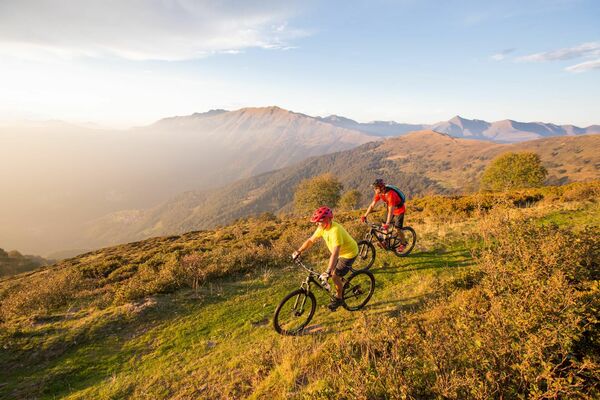
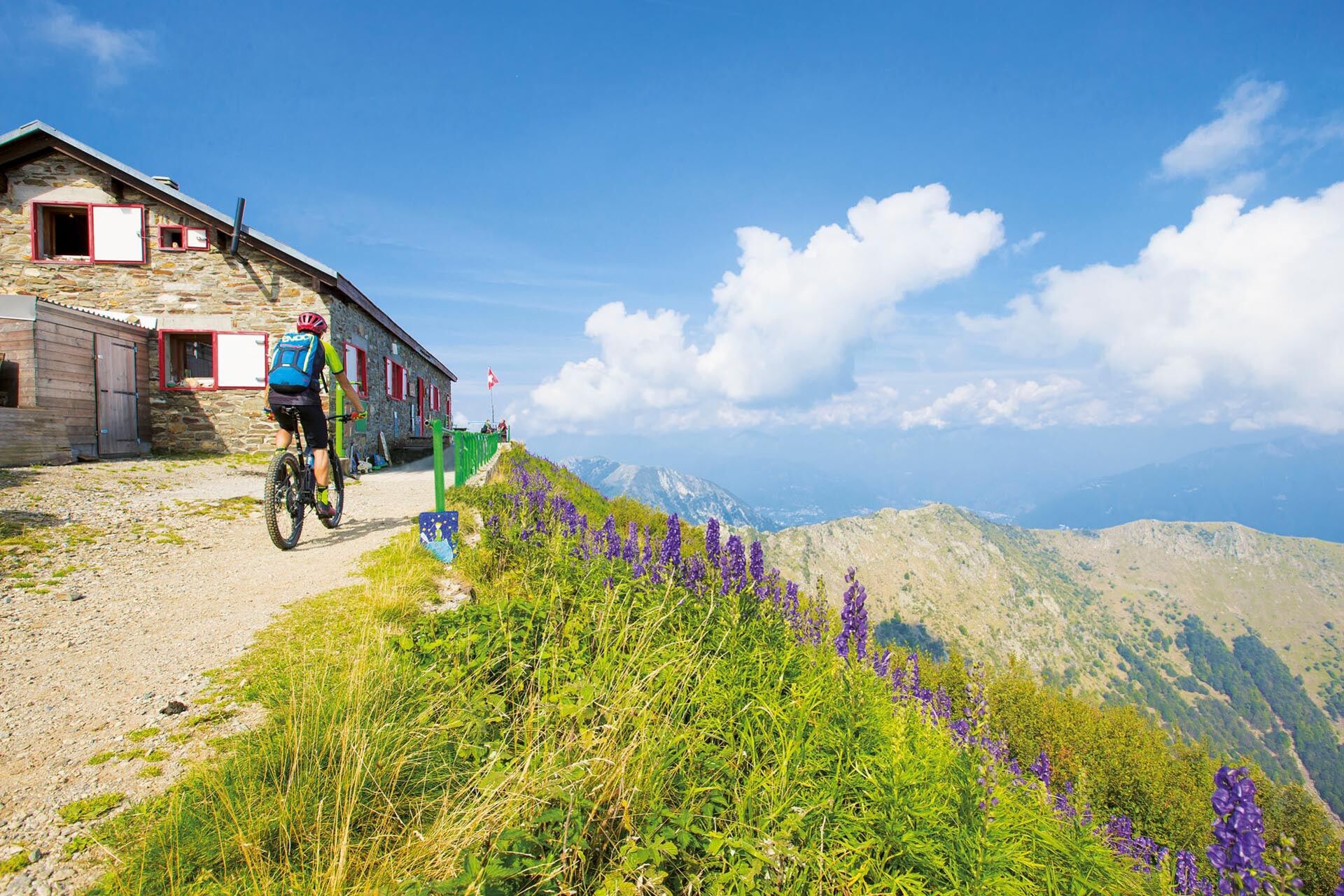
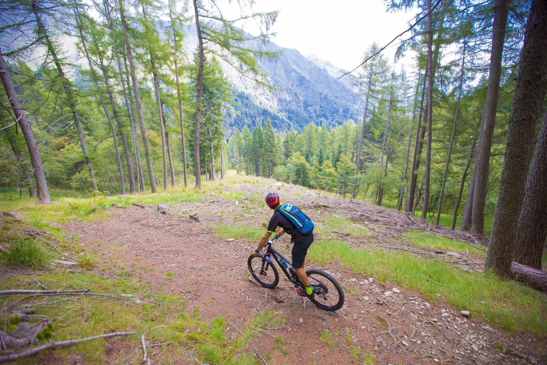
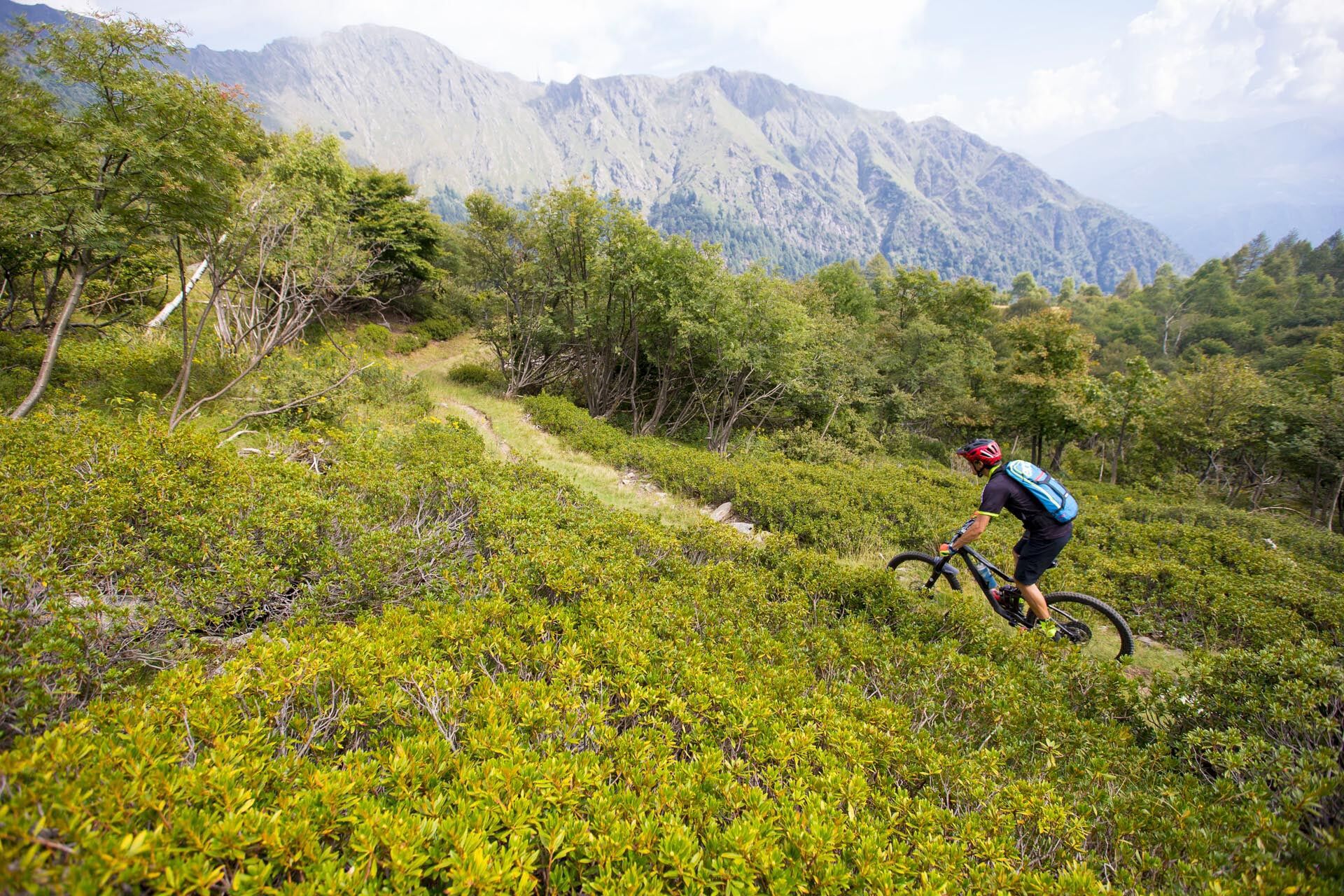
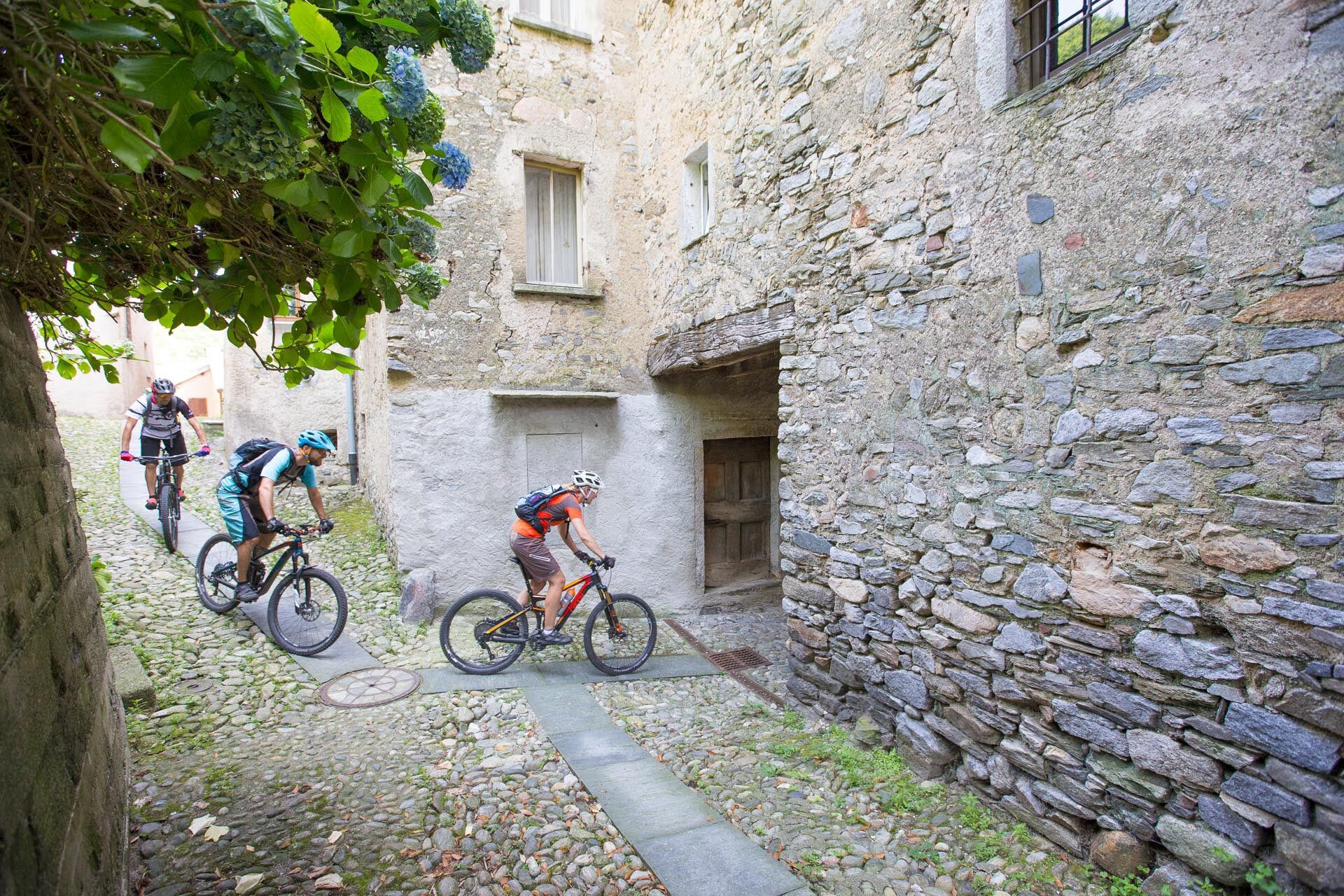
The individual sections offer wide diversity. As an example, along the stretch between the Monte Bre and Rivera and in Malcantone. The entire tour is characterized by varied and interesting countryside with fairy-tale forests and lush Alpine meadows. The first part of the ridge between the Pairolo and Gola di Lago, a biking classic, is spectacularly scenic and lined with three cosy huts. In contrast however, the Malcantone lies on a valley slope at the foot of the mountain, with lush forests and picturesque villages bearing witness to past activities and monuments of historical and artistic importance.
The first half of the tour is marked by an impressive panorama, green Alpine meadows and babbling streams. The second leads through an enchanting natural oasis. Forests of birch, chestnut and oak, both local and introduced species of trees, alternate along the entire route.
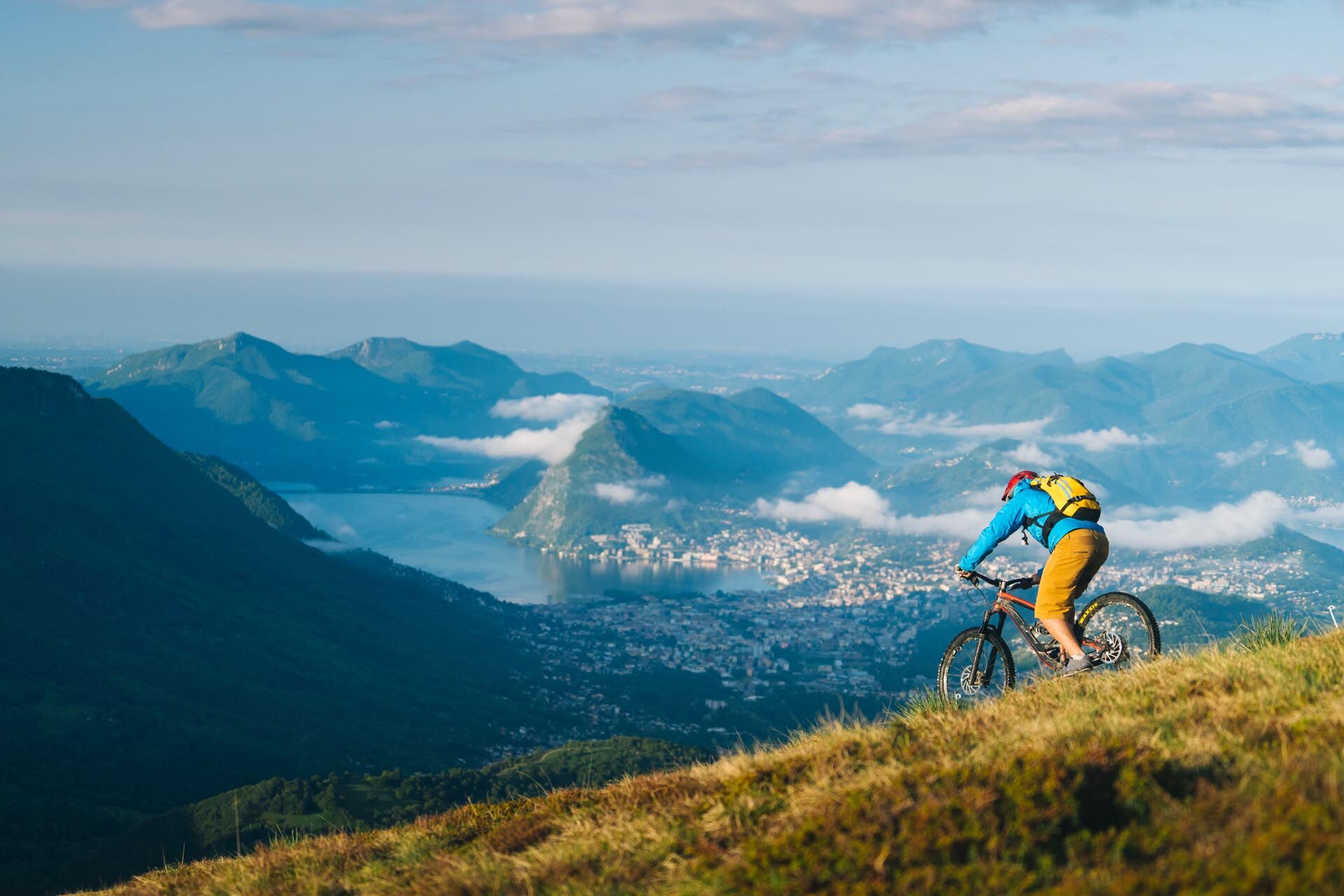
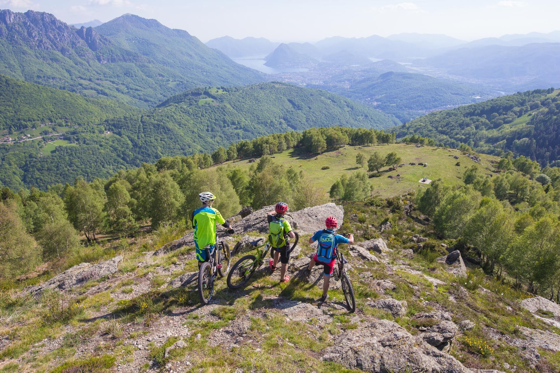
The route leads through the area of the region's most famous mountains: the Monté Brè, Monte Bar and Monte Tamaro. However, it is best to take the aerial gondola up the Monte Lema. From the four peaks you are treated to impressive views of the city of Lugano and its large lake, the imposing backdrop of the Bernese and Valais Alps, Lago Maggiore and neighbouring Italy. A perfect panorama route dotted with regional discoveries.
Flowing single trails on natural surfaces alternate with links on asphalt roads.A tour combining nature, panoramic views, history and culture. The route uses the development potential of the regional bike network. Only a few of Switzerland's bike routes can offer such variety.
Information for e-MTB: link to the map containing the positions of the charging stations along the route!
With indicative times adapted to the electric MTB.
- Directions
-
This route is only signposted in one direction: Lugano (Monte Brè) – Ponte Tresa
- Highest point
- 1,887 m
- Endpoint
-
Ponte Tresa
- Height profile
-
 © outdooractive.com
 - Directions
- Public transportation

-

-
AuthorThe tour Lugano Bike — Nr. 66 is used by outdooractive.com provided.