
- Brief description
-
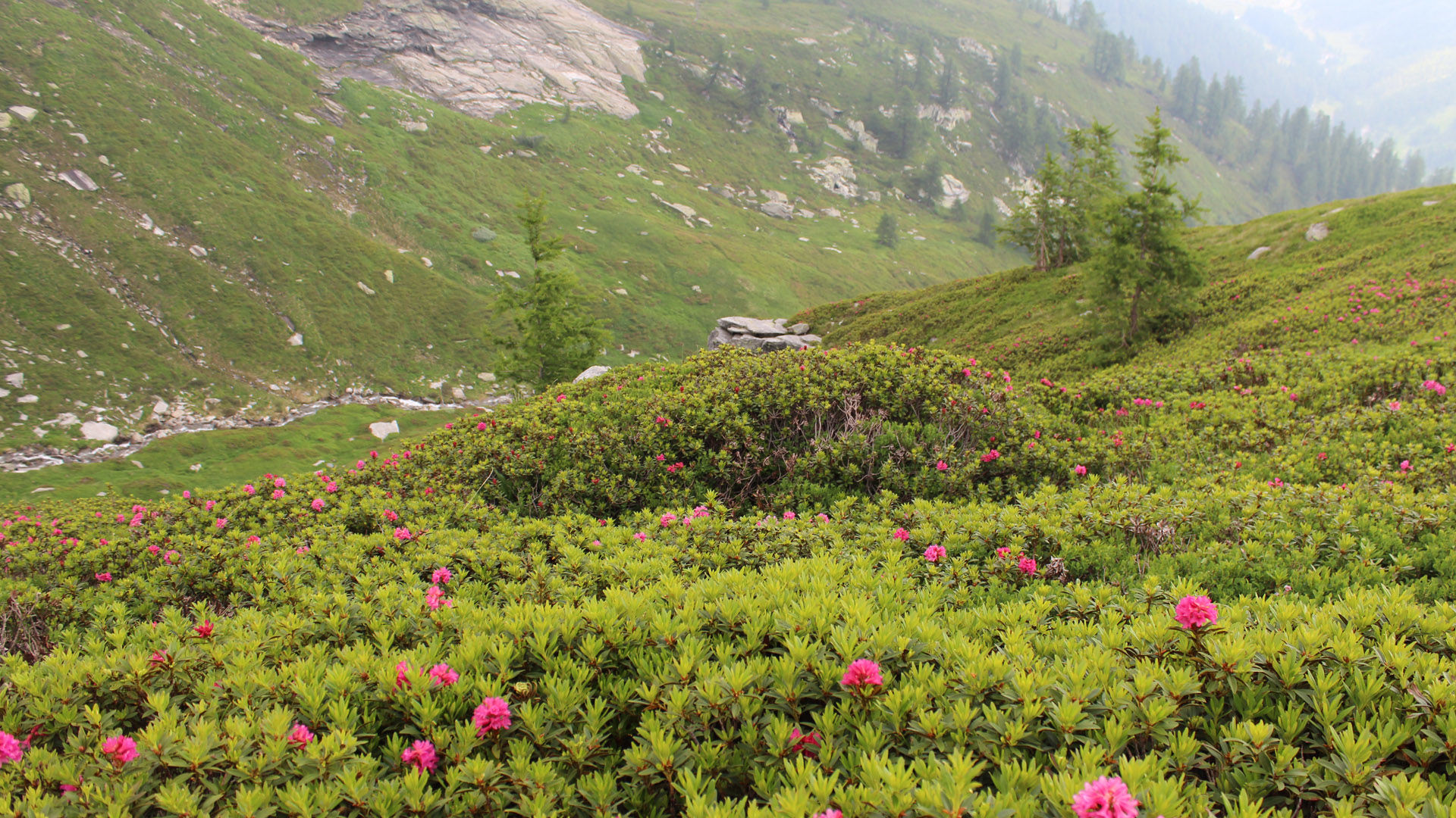
A walk through enchanting forest scenery in the realm of the Walsers. The tour is crowned by a 360° panorama from the Passo Quadrella.
- Difficulty
-
medium
- Rating
-
- Route
-
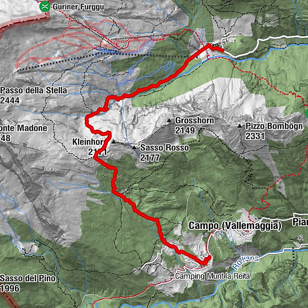
Cimalmotto (1,405 m)0.1 kmChiesa Parrocchiale di Santa Maria Assunta0.2 kmPianasc0.7 kmCavà0.8 kmAlpe Quadrella di Fuori2.5 kmGurin (1,506 m)7.8 kmOsteria delle Alpi8.0 kmRestaurant Walser8.0 km
- Best season
-
JanFebMarAprMayJunJulAugSepOctNovDec
- Description
-
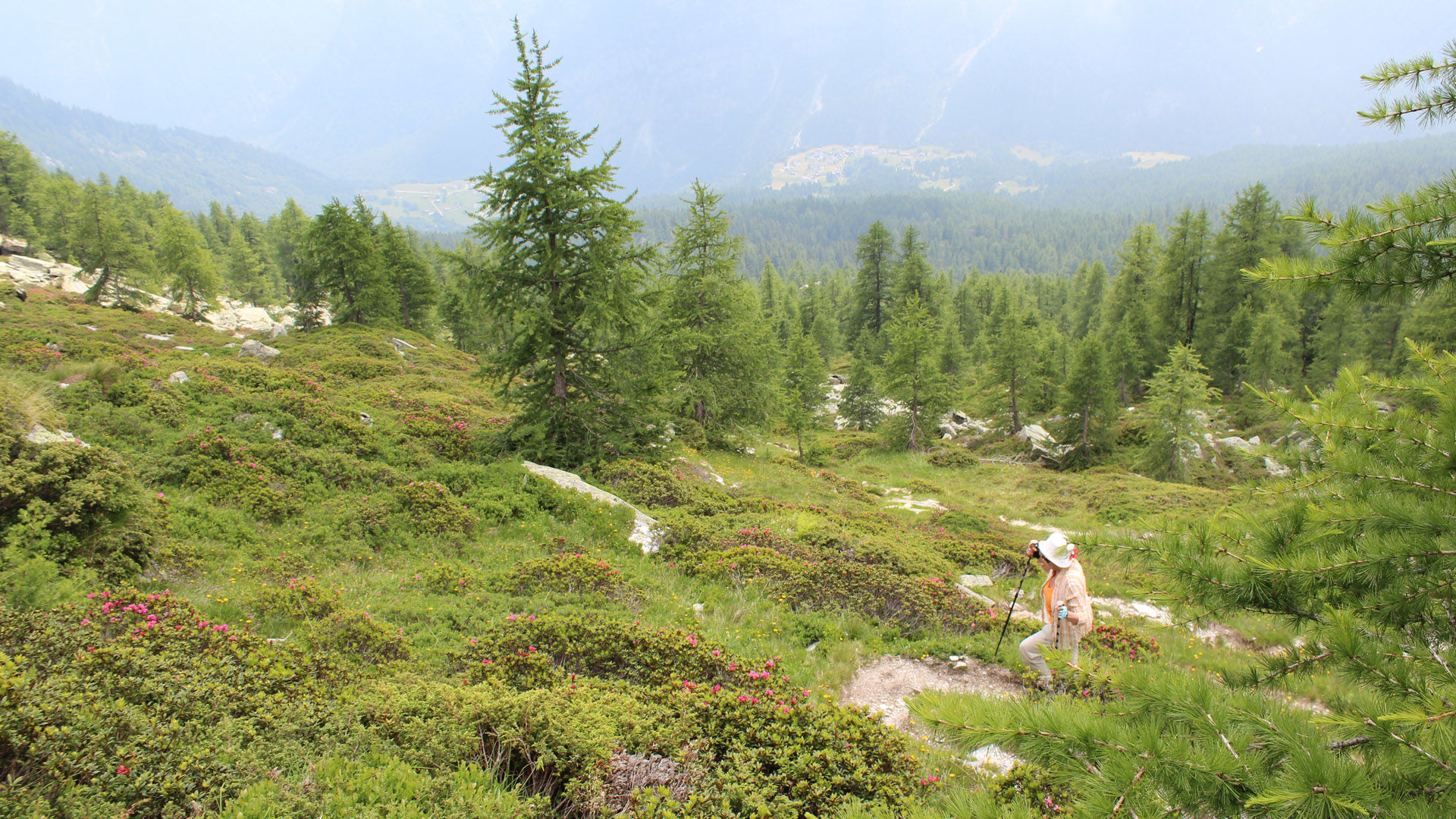
Take the bus (which runs 2-3 times a day) from Cevio to Cimalmotto. The red-and-white waymarked path climbs gently from Cimalmotto towards Cavà. Coniferous forests adorn this area, and in autumn the larch – a fan of high altitudes – colours everything in gold.
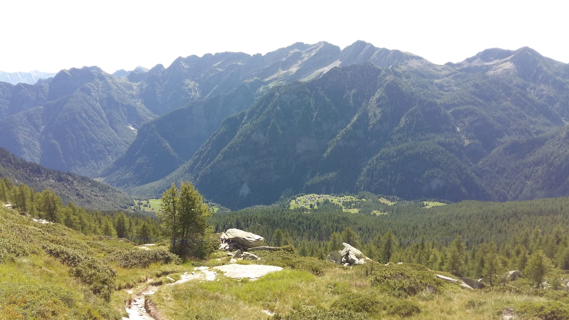
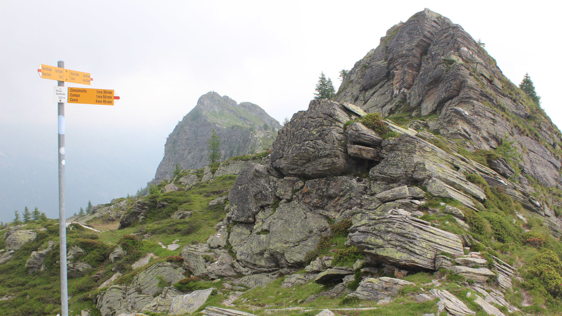
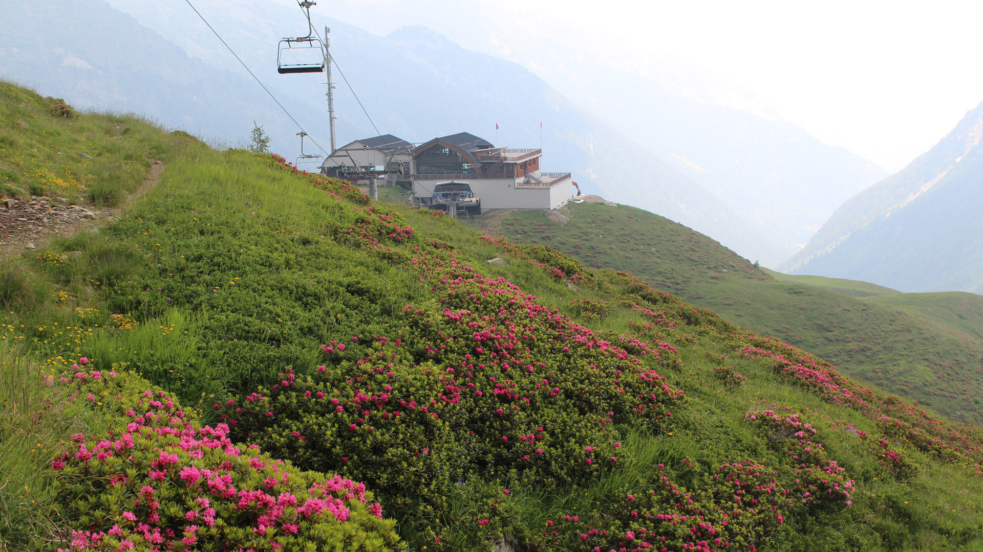
From there you continue to the Alpe Quadrella, which was farmed until about 2000, and then steeply to the eponymous pass, which offers views of Campo Vallemaggia and Bosco Gurin.
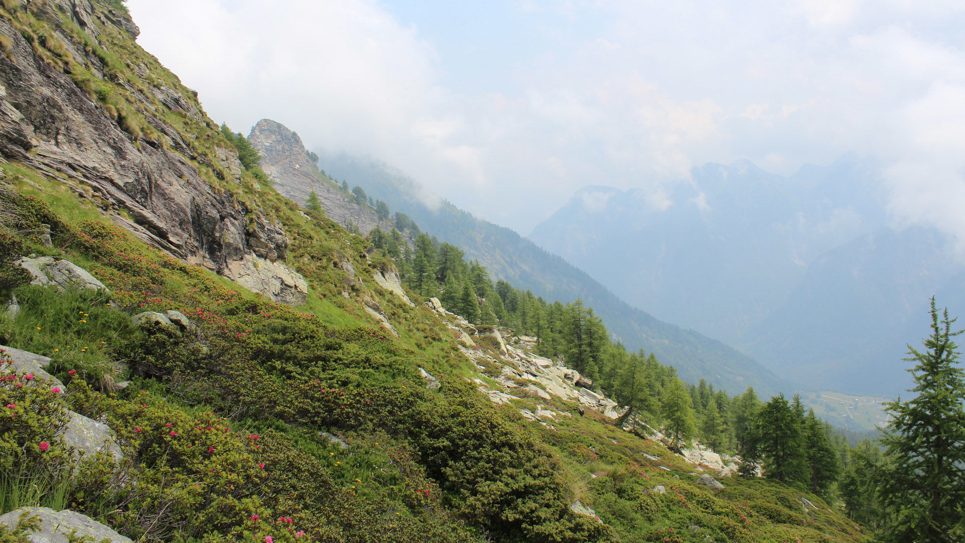
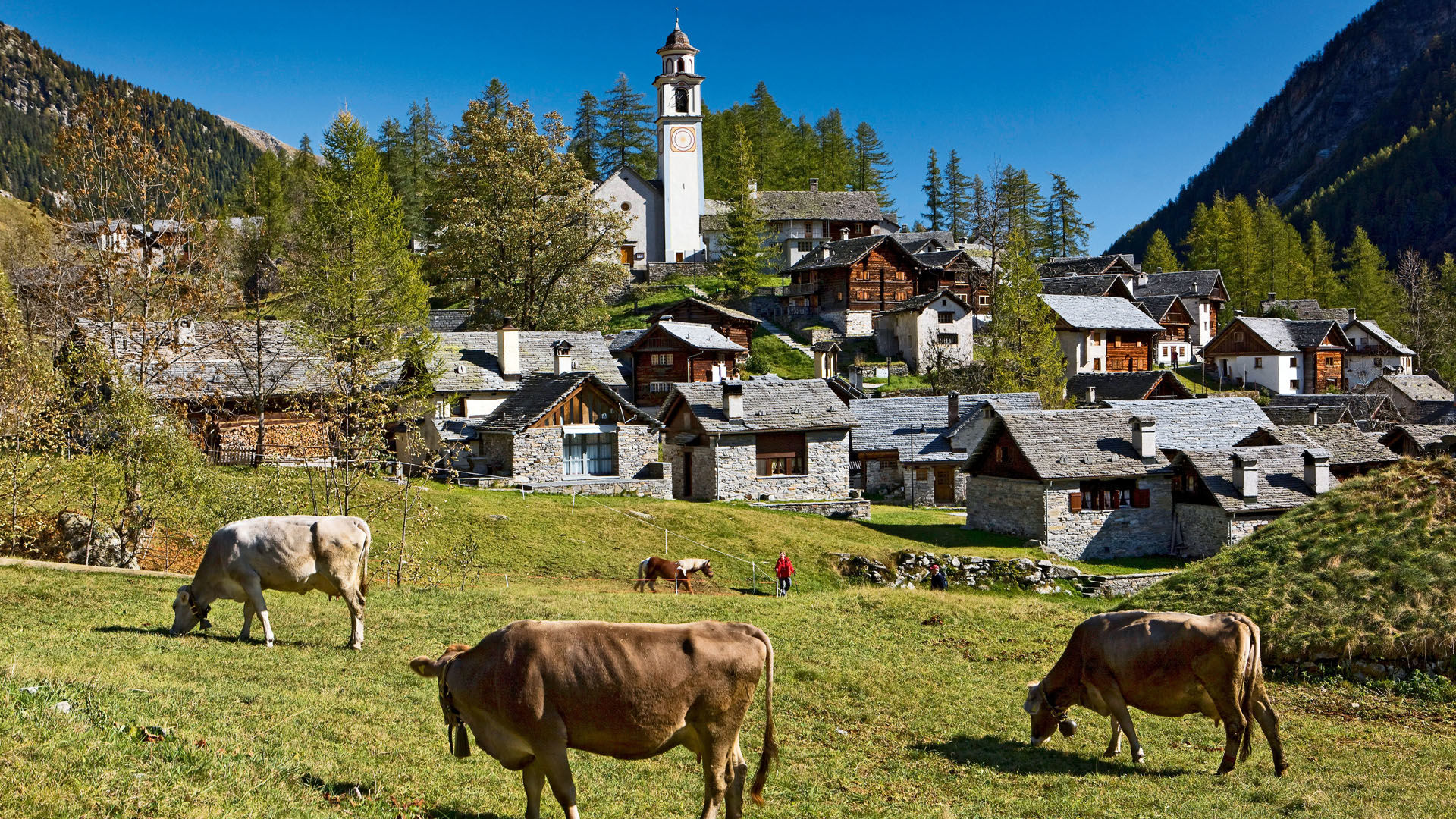
The descent zigzags down to Chumma through the Valle di Bosco Gurin to the only German-speaking village in the Ticino, Bosco Gurin; it's also the highest in the canton. The Walser village is replete with culture and history, all waiting to be discovered at the Walserhaus Museum.
The bus from here to Cevio runs several times a day (make a note of the times in advance).
- Highest point
- 2,118 m
- Height profile
-
 © outdooractive.com
 - Safety instructions
- Public transportation
-
From Locarno railway station: bus 315 towards Cavergno, Paese. Alight at Cevio, Centro and change to 331 to Bosco Gurin, Paese (2 min walk to change the bus stop). Alight at Cerentino and takte bus no. 332 to Cimalmotto.
Return from Bosco Gurin: Bus 331 to Cevio, Posta. 2 min walk to Cevio, Centro. Take the bus 315 towards Locarno Stazione. Alight at Locarno station. Further information:
- Author
-
The tour Cimalmotto-Passo Quadrella-Bosco Gurin is used by outdooractive.com provided.