- Difficulty
-
easy
- Rating
-
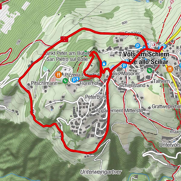
- Route
-
Pitschlmann1.3 kmPeterbühel2.5 kmPeterbühel (905 m)3.2 kmSankt Peter am Bühel3.2 kmSpielplatz Peterbühl 23.3 kmVöls am Schlern3.9 km
- Best season
-
JanFebMarAprMayJunJulAugSepOctNovDec
- Description
-
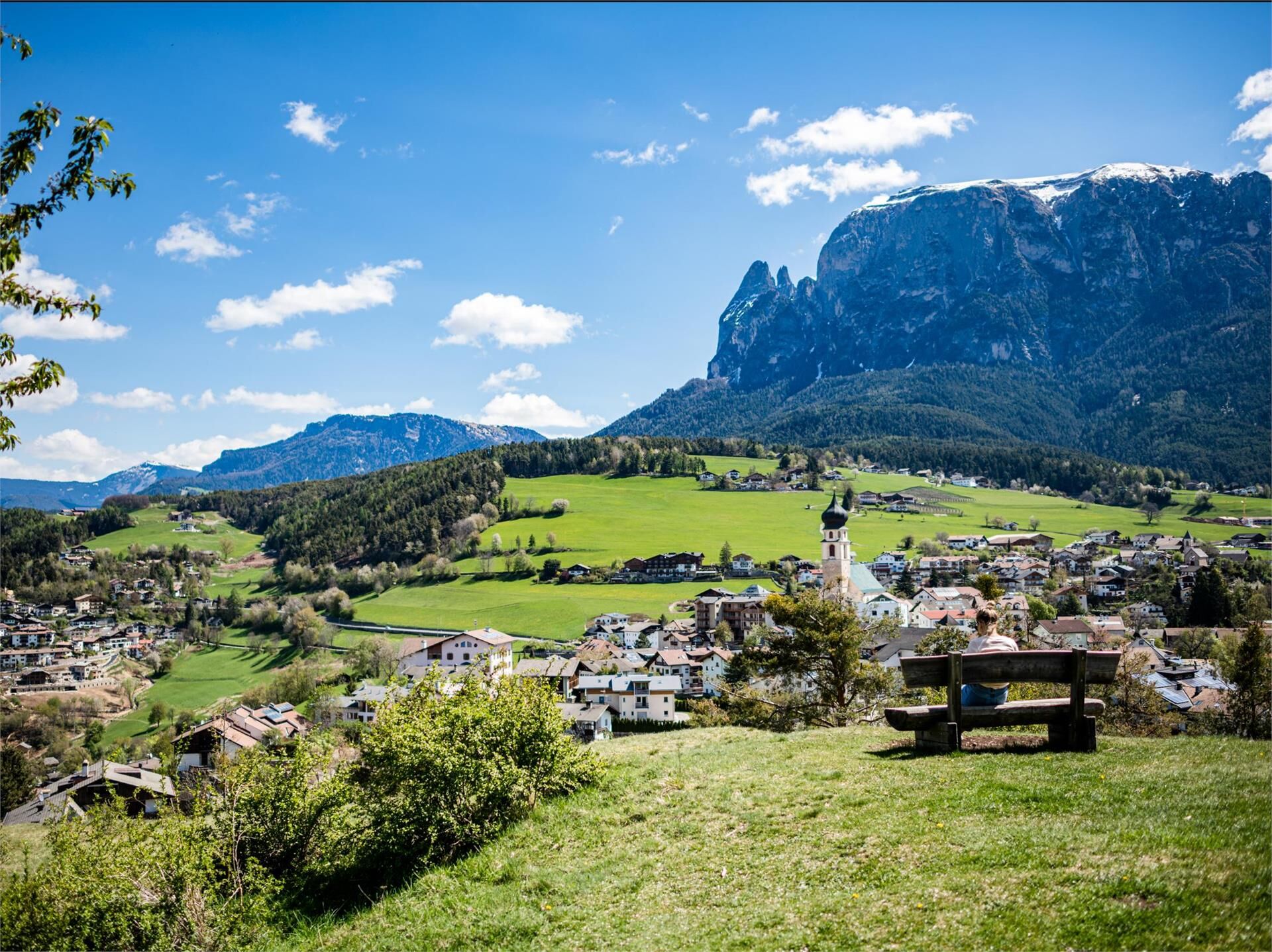
This trail leads around the village of Völs am Schlern and ends at the Peterbühl, a hill at the edge of the village, where you will also find a church of the same name. The Peterbühl is the oldest settlement in the area, and, as recent Bronze-Age findings have proven, has been inhabited since thousands of years before the birth of Christ.
This hiking tour can be found in the family hiking booklet “Out and About with Nix the Witch”.
- Directions
-
The hike begins at the tourist office at the roundabout in Völs am Schlern. The initial stretch leads towards the village centre and, after just a few steps, leads off to the right along the tarred road. Follow the signposts for the “Völser Rundweg” (Völs loop trail) and continue along the tarred road for a short stretch, followed by a field trail through soft meadowland. The trail crosses the sunny slopes and leads, in a gentle ascent, past the Pitschlmann farm inn.
Continue onwards, in part through the meadows and in part through the leafy forest, past a few farms, and then back to the centre of Völs am Schlern along the tarred road. When you come to the new cemetery the trail leads on to the Peterbühl hill, where you can enjoy magnificent views of the village and the Schlern mountain.
Refreshment stop along the hiking trail. Not pram-friendly.Please check the opening hours of the huts and restaurants: www.seiseralm.it/restaurants
- Highest point
- 896 m
- Height profile
-
 © outdooractive.com
 - Directions
-
You can get to the set-off point in Völs am Schlern on line 2 (Seiser Alm cable car) or interurban bus 170 .
- Public transportation
- Parking
-
Völs am Schlern

- Author
-
The tour Völs Loop Trail and the Peterbühl hill is used by outdooractive.com provided.


-
Bozen und Umgebung - Südtirols Süden
1949
-
Seiser Alm
1141
-
Völs am Schlern
387