- Brief description
-
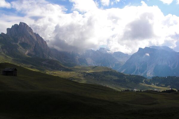
Circular hike with fantastic panoramic views of Latemar and Rosengarten | Catinaccio
- Difficulty
-
easy
- Rating
-
- Route
-
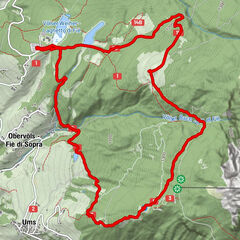
Welschnofen0.0 kmMarienkapelle2.1 kmSchillerhof3.3 kmPfarrkirche St. Ingenuin und Albuin10.6 kmWelschnofen10.6 km
- Best season
-
JanFebMarAprMayJunJulAugSepOctNovDec
- Description
-
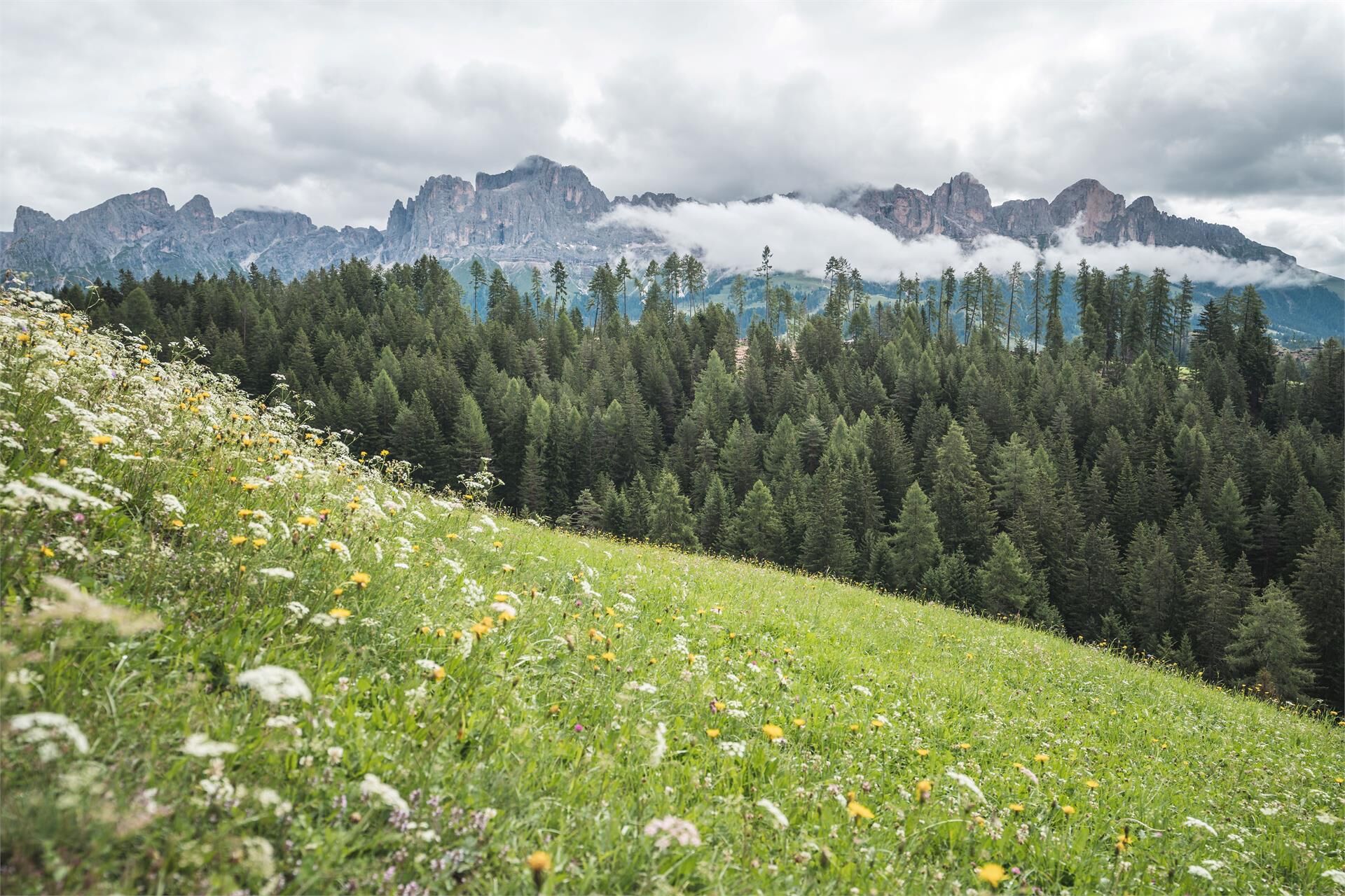
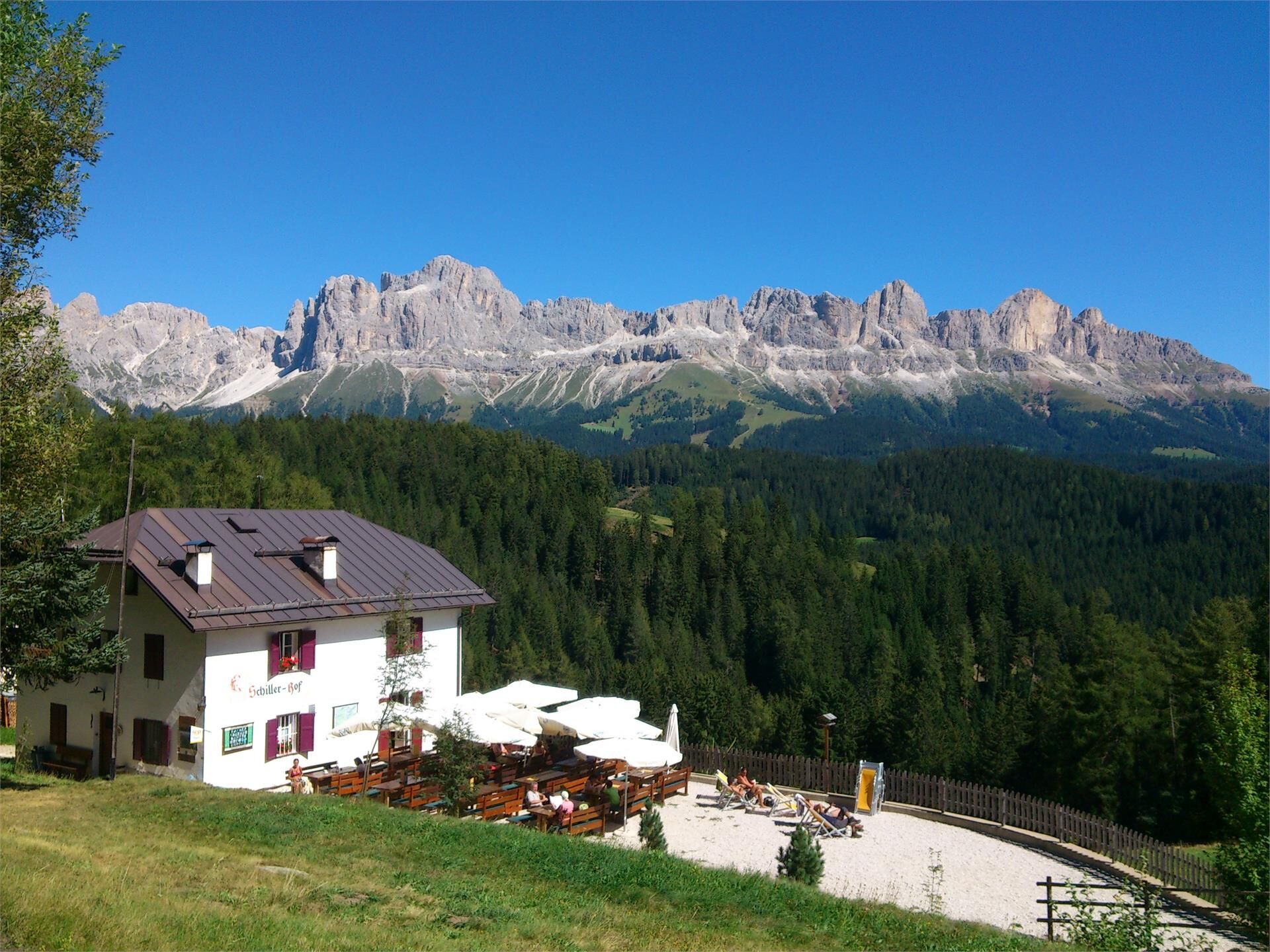
With the fabulous view of the surrounding Dolomite mountains Rosengarten | Catinaccio and Latemar, this hike is an absolute Must-Do here in Val d'Ega. The hike is suitable for the whole family. The two refreshment stops invite you to enjoy homemade dishes.
Attention!: Maso Schiller Hof is closed - Directions
-
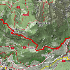
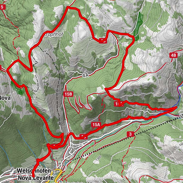
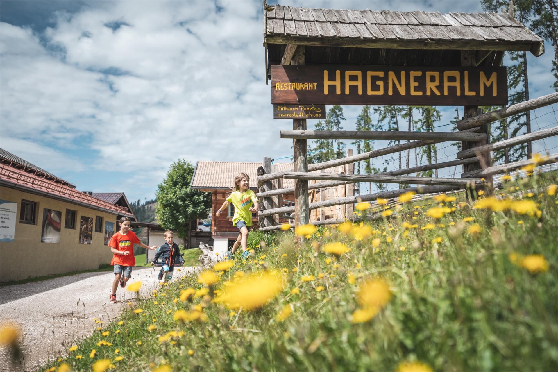
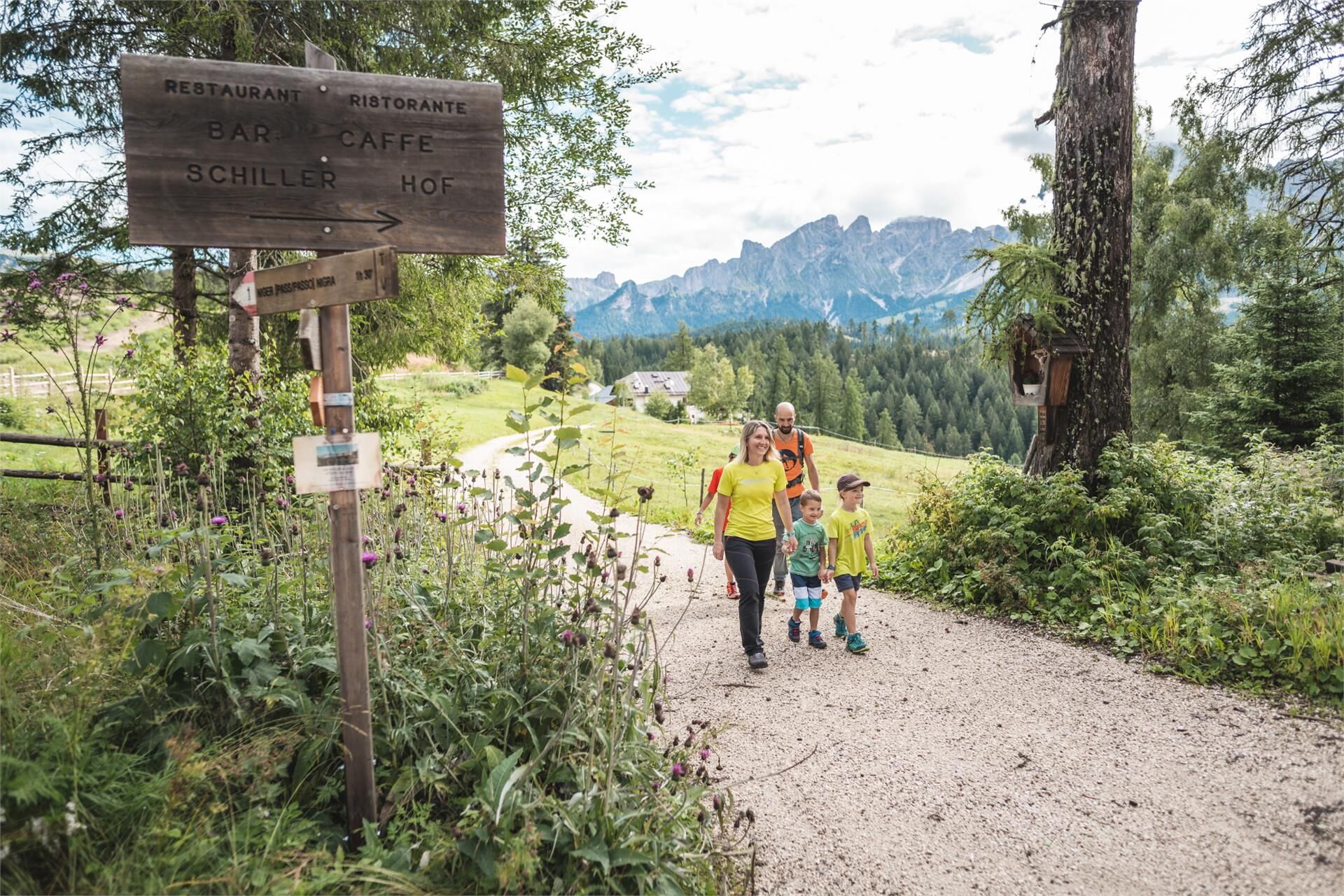
The route leads from Welschnofen | Nova Levante, church square on path [5] to the Lengeria pilgrimage chapel and on to the trapping pit. Then take path [1] to the Schiller farm (1,555 m) and continue on path [4A] to the Hagner hut. From both huts you can enjoy a fantastic panoramic view of the Latemar and the Rosengarten.
The way back to Welschnofen | Nova Levante is via paths [4B], [15A], [15] and [5].
A variant of the route starts at the Welschnofen | Nova Levante cable car valley station: take the Laurin I cable car up to the Frommer hut, from there on trail [1A] to the Pass "Nigerpass". Continue via the forest road [1] and path [4A] to the Hagner hut and path [4A] back to Welschnofen | Nova Levante (duration: 3.5 hours; ascent: 37 metres; length: 12.5 km) or back on path [1] to the Schiller farm and then on paths [1] and [5] to the starting point (duration: 3 hours; ascent: 36 metres; length: 11 km).
- Highest point
- 1,572 m
- Height profile
-
 © outdooractive.com
 - Directions
-
Getting to the starting point of the tour by public transport is easy and convenient.
By public bus line:
- 180 from Bozen | Bolzano, Birchabruck | Ponte Nova
- 180 or 184 from Karersee | Carezza, Karerpass | Passo Costalunga
- 184 from Weissenstein | Pietralba, Petersberg | Monte San Pietro, Deutschnofen | Nova Ponente, Stenk (or 181 and change 180)
- 184 from Obereggen, Eggen | Ega
- 187 from Steinegg | Collepietra, Gummer | San Valentino (or 182 and change 180)
- 180 from Val di Fassa
Bus stop: Welschnofen centre + on foot (6 minutes); online timetable search at www.suedtirolmobil.info/en/
Starting point: church square Welschnofen | Nova Levante (https://goo.gl/maps/fxsfgQF5camh8PgN9)
By car:
Destination: Welschnofen | Nova Levante centre
Parking: parking lot cable car Welschnofen | Nova Levante Laurin I + on foot (6 minutes)
Starting point: church square Welschnofen | Nova Levante (https://goo.gl/maps/fxsfgQF5camh8PgN9) - Public transportation
-
Getting to the starting point of the tour by public transport is easy and convenient.
By public bus line:
- 180 from Bozen | Bolzano, Birchabruck | Ponte Nova
- 180 or 184 from Karersee | Carezza, Karerpass | Passo Costalunga
- 184 from Weissenstein | Pietralba, Petersberg | Monte San Pietro, Deutschnofen | Nova Ponente, Stenk (or 181 and change 180)
- 184 from Obereggen, Eggen | Ega
- 187 from Steinegg | Collepietra, Gummer | San Valentino (or 182 and change 180)
- 180 from Val di Fassa
Bus stop: Welschnofen centre + on foot (6 minutes);
Starting point: church square Welschnofen | Nova Levante (https://goo.gl/maps/fxsfgQF5camh8PgN9) - Parking

- Author
-
Eggental - Deutschnofen - ObereggenThe tour Farm hike is used by outdooractive.com provided.


-
Bozen und Umgebung - Südtirols Süden
1947
-
Eggental
1063
-
Welschnofen Karersee
410