
- Brief description
-
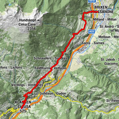
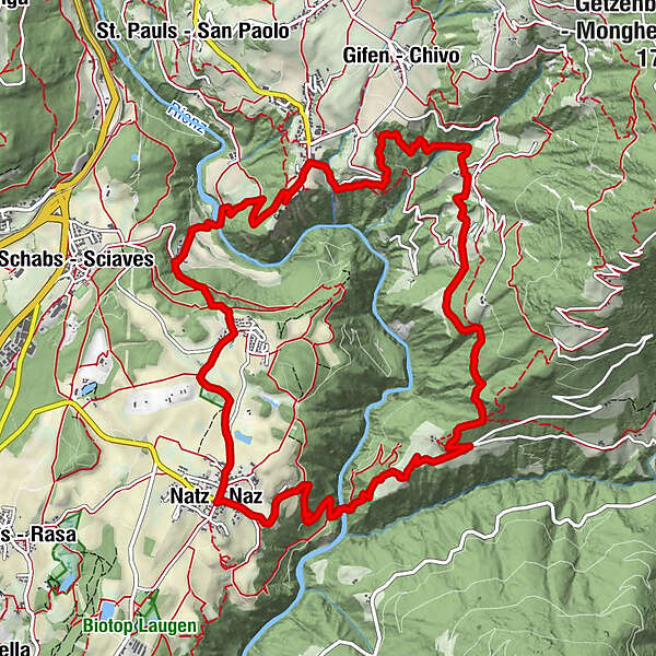
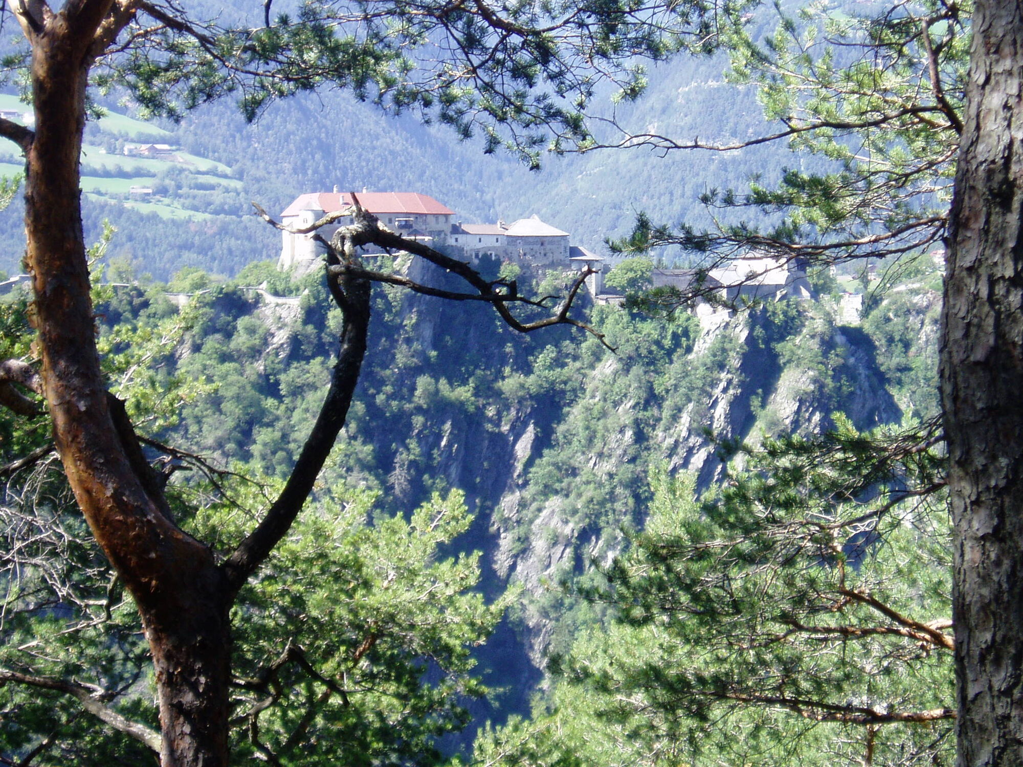
This walk leads from Naz in the wild, rugged Rienzschlucht gorge via Luson cross (Lüsen Kreuz) to Spissa, to the hamlet of Vill at the Rodengo mountain, to Rodenegg Castle and then return via the gorge.
- Starting point
-
Naz|Natz (889 m)
- Route
-
Natz0.0 kmGasthof Anich0.0 kmPhilipp- und Jacobkirche0.0 kmNiedristhof3.0 kmKreuzstöckl4.4 kmSpisses6.8 kmMunt-Flaa8.3 kmKleinackerle8.4 kmSticklrain9.0 kmUnterpuggl9.0 kmLocher-Hausacker9.1 kmTratele9.2 kmVill (885 m)9.5 kmRodeneck (882 m)9.5 kmGasthof zum Löwen9.6 kmKirchackerle9.6 kmRodenegger Hof9.6 kmKälberanger9.7 kmMaria Himmelfahrt9.7 kmWaldackerle10.3 kmKapelle beim Rundl11.8 kmSt. Magdalena12.7 kmViums12.7 kmHofschänke Walderhof14.2 kmPizzeria Goldener Apfel14.2 kmGasthof Anich14.3 kmPhilipp- und Jacobkirche14.3 kmNatz14.4 km
- Directions
-
From the village square in Naz (889m) descend with route no. 4 to the Rienzschlucht, cross the Rienz river on the bridge (590m) and return walking uphill to Niedersthof farm (821m; stop, refreshments served). After approx. 800 in the direction of Luson a left-hand fork leads to Kreuzstöckl chapel. From Kreuzstöckl (984m) follow footpath no. 1 northwards, which branches left at Spissa onto route no. 6, crosses Schanner Bachgraben ditch (785m) and then ascends again to reach the main village of Villa (885m) and Rodenegg Castle. Here, route no. 1 leads once again into Rienzschlucht gorge and on to Rundlbrücke bridge (662m), where it ascends past Rundlhof farm and on to Kirchhügel hill of Fiumes (898m). In a southerly direction through fields and orchards, passing Sommersürs biotope, you will reach the starting point.
- Highest point
- 984 m
- Endpoint
-
Naz|Natz (889 m)
- Height profile
-
 © outdooractive.com
- Author
-
The tour From Naz|Natz via Rienzschlucht Gorge to Rodengo|Rodeneck is used by outdooractive.com provided.


-
Brixen und Umgebung
1976
-
Gitschberg - Jochtal
672
-
Natz-Schabs
221