
- Brief description
-
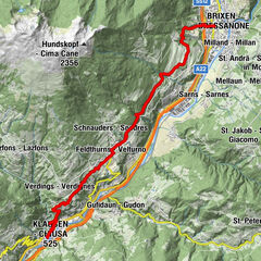
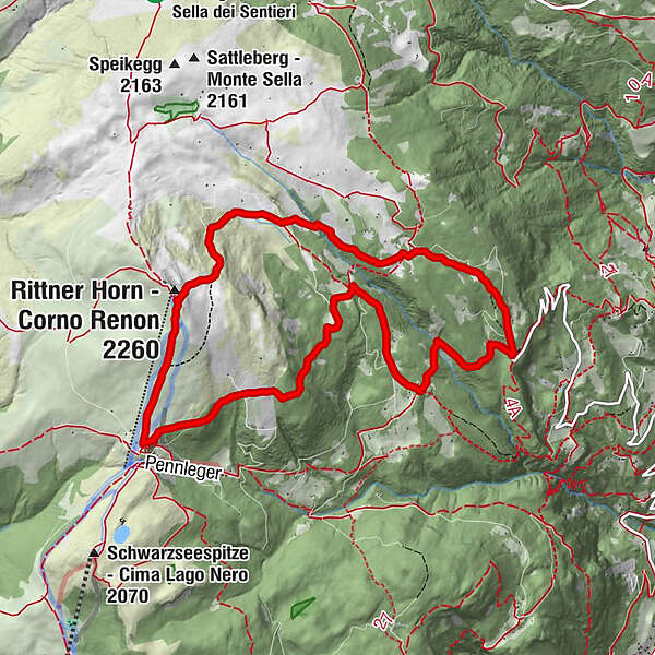
The moderately steep but not overly long ascending path from Barbiano is one of the most scenic ascents leading up to the Corno di Renon. The length of the approaching route from Ponte Gardena to Barbiano and then along the narrow mountain road to the spacious parking lot is 12.5 km.
- Starting point
-
Huber Kreuz parking lot (1,624m)
- Route
-
Rittner Horn (2,260 m)4.2 kmRittner Horn Haus4.3 kmGasthaus Unterhorn5.4 kmUnterhorn5.4 km
- Directions
-
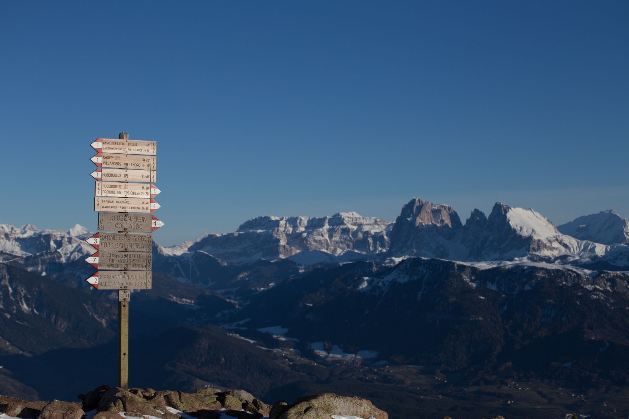
Starting from the Huber Kreuz parking lot (1,624m; indications), footpath no. 4 leads upwards through the high forest to the west, crossing the alpine road and leading to the Sisserkaser meadow (1,808m; fountain). The route then leads past the Neuhäuslhütte hut (1,849m). A little further above path no. 4 leads through a meadow to the south, and continues along the lower edge of a pasture to the crossing of two riverbeds excavated in the porphyry rock. At the point where it crosses path no. 3, the alpine path leads westward and up as a detour, in both directions, to the Platzer Alm mountain hut (2,064m; mountain inn). Trail no. 4 leads to the left through the mountain pine fields to a flat sloping terrace. After a series of short rocky steps, the route reaches the Rittner-Horn-Haus hut at Corno del Renon (2,259m; 360° panoramic view). Descend following footpath no. 1 to the Feltuner Hütte hut (2,065m; refreshments served) and to the Unterhornhaus hut (2,042m; refreshments served). Here, high mountain trail no. 15 leads along the upper edge of the timberline and slightly down to the northeast, around a mountain ridge and down through the forest to the Mountain Pine Distillery (1,858 m; here, rare mountain pine oil is manufactured). Follow the steeper road no. 3 south to the Merlalm pasture (1,607m). From here, forest trail no. 3B leads through the Kaserbachgraben ditch, circumventing the mountain ridge, before reaching the Huber Kreuz parking lot.
- Highest point
- 2,250 m
- Endpoint
-
Huber Kreuz parking lot (1,624m)
- Height profile
-
 © outdooractive.com
- Author
-
The tour From Barbiano|Barbian to Corno di Renon|Rittner Horn is used by outdooractive.com provided.
-
Brixen und Umgebung
1976
-
Lajen
1101
-
Barbian
335