
- Brief description
-
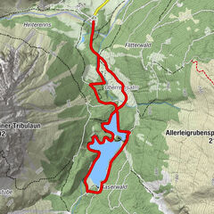
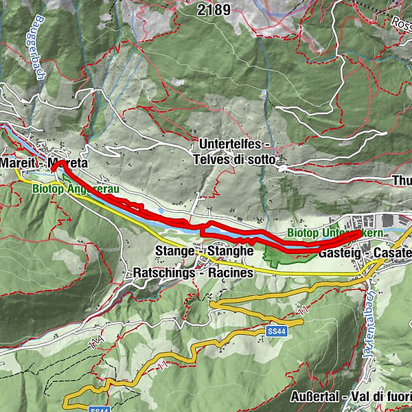
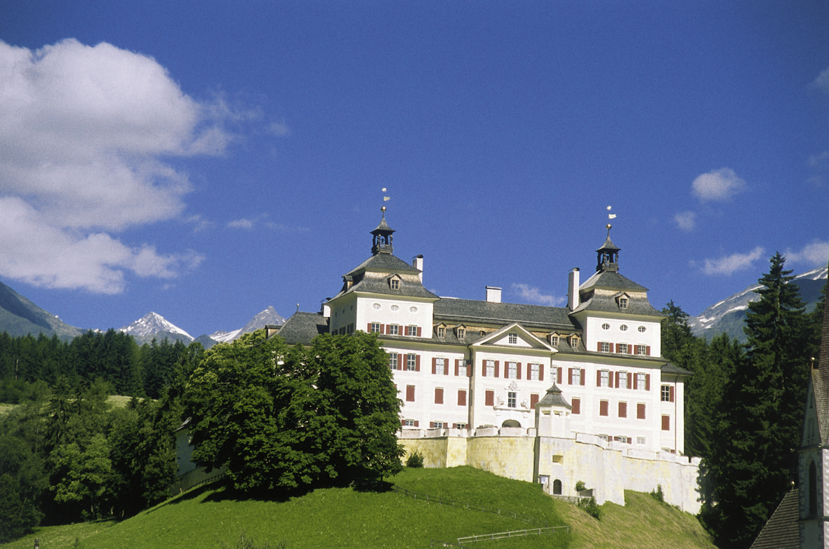
The Mareta – Casateia circuit trail is a leisurely walk along the brook. We start below the splendid scenery of Wolfsthurn Castle. It is highly recommended to visit the nearby Museum of Hunting and Fishing, as well as a small trip to the small church below the castle mound.
- Starting point
-
Mareta|Mareit, Wolfsthurn Castle parking lot (1,035m)
- Route
-
Mareit (1,070 m)0.0 kmRemlau (1,013 m)0.7 kmStange (970 m)2.2 kmRatschings2.2 kmGasteig (970 m)4.4 kmStange (970 m)6.5 kmRemlau (1,013 m)8.0 kmMareit (1,070 m)8.8 km
- Directions
-
In Mareta (1,035m; several inns) you start by walking over the bridge on the orographic left side of the brook and then turn sharp right onto the foot path (also used as cycle path), in the direction of the valley. Then follow the path to the hamlet of Stanghe (976m, stop), where you cross over to the other side of the brook. Then continue along the brook until you reach Casateia (970m, stop). Here, you cross back over to the other side of the brook again. The walk follows trail no. 9 in the direction of the valley, to Mareta. Mareiter Bach brook waters the glacier on the south side of the Stubaital Alps. The well-built wild brook contains a large amount of water when the snow melts in mid summer.
- Highest point
- 1,032 m
- Endpoint
-
Mareta|Mareit, Wolfsthurn Castle parking lot (1,035m)
- Height profile
-
 © outdooractive.com
- Author
-
The tour Circuit Trail from Mareta|Mareit to Casateia|Gasteig is used by outdooractive.com provided.


-
Brixen und Umgebung
1976
-
Eisacktal
729
-
Ratschings
100