The famous footpath Adolf-Munkel-Weg - Valley Villnöss - Dolomites - 2050


- Brief description
-
The famous footpath Adolf-Munkel-Weg
Beautiful hike at Funes/Villnöss
Starting-point: Zannes at the end of Val di Funes/Villnöss (1670 mt.)
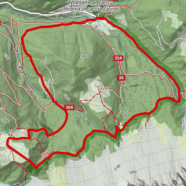
At a glance: Zannes - Ciancenon/Tschantschenon – Odle/Geisler footpath – Località Malga Glaces/Gschnagenhardtalm (hut) – Malga Casnago/Gschnagenhardtalm (hut)
- Starting point
-
Zanser Alm
- Route
-
Zans0.0 kmTreffpunkt Zans (1,680 m)0.0 kmZanser Schwaige0.2 kmGschnagenhardt Alm (2,006 m)5.0 kmDusler Alm (1,800 m)6.8 kmZans8.7 kmTreffpunkt Zans (1,680 m)8.7 km
- Description
-
The famous footpath Adolf-Munkel-Weg
Beautiful hike at Funes/Villnöss
Starting-point: Zannes at the end of Val di Funes/Villnöss (1670 mt.)
At a glance: Zannes - Ciancenon/Tschantschenon – Odle/Geisler footpath – Località Malga Glaces/Gschnagenhardtalm (hut) – Malga Casnago/Gschnagenhardtalm (hut) - Düsslerhütte - Zannes
Altitude difference: 380 mt.
Highest point: around Malga Casnago/Gschnagenhardtalm (about 2050 mt.)
Duration: 4 hours
Length: about 10 km
Difficulty: three climbing-boots hike
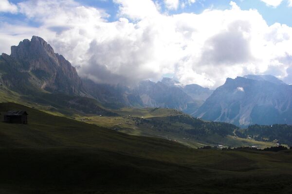
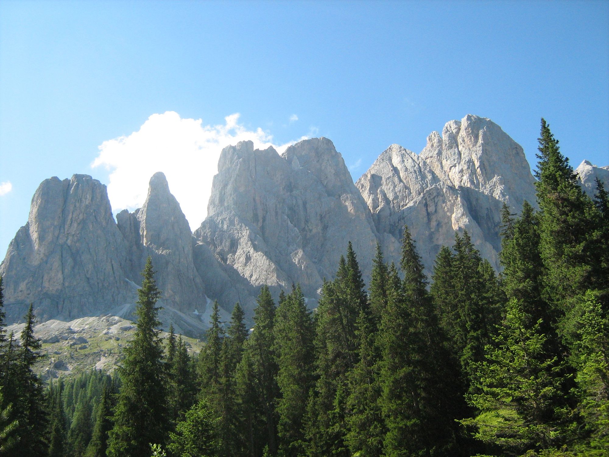
Useful advice: a famous high-mountain path with an interesting view on Dolomites’ geological conformation. It has been tracked in 1905 by Dresda’s Alpine division and received the name of its founder.
- Highest point
- 2,032 m
- Height profile
-
 © outdooractive.com
 - Directions
-
With your car to Klausen, to Valley Villnöss to the Parking Zanser Alm - 40 min.
- Public transportation
-
Velturno - Chiusa - Valle di Funes


- Author
-
The tour The famous footpath Adolf-Munkel-Weg - Valley Villnöss - Dolomites - 2050 is used by outdooractive.com provided.


-
Dolomiten
1826
-
Dolomitental Villnöss
1128
-
St. Magdalena
369