© Bruneck Kronplatz Tourismus - Harald Wisthaler
Tour data
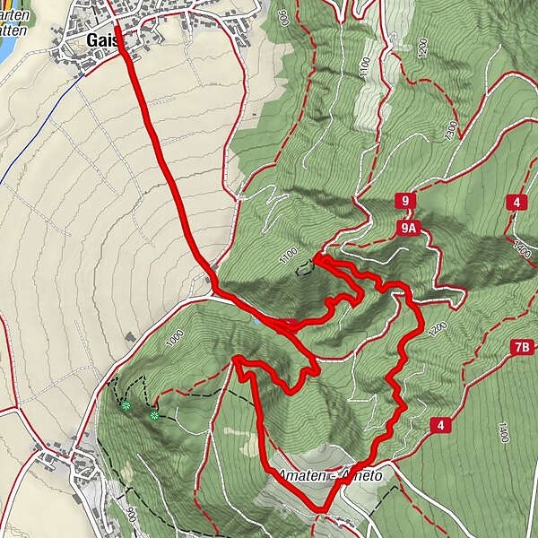
8.31km
834
- 1,252m
397hm
420hm
03:00h
- Difficulty
-
medium
- Rating
-
- Route
-
Gais0.1 kmAmaten4.5 kmGais8.1 km
- Best season
-
JanFebMarAprMayJunJulAugSepOctNovDec
- Description
-
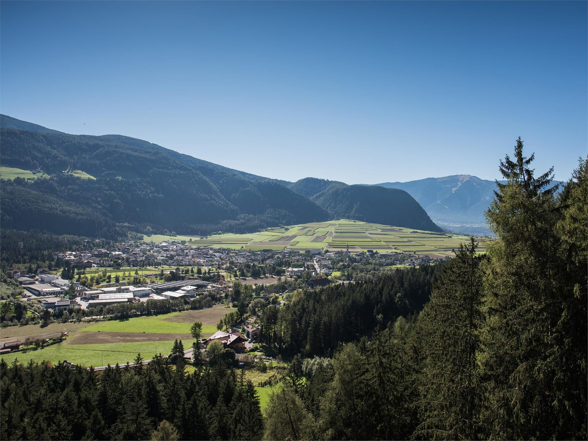
Easy hike through woods and meadows to the farms of Ameto which are located in a beautiful panoramic position.
- Directions
-
From the parish church in Gais, head north between the houses into the forest (marker 2). You cross it and then reach some mountain farms surrounded by meadows. Continue through the forest in a southerly direction until you reach the Kehlburg, which lies at an altitude of 1,187 m on a narrow wooded hill and presents itself today only as a ruin. From here you hike to the beautifully situated farms of Amaten (marked K), where you can stop for refreshments. Through the steep forest hillsides, head in a north-westerly direction (marker 5) to the Bärentalhof farm and across the fields back to Gais.
- Highest point
- 1,252 m
- Height profile
-
 © outdooractive.com
 - Directions
-
Public transport from Mobility Center Bruneck/Brunico:
With the bus no. 450 to Gais - bus stop "Dorf/Paese".
- Author
-
Bruneck Kronplatz TourismusThe tour Gais - Castle Kehlburg - Amaten - Gais is used by outdooractive.com provided.
GPS Downloads


Other tours in the regions