- Difficulty
-
medium
- Rating
-
- Route
-
CompatschSpielplatz Panorama2.1 kmLaurinhütte2.9 kmSaltner Hütte4.8 kmSpielplatz Saltner Hütte4.9 kmPetz (2,568 m)9.6 kmGugglochegg (2,375 m)14.7 kmTierser Alpl Hütte15.7 kmTierser Alpl Joch (2,440 m)15.8 kmPlattkofelhütte22.1 kmMurmeltierhütte23.9 kmSaltria27.8 kmRitsch Schweige30.1 kmFranziskuskirche32.5 kmCompatsch32.6 km
- Best season
-
JanFebMarAprMayJunJulAugSepOctNovDec
- Description
-
A must for all Dolomite fans: This multi-day hut tour leads to the most beautiful spots of the holiday region of the Seiser Alm, and boasts fairytale-like views over the UNESCO World Heritage Dolomites. The first stage leads to the Schlern which, with its distinctive shape, is the emblem of South Tyrol. On the following day the tour leads on to the Refuge Tierser Alpl, the private mountain hut with the distinctive red roof and onwards to the Plattkofelhütte hut, at the foot of the Plattkofel.
- Directions
-
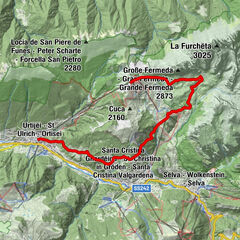
Day 1:
The hike begins at Compatsch on the Seiser Alm, Europe's largest alpine pasture. The easiest and quickest way to get here is by the Seiser Alm cable car from Seis am Schlern (large free car park at the valley station). From Compatsch we climb up to the Hotel Panorama (or take the chairlift) before heading downhill to the Saltner hut. From here, we follow the numerous bends of the trail up to the high plateau of the Schlern and the Schlernhaus (2,457 m), whose palatial aspect has led to its alternative title of "the castle in the mountains.”
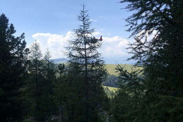
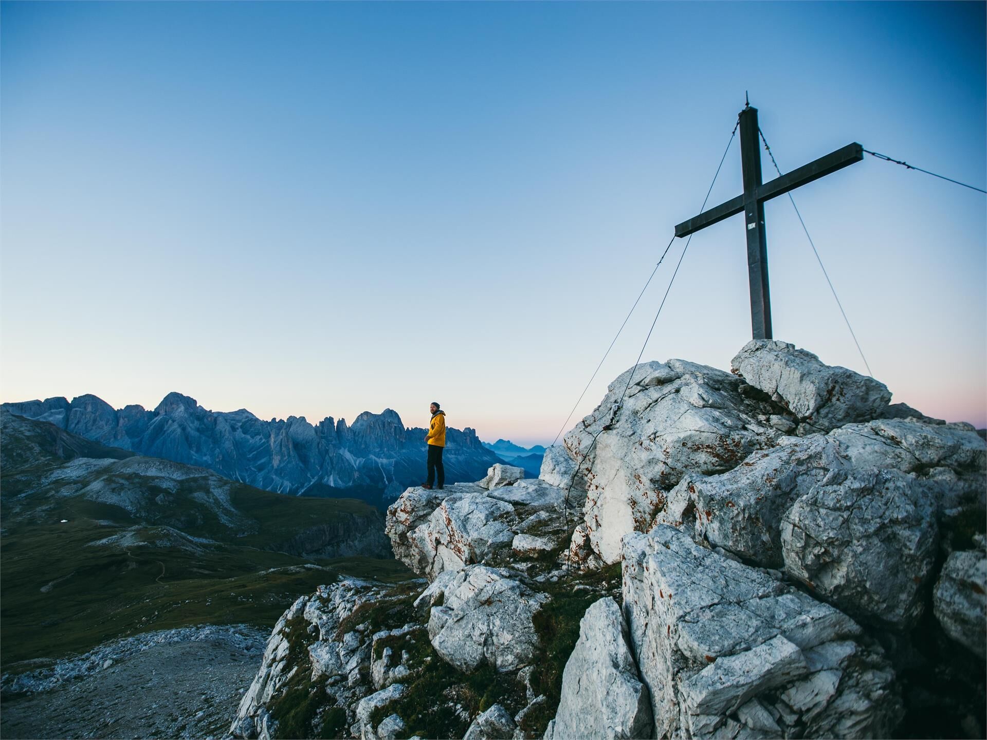
Our tip: Sunset on the Petz, the highest point of the Schlern (2,564 m), is an absolute must-see for all nature lovers. A 15-minute walk will take you from the Schlernhaus to the summit, where a breathtaking 360 ° panorama unfolds before you as you admire the mountain peaks of the Dolomites at sunset.
Duration: 3.5 hours
Length: 9.2 km
Ascent: 827 m
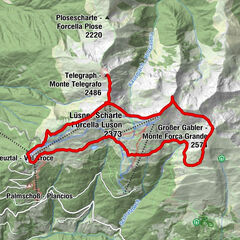
Day 2:
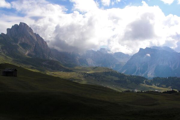
Although we don’t have quite as much height to cover the following day, the tour from the Schlernhaus past the Refuge Tierser Alpl to the Refuge Plattkofel is a fairly lengthy expedition nevertheless. Throughout the tour the views of the Dolomite peaks, including the Rosengarten, the Langkofel Group and even the highest mountain in the Dolomites, the Marmolada, are breathtaking.The route leads over the back of the Schlern in a slight ascent towards the Rosszähne, where the trail branches off steeply and we can see the striking red roof of the Tierser Alpl (2,441 m), ready to welcome us in for a lunch break. The landlord built the hut with his own hands and opened two climbing routes, the Via Ferrata Maximilian and Laurenzi, both of which begin here. The hut was renovated and partly rebuilt in 2015, and is one of the architectural highlights of South Tyrol. Following the signposts, we stroll leisurely onwards towards the Rifugio Sasso Piatto where the second night’s lodgings await.
Duration: 4 hours
Length: 12.1 km
Ascent: 499 m
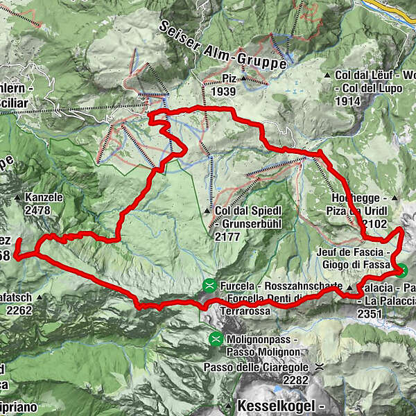
Day 3:
The Refuge Plattkofel is located in a quiet location surrounded by breathtaking countryside. To ensure that you get the most out of the experience, we have a special tip to share with you: sunrise on the Plattkofel. The walk from the hut to the summit cross covers around 650 meters of altitude in just under 1.5 hours. Your efforts will be rewarded with an outstandingly beautiful panorama, and breakfast in the refuge will taste twice as good afterwards. During the hike you will be able to appreciate the Seiser Alm in all its colossal majesty. The last section of the tour leads you past the Murmeltierhütte hut to Saltria and back to your set-off point in Compatsch.
Duration: 4 hours
Length: 11.8 km
Descent: 705 m
Please check the opening hours of the huts and restaurants: www.seiseralm.it/huts
- Highest point
- 2,559 m
- Height profile
-
 © outdooractive.com
 - Directions
-
The start and end point of this tour is Compatsch on the Seiser Alm. To get here, take the Seiser Alm cable car or with line 10 from Seis am Schlern via Kastelruth. Parking facilities are available at the valley station of the Seiser Alm car.
The road to the landscape conservation area Seiser Alm is closed to private traffic from 9.00am to 5.00pm. During this time you can get to the Seiser Alm by the Seiser Alm cable car from Seis or by bus from Kastelruth. You can descend from Compatsch at any time.
- Public transportation
-
The starting point of the tour or the sight is easily and comfortably accessible by public transport:
Bus n. 1 from Seis am Schlern, n. 2 from Völs am Schlern, n. 3 from Kastelruth or by bus line no. 170 from Bozen Bus Station or Brixen Bus Station to the bus stop of the Seis-Seiser Alm Aerial Cableway at Seis.
- Author
-
The tour From hut to hut in the heart of the Dolomites is used by outdooractive.com provided.


-
Brixen und Umgebung
1973
-
Seiser Alm
1121
-
Seiser Alm
479