

- Difficulty
-
difficult
- Rating
-
- Route
-
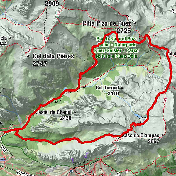
Sylvesterkapelle0.3 kmCrespeinajoch (2,528 m)4.5 kmPuez Hütte8.8 kmLangental14.7 kmSylvesterkapelle15.2 km
- Best season
-
JanFebMarAprMayJunJulAugSepOctNovDec
- Description
-
The Puez circuit is an absolute treat for those who love long trail runs in alpine terrain. We go right at the entrance to the Vallunga, taking the path no. 12 through the Chedul Valley to Creispëina Pass. From the beginning, it’s quite steep, partially in steps, until the valley begins to open and becomes gentler and flatter. From Crespëina Pass we continue over the Dolomite High Path no. 2 to the Rifugio Puez, from there we continue to follow the High Path no. 2 until it diverges in path no. 16, which brings us back to Vallunga.
- Highest point
- 2,516 m
- Height profile
-
 © outdooractive.com
 - Directions
-
Val Gardena is located in South Tyrol, right in the heart of the Dolomites. The valley can be reached using the Brenner Motorway (A 22), exit Chiusa. Following the well-marked roads, you should reach Ortisei in about 20 minutes, then S. Cristina and Selva Val Gardena.
- Author
-
The tour Puez is used by outdooractive.com provided.


-
Dolomiten
26
-
Sellaronda
15

