- Brief description
-
ETAPPE 13 – 17
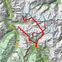
Similaunhütte (3.017 m) – Hochjoch-Hospiz (2.412 m) – Brandenburger Haus (3.274 m) – Vernagthütte (2.755 m) – Breslauer Hütte (2.844 m) – Restaurant Tiefenbach (2.789 m) – Rettenbachjoch (2.990 m) – Braunschweiger Hütte (2.758 m) - Difficulty
-
medium
- Rating
-
- Route
-
grotta1.5 kmHochjoch-Hospiz8.6 kmBrandenburger Haus14.9 kmFluchtkogel (3,494 m)17.4 kmOberes Guslarjoch (3,316 m)17.9 kmVernagthütte21.4 kmBreslauer Hütte28.4 kmSchwarze Schneid Mittelstation44.1 kmRettenbachjoch (2,990 m)44.2 kmMarienkapelle46.3 kmBraunschweiger Hütte46.3 km
- Best season
-
JanFebMarAprMayJunJulAugSepOctNovDec
- Description
-
On Ötzi's tracks ETAPPE 13-17 Similaunhütte (3,017 m) - Hochjoch-Hospiz (2,412 m) - Brandenburger House (3.274 m) - Vernagthütte (2.755 m) - Breslauer Hütte (2.844 m) - Restaurant Tiefenbach (2.789 m) - Rettenbachjoch (2.990 m) - Braunschweiger Hütte 2,758 m) One of the most popular mountain regions is probably the glacier world around Vent in the Ötztal. On Route 4, we follow Ötzi's footsteps, of course, an alpine experience and a glacier with all its safety precautions are essential.
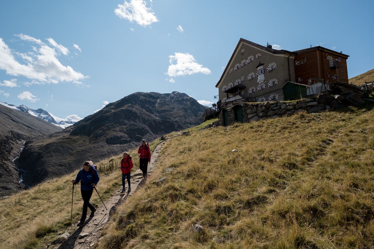
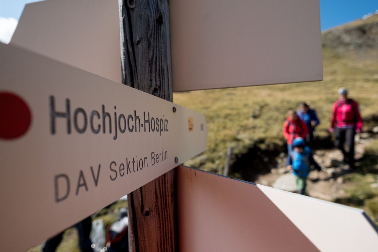
SECTION 13: SIMILAUNHÜTTE (3.017 m) –> HAUSLABJOCH (3.283 m) –> HOCHJOCH-HOSPIZ (2.412 m)
Course: Climbing, Path Requirements: Step safety, dizziness, condition, high alpine experience; Mountain path black, intersection alpine route Difficulties: Passage over Hochjochferner (columns); Mountain guide recommended Equipment: normal hiking equipment, crampons, pimples according to circumstances; In any case rope; Climbing on the glacier Duration: approx. 5 h Difference in altitude: approx. 450 Hm ascent, approx. 1.050 hm descent Highest point: 3.283 m Distance: approx. 7.5 km Accommodation, stop: Similaunhütte, Hochjoch-Hospiz Vent through the Niedertal to the Martin-Busch-Hütte and further to the Similaunhütte (about 4.5 h ascent, approx. 3.75 h descent); From Vent through the Rofental to Hochjoch-Hospiz (about 2,5 h ascent, about 2 h descent)
A tour under the sign of the ice man
First it goes from the hut over a wide back upwards, until the back turns into a steep block ridge. Fixed ropes are a help in this passage until the terrain in the last section of the Tisenjoch on the South Tyrolean side gets flatter again. The discovery of the ice-skier Ötzi here at the Tisenjoch is the highlight of the stage. In the end, we climb another 100 meters to Hauslabjoch. We enter the Hochjochferner and stop at the right edge northwards. At an elevation of 3,000 m, the glacier is abandoned and at 2,950 m the route leads into the path, which descends from the lake. Continue down the steep slope before the trail goes down into serpentines down into the Rofental. At 2.500 m, you cross the Hochjochbach and again hike in serpentines on steeper terrain down to the stream of the Hintereisferner. To the Hochjoch hospice, 100 challenging heights have to be managed.
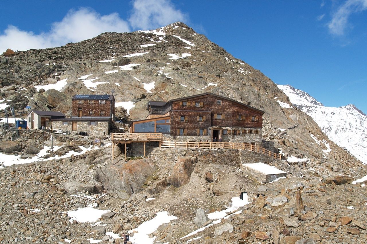
SECTION 14: HOCHJOCH-HOSPIZ (2,412 m) -> BRANDENBURGER HOUSE (3.274 m)
Route: Climbing, Path Requirements: Walking security, basic level of dizziness, high alpine experience; Mountain path black, intermittent alpine route Difficulties: Passage over the boiler wall remover (columns); Mountain guide recommended Equipment: normal hiking equipment, crampons, pimples according to circumstances; In any case rope; Climbing up: from Vent through the "Hochjoch-Hospiz", the "Brandenburger Haus" (cross-country skiing trail) Rofental to Hochjoch-Hospiz (about 2,5 h ascent, about 2 h descent)
To the majestic Gletscherschloss
First you walk up the steep meadow slope behind the hut in serpentines. The course of the route becomes steeper and we can already recognize our goal. Majestically, the Brandenburger House is located at a height of 3,274 meters on a rock above the Kesselwandferner. Up to a height of more than 3,000 m you have followed the Delorette trail and you are now entering the splendid glacier. The route is marked with visible bars. Rasping, however, is an indispensable requirement! A good hour takes the passage in the eternal ice to the west and north-west. In the final section of the tour, the last meters of the rock climb to the Brandenburger Haus. Now it is said to enjoy location and panorama. The white ball, perhaps the most beautiful mountain in Tyrol, is one of the countless optical highlights.
DAILYTIP
Dahmannspitze (3.397 m) from the Brandenburger House (30 min ascent, approx. 20 min descent); Tread safety, dizziness; Most of the route is covered by mostly snow-covered, column-free ice fields; Crampons, pimples, rope generally not required; Bergweg schwarz Note: Fantastic sunset tour.
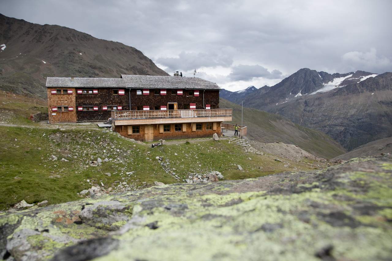
SECTION 15: BRANDENBURGER HAUS (3.274 m) –> FLUCHTKOGEL (3.497 m) –> VERNAGTHÜTTE (2.755 m)
Route: Climbing, path Requirements: tread safety, dizziness, high alpine experience; Mountain path black, intermittent alpine route Difficulties: Passage over boiler wall, Guslarferner and over glacier slope from the yoke to the escape creek (in each case columns); Mountain guide recommended equipment: usually crampons, pimples; In any case rope; Climbing on the glacier Walking time: approx. 4,5 h Difference in altitude: approx. 250 Hm ascent, approx. 800 Hm descents Highest point: 3,497 m Distance: approx. 5,5 km Stay, stop: Brandenburger Haus, Vernaghütte Cross- From Vent through the Rofental to Hochjoch Hospiz, from Hochjoch Hospiz via Deloretteweg and Kesselwandferner to Brandenburger House (about 6 h ascent, approx. 4,5 h descent); From Vent via the Vernagtegg to Vernagthütte (about 3.5 h ascent, about 2.5 h descent)
The glacier castle and a magnificent summit
We walk from the Brandenburger House through blockwork about 50 meters down to the Kesselwandferner. In succession we cross the glacier in north-east direction to the Upper Guslarjoch. Not even 150 meters of altitude separates us on the Upper Guslarjoch from the 3.497 m high escape coaster, the summit climb to the fabulous views is obligatory. From the yoke, you climb up to the summit on the right side of the glacier slope. Then back to the Upper Guslarjoch and from there to the relatively steep terrain down to the Guslarferner. It is now flat over the first distant floor, until you have to cross a terrain camp (especially here danger of splitting). After another steep slope, we descend south-eastwards. Finally, a trail leads in the moraine area or directly on the Moraine Ridge to the Vernagthütte.
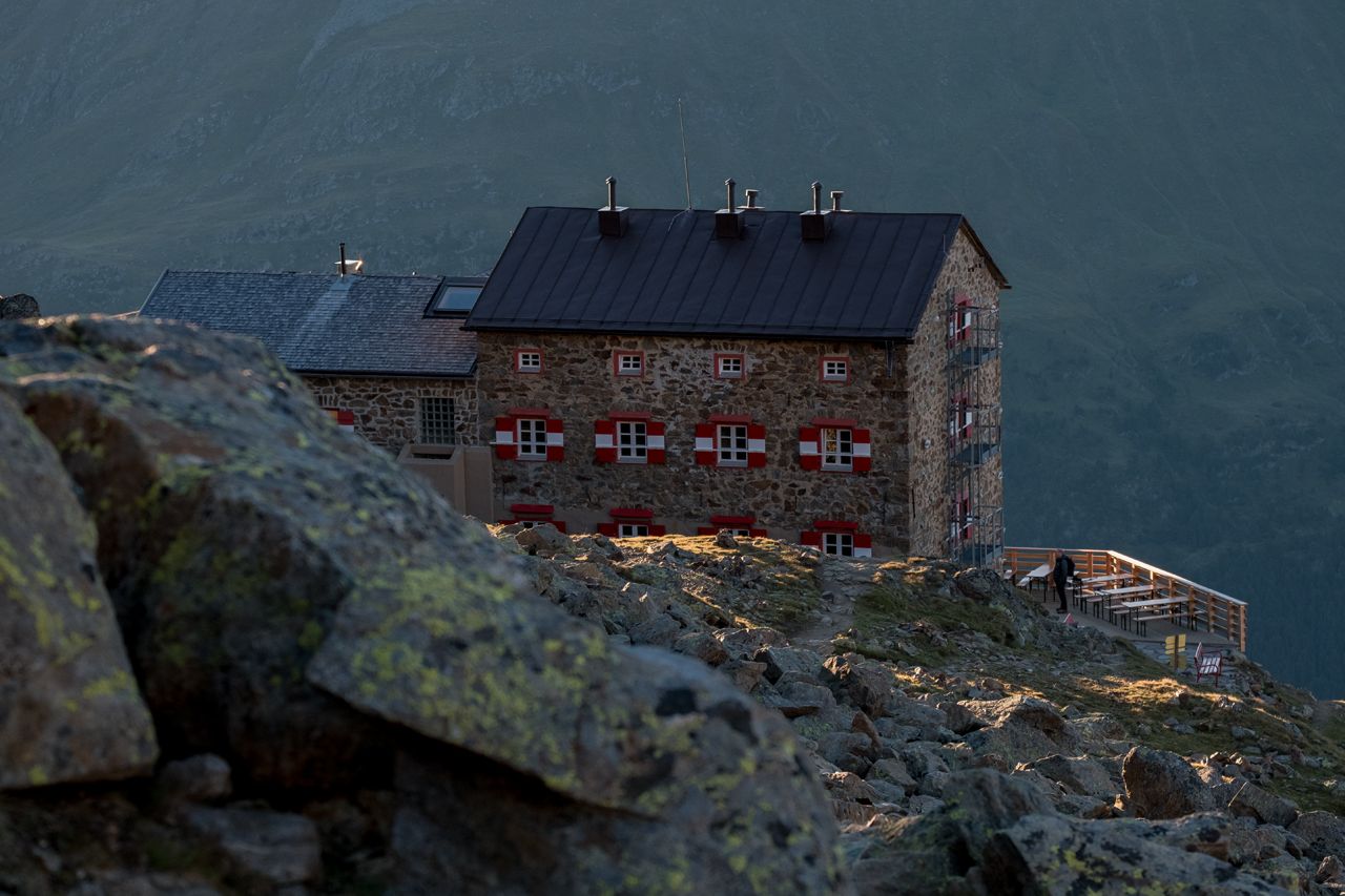
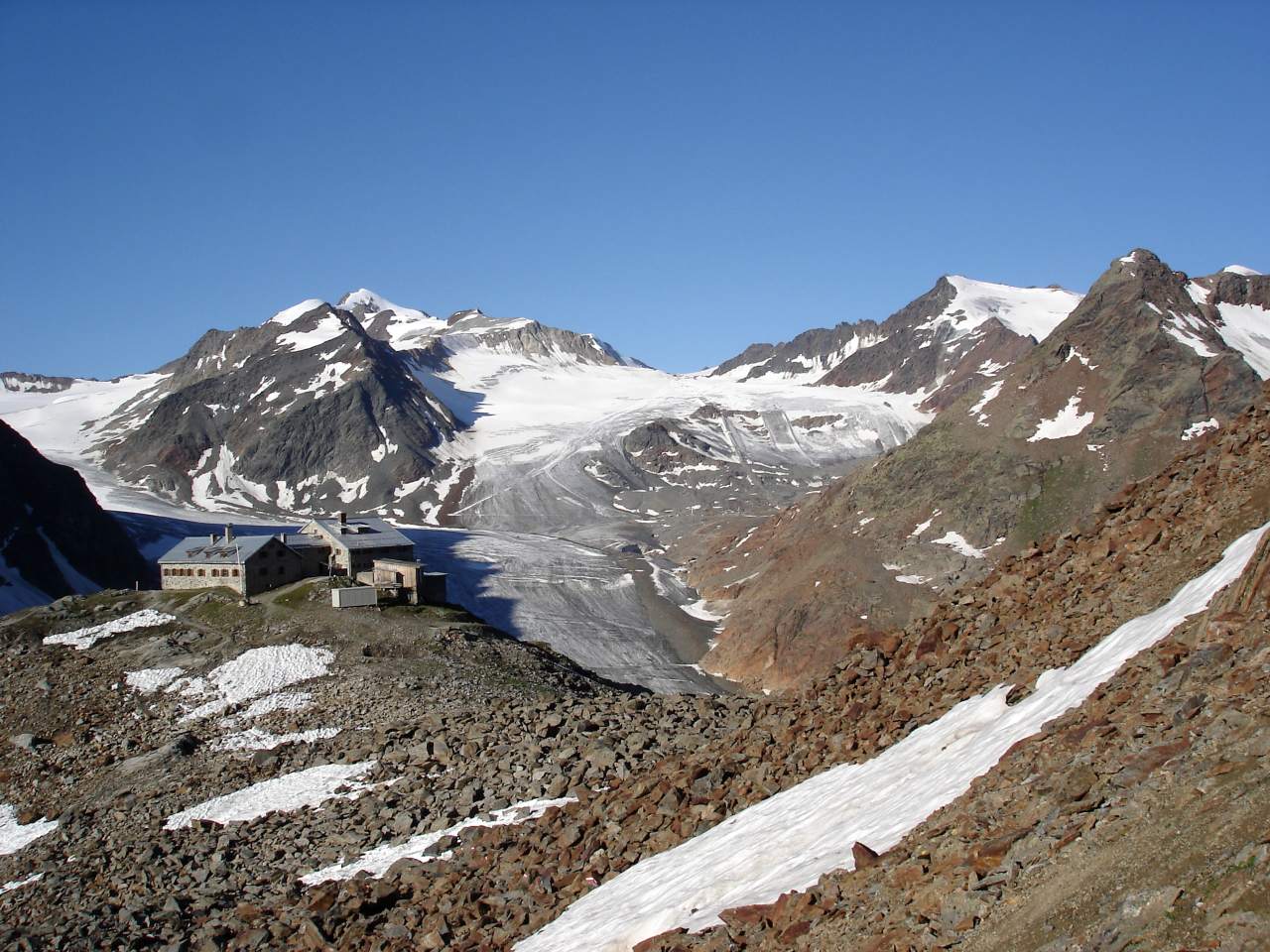
SECTION 16 VERNAGAGÜTTE (2.755 m) -> BRESLAUER HÜTTE (2,844 m)
Route: Climbing Requirements: Step safety, dizziness; Mountain route red Difficulty: no special difficulties Equipment: normal hiking equipment Walking time: approx. 2 h Difference in altitude: approx. 300 Hm Rise, approx. 250 Hm Descent: 2,860 m Distance: approx. 7 km Stay overnight, stop: Vernagthütte, Breslauer Hütte , Exit: from Vent via the Vernagtegg to Vernagthütte (approx. 3,5 h ascent, approx. 2,5 h descent); From the Stablein station of the Wildschitze chair lift (valley Vent) to the Breslauer Hütte (about 1.5 h ascent, about 1.25 h descent)
Over the Rofental road
Walk down the slope before the hut and then descend to the valley of the Vernagtbach. From here, a great view of the Great Vernagtferner opens with the Hochvernagtspitze in the north and north-west. We cross the Vernagtbach and go on the opposite side to the flat soil at Platteiberg. From the Platteiberg the tour is only over the Rofental. The plateau is then crossed, a little later the trail passes through the Mitterkar. Directly above Mitterkar rises the Ötztaler Wildspitze, which presents an unfamiliar, because rocky face. At the Schutzhaus you can enjoy the view: Opposite, among other things, the Kreuzspitze rises up, in the southwest show Hochjochferner and the shapely white ball. TAGESTIPP Urkundholm (3.134 m) from the Breslau hut (about 1 h ascent, approx. 45 min descent); Safety and dizziness; Mountain road red
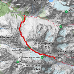
SECTION 17 BRESLAUER HÜTTE (2.844 m) -> RESTAURANT TIEFENBACH (2.789 m) -> RETTENBACHJOCH
Course: Climbing, Path Requirements: Step safety, dizziness, condition, endurance, high alpine experience; Bergweg black, partly alpine route Difficulties: glacier crossing over the Rettenbachferner (columns, path not marked); Mountain guide recommended Equipment: normal hiking equipment, crampons, pimples according to circumstances; In any case rope; Climbing on the glacier Duration: approx. 7,5 h Difference in altitude: approx. 650 Hm ascent, approx. 750 Hm descent Maximum point: 3,056 m Distance: approx. 15 km Accommodation: Breslauer Hütte, Braunschweiger Hütte, Restaurant Tiefenbach, T + 43 (0) 5254 5010 Crossing: Exit Stablein from the chair lift Wildspitze (valley Vent) to Breslauer Hütte (approx. 1,5 h ascent, approx. 1,25 h descent); From the valley station of the Rettenbacherfern over the Rettenbachjoch or the Pitztaler Jöchl to the Braunschweiger hut (about 1.75 h way, approx. 1.5 h Retourweg) Information on bus times between Tiefenbach- and Rettenbachferner T +43 (0) 57200 200
Over the Venter Valley and in the eternal ice
We descend on a trail - the route leads past the foothills of the Rofenkars. A little below, you will change left to the new high-way path, which runs over the Venter valley, to the original panoramic path between Vent and Tiefenbachferner. The trail then descends, then ascending and continues over the Venter valley to the restaurant Tiefenbach at the Tiefenbach glacier. At the restaurant Tiefenbach, you walk in front of the road tunnels on the left to the ski slope to Seiterjochl (follow the Seiterjochlbahn - chairlift). From Jöchl it is to the north to the Rettenbachferner descend. We turn left around Felssporn, head north-west and cross the glacier to Rettenbachjoch with the lift stations. From the yoke it goes down and finally to the Braunschweiger hut. VARIANT: By bus from the restaurant Tiefenbach to the valley station of Rettenbacherfern and on foot up to the top parking lot of the Gletscherstraße; From there up to the Pitztaler Jöchl (2.996 m) - the last meters over a column-free glacier field (u. Cramp); On the other side, downhill to the Braunschweiger hut; Approx. 1.75 h from Rettenbachferner station. When the Pitztaler Jochl is blocked. From the highest parking lot to the Rettenbachjoch (the last few meters uncomfortable at the glacier); About 1.75 h from the valley station to the hut.
more info
ARRIVAL
By train - from Innsbruck or Bregenz to Ötztal station, then by bus to the Ötztal to Vent By car - A12 exit Ötztal to Vent - cable car -> Parking Access - from Vent through the Niedertal to the Martin-Busch-Hütte and Continue to the Similaunhütte (about 4.5 h ascent)
INFORMATION
Ötztal Tourismus T +43 (0) 57200 Mountain guides (wandern.oetztal.com) Alpinsportscenter T +43 (0) 664 5016864 AlpinGuide T +43 (0) 664 4434684 Mountain sports and adventure school Sölden T +43 (0) 664 8478155 Bergführerstelle Obergurgl T +43 (0) 664 1839012 Mining company Vent T +43 (0) 5254 8106
HÜTTEN Similaun Hut T +43 (0) 676 5074502 Hochjoch Hospice T +43 (0) 664 5402574 Brandenburger Haus T +43 (0) 676 6468650 Vernagthütte T +43 (0) 664 1412119 Breslauer Hütte T +43 (0) 664 5300898 Braunschweiger Hütte T +43 (0) 664 5353722
ACCOMMODATION - WALKING SPECIALISTS IN THE ÖTZTAL
Hotel Alpenaussicht 6456 Obergurgl T +43 (0) 5256 6236 Alpengasthof Grüner 6450 Sölden T +43 (0) 5254 2214 RETURN TRANSPORTATION Public bus line Ötztaler Verkehrsbetriebe T +43 (0) 5254 3550 Postbus GmbH T +43 (0) 5412 66266
MISCELLANEOUS On this itinerary requires a glacier experience, possibly only with a mountain guide
- Highest point
- 3,468 m
- Endpoint
-
Braunschweiger Hütte
- Height profile
-
 © outdooractive.com
 - Equipment
-
It is recommended to wear hiking equipment such as breathable and weather-adapted outdoor clothing, ankle-high mountain boots, wind, rain and sun protection, cap and possibly gloves. It is also important to have enough food, as well as a first-aid package, a cell phone and a hiking map.
- Additional information
- Directions
- Public transportation
- Parking
-
The following parking facilities are available in Vent: In front of the village and at the valley station from the chair lift (payable)


- Author
-
The tour Ötztal Trek Route 4 is used by outdooractive.com provided.


-
Vinschgau
1285
-
Schnalstal
596
-
Vent
292