Winter hiking on the Climate Future Trail in the Pöllauer Tal Nature Park


- Brief description
- Difficulty
-
easy
- Rating
-
- Starting point
-
Pöllau, castle park
- Route
-
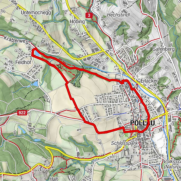
Pöllau0.0 kmSpielplatz Hinterbrühl2.4 kmPöllau4.4 kmPfarrkirche Pöllau4.4 km
- Best season
-
AugSepOctNovDecJanFebMarAprMayJunJul
- Description
-
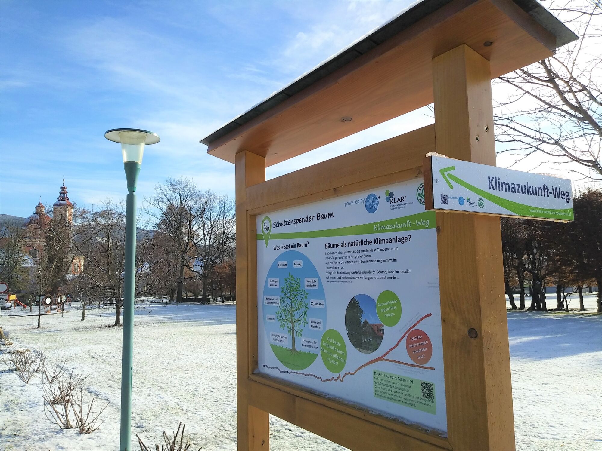
The Climate Future Trail shows measures for adaptation for a liveable future and is designed in such a way that it can also be hiked in two parts.
On this winter walk we will learn about the northern part with the focus on
Shade tree Humus in the soil Wilderness and deadwoodgetto know.
- Directions
-
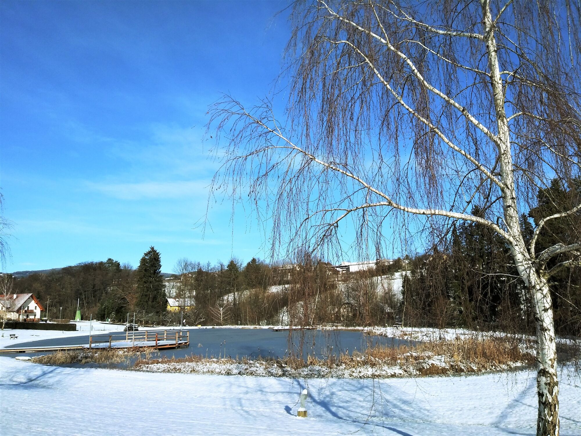
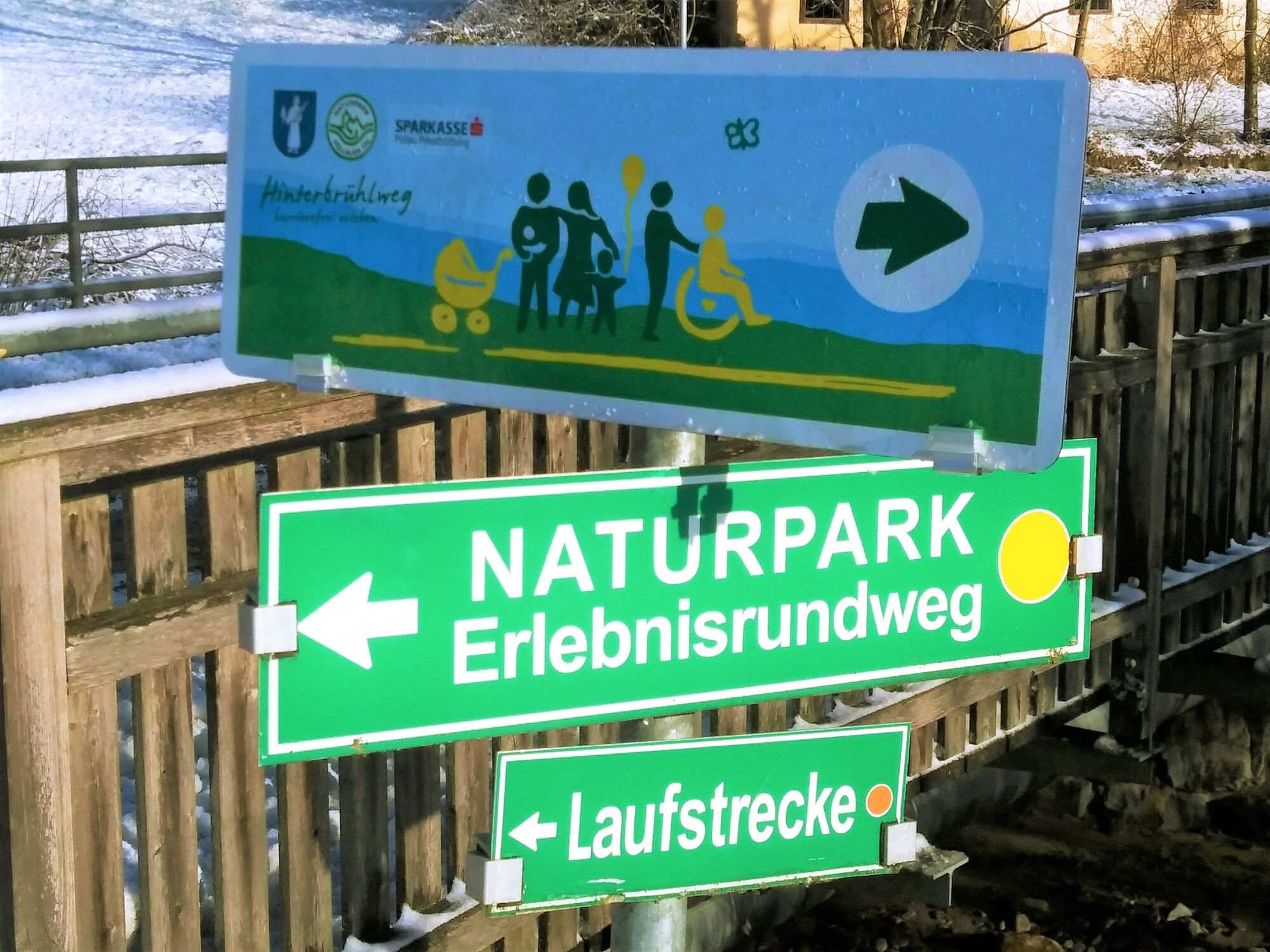
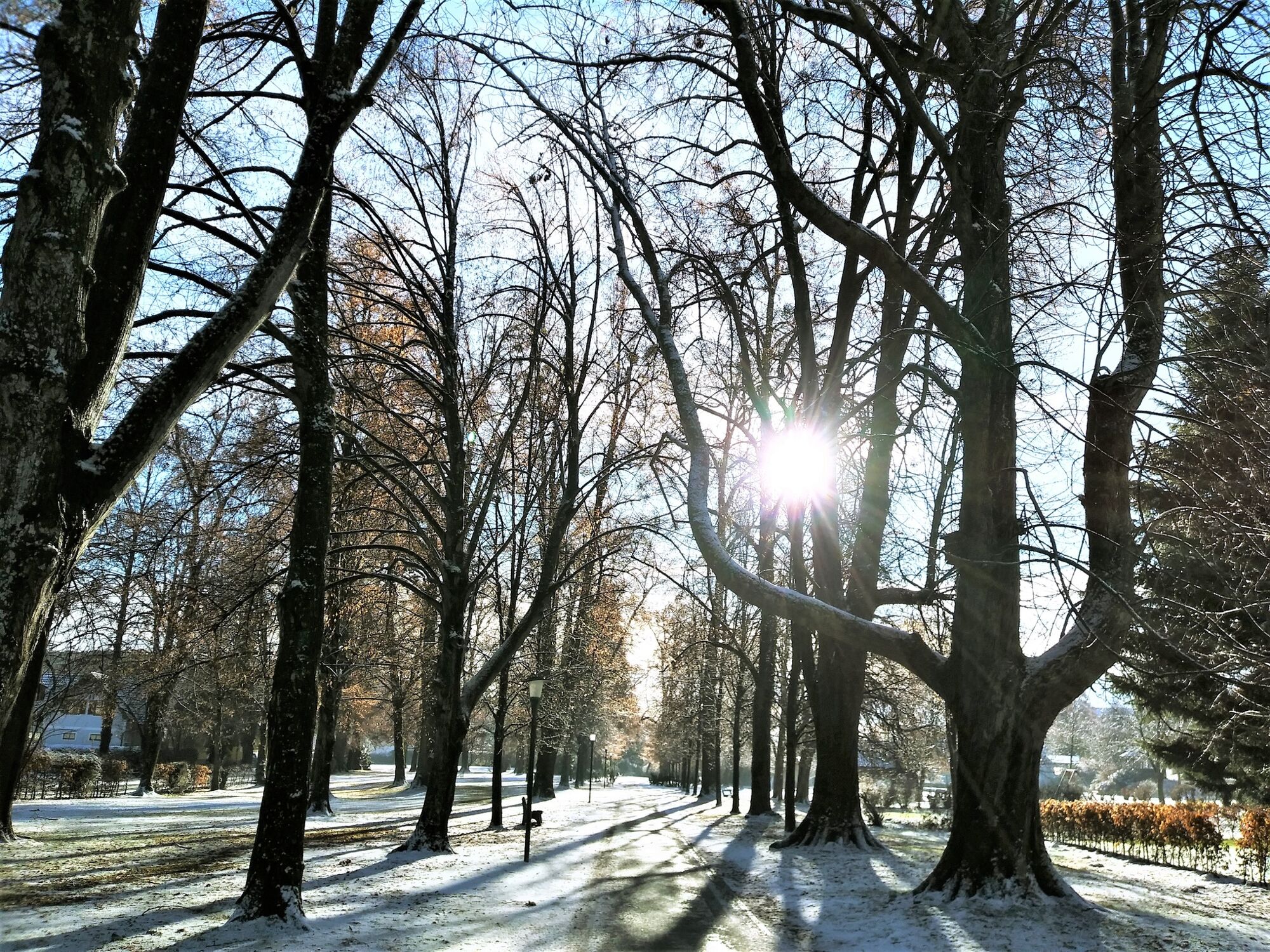
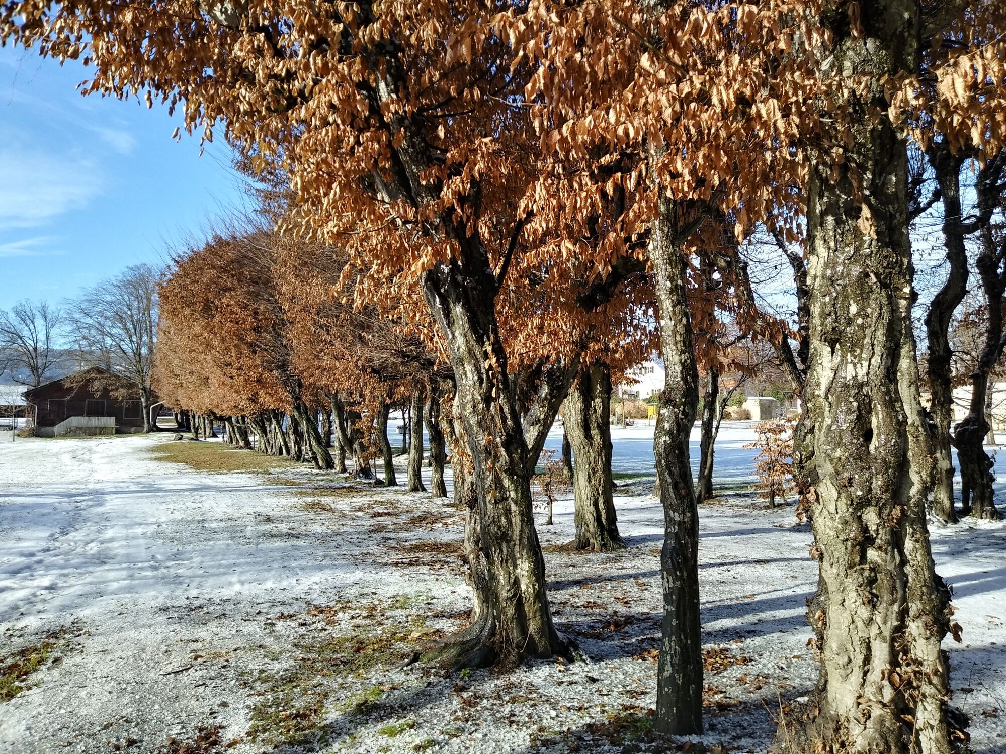
We start at the information board "Schattenspender Baum" in the castle park right next to the car park (access via Julius Meinl Straße). We leave the castle park through the access road and follow the signpost "Klimazukunft-Weg" (Climate Future Trail), where we follow the road for a while until we turn right towards Hinterbrühl. Passing the bumblebee showcase and shortly afterwards the information point "Humus im Boden" (humus in the soil), we now arrive at the Hotel Restaurant Gruber. We circle the bathing pond to the north and thus reach the forest path along the Saifenbach. Along the barrier-free path we meet the next information point "Wilderness and deadwood" and further on we get back to the centre of Pöllau via the Aupark.
- Highest point
- 486 m
- Endpoint
-
Pöllau, castle park
- Height profile
-

- Equipment
-
Small backpack with water bottle (+ provisions)Sturdy shoes
Appropriate clothing - preferably several layers - "onion principle"
Rain and sun protection
Hiking poles as required
Mobile phone
Small first aid kit
Route description
Before starting the hike, check where you can stop for refreshments, including opening times, or pack suitable provisions. - Safety instructions
-
Important telephone numbers: European emergency call: 112 Emergency call mountain rescue: 140 (if possible, please provide GPS data) Rescue: 144 Fire brigade: 122 Police: 133
The trail is easy to walk and therefore suitable for the whole family. Correct behaviour when hiking: Rules of behaviour when hiking
A few tips on correct and fair behaviour in the forest: (Source: www.bundesforste.at )
Hikers should avoid visiting the forest approx. 1.5 hours before sunrise and after sunset, as wild animals are particularly active at this time. Plastic bottles, handkerchiefs, cigarette butts etc. have no place in the forest! Please make sure that you do not leave any rubbish in the forest. Camping and making fires is strictly forbidden in the forest! In principle, every person in the forest is allowed to collect 2kg of mushrooms and berries per day for their own use. It is only prohibited if the forest owner expressly forbids it. - Tips
-
In any case, we always plan enough time to enjoy the culinary delights of the region's warm hosts!
- Additional information
- Directions
- Public transportation
- Parking


-

-
AuthorThe tour Winter hiking on the Climate Future Trail in the Pöllauer Tal Nature Park is used by outdooractive.com provided.