
- Brief description
-
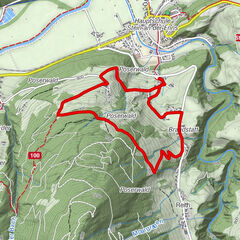
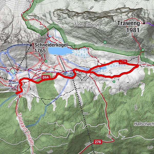
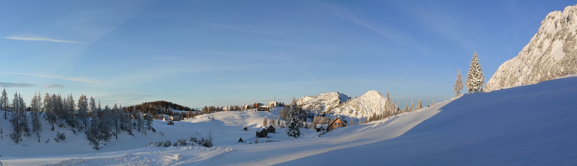
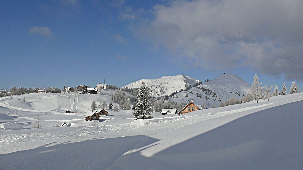
A hike across the wintry high plateau of the Tauplitzalm with beautiful views and cozy refreshment stops.
- Difficulty
-
medium
- Rating
-
- Starting point
-
Mountain station of the 4-seater chairlift or parking lot Tauplitzalm
- Route
-
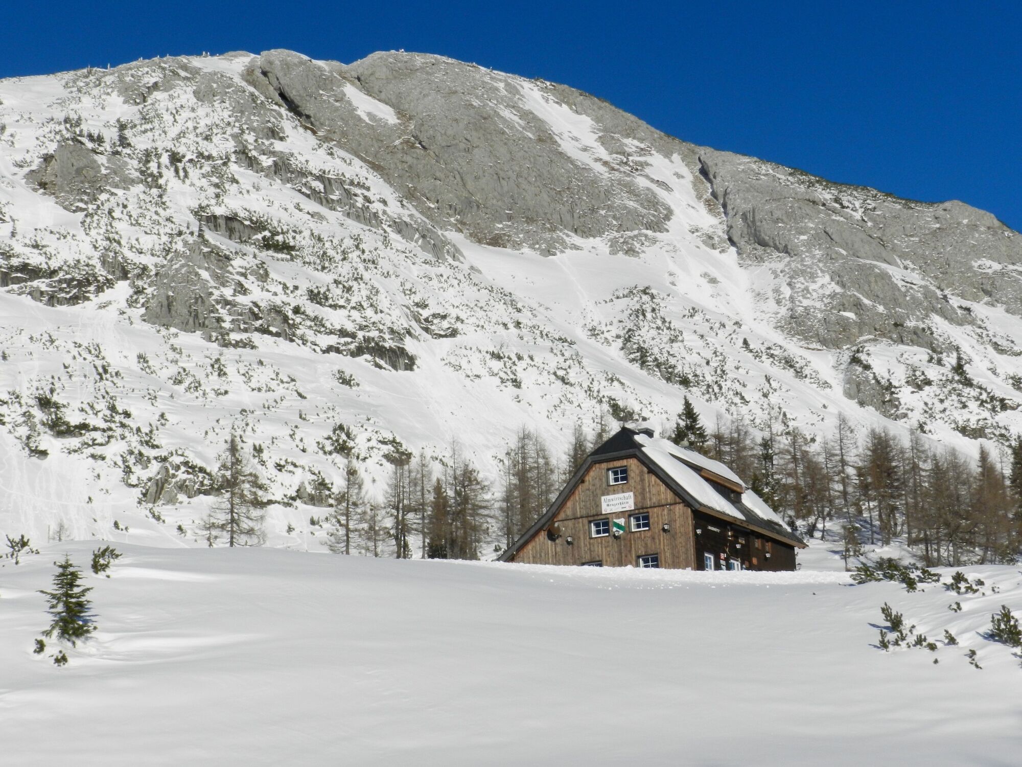
Tauplitzalm2.1 kmGrazer Hütte2.8 km
- Best season
-
AugSepOctNovDecJanFebMarAprMayJunJul
- Description
-
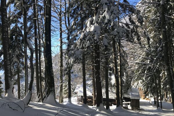
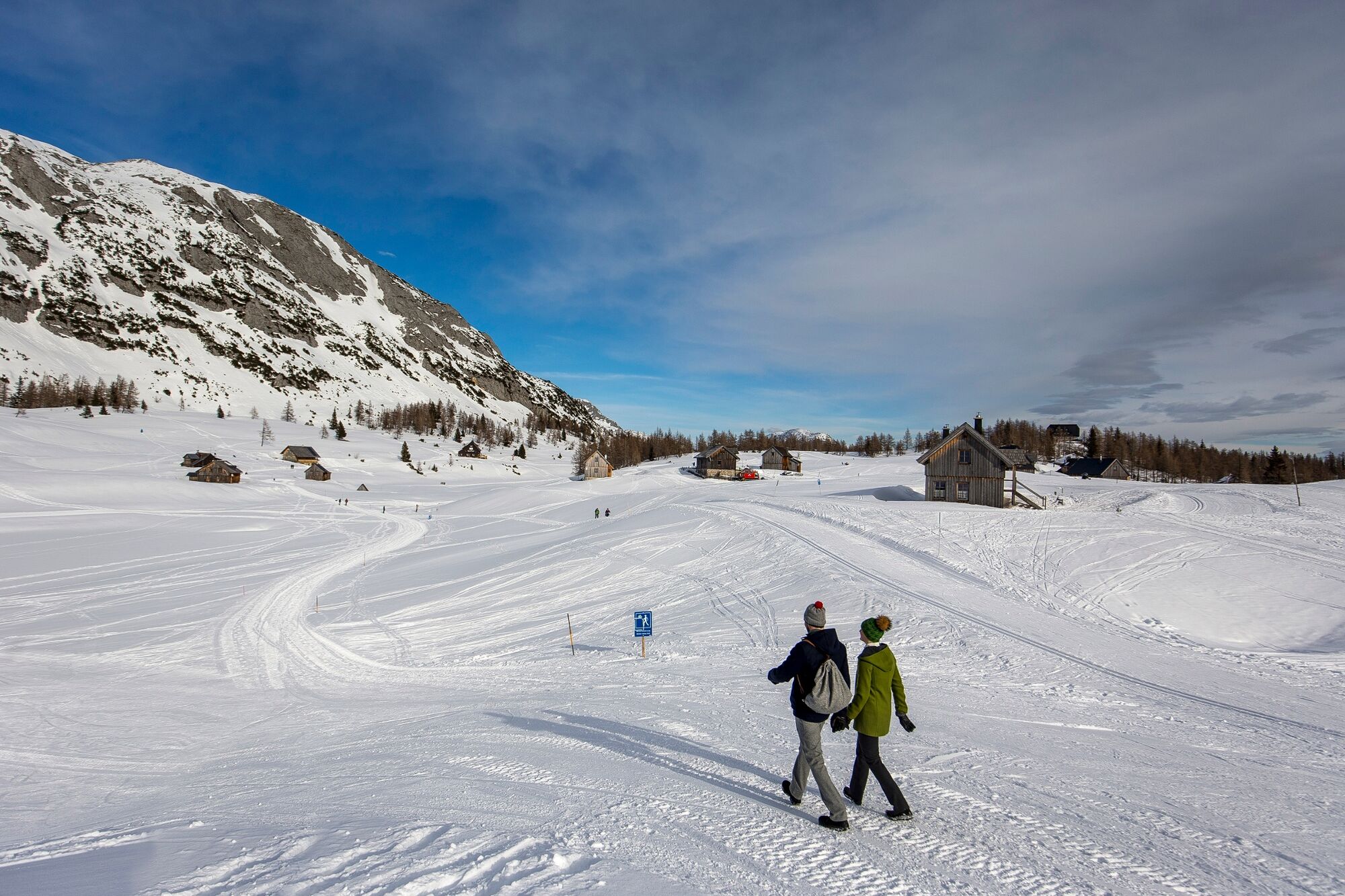
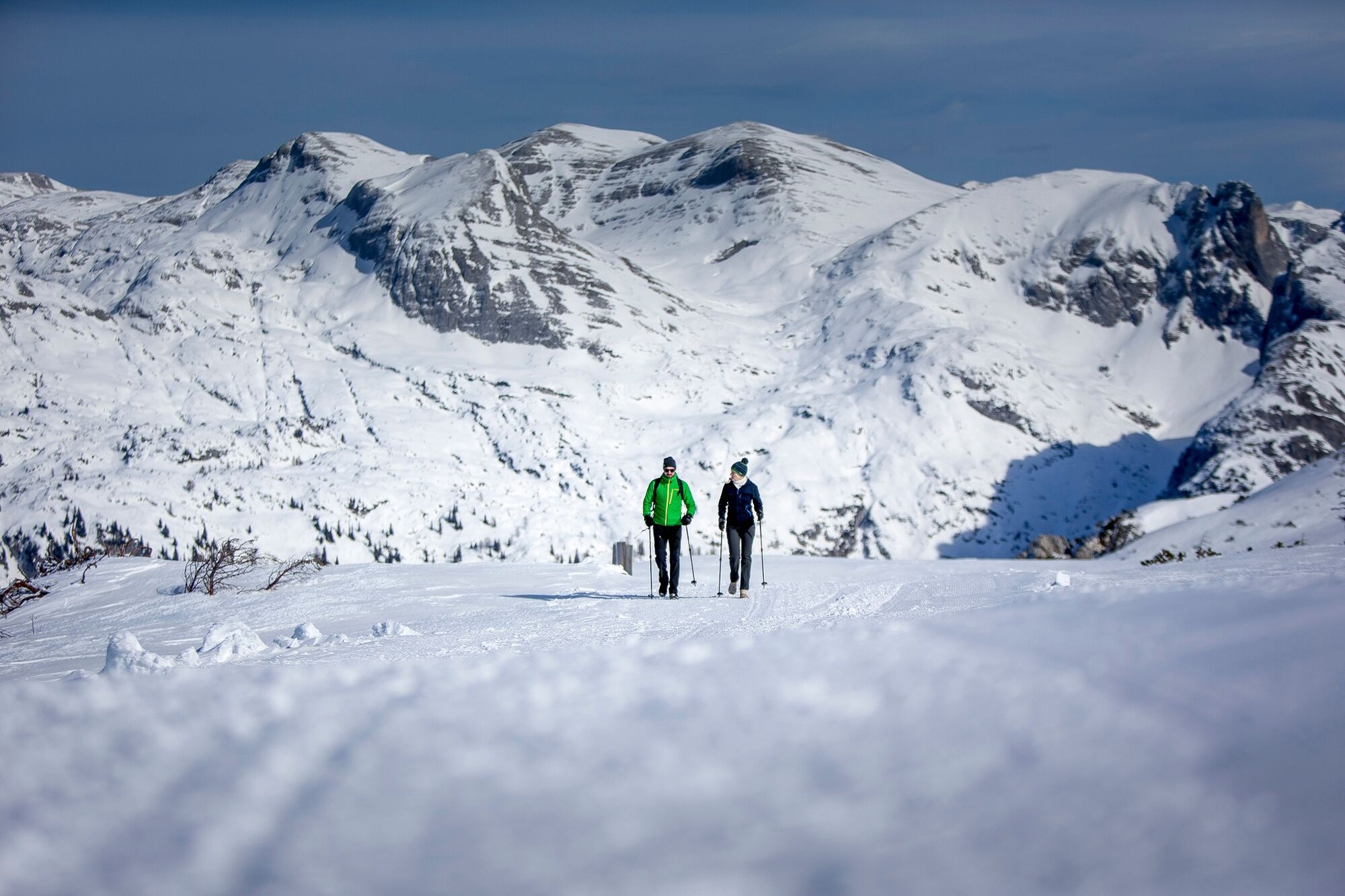
On the hike you will encounter the many possibilities on the wintry Tauplitzalm. The groomed hiking trails are also used as feeders to the shelters and self-catering huts, so you can expect to see the odd skidoo or piste machine.
The plateau is very clear, so personal variants can be chosen in the course of the hike.
- Directions
-
The hike is started at the mountain station of the 4-seater chairlift or at the parking lot on the Tauplitzalm.
The hike takes you eastwards along a groomed track for snow groomers. After the Grazerhütte, check whether there is a track leading further in the direction of the Steirerseehütten. From the Steirerseebankerl you can enjoy a fantastic view of the Sturzhahn and the Steirersee.
Return to the right in the direction of Grazerhütte and at the foot of Traweng to the snow-covered Tauplitzsee. The trail leads next to the lift track up towards the Naturfreundehaus and back to the starting point.
There are plenty of opportunities to warm up and have a snack on this hike.
- Highest point
- 1,655 m
- Endpoint
-
is the starting point
- Height profile
-

- Equipment
-
Proper backpacking makes many things easier:
pack heavy things first.
The water bottle should always be within easy reach in a side pocket.
All things that are often needed, such as sunglasses, camera or hiking map, belong on top.
An emergency kit including blister plaster belongs in every backpack and a clothing according to the "onion system" is always recommended. - Safety instructions
-
Emergency call mountain rescue: 140
Emergency reporting tip - provide answers to the six W questions:
What happened? How many injured? Where did the accident happen? (possibly GPS coordinates) Who is reporting? (callback number) When did the accident happen? Weather at the accident site? - Tips
-
The hike can be started from the parking lot on the Tauplitzalm or from the mountain station of the 4-seater chairlift.
- Additional information
- Directions
- Public transportation
- Parking
-
There are plenty of free parking spaces available in Tauplitz and on the Tauplitzalm.
- Author
-
The tour Winterhike on Tauplitzalm is used by outdooractive.com provided.