- Brief description
-
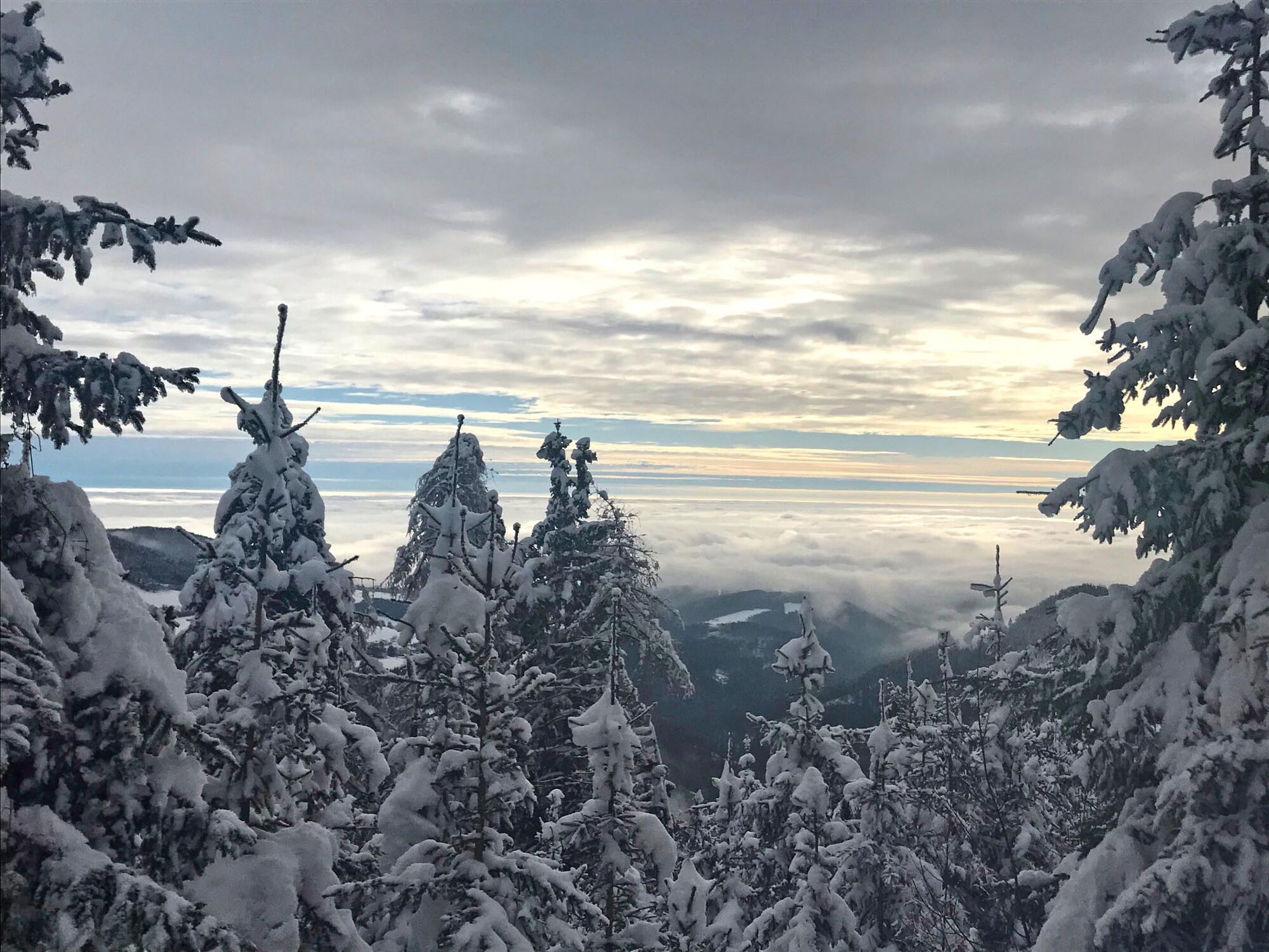
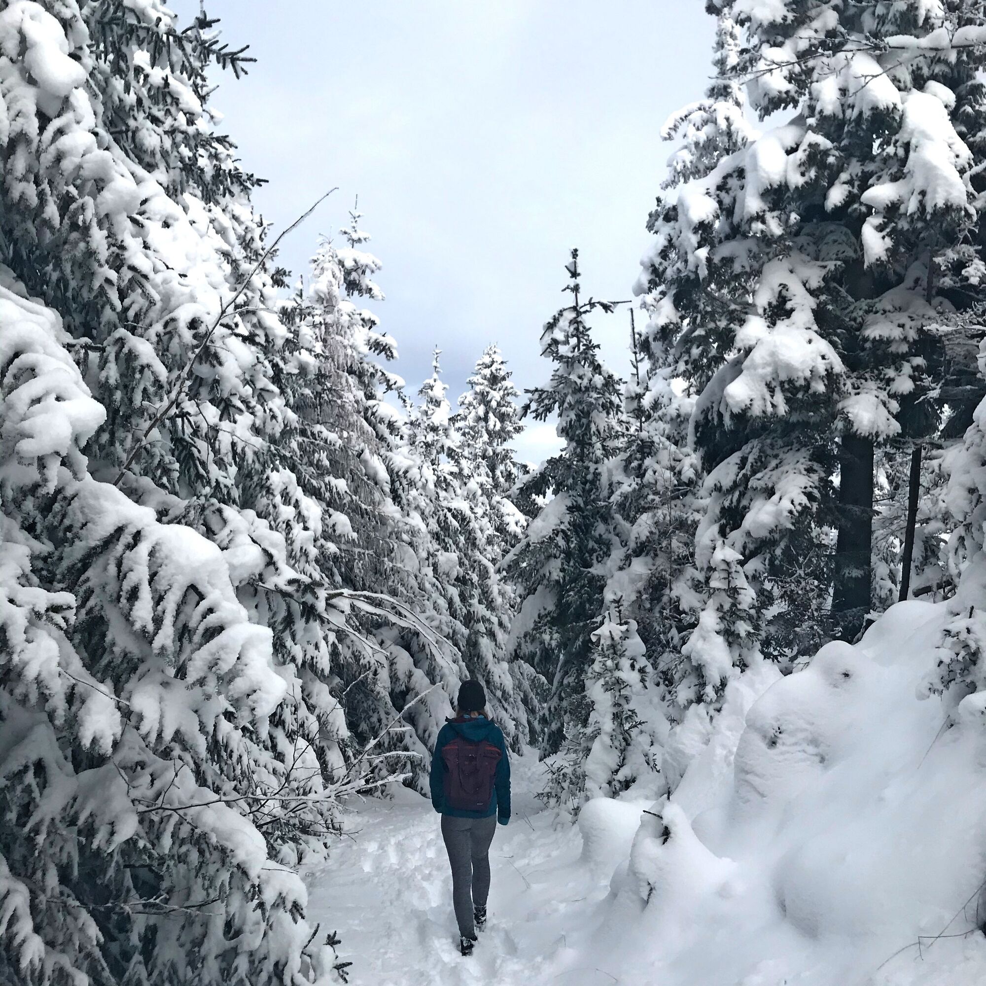
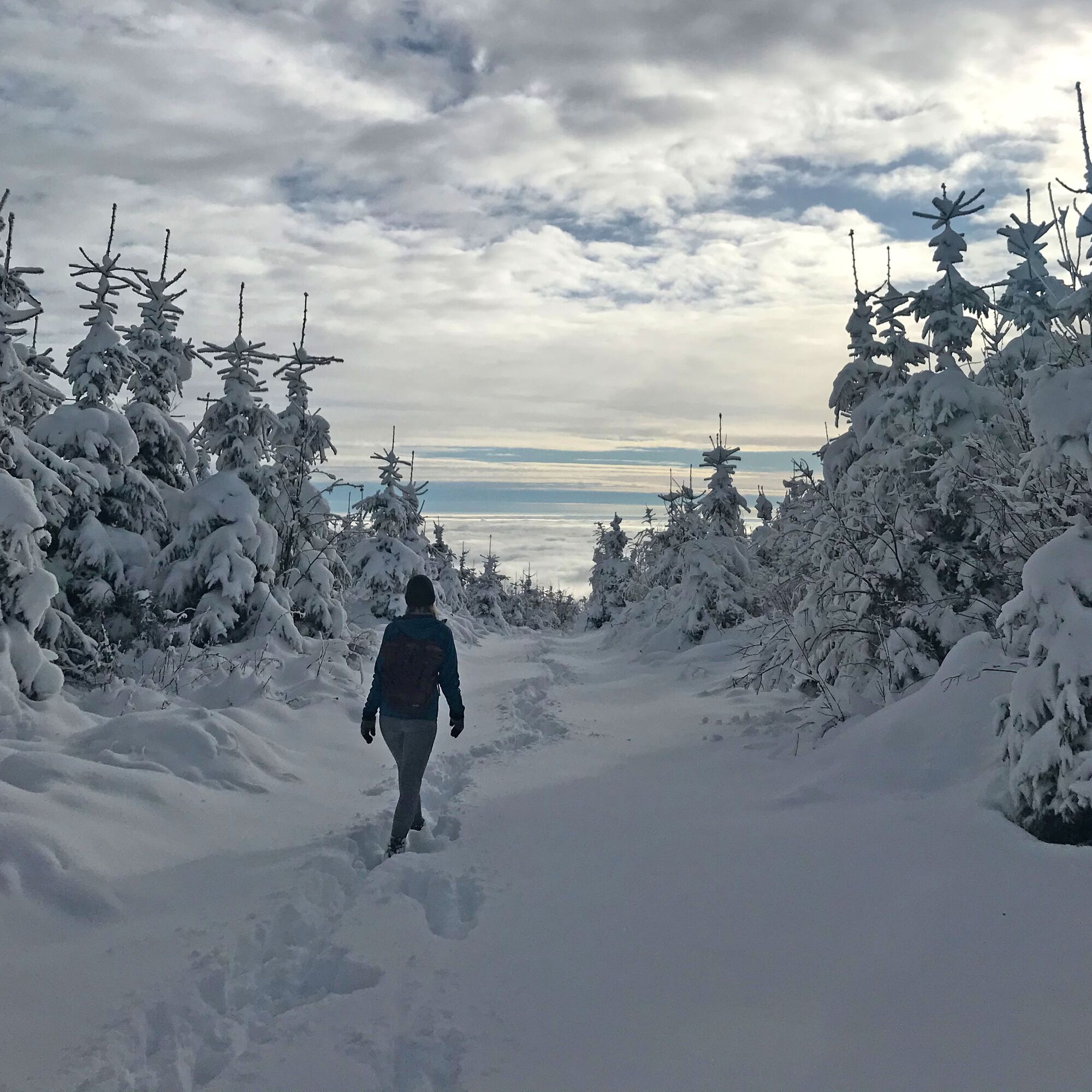
This circular hike is a true dream in winter. The landscapes are unspoilt and invite you to relax.
- Difficulty
-
medium
- Rating
-
- Starting point
-
Dürntalwirt Inn
- Route
-
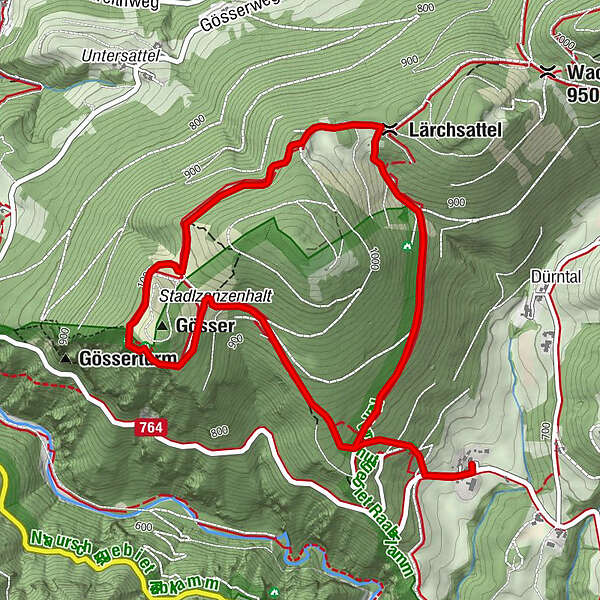
Dürntalwirt0.0 kmGrasslhöhle0.2 kmGösser (1,030 m)2.3 kmLärchsattel3.9 kmGrasslhöhle5.8 kmDürntalwirt6.1 km
- Best season
-
AugSepOctNovDecJanFebMarAprMayJunJul
- Description
-
On the circular hike on the Gösser- und Lärchsattel, every nature lover gets their money's worth due to the dreamlike views. Only a few minutes by car from Weiz, the Gösser- und Lärchsattel is perfect for short hikes with the whole family. You start at the Dürntalwirt inn and after a few minutes you enter the first section of forest.
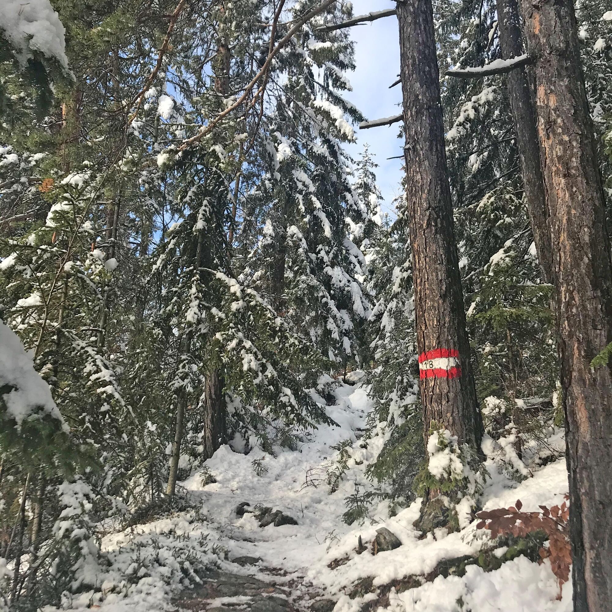
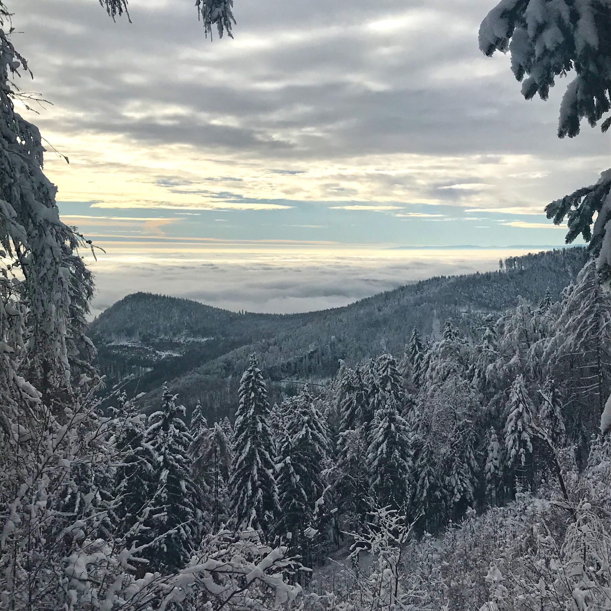
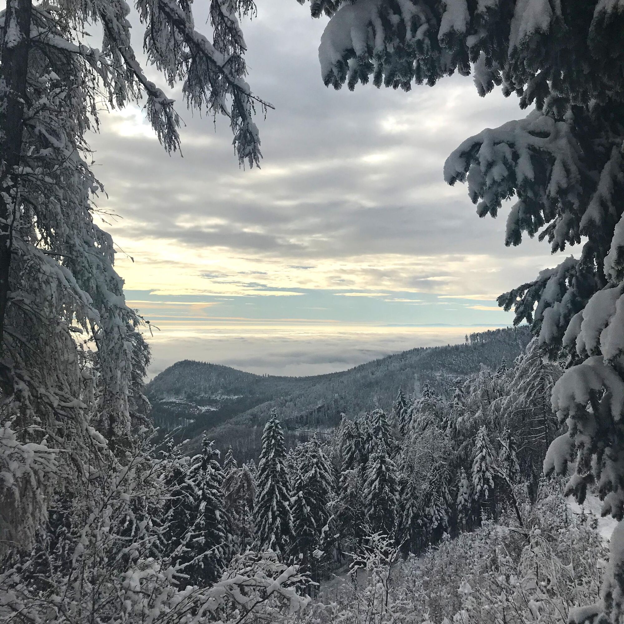
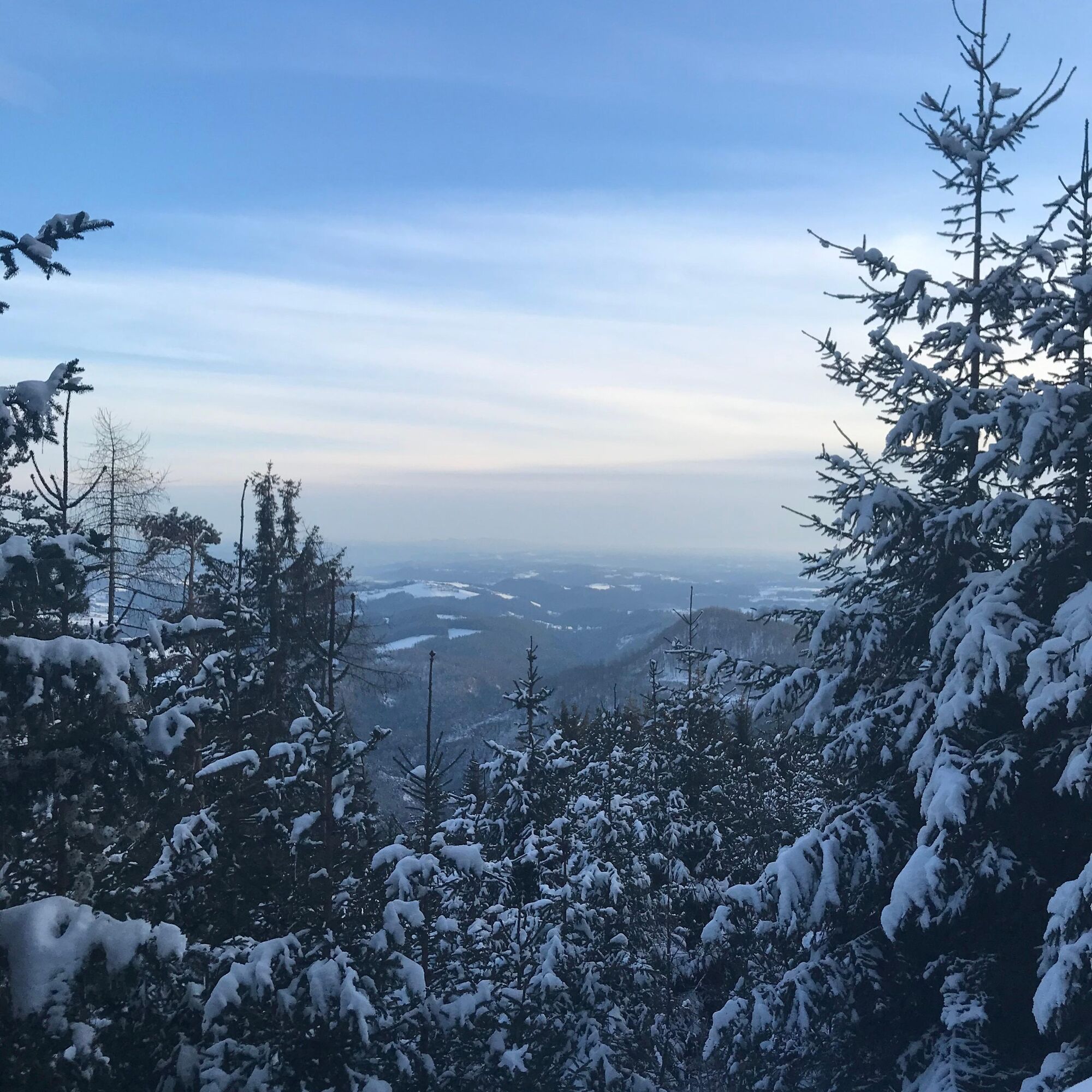
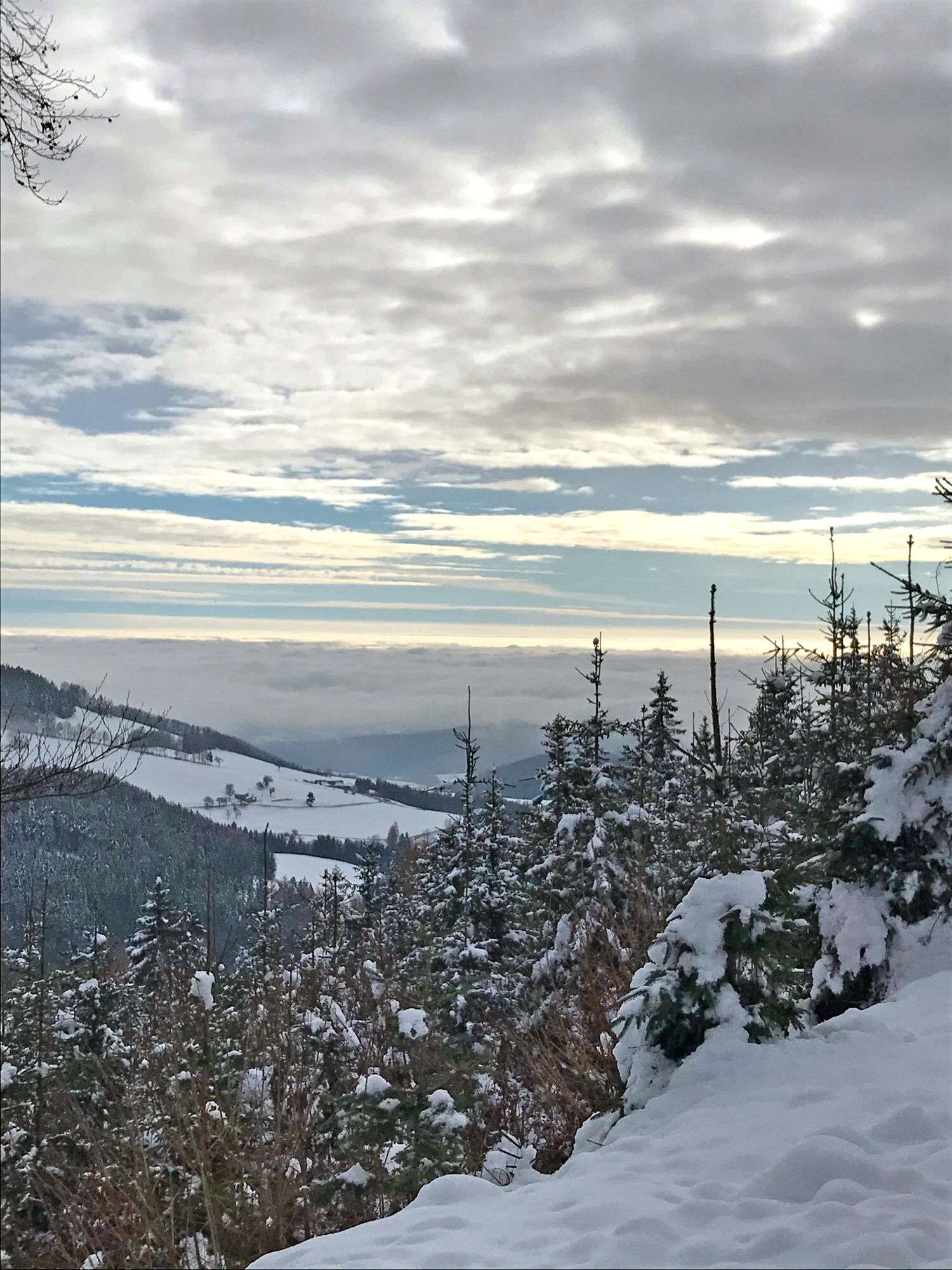
The region is known for its cave systems. In particular, the Katerloch and the Grasslhöhle, which our trail passes, are enjoyed by numerous guests and are a source of amazement. The Naas Cave Trail, whose signs we encounter several times on our tour, connects these cave systems. The view along the tour in the direction of the Almenland Nature Park as well as the hilly landscape of Eastern Styria and the city of Weiz is beautiful.
- Directions
-
We start our route at the Dürntalwirt inn.
First, we follow the signposts in the direction of the Naas Cave Trail.
When we reach the Grasslhöhle cave, we follow trail no. 18 in the direction of Gösser.
Always following the Austrian flags, we come to a rise with a seat after the first ascent.
After a short rest, we follow the signs to the left towards Gösser.
Soon we reach the highest point of the Gösser.
We follow the markings on the descent and walk along a forest road towards the Lärchsattel.
Turn left towards the Lärchsattel and follow the forest road.
Soon we come to a junction where we keep to the right to go up to the Lärchsattel.
A short detour at the summit cross is definitely worth it.
Back on the forest road, we make a short stop at the meadow with a beautiful view of Weiz.
We follow the path back to the forest road.
Here we keep to the right and return to the path to our starting point. - Highest point
- 1,013 m
- Endpoint
-
Dürntalwirt Inn
- Height profile
-

- Equipment
-
Small rucksack with water bottle (+ provisions)
Sturdy shoes
Appropriate clothing - preferably several layers - "onion principle"
Rain and sun protection
Hiking poles as required
Cell phone
Small first aid kid
Route description
Before starting the hike, check where you can stop for refreshments, including opening times, or pack suitable food and drink. - Safety instructions
-
Important telephone numbers: European emergency call: 112 Emergency call mountain rescue: 140 (if possible, please provide GPS data) Rescue: 144 Fire department: 122 Police: 133
Tips for even more hiking fun: Rules of conduct when hiking
A few tips on correct and fair behavior in the forest:
(Source: www.bundesforste.at )
Hikers should avoid visiting the forest approx. 1.5 hours before sunrise and after sunset, as wild animals are particularly active at this time. Plastic bottles, handkerchiefs, cigarette butts etc. have no place in the forest! Please make sure that you do not leave any garbage in the forest. Camping and making fires is strictly forbidden in the forest! In principle, every person in the forest is allowed to collect 2 kg of mushrooms and berries per day for their own use. It is only prohibited if the forest owner expressly forbids it. - Tips
-
There is usually a lot of snow at the Gösser, so we recommend good shoes and possibly poles.
- Additional information
- Directions
-
The district capital of Weiz is located in Eastern Styria.
From Graz via the main road: Take Kaiser-Franz-Josef-Kai and Wickenburggasse to Jahngasse / B67a. Follow the road on the B72 to Weiz and take the exit towards Weiz-West.
From Weiz you must then drive via Weizer Hauptplatz in the direction of Mortantsch. Then keep going in the direction of Leska and follow the road for about another 5 km to Dürntalwirt Inn.
- Public transportation
- Parking

-

-
AuthorThe tour Winter Hike Gösser and Lärchsattel is used by outdooractive.com provided.