
- Brief description
- Difficulty
-
easy
- Rating
-
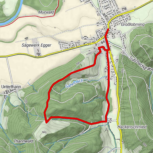
- Starting point
-
Großlobming
- Route
-
GroßlobmingGroßlobming5.0 km
- Best season
-
AugSepOctNovDecJanFebMarAprMayJunJul
- Description
-
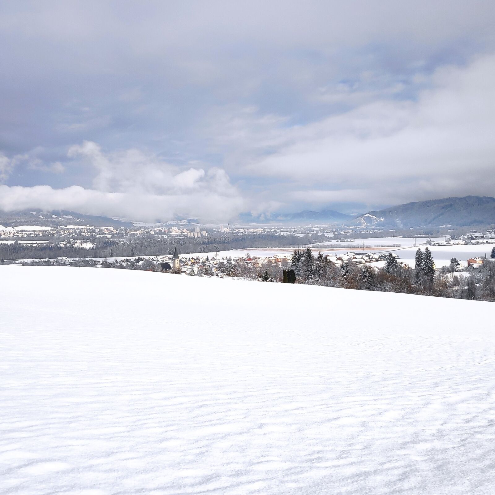
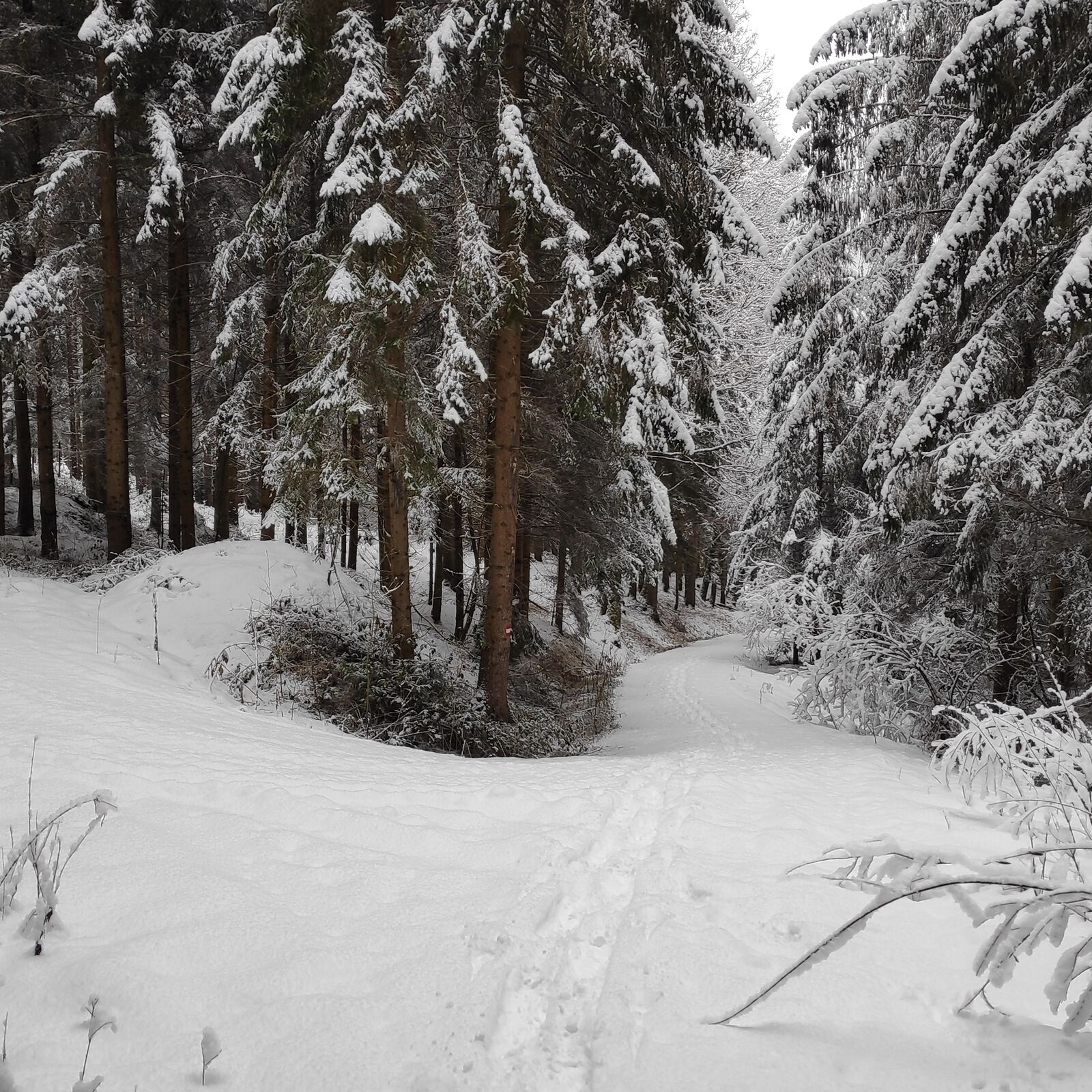
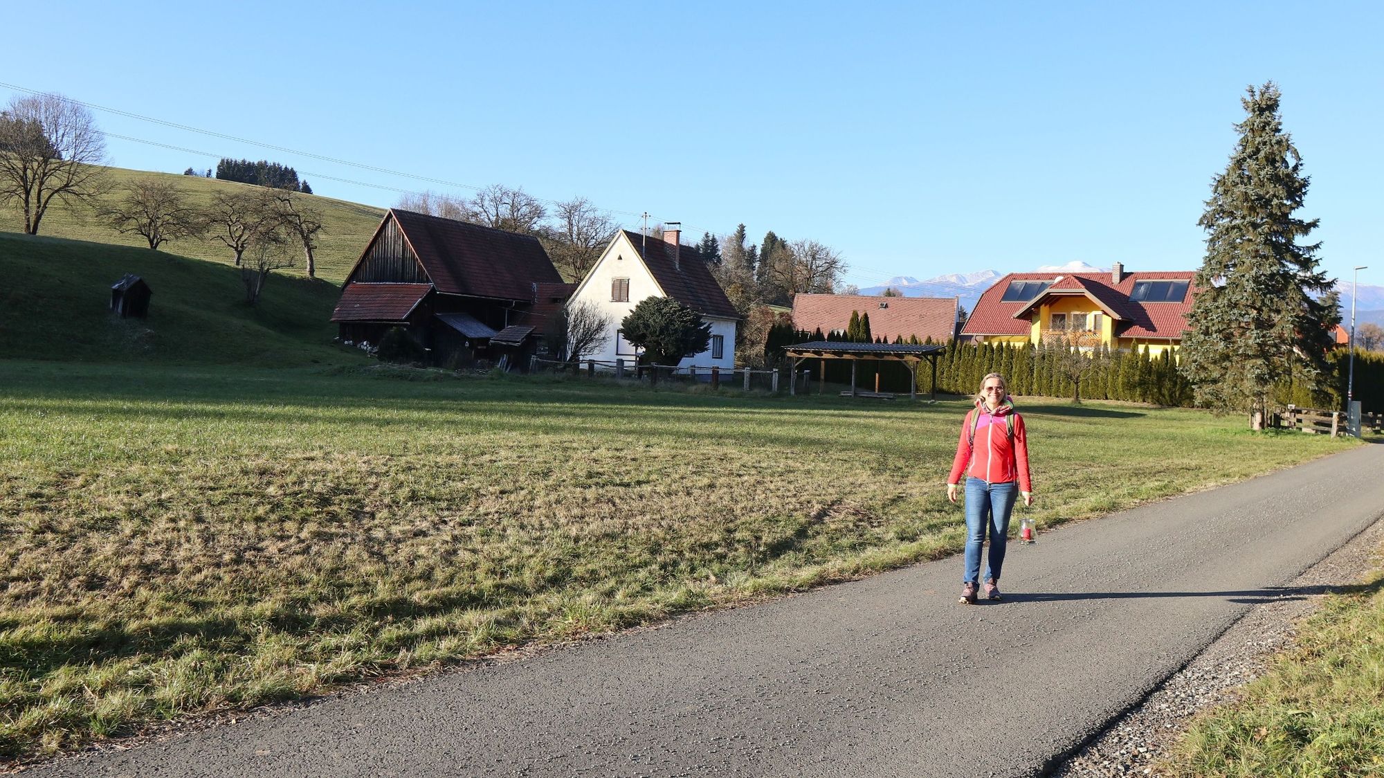
We present a winter hike for young and old in the municipality of Lobmingtal in the Murtal adventure region, namely the forest circular trail. Starting from the center of Großlobming, we hike a popular local recreation trail in the region in around 1 ½ hours, with easy ascents and descents. The special feature of this forest circular trail are two cozy resting and viewing points.
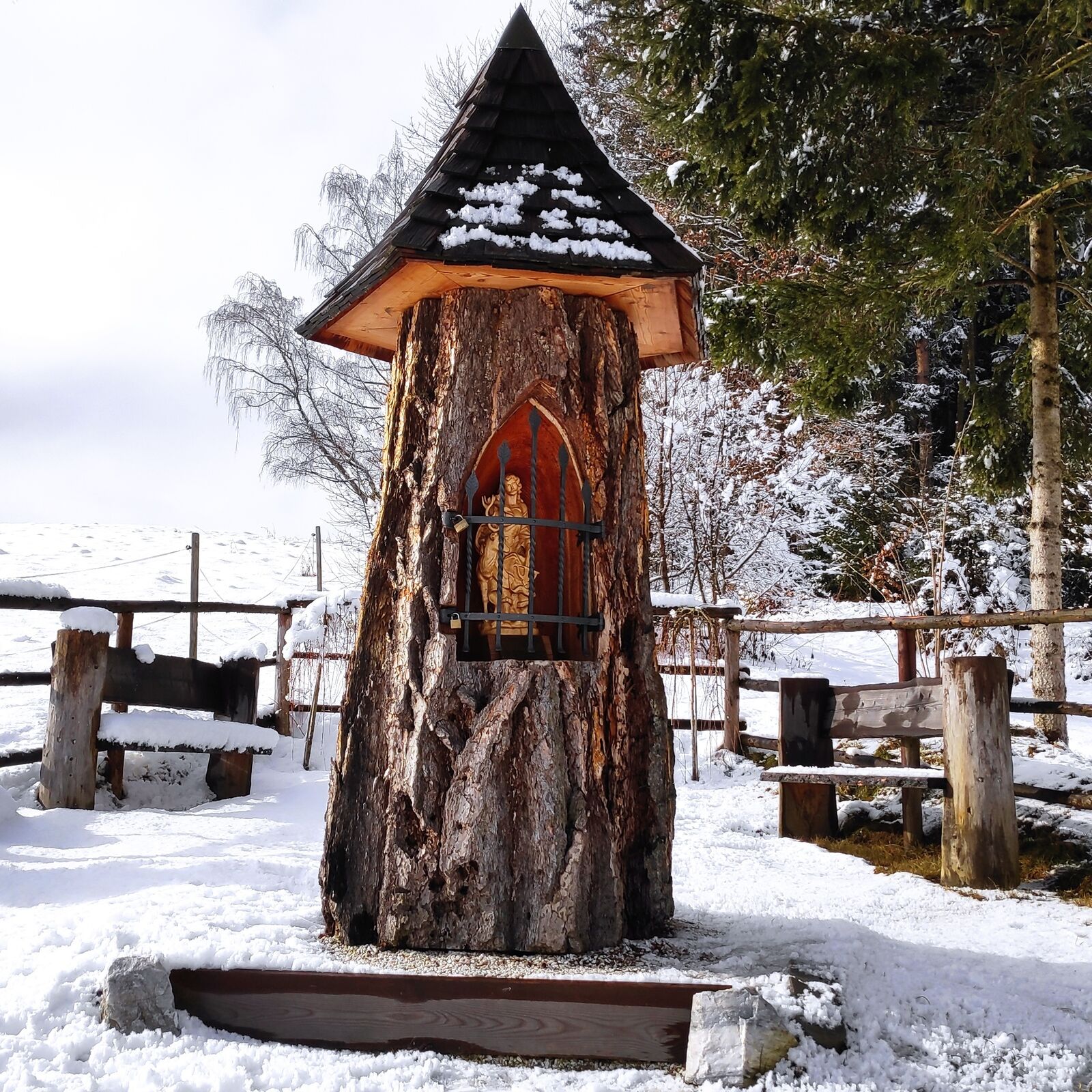
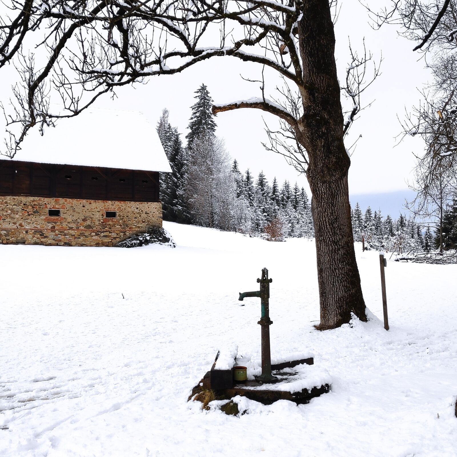
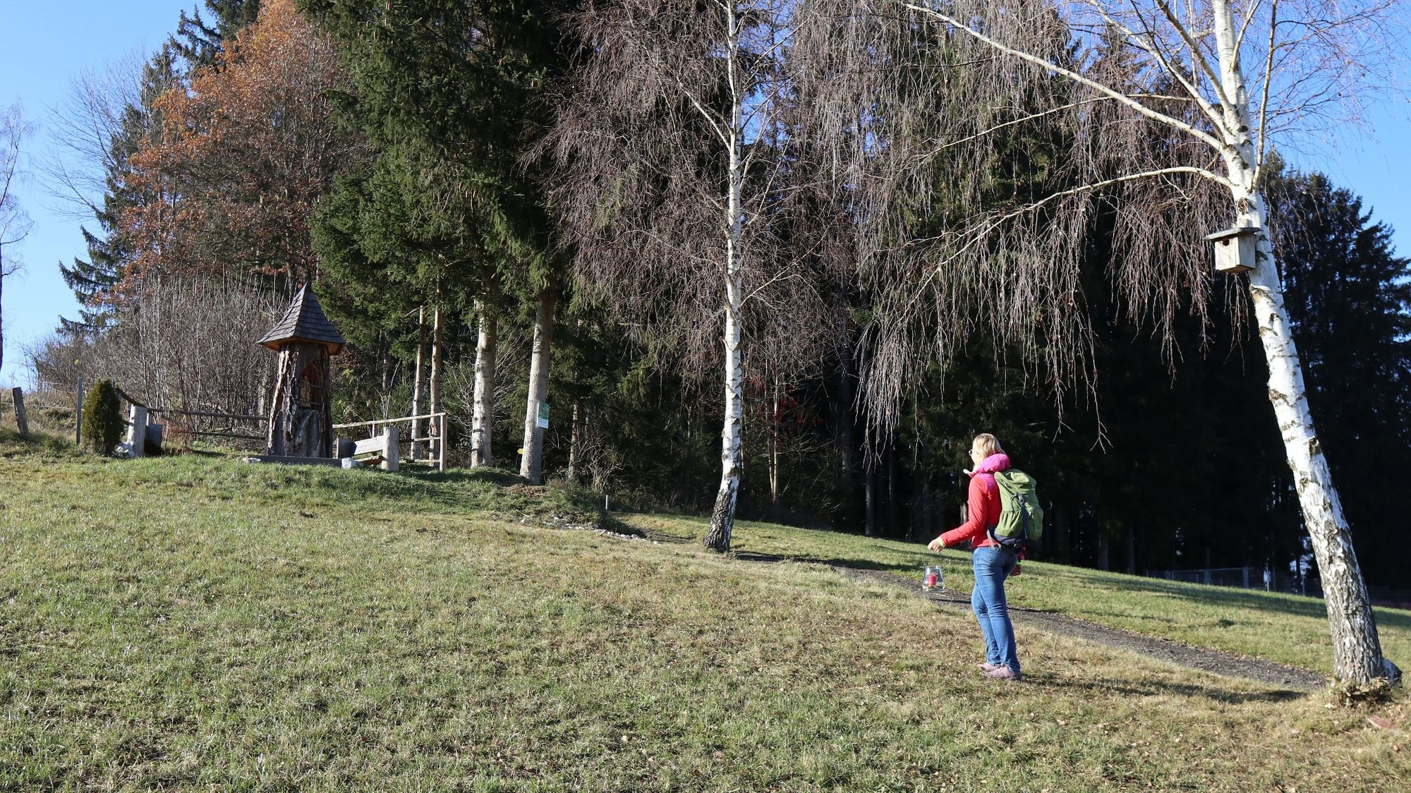
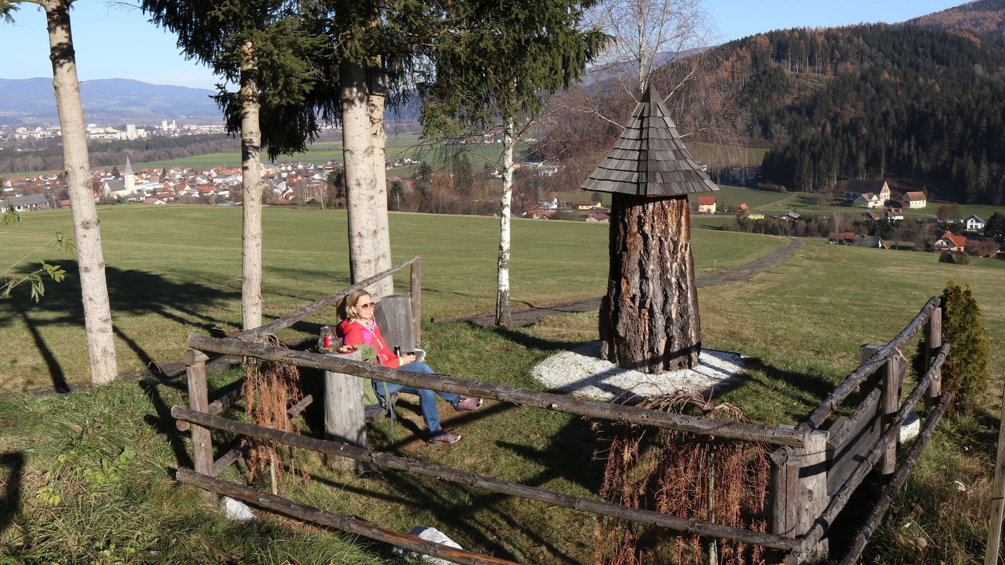
The first place, the Hubertus wayside shrine, can be reached after about 20 minutes. This scenic resting place impresses with a larch tree that has been lovingly converted into a wayside shrine. The patron saint of hunting, a detailed carved figure of St. Hubert, can be seen inside the larch tree. On wooden benches with a view of the valley, we can enjoy our tea and the delicacies we have brought with us. The second break along the forest trail is a large clearing with a stable building. At the "Reitinger" we feel the warmth and power of the winter sun, as there is hardly any wind here and the place is like a heat trap.
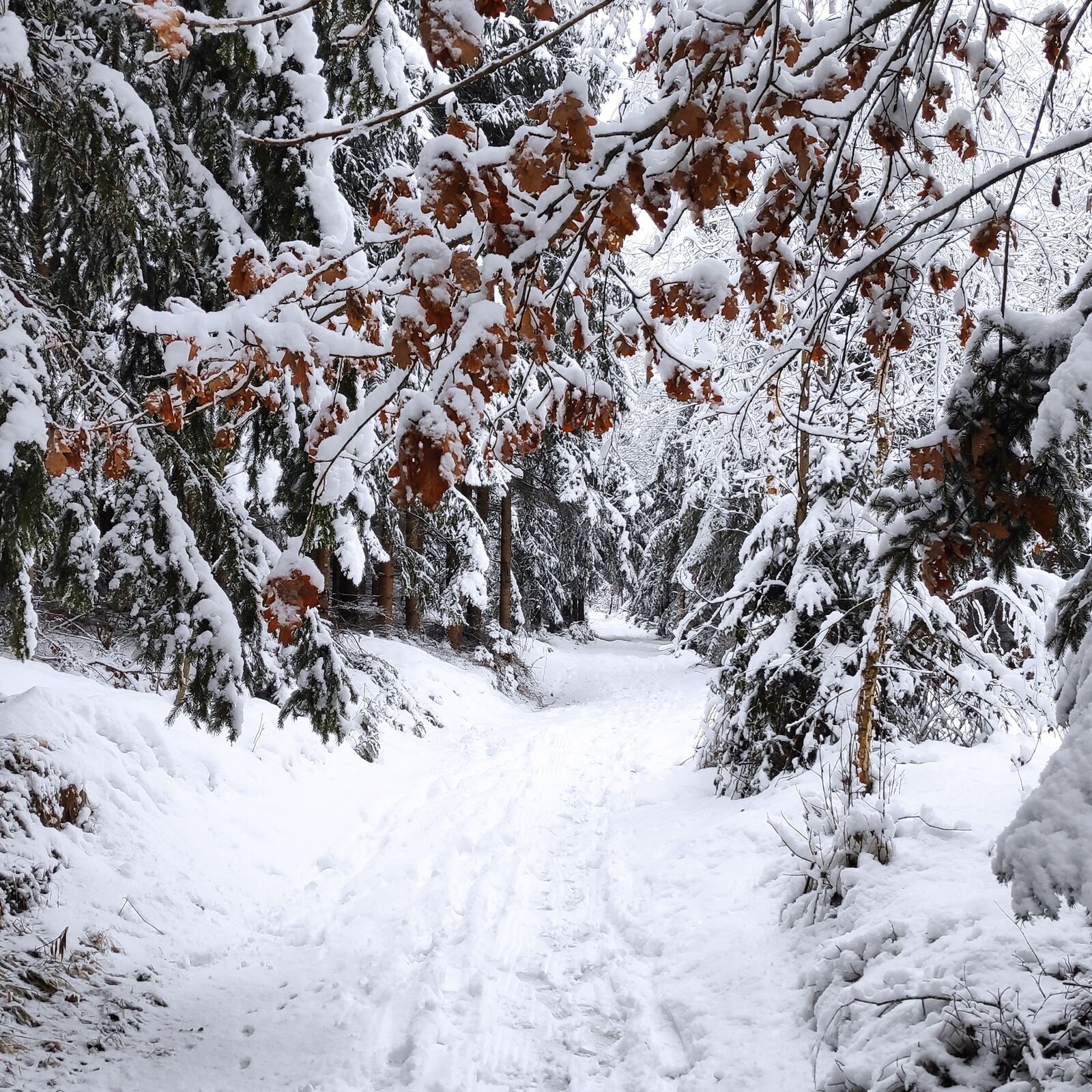
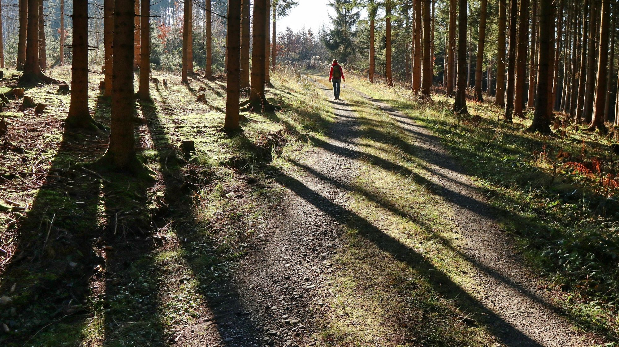
The hiking trail is generally very well marked and easy to find. Just look out for the red-white-red markings and the yellow signposts labeled "Waldrundweg".
- Directions
-
Tour corresponds to trail no. 45c on signposts on site and in the regional hiking map
At the parking lot, 641 m, of the Raiffeisenbank in Großlobming, we follow the yellow signpost with the inscription "Waldrundweg über Reitinger". We walk through the village past the Wulz inn, change sides of the road and walk along the sidewalk to the start of the Lobming Valley cycle and adventure trail. Cross the bridge over the Lobmingbach stream and follow the road slightly to the right, passing the herbal competence center. Turn left at the next crossroads, briefly along the park road, until we turn slightly right uphill at the next crossroads. Now follow the asphalt road for a few more meters until a gravel road branches off to the left, which we follow to the Hubertus wayside shrine, 722 m. The hiking trail continues along forest roads and forest paths and takes us directly to a large clearing, the Reitinger waypoint, 770 m. After a leisurely break, we follow the forest road downhill and leave the main path at the first right-hand bend. We continue leisurely through the forest and then downhill along the edge of the forest until we reach the Lobmingtal cycle and adventure trail. Now we turn left and walk along the newly constructed asphalt path and the path we already know through the village back to our starting point.
- Highest point
- 775 m
- Endpoint
-
Großlobming
- Height profile
-

- Equipment
-
Backpack with rain coverTelescopic / hiking polesMountain / hiking bootsGloves: waterproof and warmHeadgear / sunglassesOuterwear: Onion layer system, T-shirt, sweater, jacket and winter jacket with hoodHiking pantsSeat padWater bottle / thermos flask (on cooler days a warming drink is pleasant)Snack or snackFirst aid kit with blister plasters and tick tweezers
Other important items of equipment:
Route descriptionDetailed plan of the hikeHiking map: For an overview, a 1 : 50000 scale map of the respective regionGPS devicecell phone
- Safety instructions
-
There are a few rules to follow to ensure conflict-free coexistence on alpine pastures and meadows, especially when out and about with dogs. (Source: www.sichere-almen.at - 09/2020)
Avoid contact with grazing livestock, do not feed animals, keep a safe distance!Keep calm, do not frighten grazing cattle!Mother cows protect their calves. Avoid encounters between suckler cows and dogs!Always keep dogs under control and on a short lead. If an attack by a grazing animal is foreseeable: Put them on a lead immediately!Do not leave hiking trails on mountain pastures and meadows!If grazing animals block the path, keep as far away as possible!When approaching grazing animals: Stay calm, do not turn your back, avoid the animals!Leave the grazing area quickly at the first sign of restlessness!Pay attention to fences! If there is a gate, use it, then close it again and cross the pasture quickly!Treat the people working here, nature and the animals with respect!
A few tips on correct and fair behavior in the forest: (Source: www.bundesforste.at - 9/2020)
- Tips
-
Take treats such as doughnuts and tea with you and enjoy the winter atmosphere at one of the two rest areas along the hiking trail.
- Additional information
-
Maislinger Inn, Tel.: +43 3512 82125, 8734 Großlobming, Lindenweg 3, www.gh-maislinger.at
Gasthof Wulz, Tel.: +43 3512 829830, 8734 Großlobming, Hauptstraße 2
Gasthaus Rüf-Peterwirt, Tel.: +43 3512 83193, Hauptstraße 12, 8734 Lobmingtal, www.gasthaus-ruef.at
Cafe im Schablhof, Tel.: +43 664 99707944, 8734 Großlobming, Kirchengasse 1, www.cafeimschablhof.at
Cafe & Kegelbahn Glatz, Tel.: +43 3512 82870, 8743 Großlobming, Weißkirchnerstraße 7
G'Schlössl Murtal, Tel.: +43 3512 46904, 8734 Lobmingtal, Murhof 1, www.gschloessl-murtal.at
Gasthaus Murstüberl, Tel.: +43 664 3045045, 8734 Großlobming, Mursiedlung 24, www.camping-murinsel.at
Grocery store Adeg, Tel.: + 43 6137 5118, Dorfstrasse 28, 8734 Großlobming
Murtal region: www.murtal-herzklopfen.at
Municipality of Lobmingtal: www.lobmingtal.at
- Directions
-
From St. Michael in Upper Styria via the Murtal expressway S36 (toll sticker required) to Knittelfeld (24 km, approx. 20 minutes) and on to Großlobming (30 km in total, approx. 25 minutes).
From Judenburg via country roads to Großlobming (14 km, approx. 20 minutes)
Winter hiking by car - a few things you should be aware of!
Good winter tires are an absolute MUST!Ice scraper, snow broom, de-icer for the door locks and a small shovel are part of the basic equipment.Put snow chains and a tow rope in the car, even if you are not good with them yourself. There are always helpful and knowledgeable hikers on the mountain!Clear all snow and ice from the car, especially the roof.When parking, make sure that you also leave space for other drivers.Always park in such a way that the rest of the road remains clear for cars, timber trucks and snow clearing vehicles.Find out about the snow situation on the access road or parking facilities before setting off. (Hüttenwirt, webcams)
- Public transportation
-
The nearest train station is Knittelfeld. From here, take bus line 847 to Großlobming or Kleinlobming. Please note that at weekends and during vacation periods this line is only available to a very limited extent. Here you can travel the 5 km to Großlobming or 11 km to Kleinlobming with a regional cab company - available directly at Knittelfeld station. If you stay overnight in one of the hotels, they often offer a pick-up service from the station.
General information about public transportation in the region: www.verbundlinie.at
Murtal Taxi, Tel.: +43 660 1018101, 8740 Zeltweg, www.murtal-taxi.at
Cab Jäger, Tel.: +43 3512 44833, 8720 Knittelfeld
Cab Steiner, Tel.: +43 3512 71718, 8720 Knittelfeld
- Parking
-
Parkplatz der Raiffeisenbank in Großlobming


- Author
-
The tour Winter hike on the forest trail in Lobming is used by outdooractive.com provided.