- Brief description
-
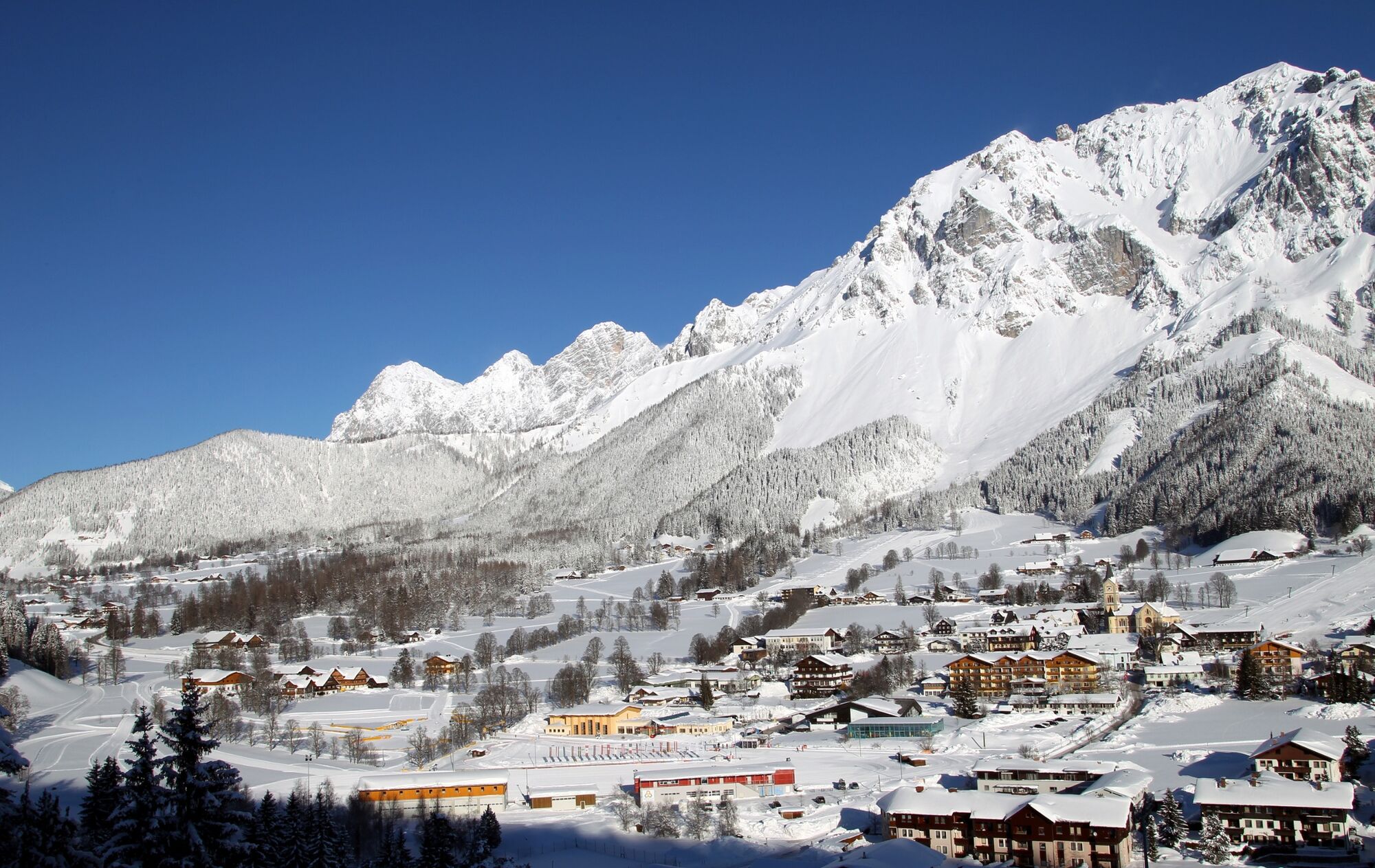
The 10 km long Kulmberg Loop Trail plays a major part in horse-drawn sleigh rides. A sleigh will take you around the Kulmberg in two hours.
- Difficulty
-
easy
- Rating
-
- Starting point
-
Cross-Country Stadium Ramsau Ort
- Route
-
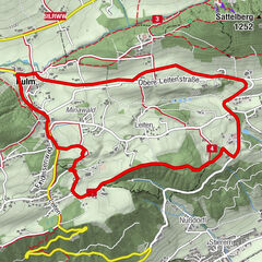
Ramsau am Dachstein0.0 kmKulm2.2 kmStockerwirt5.4 kmVorberg7.6 kmAlpengasthof Peter Rossegger8.4 kmRamsau am Dachstein10.1 km
- Best season
-
AugSepOctNovDecJanFebMarAprMayJunJul
- Description
-
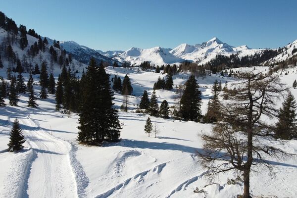
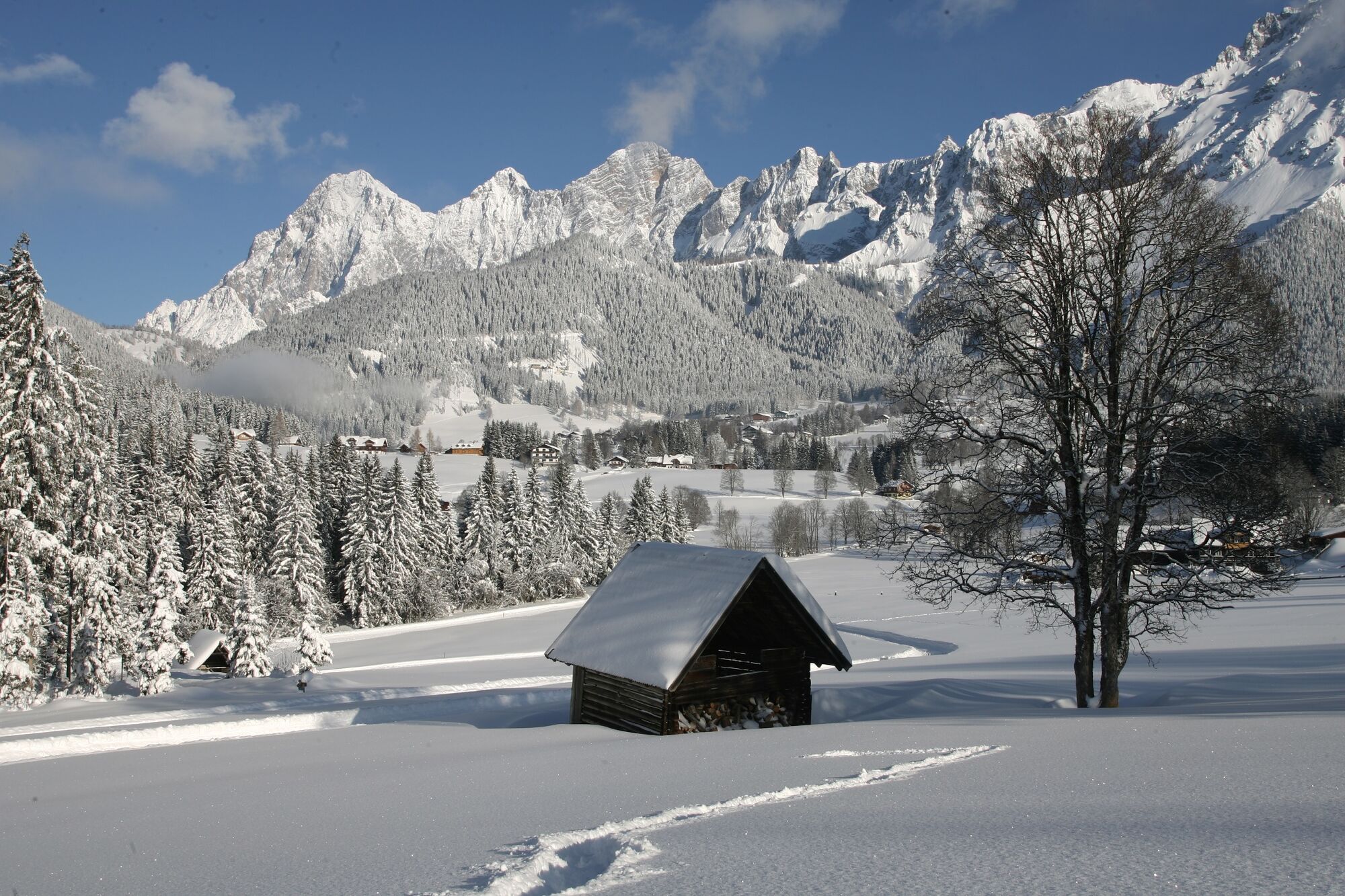
Ramsau’s sun plateau offers ideal surroundings for winter walks at the foot of the Dachstein - separated into winter walking trails and paths. From the beginning of the winter season, the paths/tracks will be groomed and open to walkers as well as horse-drawn sleighs.
- Directions
-
Starting at the Cross-Country Stadium in Ramsau Ort you will pass through Ramsau Kulm and Vorberg. This 10 km long "horse-drawn sleigh track" forms a loop around the mountain called Kulmberg. The Kulmberg Loop Trail, also known as Kulmbergrunde, is the main route for horse-drawn sleigh rides which the sleighs will complete in two hours. Please be considerate of the horse-drawn sleighs.
- Highest point
- 1,179 m
- Endpoint
-
Cross-Country Stadium Ramsau Ort
- Height profile
-

- Equipment
-
Winter Walking Attire
- Safety instructions
-
Beware - this is the main route for horse-drawn sleighs!
- Additional information
-
www.ramsau.com
- Directions
-
From the west:
Tauern Autobahn (A 10) to Knoten Ennstal - turnoff direction Graz/Schladming - stay on the Ennstal-Bundesstraße (B320) for approx. 20 km until Schladming - take the turnoff for Ramsau.From the north:
Pyhrn Autobahn (A 9) direction Liezen - take the Ennstal-Bundesstraße (B320) to Schladming - turnoff Ramsau. - Public transportation
- Parking
-
Congress Centre Ramsau Ort
-

-
AuthorThe tour Kulmberg Loop Trail is used by outdooractive.com provided.
Die Route ist schön lange, jedoch empfehlenswerter wenn ein Schnee liegt.