- Brief description
-
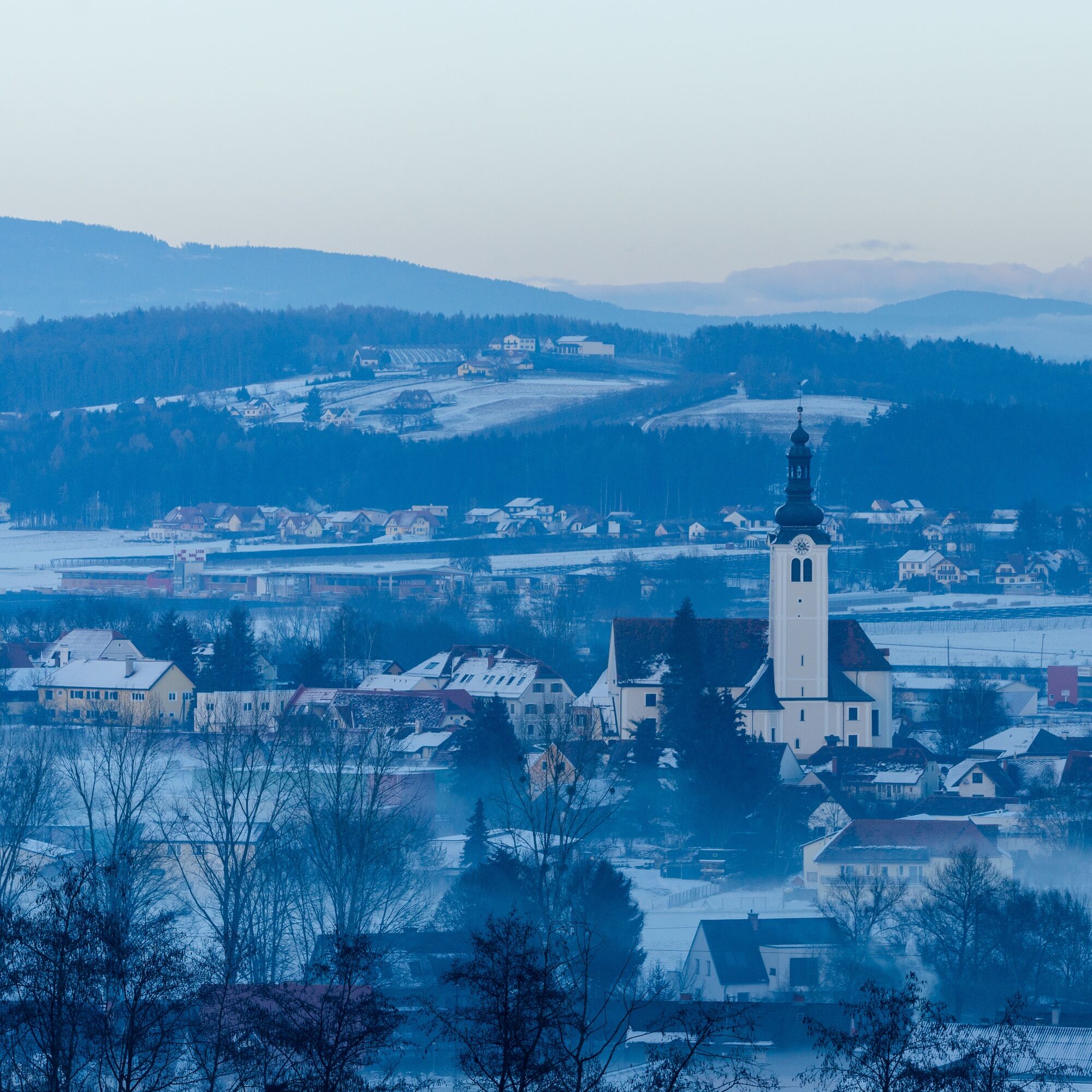
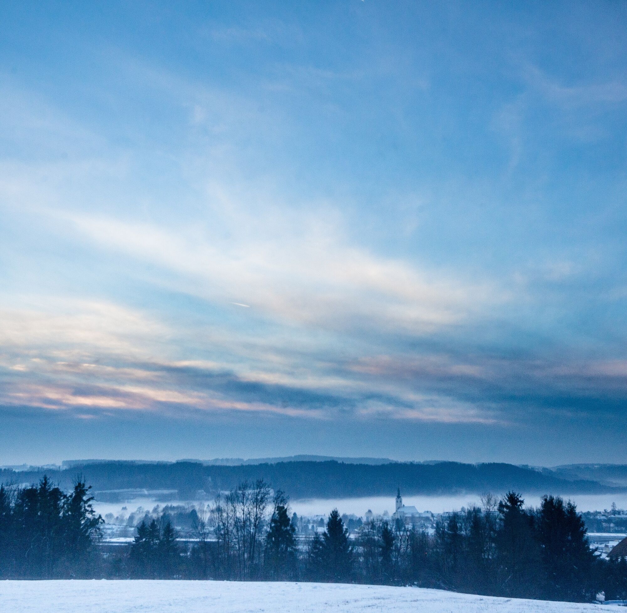
This circular hike takes us through beautiful forest passages to the core caphel, which invites you to linger with its life-size wood-carved "Emmaus-Jesus" and a wonderful 360° view of wintery Styria.
- Difficulty
-
medium
- Rating
-
- Starting point
-
St. Ruprecht – main square
- Route
-
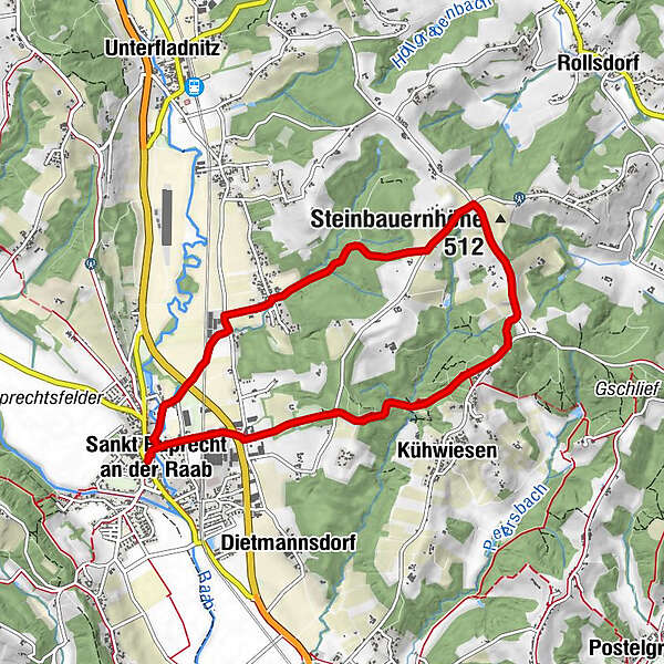
Sankt Ruprecht an der Raab0.0 kmPfarrkirche hl. Ruprecht0.0 kmMariensäule0.0 kmFriedensgrotte0.0 kmKühwiesen2.4 kmPichlberg3.7 kmKernkapelle3.7 kmSteinbauernhöhe (512 m)4.2 kmArndorf bei Sankt Ruprecht an der Raab6.2 kmSankt Ruprecht an der Raab8.1 kmPfarrkirche hl. Ruprecht8.2 kmFriedensgrotte8.2 kmMariensäule8.2 km
- Best season
-
AugSepOctNovDecJanFebMarAprMayJunJul
- Description
-
The tour's namesake is the core chapel. Built in 1838, this listed chapel has been renovated several times. Since the last renovation in 2015 by the Hans and Angela Unger family, an approximately 1.95 tall "Emmaus Jesus" welcomes visitors with open arms, at eye level so to speak. This Emmaus Jesus was carved by Hans Pendl, a very well-known and active wood carver from St. Ruprecht.
The chapel had and has a very important role in the religious life of the surrounding inhabitants. During the war, when religious instruction was forbidden in schools, it was held in the chapel. Today, Christian teachings and May devotions are still held in the chapel. The chapel bell is still rung three times a day and when there are local deaths.
- Directions
-
This winter circuit to the core chapel starts at the main square of St. Ruprecht an der Raab, the central hiking starting point. It first leads together with the Panorama trail past the fire brigade over the Weizbach bridge into Gartengasse, which we follow straight on to soon cross the main road.
Here we first turn right and then immediately left, where after a short ascent we reach the Hubertus Chapel, a popular resting place with a beautiful view of wintry St. Ruprecht an der Raab and Breitegg.
Up to here we hike on cleared roads - nevertheless it can be icy along the way!
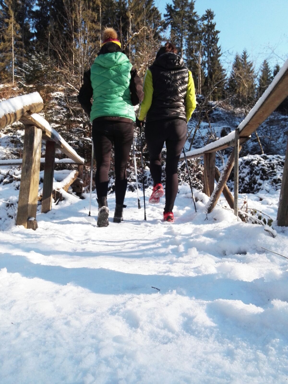
Further on, the path leads us across a meadow (beware, there is no clearing here - proper footwear is needed) directly into one of the beautiful high forests that line the ridge. Enjoy the peace and quiet of the forest in winter.
Then cross a road and after about 100 metres turn left into the forest at a house.
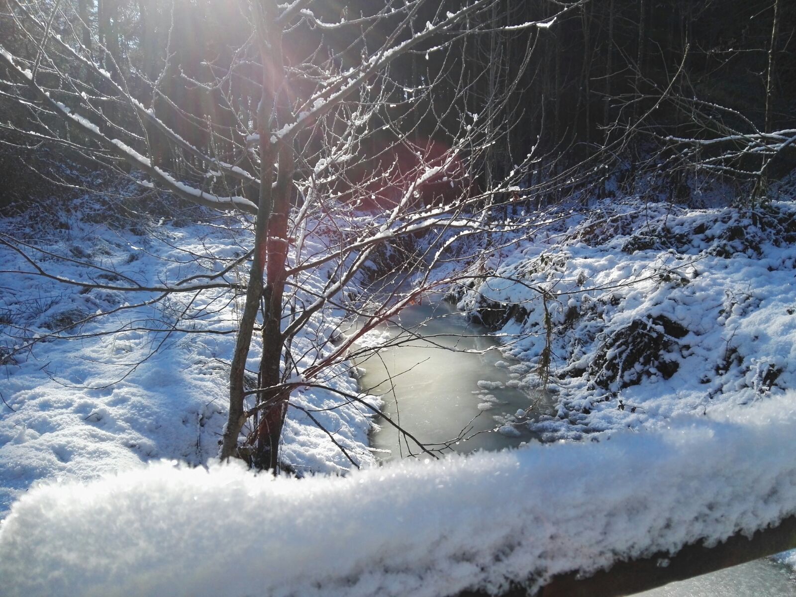
Via a particularly idyllic spot - the Salmbachbrückerl and the Marienruhe - especially in winter when the Salmbach is iced over and glistens in the sun - we continue uphill a little through the snow-covered forest until we come to a junction where the Panorama trail and the core chapel trail separate.
We continue straight ahead following the yellow signs towards the core chapel (the Panorama trail turns right) until we reach the end of the forest. There the "Stoarieglkreuz" is waiting for us and invites us to take a short rest.
We walk past beautiful detached houses towards the road. At the asphalted and cleared road, we turn left and follow it for a few hundred metres.
After a few hundred metres, we take a forest path to the left into a small wood. Here, after a few metres, we turn right again and continue hiking towards the ridge.
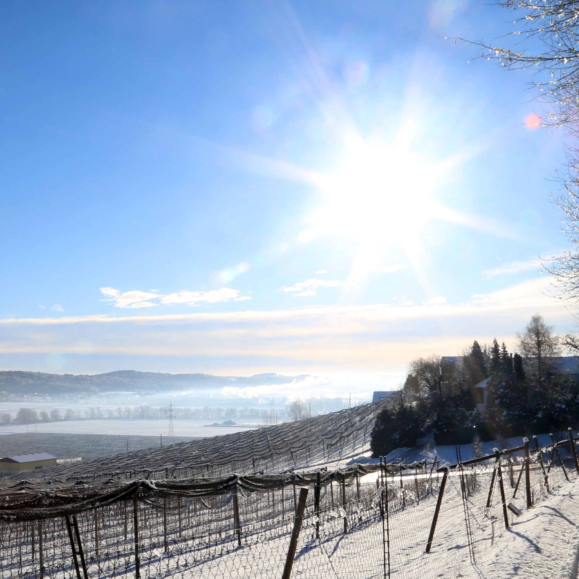
At the edge of the forest, right next to beautiful apple orchards, we continue uphill for a bit until we reach the road via a meadow path. Here we can enjoy the apple orchards, now snow-covered in winter or glistening in the frost in the sun and hibernating.
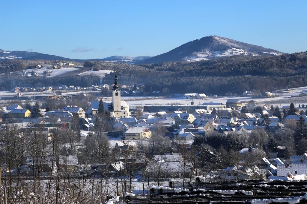
Arriving at the cleared road, a wonderful 360 °degree panoramic view will surprise us. At 450 m above sea level, directly on the Styrian Apple Road, we have a magnificent view of wintry Styria: to the Schöckl, the local mountain of Graz, to the Kulm, the Koralpe and the mountains of the Wechsel region.
Enjoying this wonderful view, we can already see the core chapel - the destination - on our left. The core chapel - a special place of spiritual life - invites us to linger. Here, the life-size Emmaus Jesus, carved by Hans Pendl, welcomes us at eye level, so to speak. Here we can take a little time to find peace in the core chapel and enjoy the wonderful view.
With fresh strength we start the way back. We continue along the asphalted road in a westerly direction until we come to a crossroads. Here we turn left. We pass well-kept family homes and farms for about one kilometre until we turn right along a forest road.
We walk a few metres through fragrant apple orchards until we reach the so-called "Arndorfer Wald". This forest road was once the connection between St. Ruprecht and Kühwiesen, but is no longer used and therefore there is no winter road maintenance. Nevertheless, it should be possible to walk along it at any time (unless there is a lot of snow).
We hike downhill through this beautiful forest until we arrive in the St. Ruprecht district of Arndorf. There we come to the asphalted road and turn left at the first junction to the Arndorf village chapel, an open prayer chapel that was redesigned in 2015.
We follow the road until we come to a larger crossroads again. Here we turn left towards "Lieb Bau", a large local construction company. Directly at the Lieb Bau company we make a sharp right turn and walk across a level crossing and a subway back to the St. Ruprechter main square.
The last kilometres are again on cleared asphalt roads. - Highest point
- 501 m
- Endpoint
-
St. Ruprecht – main square
- Height profile
-

- Equipment
-
Backpack with water bottle/thermos flask and provisions
Mountain / hiking boots
Appropriate clothing - preferably several layers - "onion principle" on cool days: long hiking trousers, don't forget gloves: Headgear, sunglasses
Rain protection, seat pad
Hiking poles
cell phone
First aid kit
Directions, detailed plan of the hike/hiking map/GPS device
Before starting the hike, check where to stop for refreshments, including opening times, or pack appropriate food and drink - Safety instructions
-
In winter, caution is advised even on supposedly easy hikes. The ground can be icy in shady places and it can also be icy underneath the snow. In addition, the winter hiking trail is not cleared in many places - walk at your own risk. Mountain sports are therefore - even more so in winter - primarily a matter of personal responsibility. Tourism associations or avalanche warning services do not accept any liability based on the information provided.
Important telephone numbers:
European emergency number: 112 Emergency call mountain rescue: 140 (if possible, please provide GPS data) Rescue: 144 Fire department: 122 Police: 133A few tips on correct and fair behavior in the forest: (Source: www.bundesforste.at )
Hikers should avoid visiting the forest approx. 1.5 hours before sunrise and after sunset, as wild animals are particularly active at this time. Plastic bottles, handkerchiefs, cigarette butts etc. have no place in the forest! Please make sure that you do not leave any garbage in the forest. Camping and making fires is strictly forbidden in the forest! In principle, every person in the forest is allowed to collect 2 kg of mushrooms and berries per day for their own use. It is only prohibited if the forest owner expressly forbids it. - Tips
-
The following excursion destinations can also be visited: Peace Grotto on the main square in St. Ruprecht Baroque church of St. Ruprecht an der Raab "Stoarieglkreiz Arndorf village cross.
You can find refreshment in the numerous restaurants in St. Ruprecht an der Raab.
- Additional information
-
Information about the region, places to stop and stay, excursion destinations etc. can be found here:
Eastern Styria Tourist Board
St. Ruprecht an der Raab office
Lower main road 27
8181 St. Ruprecht an der Raab
Tel. +43 664 2353414
Marking:
Our hiking trails are marked red-white-red, as is generally the case in the Alpine region, and at the crossing points you will find yellow signs with black lettering and time information. At the core chapel trail, please follow the signs "core chapel trail". At the main square - the general hiking starting point in St. Ruprecht an der Raab - a stand with many yellow signs marks the direction.
Our cycling and hiking map "A Region on the Move" is available at the municipal office, at the Raiffeisenbank St. Ruprecht an der Raab and at all catering and accommodation establishments.
- Directions
-
The market town of St.Ruprecht is located in Eastern Styria and is very easy to reach via the A2 motorway from Vienna (approx. 2 hours) and Graz (approx. 30 minutes).
- Arrival from Vienna and from Graz: On the A2 from Vienna and from Graz, take motorway exit 161 / Gleisdorf West in the direction of B54/B64. Follow the B65 / Gleisdorf federal road until you reach the B54 / Wechselbundesstraße. At the roundabout take the second exit to the B64 / Rechberg-Bundesstraße. After about 6 km turn left to St. Ruprecht an der Raab.
- Public transportation
- Parking

-

-
AuthorThe tour Winter hike core chapel is used by outdooractive.com provided.