Alpine Hike from the Stoderzinken across the Grafenbergalm to the Kufstein


- Brief description
-
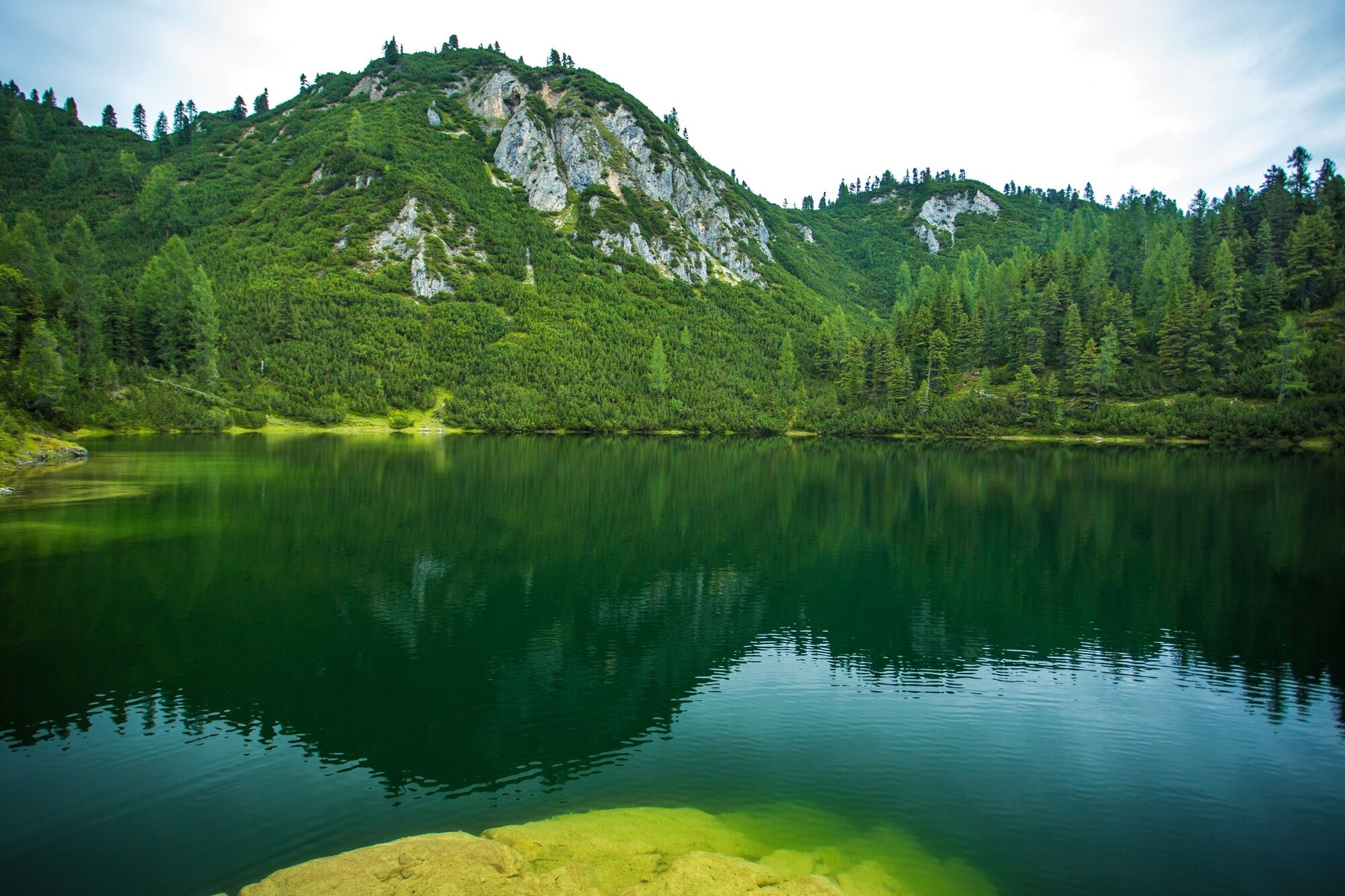
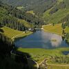
Beautiful alpine hike through forest, to the high pastures and mountain tarns of the Grafenberg Alm. In early summer, especially, this area is full of flowers and truly something to see.
- Difficulty
-
difficult
- Rating
-
- Starting point
-
Stoderzinken car park at the end of the alpine road
- Route
-
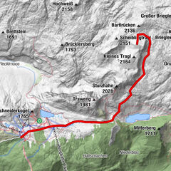
Stoder0.1 kmBerggasthof Steinerhaus0.1 kmBrünner Hütte1.0 kmSchwiegermuttersprung4.4 kmGrafenbergalm7.0 kmKufsteinscharte (2,004 m)7.9 kmKufstein (2,049 m)9.0 kmWasserbode9.9 km
- Best season
-
JanFebMarAprMayJunJulAugSepOctNovDec
- Description
-
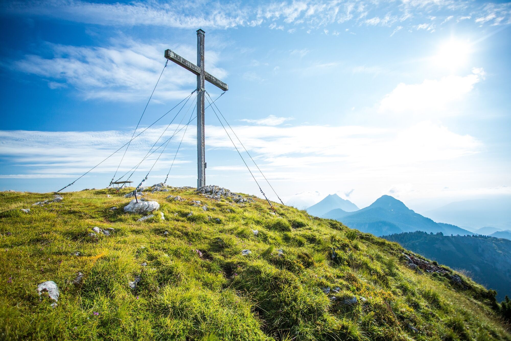
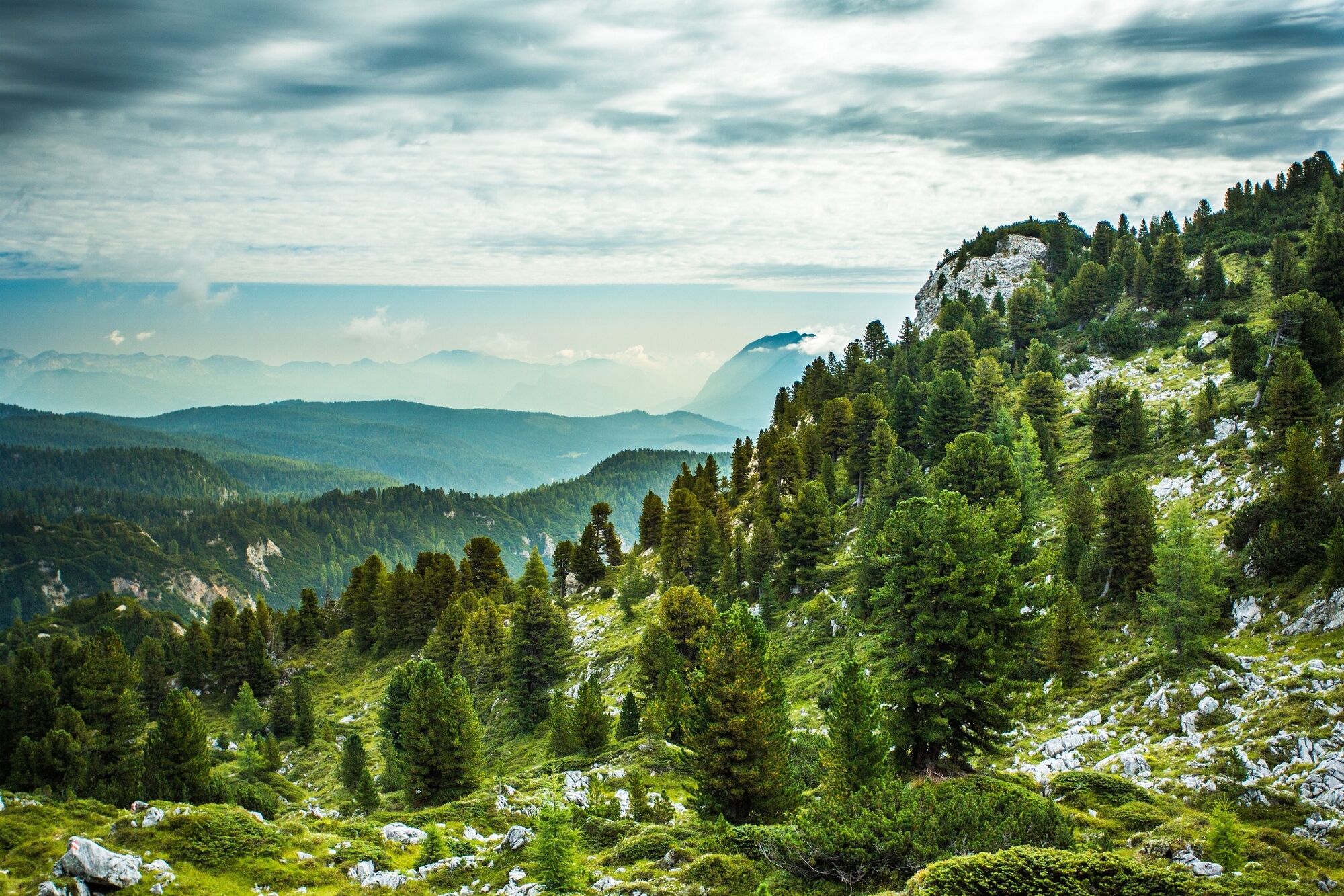
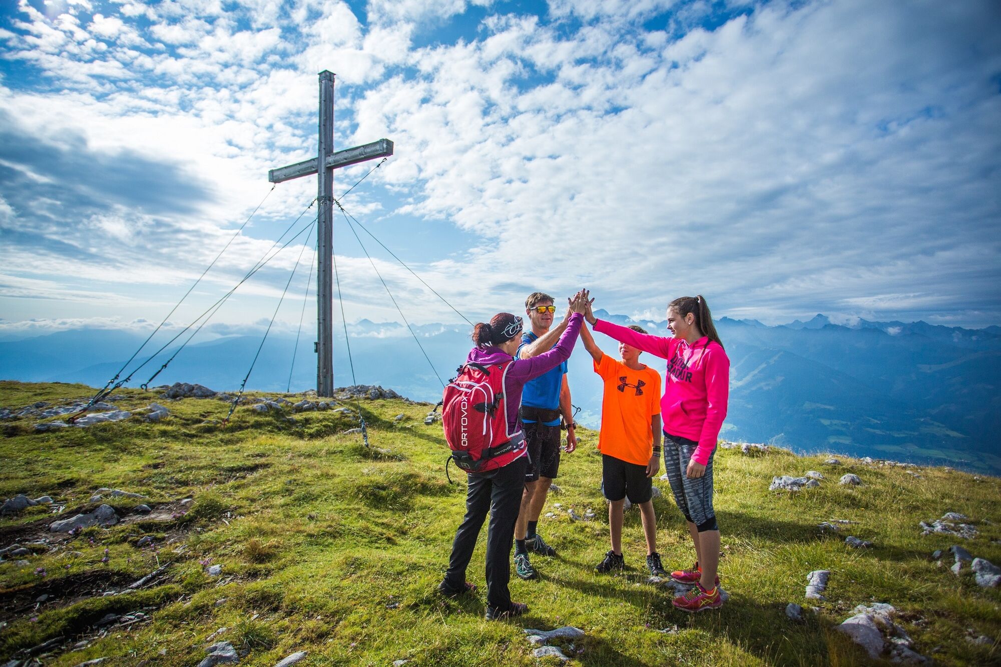
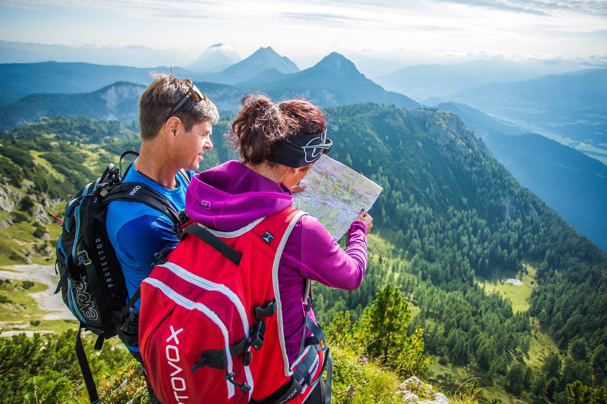
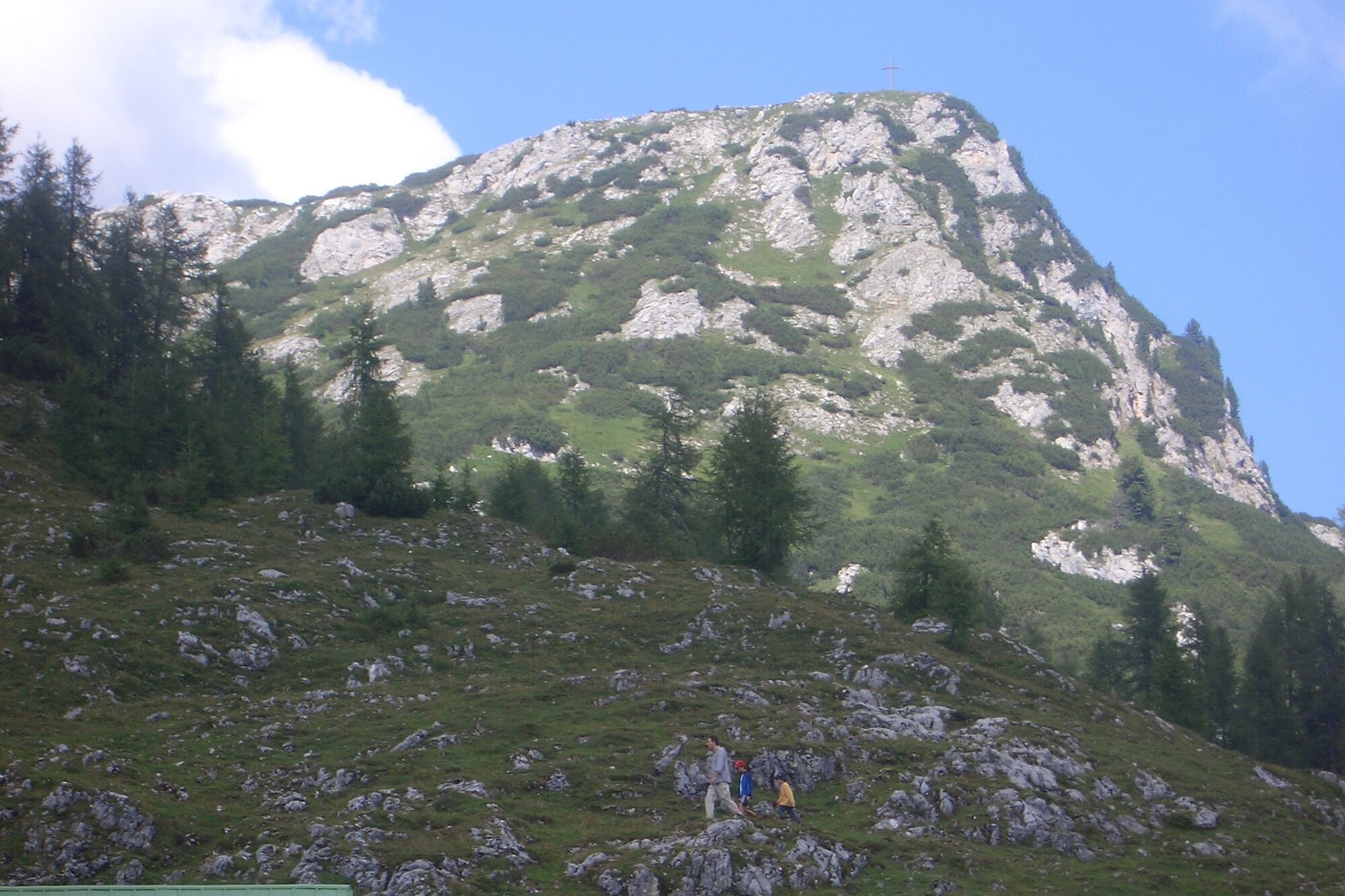
Already at 1,890 meters we start this high-altitude hike with a very special character. We march through a beautiful light larch forest before a dark spruce forest surrounds us a little later. The path high above the Ahornsee lake is characterized by a unique humpback landscape with beautiful clearings. Again and again we enjoy the beautiful views. A wonderful place to rest is offered to us in the idyllic alpine basin of the Grafenbergalm, before we continue on to the magnificent view peak Kufstein.
- Directions
-
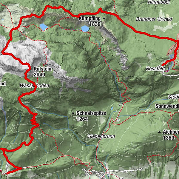
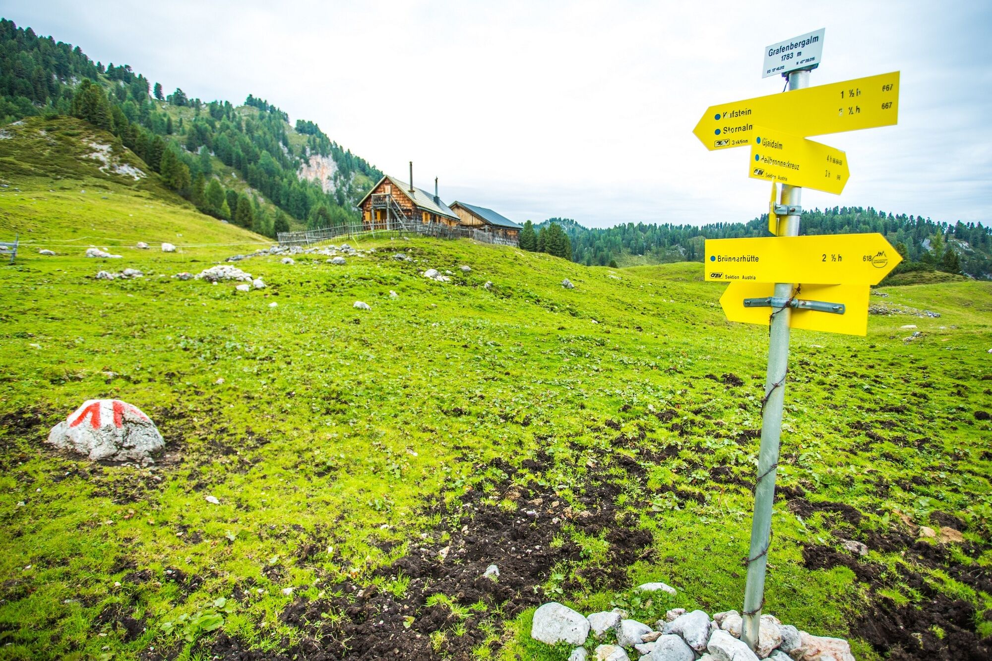
Our hike begins from the Stoderzinken parking lot at the end of the (toll) alpine road in Gröbming. The trail with the number 675 leads us first slightly downhill to the Brünner Hütte, from there we hike through the "Brandner Urwald" (Brandner Primeval Forest) in a westerly direction (trail no. 618). Over a narrow forest path, which first leads steadily downhill and then in a slight up and down through wide depressions, then again over humps and small rocky lanes, we reach the hill above the Ahornsee. In the last quarter we hike very close to the edge of the break-off high above the Grafenbergsee. Over beautiful alpine meadows we reach the alpine basin of the Grafenbergalm. From here we choose trail no. 667 to the highest point of our hike, the Kufstein (2,049 m). Our descent is via the Stornalm. At the Schartl we continue on trail no. 667 and end our hike at the Burgstaller in Ramsau-Rössing.
- Highest point
- 2,038 m
- Endpoint
-
Burgstaller Ramsau Rössing
- Height profile
-

- Equipment
-
Sturdy shoes, rain gear, hiking sticks
- Tips
-
Very beautiful viewpoints and a many-faceted alpine flora, especially at the beginning of summer
- Additional information
-
Safety information
Safety on the mountainside: changes in the weather, sudden fall in temperature, thunder storms, wind, fog and snow fields are all objective dangers and require the correct behaviour whilst underway. the landlords of the huts are all very knowledgeable about the mountains and can give you good tips about the weather and the routes. Insufficient equipment, exaggerated opinion of ones capabilities, frivolousness, poor health condition and a false evaluation of the situation can lead to a critical situation. In thunder storms: summits, crest-sites and safety rope aids are to be avoided.
If something should happen call following emergency numbers:
No. 140 - the number for all Alpine Emergencies in all of Austria
No. 112 - European emergency call GSM emergency-call-service - Directions
-
Ennstalbundesstraße (B320) to Gröbming - from there follow the approx. 12 km long toll Stoderzinken Alpenstraße
- Public transportation
-
Unfortunately there is no public transportation available!Arrival by cab is recommended, since the starting point of the hike is not the end point of the hike.
- Parking
-
Parking area at the end of the Stoderzinken Alpenstraße
-
-
AuthorThe tour Alpine Hike from the Stoderzinken across the Grafenbergalm to the Kufstein is used by outdooractive.com provided.


General info
-
Schladming - Dachstein
3001
-
Haus - Aich
1364
-
Haus im Ennstal
366