


- Brief description
-
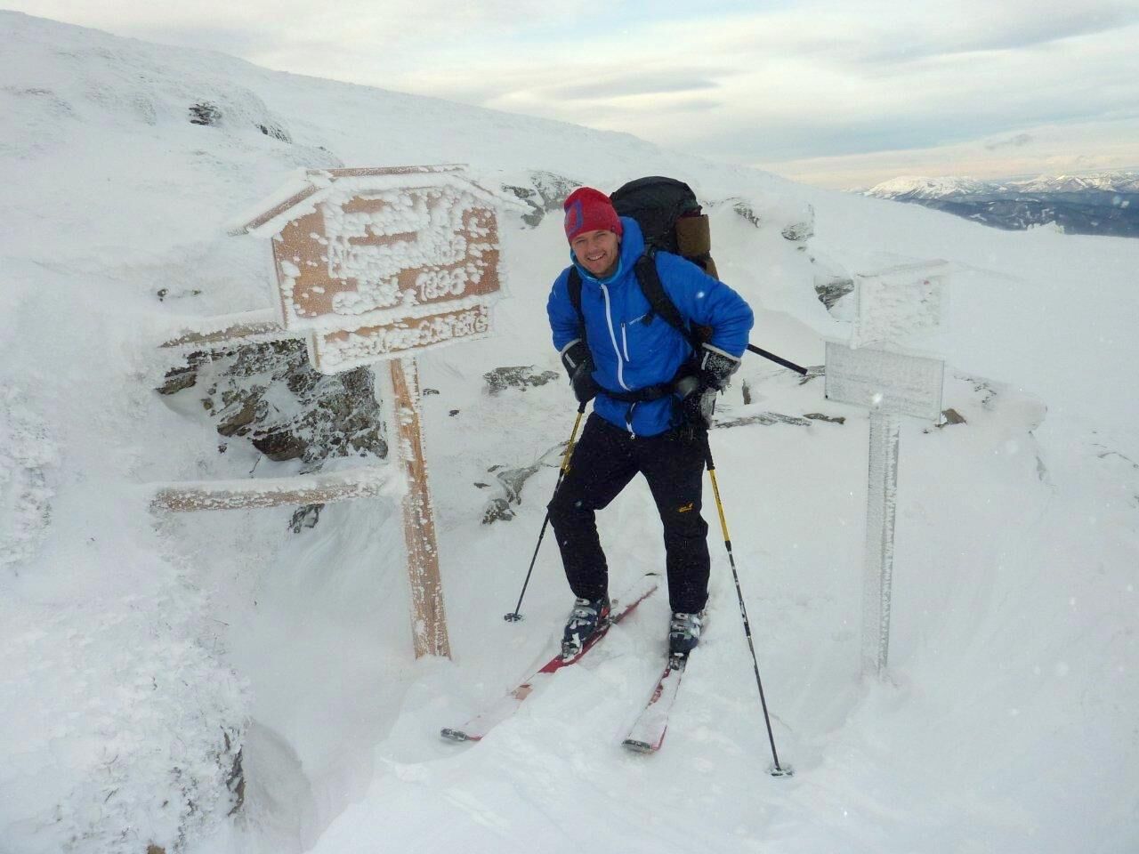
An easy hike in Hochsteiermark that can be done almost all year round (in winter with snowshoes or touring skis, in summer ideal for families) to one of the most beautiful vantage points in the Eastern Alps and thus the entire BergZeitReise. In addition, it also goes to the first ski hut of the entire Alpine region (today, unfortunately, only a ruin). By the way, the Stuhleck is the highest point of the entire Fischbach Alps, which also includes Peter Rosegger's forest home. By the way, the leisurely hike can also be made into a small round trip.
- Difficulty
-
easy
- Rating
-
- Route
-
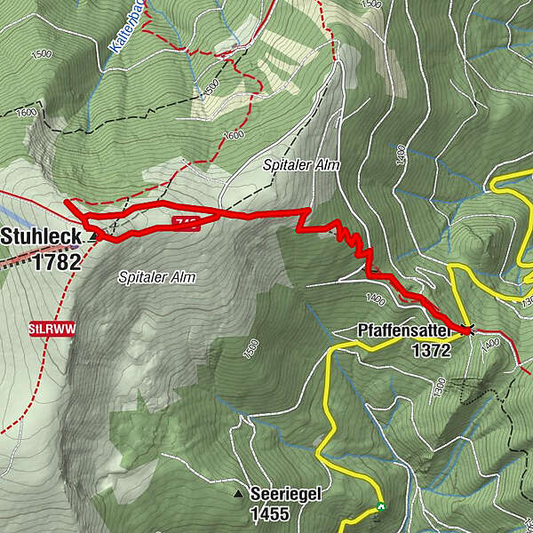
Pfaffensattel (1,372 m)0.0 kmStuhleck (1,782 m)2.9 kmAlois-Günther-Haus3.0 kmPfaffensattel (1,372 m)5.5 km
- Best season
-
JanFebMarAprMayJunJulAugSepOctNovDec
- Description
-
From the Pfaffensattel, a mountain pass between Steinhaus am Semmering and Rettenegg, it is never really steep, uphill to the gentle hilltop of the Stuhleck.
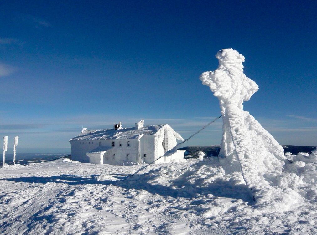
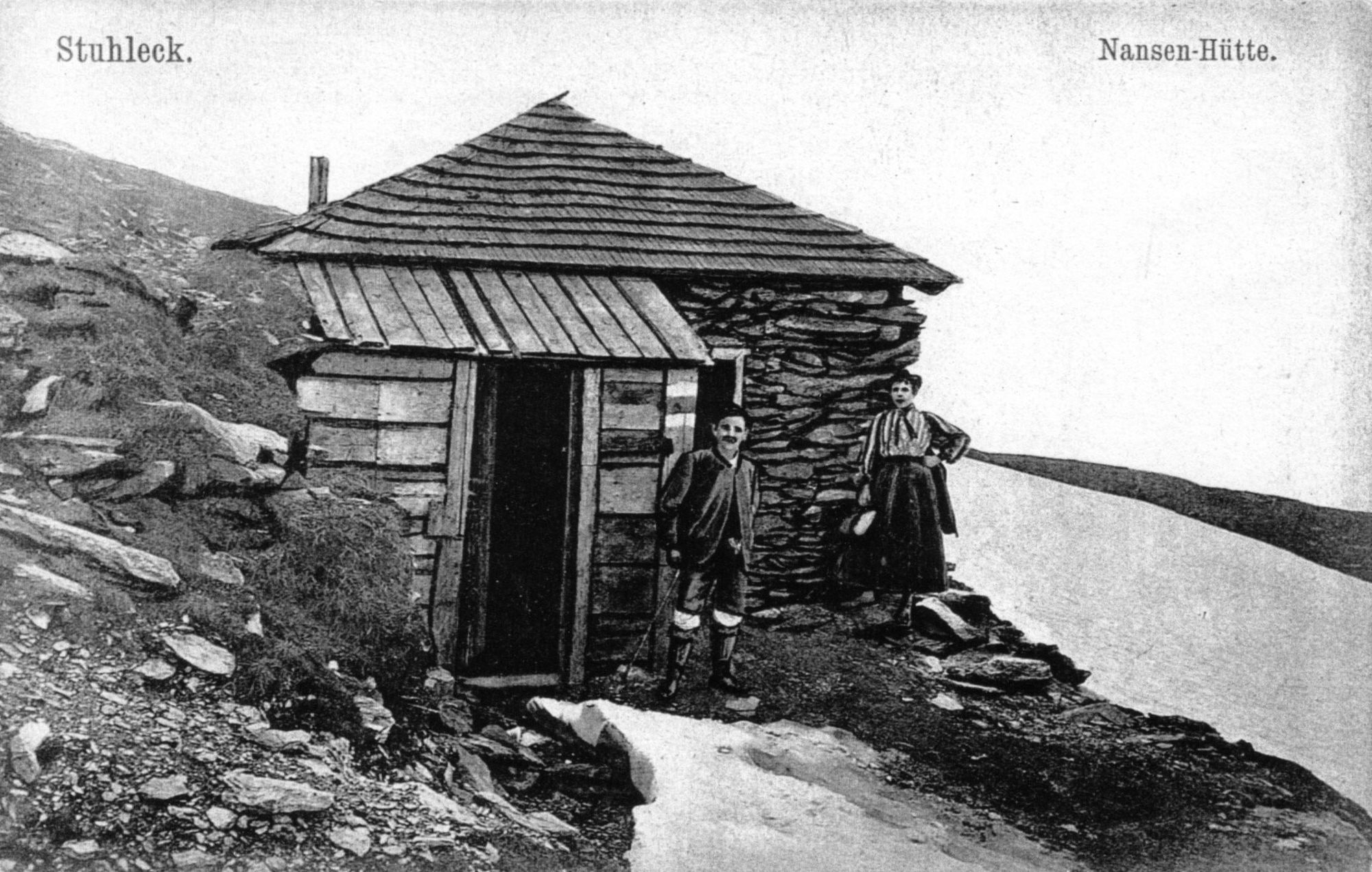
This first mentioned ski hut in the Alps on the Stuhleck, the Nansenhütte, was, by the way, unfortunately not a real stroke of luck in terms of construction. Built in 1896 as a replacement for the small shelter of the Gustav Jäger hut, which had already been built in 1869, it soon had to be determined that the building site had not been chosen very favorably. For wind, snow and moisture penetrated the hut and soon made it a rather uncomfortable place.
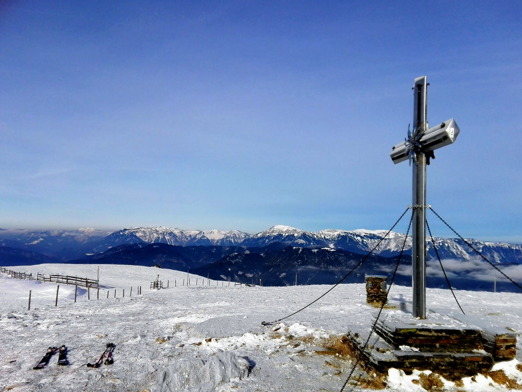
One of the most beautiful panorama places of the BergZeitReise
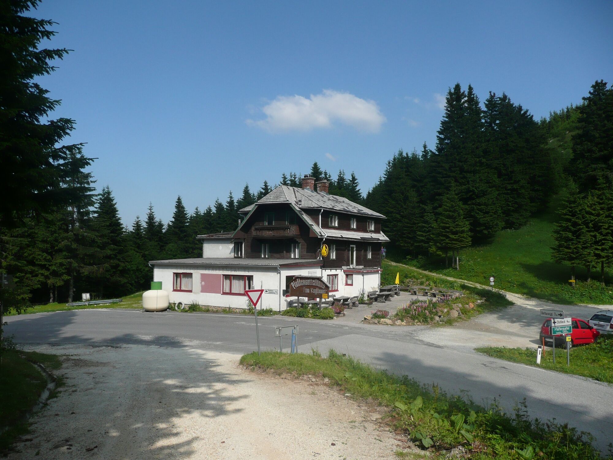
But as badly as the weather had chosen the place for building the hut, the panorama on site is dreamlike. Therefore, a hike here is worthwhile, especially since this destination of the BergZeitReise can be reached relatively easily almost all year round, provided the weather is good. Not far from the ruins of the hut is the Alois Günther Haus as a perfect resting place (Tel.: +43 3853 300).
By the way, the Stuhleck is also located on the hiking route "from glacier to wine" - click here for the corresponding stage!
- Directions
-
From the Pfaffensattel, we head via the Spitaler Alpe to the Stuhleck summit and to the ruins of the Nansenhütte located just below.
To do this, we start at the 1,372m high Pfaffensattel, which can be reached from Spital and Steinhaus am Semmering via an easily passable mountain road. We start (in winter with snowshoes or touring skis, in summer with appropriate hiking equipment) vis a vis the old saddle inn (P, unbew.) on a well-marked hiking trail uphill until we reach a junction with the Stuhleck - toll road, which is open to cars in summer.
Across the Spitaler Alpe to the hut ruins
We cross this gravel road and continue along the hiking trail, first through an increasingly sparse forest, then across the open space of the Spitaler Alpe to the already visible Alois Günther Haus at the Stuhleck summit (Tel.: +43 3853 300).
But shortly before reaching the summit, we branch off to the right and walk in a few minutes to the remains of the former Nansenhütte, marked with an information board. On the one hand, we have an impressive view down into the Fröschnitz and Kaltenbach valleys, and on the other hand, the panorama extends over the entire Vienna Hausberge all the way to the Vienna Basin and Lake Neusiedl.
After a rest in the nearby Güntherhaus, we return to the Pfaffensattel along the ascent path or via the toll road.
- Highest point
- 1,777 m
- Endpoint
-
Parkplatz am Pfaffensattel
- Height profile
-

- Equipment
-
Proper backpacking makes a lot of things easier:Pack heavy things first. The water bottle should always be within easy reach in a side pocket. All things that are often needed, such as sunglasses, camera or hiking map, belong on top. An emergency kit including blister plaster belongs in every backpack and a clothing according to the "onion system" is always recommended!
For all hikes, be sure to wear good, ankle-high shoes!
- Safety instructions
-
The Stuhleck is very exposed to the wind and in fog orientation can be problematic!
Emergency call mountain rescue: 140, www.bergrettung-stmk.at
Tip for emergency reporting - give answers to the six W-questions:What happened? How many injured? Where did the accident happen (possibly GPS coordinates)? Who is reporting (callback number)? When did the accident happen? Weather at the accident site?
Mountain accommodation: Alois Günther Haus am Stuhleckgipfel, Tel.: +43 3853 300
- Tips
-
The Stuhleck summit can also be reached via a toll road in summer (also for mountain bikes), and in winter with the Steinbachlift (Stuhleck lifts).
Not far from the hut ruin is the Alois Günther Haus as a perfect resting place (Tel.: +43 3853 300).
- Additional information
-
www.hochsteiermark.at
www.steiermark.com
www.stuhleck.com
www.aloisguentherhaus.at
The Styria Tours App, available for free on Google Play and in the App Store (Android, iOS), offers detailed first-hand information:
Shortfacts (length, duration, difficulty, ascent and descent in altitude meters, ratings), map, route descriptions, altimeter, compass, summit finder, navigation along the tour.
In addition, you can create your personal favorites list of favorite tours and points, save tours and destinations offline, play social media channels and more.
Mountain accommodation: Alois Günther Haus am Stuhleckgipfel, Tel.: +43 3853 300, www.aloisguentherhaus.at
- Public transportation
-
Timetables and travel information can be found directly at:Austrian Federal Railways (ÖBB)Styrian State Railways (STLB)www.busbahnbim.at
With the BusBahnBim app from Verbundlinie, finding a timetable has never been easier:All bus, train and streetcar connections in Austria can be queried by entering places and/or addresses, stops or important points. The app is available as a free app for smartphones (Android, iOS) - on Google Play and in the App Store.
- Parking
-
Parking facilities directly at the .
If you drive up to the Stuhleck in summer by car (or motorcycle) via the toll road, there are plenty of parking facilities close to the summit.

-

-
AuthorThe tour Pfaffensattel - Stuhleck is used by outdooractive.com provided.


General info
-
Hochsteiermark
4066
-
Waldheimat
2182
-
Rettenegg
452


