- Brief description
-
A beautiful hike through open alpine pastures to the ancient passage “over the Glattjoch.”
- Difficulty
-
medium
- Rating
-
- Starting point
-
Parking Hinterwald
- Route
-
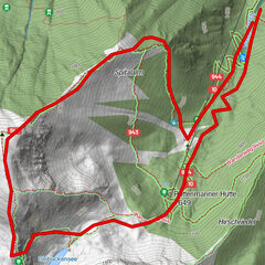
DorfschenkeGlattjochkapelle8.8 kmGlattjoch (1,988 m)8.8 kmDorfschenke17.8 km
- Best season
-
JanFebMarAprMayJunJulAugSepOctNovDec
- Description
-
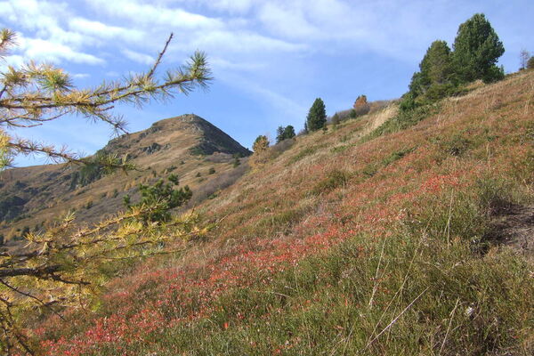
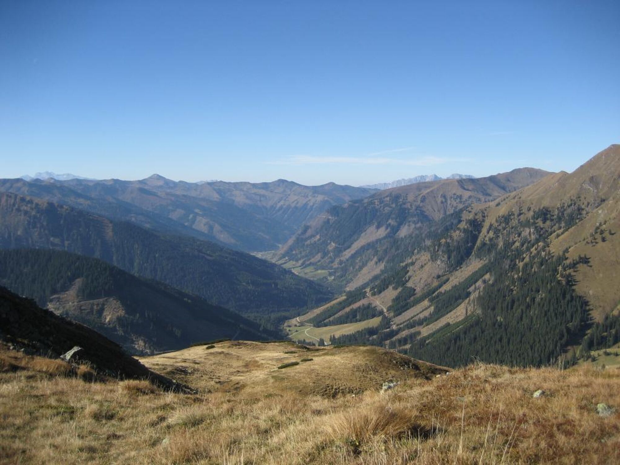
At the Hinterwald resort village parking area, we follow the forest road along the Donnersbach up to the Riedler Alm. Trail No. 936 takes us across gorgeous alpine terrain to the lower and upper Glattalm.
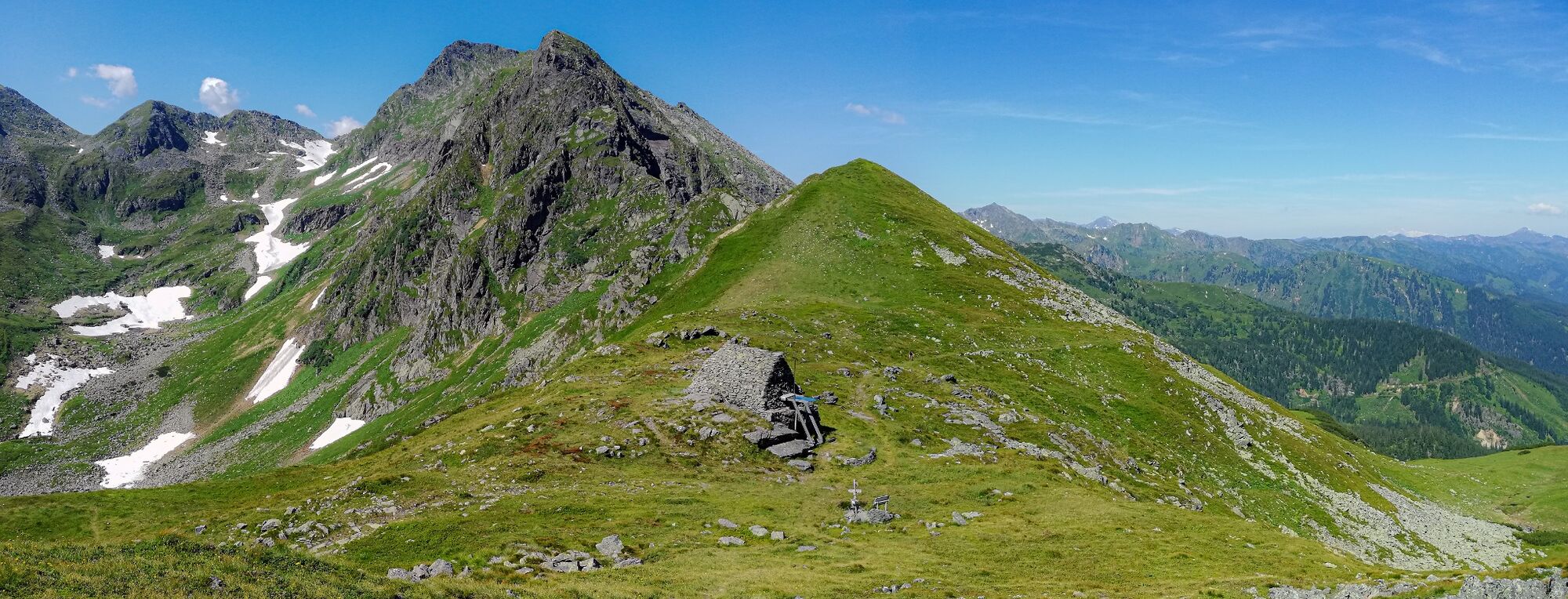
From here on, the path becomes steeper and narrower as it passes through the broad alpine plateau and on toward the ridge’s deepest dip, the Glattjoch. The old chapel located in this ridge saddle, flanked by the striking green slopes of the surrounding mountain peaks, attests to this passage’s importance as a main crossing route between Oberwölz and the Ennstal. We will take the same path down the mountain that we followed up. - Directions
-
From the Hinterwald parking lot, after the Riedler barrier, follow the forest path along the Wildbach stream to the Riedleralm pasture. The trail 936 (keep left) leads you past the Beireutalm to the Untere and Obere Glattalm. A bit above you cross the stream and continue along the path to the small gate on the right below. Cross the stream again before you reach the forest. Following the markings, you now hike uphill on a narrow path through the forest and wide alpine plateaus. Small lakes and a variety of beautiful mountain flowers refine your ascent to the Glattjoch, a crossing of the so-called "salt road" that has been used for thousands of years. The chapel at the top is the highest in Styria. It was built in the 9th or 10th century. After admiring this ancient chapel and an extensive rest, you march back along the same path.
This trail is also a stage of the Hemma Pilgrimage Trail on the route from Admont to Oberwölz.
- Highest point
- 1,983 m
- Endpoint
-
Parking Hinterwald
- Height profile
-

- Equipment
-
In your weatherproof backpack belong: Sun and rain protection, warm, windproof clothing, drinks and provisions, small first aid kit, hiking map and a fully charged cell phone. Suitable footwear goes without saying.
- Safety instructions
-
Plan your tour in advance, taking into account walking time, route length, altitude difference, danger spots and weather forecast.Together is much more beautiful and at the same time safer in the mountains.
Do not go alone, if possible, and adapt the tour to the ability of your group.
Let them know where you are going and when you want to be back. Also sign hut or summit books.
Turn back in good time if the weather deteriorates. If you get caught in a thunderstorm, do not stay on the summit or ridge and stay away from individual trees. Wait out the storm, if possible in a crouching position.
Stay on the marked trails and remember to close pasture fences again.
Getting up the trail is only half the battle. Stay alert, especially on the descents, to make it back to the valley safely.In case of emergency, keep calm and call the mountain rescue on 140. If you have no reception, take out the sim card and dial 112.
If you encounter cows: It is best to pass above the herd with at least 50 meters distance. Stay calm, don't make any frantic movements and don't run away. Do not imitate cow sounds and do not try to pet the animals. A stick and loud shouting can often make the animals turn back in an emergency.
If you are a dog owner: Clarify before the hike if you have to cross a pasture. Keep your dog on a leash and make sure he stays calm. If a cow attacks, let the dog off the leash immediately. Never pick him up to defend him.
You can get detailed information on "Safe Mountain Hiking" from the Alpine Club. At www.alpenverein.at you can inform yourself comprehensively about it. - Tips
-
Part of the Hemma Pilgrims Way.
- Additional information
-
Tourism information: www.schladming-dachstein.at
Tourism blog: www.derbergdastal.at
Tourist Office Schladming-Dachstein
Ramsauerstrasse 756
8970 Schladming
T: +43 3687 23310
info@schladming-dachstein.at
Garbage on meadows and paths can not smell mountain and valley. Please take it with you. Agriculture and forestry are important partners for Berg und Tal. They allow you to walk and drive on many of their paths. Be aware that only good cooperation will guarantee your recreational enjoyment in the future.
- Directions
-
Leave the Bundesstraße B320 towards Irdning-Donnersbach-Donnersbachwald. Several kilometres after Donnersbachwald towards the wildlife park.
- Public transportation
- Parking
-
Parking Hinterwald


- Author
-
The tour Up to the Glattjoch - elev. 1.988 m is used by outdooractive.com provided.