


- Brief description
-
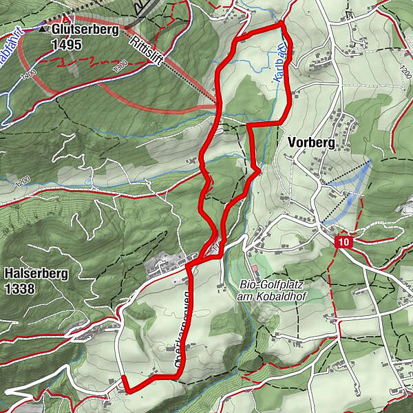
Short walk from Pichl Vorberg to Ramsau-Vorberg
- Difficulty
-
easy
- Rating
-
- Starting point
-
Hiking trail head Vorberg-Steirerhof
- Route
-
Jausenplatzl Astlhof0.6 kmVorberg3.7 kmJausenplatzl Astlhof5.5 km
- Best season
-
JanFebMarAprMayJunJulAugSepOctNovDec
- Description
-
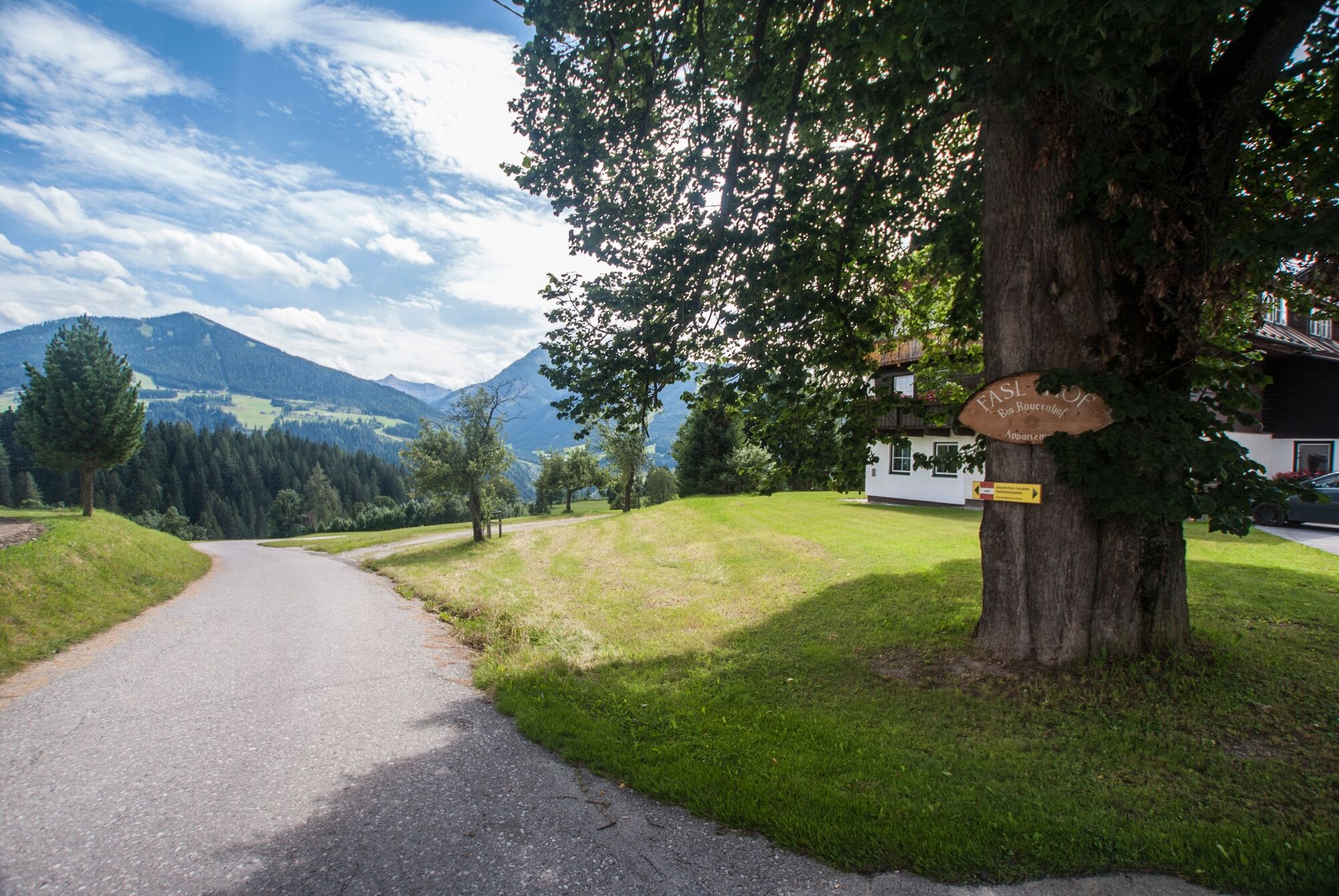
An easy and beautiful walk across Vorberg with nice sections through forest near Halserberg and other parts where you pass by beautiful farms in Ramsau and Vorberg.
- Directions
-
From the hiking trail head Vorberg-Steirerhof you follow the road to Brandstätterhof farm and continue past the farms Fasl and Astl until you reach the hiking trail head Vorberg-Arnika. Just after passing pension Arnika you follow the trail to the right (small saw-mill) and continue on the forest track until you reach trail n° 100. Continue to Tischlberger inn and take trail n° 100 passing by Greimelbacherhof farm. To the right via the forest track continue to a trail junction. Make a left and follow the trail back to the starting point at Vorberg-Steirerhof.
- Highest point
- 1,149 m
- Endpoint
-
Hiking trail head Vorberg-Steirerhof
- Height profile
-

- Equipment
-
A well-packed backpack is helpful and especially when touring Alpine terrain a tuque, gloves, a windproof jacket and pants are standard equipment. Good, waterproof shoes, sun glasses, sun cream and sufficient beverages are essential too. Torch light, a map of the area, knie and a small first-aid kit should also be in the backpack.
- Safety instructions
-
Changes in weather patterns, quick falls in temperature, thunderstorms, wind, fog and snow are some of the dangers that can be encountered on a hiking tour. Hosts of alpine huts and mountain refuges have a lot of experience in the mountains and can give good advice about weather and the trails. Poor equipment, overestimation of one's own capabilities, carelessness, poor personal constitution and/or wrong judgement can lead to critical situations. In case of thunderstorms: avoid summits, ridges and steel ropes.
GPS data and orienteering
Available GPS data - just like hiking maps - is only a guidance for orientation and can never depict a trail exactly with all its details. Especially at dangerous spots it is essential to judge on site how to proceed.
In an emergency please call:
140 - for Alpine emergencies (all over Austria) 112 - European GSM emergency number - Additional information
- Directions
-
Leave the highway B320 Ennstalbundesstraße in Pichl an der Enns and continue to "Vorberg" via the Vorbergstraße road until you reach hotel Steirerhof. The hiking trail head is situated straight ahead at the intersection.
- Public transportation
- Parking
-
The closest car parking is available at the trail head at pension Arnika.


-

-
AuthorThe tour Vorberg Walking Tour is used by outdooractive.com provided.


General info
-
Schladming - Dachstein
3000
-
Ramsau am Dachstein
1690
-
Pichl
524


