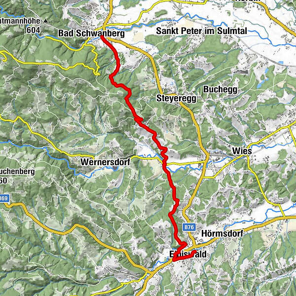
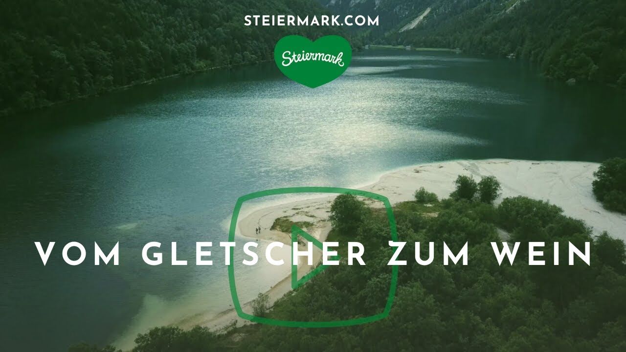
Stage 20 From Glacier to Wine South Route Bad Schwanberg - Eibiswald


- Brief description
-
A beautiful scenic stage of the hiking route "From glacier to wine" right through the Schilcherland. The destination of the tour is Eibiswald, the long-distance hiking hub of Austria. No less than 3 long-distance hiking trails of the Alpine Club - the Mariazell Trail 06, the Southern Alpine Trail 03 and the North-South Long-Distance Trail 05 - as well as the European Long-Distance Trail E06, which leads from the Baltic Sea to the Aegean Sea, meet here.
- Difficulty
-
easy
- Rating
-
- Starting point
-
Bad Schwanberg
- Route
-
Bad SchwanbergSchwanbergerstüberl0.1 kmOberkraß5.2 kmUnterkraß6.0 kmGasthof Polz6.7 kmVordersdorf6.8 kmKreuzkirche10.9 kmPizzeria & Kebaphaus MEMO11.1 kmEibiswald11.4 kmHasewend’s Kirchenwirt11.7 kmPfarrkirche Maria im Dorn11.8 km
- Best season
-
JanFebMarAprMayJunJulAugSepOctNovDec
- Description
-
Eibiswald is also home to the long-distance hiking museum of the Austrian Alpine Association, which is run with much love and idealism. It is located in the Lerchhaus, which is situated on the Upper Square of Eibiswald and dates back to the 16th century. The museum has existed since 1998 in the courtyard wing of the building complex and, based on the "Hermann Collection", presents the history of the origins of long-distance hiking as well as the regional connection to this subject. Carl Hermann, born on October 28, 1918 in Wolfgruben near Wies / Eibiswald was an Austrian sculptor, cultural worker, author and founder of the North-South long-distance hiking trail 05.
- Directions
-
From Bad Schwanberg, right at the beginning of our stage of the hiking route "From Glacier to Wine", we go uphill to the beautifully situated Limberg Castle in the middle of a forest, which today accommodates youth and vacation camps. Limberg Castle was first mentioned in a document in 1244 as a castle with the name "Lindenperch". The structure that still exists today dates from the 16th and 17th centuries. On the valley side there is an outer castle with a central gate tower and two corner towers on the flanks, which are connected to the central building by galleries. The outer castle is connected with the main castle by defensive walls. In the past, there was a moat between them, which was spanned by a bridge. Today, however, the entrance leads through the forecourt directly into the castle, which consists of a quadrangular building with a rectangular courtyard including pillared arcades. Of the once magnificent rooms, the Knight's Hall, the "Painted Room" and a hall in the south wing are still preserved.
But now back to our way to Eibiswald. This leads us on the next kilometers steadily slightly uphill through a beautiful forest to the highest point of the hike at 608 m above sea level, and immediately after that to the Hochmasser inn, a stamp control point for all Mariazell pilgrims. Strengthened, the leisurely tour leads us ever so slightly downhill to the vineyards around the settlement of Oberkraß, where we also encounter Buschenschänken such as that of the Fürpaß family. From Oberkraß we go to Unterkraß, where we keep to the right to get to Vordersdorf. From here the path goes again slightly uphill over a small wooded hill, which brings us on the other side, past beautifully situated vineyards, farmhouses and family homes directly to Eibiswald. In addition to the ÖAV long-distance hiking museum, the beautiful old town houses or the Lechhaus, which also houses a small fine cultural center, there is also another tip: in the Domaines Kilger Hasewend in the center of Eibiswald we can not only stay overnight in the best way, but are also spoiled with regional specialties. This is how we imagine a conclusion to a wonderful hike before we head off on the next stage to the Südsteiermark Nature Park.
- Highest point
- 597 m
- Endpoint
-
Eibiswald
- Height profile
-

- Equipment
-
Proper backpack packing makes many things easier: Pack heavy things first. The water bottle should always be within reach in a side pocket. All the things that are often needed, such as sunglasses, camera or hiking map, belong on top. An emergency kit, including blister plasters, belongs in every rucksack and it is always advisable to dress in layers.
- Safety instructions
-
Emergency call mountain rescue: 140
Tips when reporting an emergency – Answer these six WH questions: What happened? How many people are injured? Where did the accident happen (are there GPS coordinates)? Who is reporting the incident (callback number)? When did the accident happen? What is the weather like at the site of the incident?
- Tips
-
In the Thermen- & Vulkanland region of Styria, Eastern Styria and Southern and Western Styria, the GenussCard opens the door to over 200 excursion destinations when you stay overnight in one of the approximately 100 GenussCard partner establishments. Countless of these GenussCard excursion destinations, ranging from culinary manufactories to bathing lakes and museums, are located directly on the hiking route "From Glacier to Wine".
- Additional information
-
Steiermark Tourismus
Tel. +43 316 4003
If you would like to hire a tour operator, simply book with Steiermark Touristik, the official travel agency of Steiermark Tourismus:
Tel. +43 316 4003 450,
The Steiermark Touren app, available free of charge on Google Play and the App Store (Android, iOS), offers detailed first-hand information: brief facts (length, duration, difficulty, ascent and descent/elevation gain, ratings), map, route descriptions, altimeter, compass, peak finder, navigation along the tour. You can also create your own personal lists of favourite tours and sites, store tours and destinations offline, use social media channels, and much more.
- Public transportation
-
Accessible by train and bus.
Detailed information about arriving by ÖBB (Austrian Federal Railways) can be found at www.oebb.at or on the Verbundlinie Steiermark website www.busbahnbim.at
With Verbundlinie’s BusBahnBim route planner app, planning your journey has never been easier: simply enter towns and/or addresses, stop names or points of interest to check all bus, train and tram connections in Austria. The app is available free of charge for smartphones – on Google Play and in the App Store
- Parking
-
There are numerous parking spaces available in Bad Schwanberg.


-

-
AuthorThe tour Stage 20 From Glacier to Wine South Route Bad Schwanberg - Eibiswald is used by outdooractive.com provided.


General info
-
Südsteiermark
1135
-
Schilcherland Steiermark
1100
-
Eibiswald
114