- Brief description
-
Fist bike, second hiken1
Fist Bike & Hike way in Schladming-Dachstein.
- Difficulty
-
medium
- Rating
-
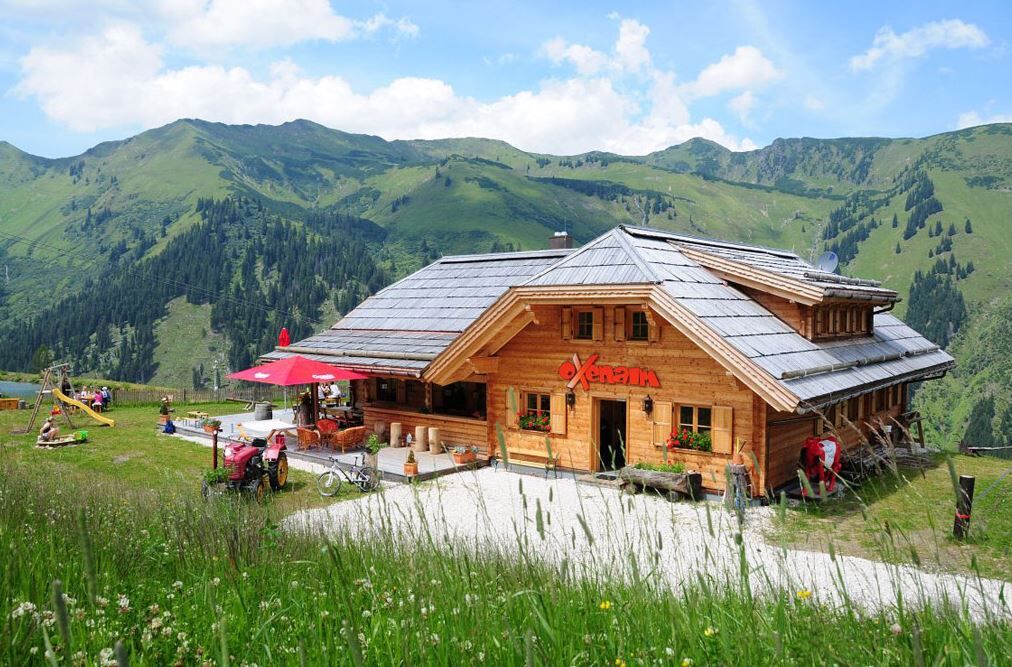
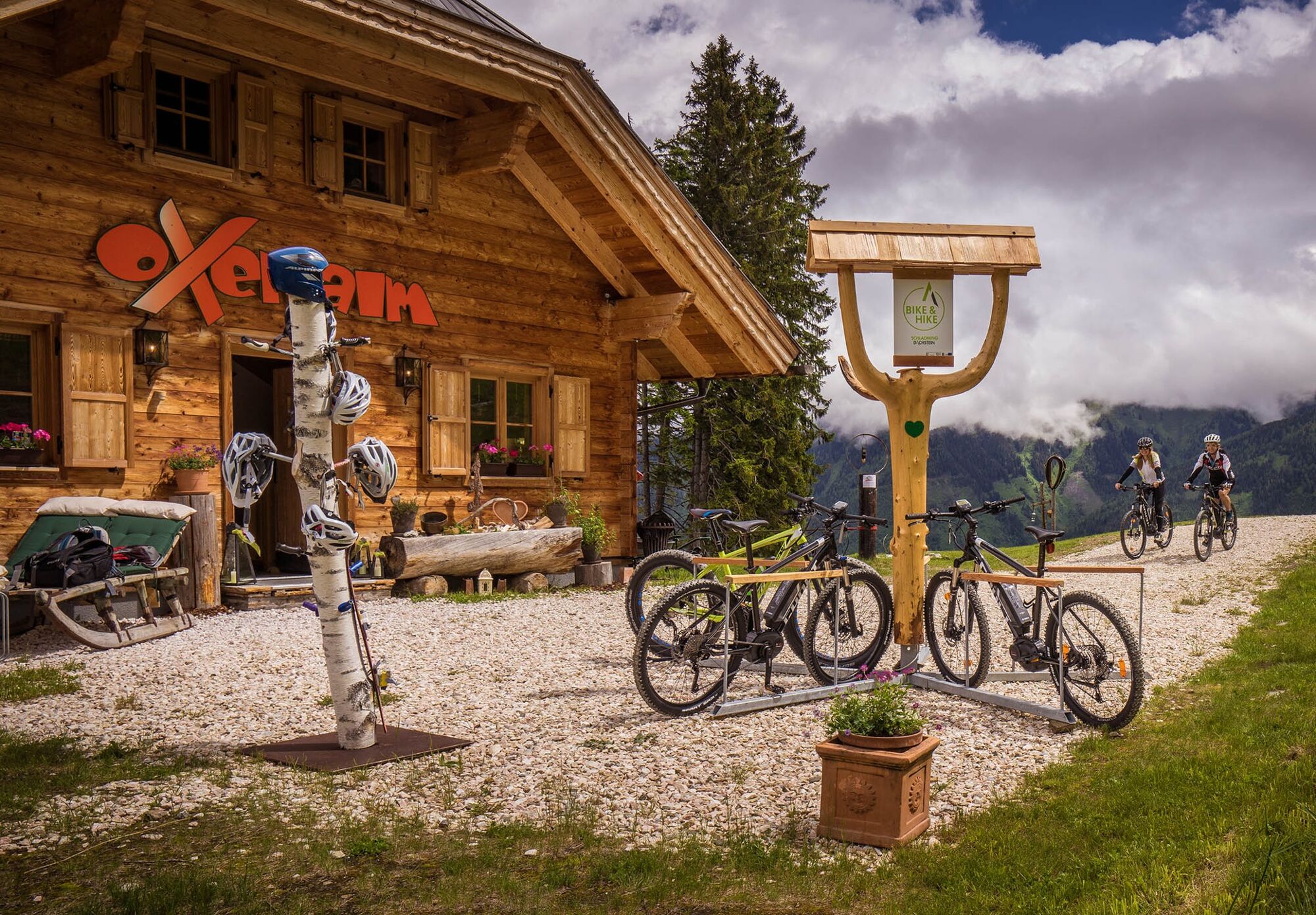
- Starting point
-
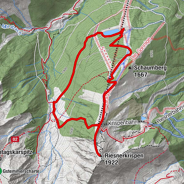
Oxenalm
- Route
-
Oxenalm0.0 kmRiesnerkrispen (1,922 m)3.2 kmHochsitz3.7 kmOxenalm5.8 km
- Best season
-
JanFebMarAprMayJunJulAugSepOctNovDec
- Description
-
Once your bike is parked and locked at the station, you start your hike to the Riesneralm at the Oxenalm.
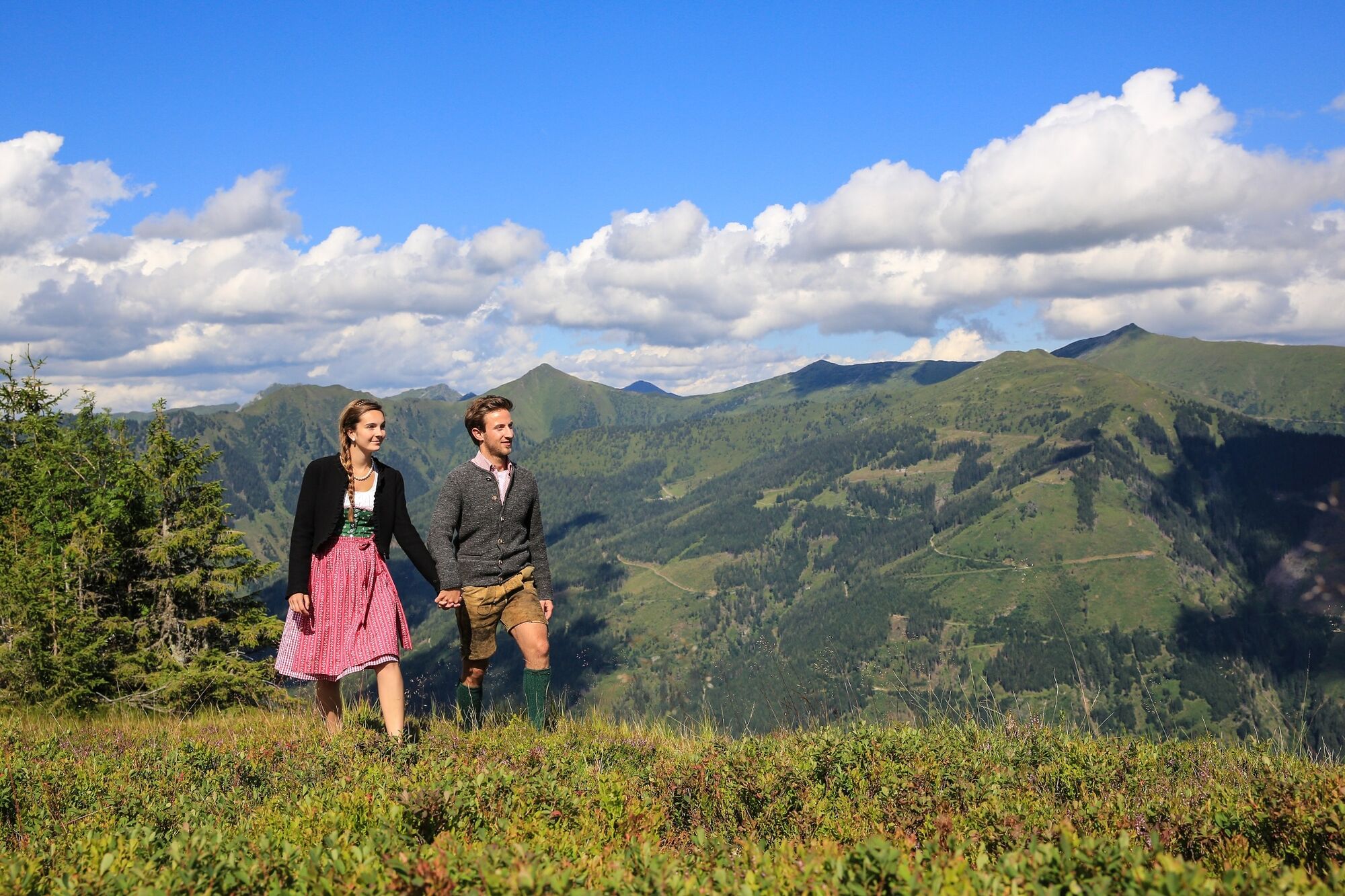
Grimming-Donnersbachtal in the Schladming-Dachstein vacation region offers the best conditions for hikers and mountain bikers with its breathtaking landscape experiences. Bike & Hike stations connect these popular vacation activities in an innovative way. You can cover longer forest or bike trails comfortably with your mountain bike or eBike. Once you arrive at the Bike & Hike Station, you have the opportunity to lock and charge your bike. Now you can - according to your individual wishes - start a relaxed hike or stop at the rustic alpine hut, right next to the station, and let your soul dangle.
https://www.schladming-dachstein.at/de/Regionales-und-Angebote/Touren/Moersbach-Runde-mit-Lademoeglichkeit_td_370677#13.39/47.37879/14.09998
- Directions
-
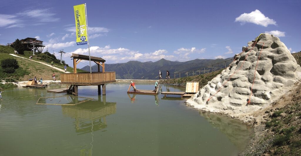
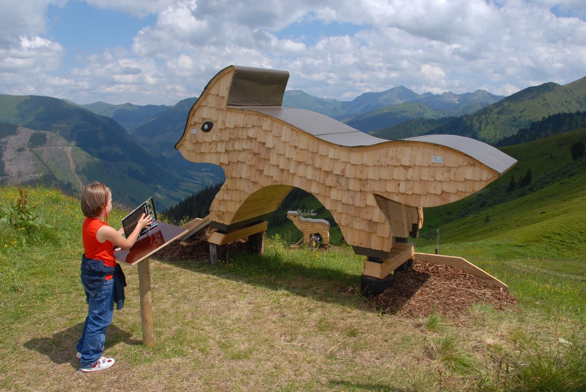
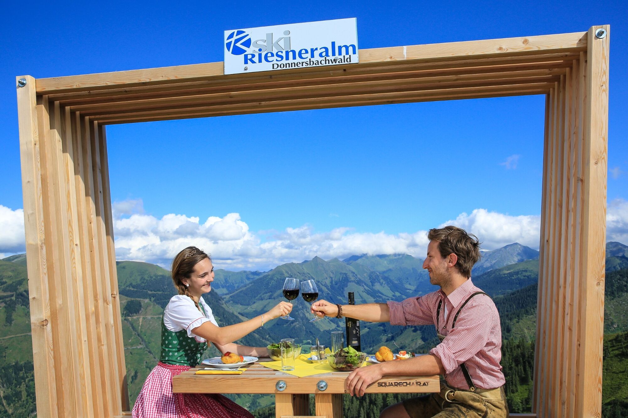
From the Oxenalm the trail leads past the reservoir down to the Hintere Mörsbachalm. In the area of the hut, the ascent takes place over alpine pastures and forest up to the Hochsitz and the summit experience Riesneralm with many spectacular attractions such as the summit bath anno dazumal, the TierHOLZpark, the HochSEEsitz or the GipfelBarfussWeg. Here you have the opportunity to make a detour to the Riesnerkrispen. From the SquareChair you can enjoy an incomparable panorama over the Tauern mountains. The loop then continues along the slope back to the starting point.
- Highest point
- 1,909 m
- Endpoint
-
Oxenalm
- Height profile
-

- Equipment
-
Good shoes and rainjacket.
- Safety instructions
-
Weather changes, rapid drop in temperature, thunderstorms, wind, fog and snowfields are objective dangers and require the right behavior on the way. Hut keepers are experienced mountain connoisseurs, they can give good tips on the weather and the course of the trail. Lack of equipment, overestimation of one's own abilities, carelessness, poor physical condition and a wrong assessment can lead to critical situations. In case of thunderstorms: avoid peaks, ridges, trees and rope belays at all costs.
In case of emergency, please dial the following emergency numbers: No. 140 - Mountain rescue No. 112 - Euro emergency call
- Tips
-
Take on swimwear. You can jump in the summitpool.
- Additional information
-
Tourism information: www.schladming-dachstein.at
Tourism blog: www.derbergdastal.at
Tourist Office Schladming-Dachstein
Ramsauerstrasse 756
8970 Schladming
T: +43 3687 23310
info@schladming-dachstein.at
Garbage on meadows and paths can not smell mountain and valley. Please take it with you. Agriculture and forestry are important partners for Berg und Tal. They allow you to walk and drive on many of their paths. Be aware that only good cooperation will guarantee your recreational enjoyment in the future.
- Directions
-
Coming from the B320, at the Trautenfels intersection in the direction of Irdning. Then direction Donnersbach, Donnersbachwald.
- Public transportation
- Parking
-
Parking in center of the town-near the accommodation Stegerhof.


-

-
AuthorThe tour Bike & Hike Riesneralm via Oxenalm is used by outdooractive.com provided.