
- Brief description
-
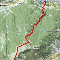
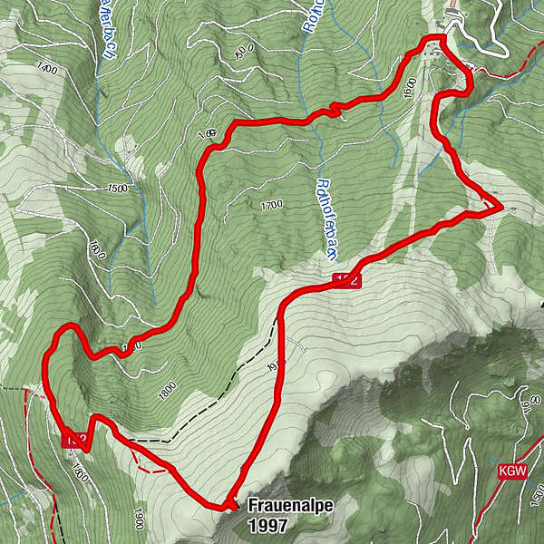
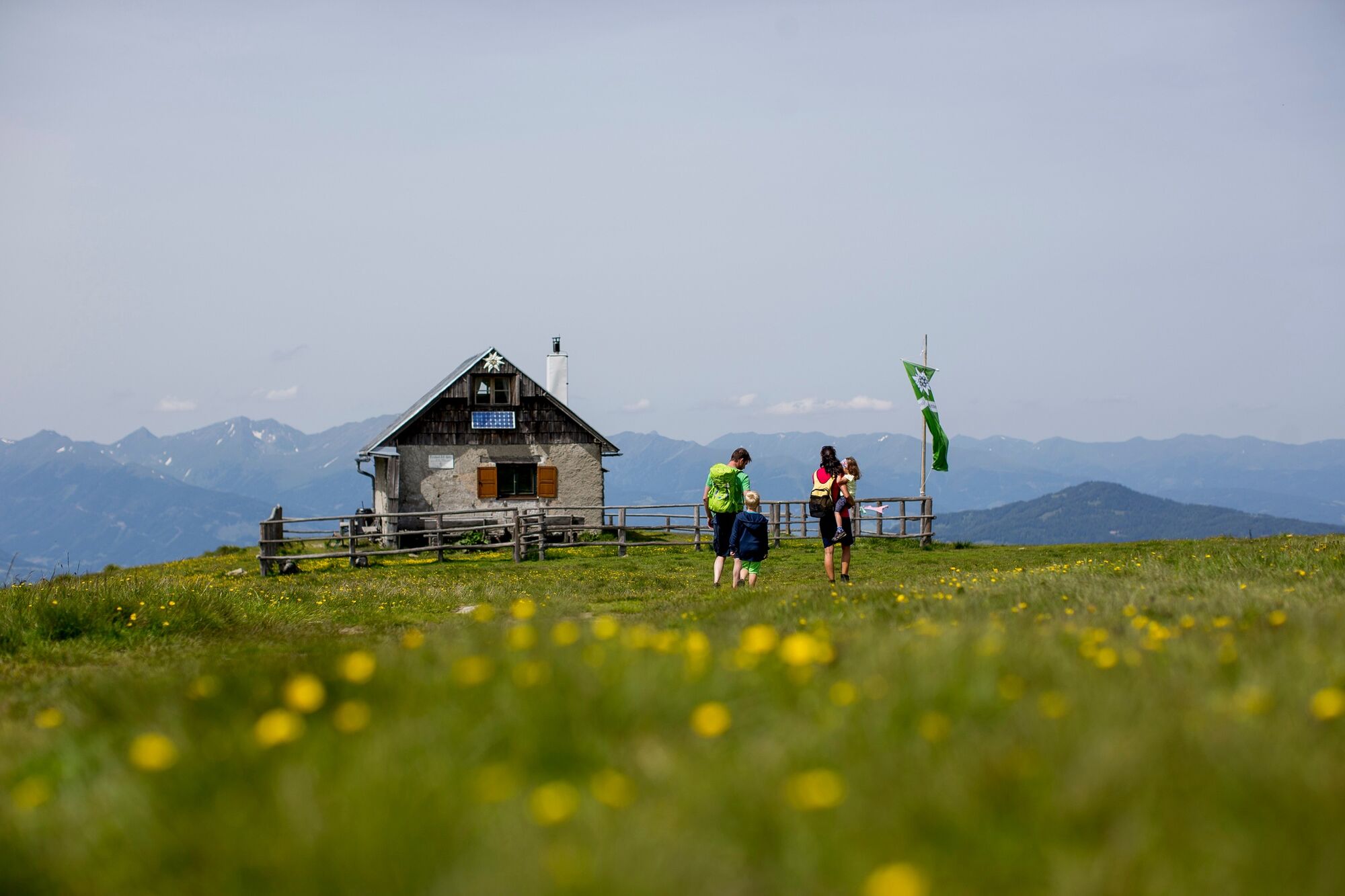
Starting from the Murauer Hut, the beautiful hike begins through the forest area over the Frauenalpen summit back to the starting point.
- Difficulty
-
medium
- Rating
-
- Starting point
-
Murauer Hütte, Frauenalpe
- Route
-
Murauer Hütte0.0 kmFrauenalpe (1,997 m)5.0 kmMurauer Hütte8.2 km
- Best season
-
JanFebMarAprMayJunJulAugSepOctNovDec
- Description
-
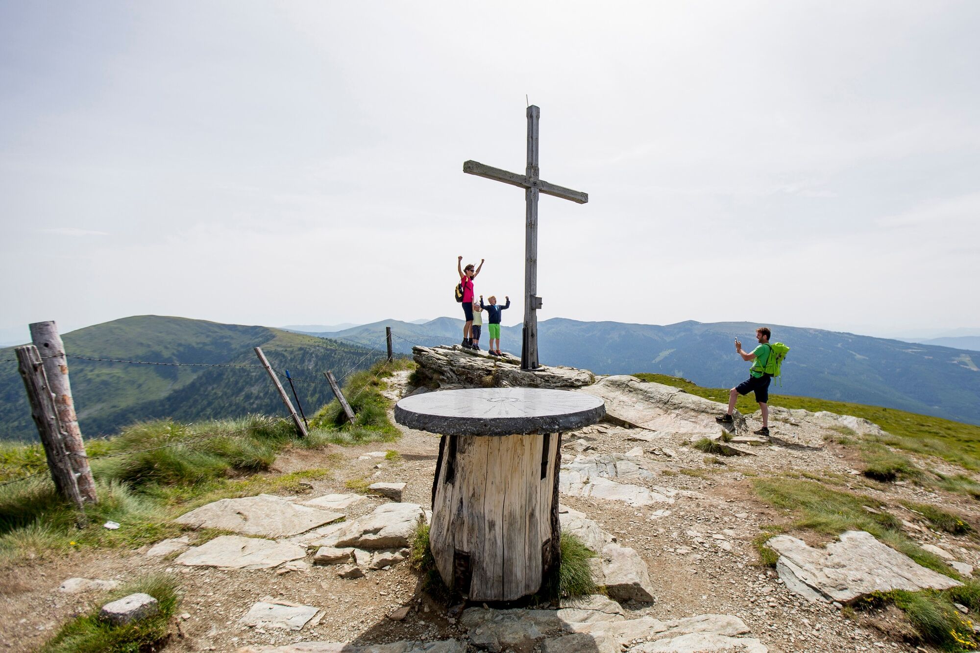
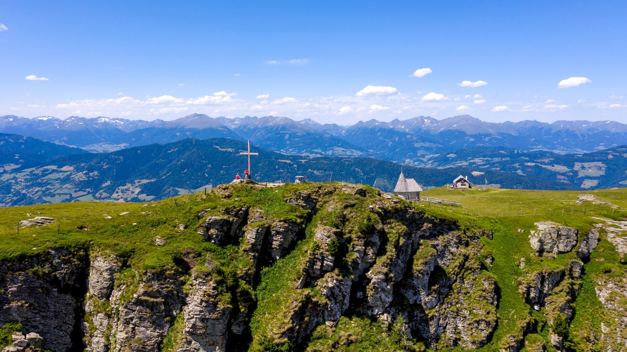
The hike leads through forest and woodland paths through wooded areas to the Troghütte. This is followed by the climb to the Frauenalpen summit or to the Bernhard-Fest-Hütte (not managed), from there it goes back to the starting point.
- Directions
-
From the Murauer Hütte car park, the path leads left into the forest path in front of the currently unmanaged Gasthof Krische. Follow the signs to the Troghütte (not managed). Then we go to the Frauenalpen summit and past the Apollonia Chapel and the Bernhard-Fest-Hütte back along the signposted path to the starting point.
- Highest point
- 1,991 m
- Endpoint
-
Murauer Hütte, Frauenalpe
- Height profile
-

- Equipment
-
Good footwear (sturdy high shoes with non-slip soles), rain, cold and sun protection, sufficient drinks, hiking map, emergency equipment (first aid kit, blister plasters, etc.).
Packing your backpack correctly makes a lot of things easier: pack heavy things first. The water bottle should be stored within easy reach in a side pocket. Items that are often needed such as sunglasses, camera, hiking map, etc. belong on top. - Safety instructions
-
Plan tours carefully & stay flexible. Take the right equipment. Obtain current weather information. If the weather is bad, cancel the tour.I n the event of an accident, remain calm. Emergency call for mountain rescue: 140 Take your waste with you to the valley. Calm behavior with animals on the mountain pastures. Be sure to keep dogs on a leash.
- Tips
-
Stop at the Murauer Hütte
- Additional information
-
The ideal time for this tour is from May to October.
- Directions
-
Coming from Judenburg via Unzmarkt to Scheifling. Turn right here towards Murau. In Murau turn left towards Schlatting. Follow the mountain road to the Gasthof Krische or the Murauerhütte.
Coming from Tamsweg via Ranten or Stadl an der Mur, always drive straight on to Murau. In Murau keep right towards Schlatting. Follow the mountain road to the Gasthof Krische or the Murauerhütte.
- Public transportation
-
With the BusBahnBim app from the interconnected line, timetable information is easier than ever before: all bus, train and tram connections in Austria can be queried by entering locations and/or addresses, stops or important points. The app is available as a free app for smartphones (Android, iOS) - on Google Play and in the App Store.
- Parking
-
Public parking spaces are available directly at the Murauer Hütte.
- Author
-
The tour Frauenalpe circuit (not signposted) is used by outdooractive.com provided.


General info
-
TourismusRegion Murau
1743
-
Nockberge
882
-
Frauenalpe - Murau
126