- Brief description
-
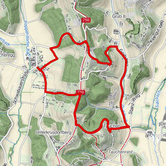
A circular hiking trail, which leads with 11 stations in a leisurely up and down through a soothing natural and cultural landscape from the spa to Unterlamm.
- Difficulty
-
easy
- Rating
-
- Starting point
-
Spa Loipersdorf
- Route
-
Hartegg3.2 kmMagland5.2 kmGasthaus Riegler7.6 kmUnterlamm7.7 kmLourdesgrotte7.7 kmThier Kapelle11.0 kmGeisterkapelle11.6 kmSieglhof12.2 km
- Best season
-
JanFebMarAprMayJunJulAugSepOctNovDec
- Description
-
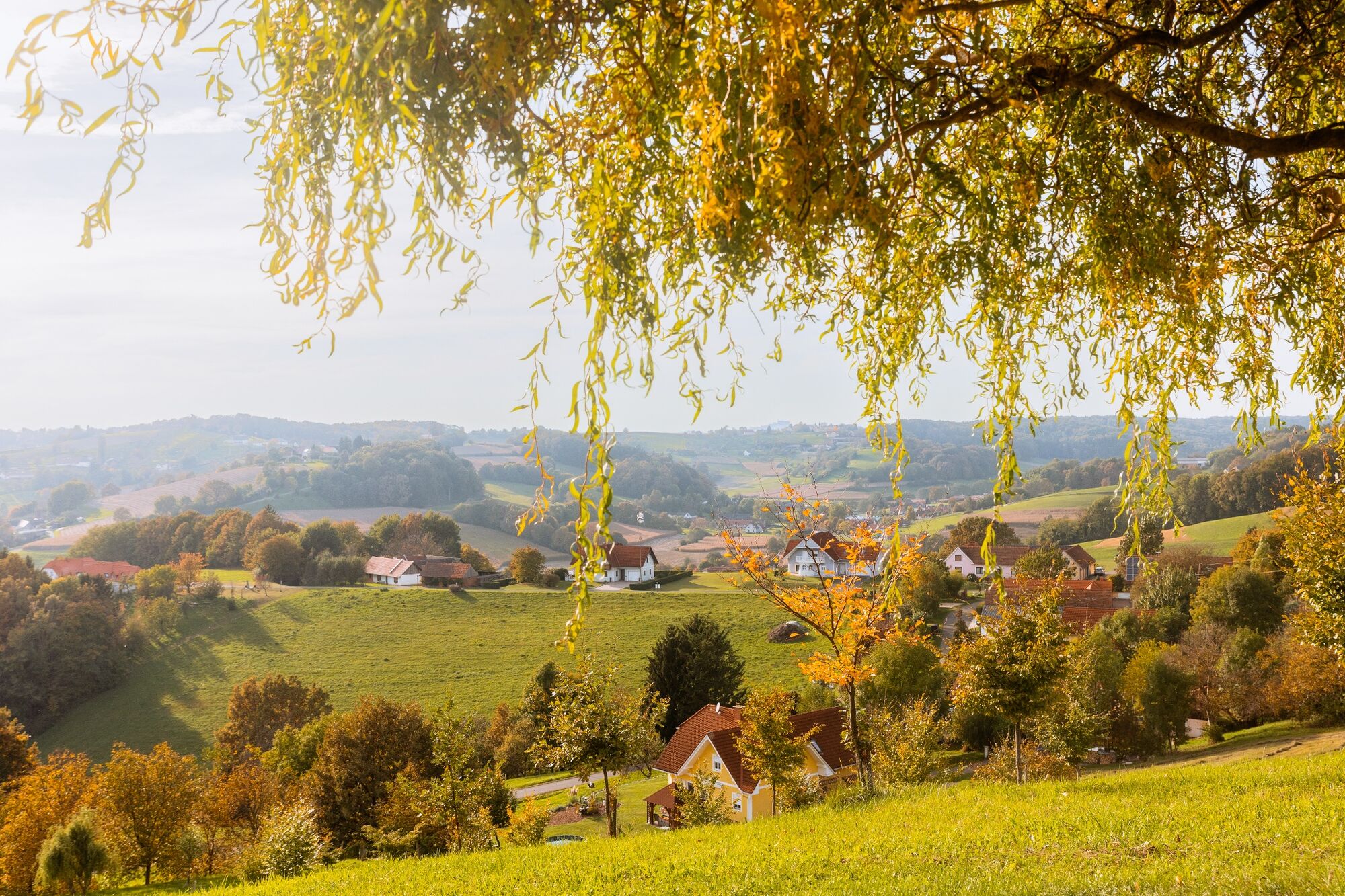
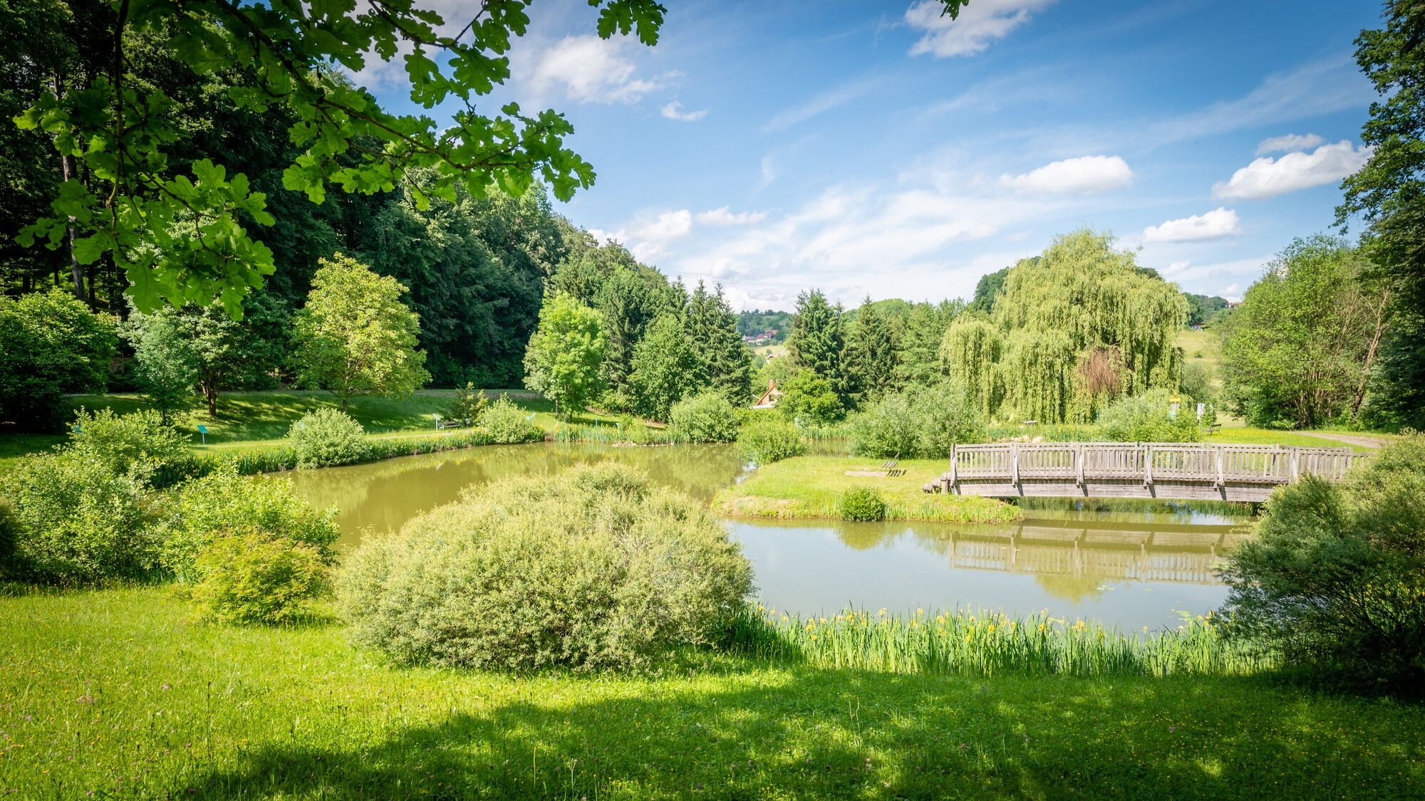
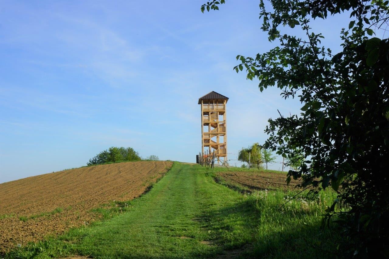
The "Experience Path of the Senses" hikes the area between the Loipersdorf spa and the village of Unterlamm. Along the way, 11 stations illustrate the natural and cultural area, the life of the people and the history of this region. The hiking trail leads over long sections through pleasant mixed forests and well-tended meadows and farmland. Again and again, comfortable resting places invite you to linger, so that this tour can also be arranged as an extended day hike. In this case, a picnic blanket and a regional snack should not be missing in the backpack, so that the pleasure can be perceived with all senses. In Unterlamm, the natural pond, the replica of the Lourdes Grotto and the lookout point are worth seeing.
- Directions
-
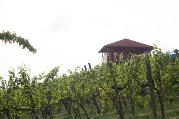
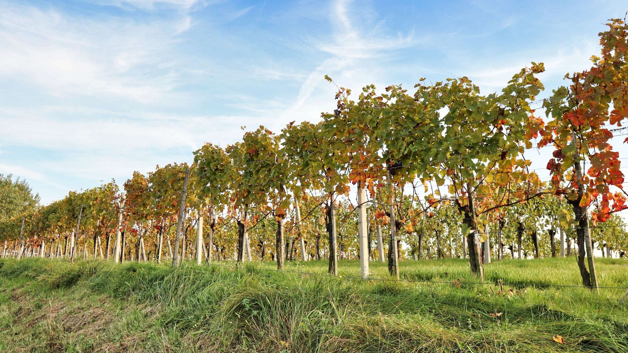
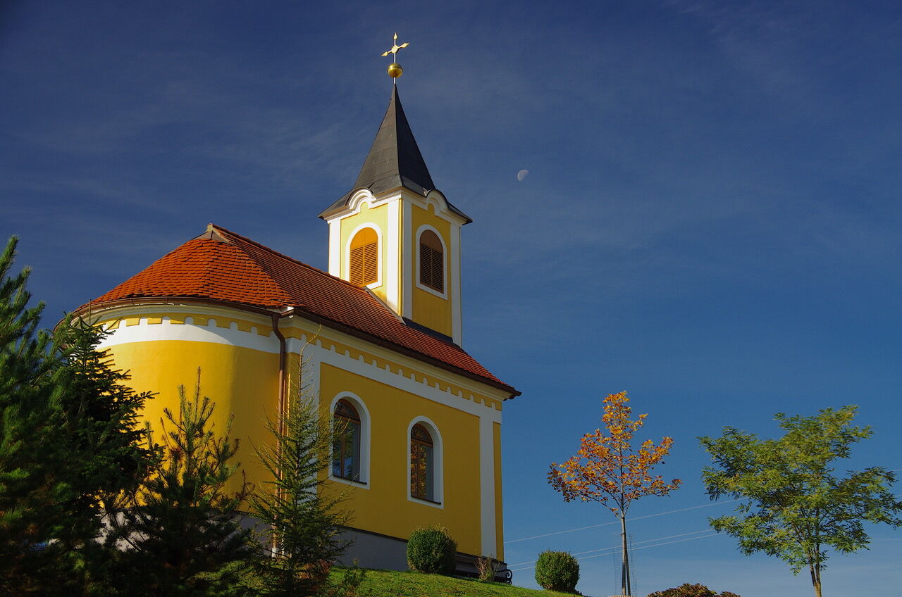
We start at the main entrance of the thermal spa Loipersdorf and go right in the direction of Hotel Stoiser. At the traffic circle we change the side of the road and after a few meters we see the entrance to several hiking trails on the right. We pay attention to the signs for the hand track and hike through the forest. After a short time we cross the road and continue through the forest in a slight up and down, always following the yellow signs "On the tracks of the volcanoes - Handspur". At the information board of the Roman burial mounds we turn left. When we come out of the forest, we walk along fields and meadows and reach station 7 with the rest and information place "Zu die Nachbarn schaun". We pass a farm and immediately turn left. It goes through the forest and over meadows until we reach the Haselbach chapel. At the chapel we keep to the right and walk slightly downhill over meadows and fields until we reach an asphalt road. Now we go downhill to the left, past vineyards, until we reach the valley floor. Turn right along the road until, after the bus stop "Magland Abzw. Stambach", we see the turnoff to the left. We walk across the fields and reach the Lehenbach, which we follow upstream. In Magland we walk a bit along the village street and then turn left over the bridge. It goes through the sparsely populated area, keeping straight on in a left turn and passing directly by the houses. Immediately after, we continue walking on fields until we make the loop to the pond facilities just before Unterlamm. The natural pond complex Unterlamm consists of three ponds and numerous information boards about the Celtic tree calendar. We walk a loop around the ponds and follow the asphalt road downhill and arrive in Unterlamm. In front of the center we walk to the right to the church. At the back of the church you can see the Lourdes Grotto, a replica of the Marian Grotto of Lourdes. Now we go uphill along an asphalt sidewalk, then turn right and walk along the road through the populated area. At a crossroads we turn left, continue slightly uphill and soon come to a meadow path that leads over a panoramic ridge. We reach the lookout point and hike level or slightly uphill over this hilly landscape. The trail continues along an asphalt road until we reach station 3 "Enjoy our wines". Continuing past the Weingarten Resort with the "smallest restaurant in Austria" and the "Speisenmanufaktur", we follow the asphalt road until we see the turnoff into the forest on the left. At this turnoff, the signposts are not directly next to the road, but somewhat hidden at the edge of the forest. From now on, the trail always goes through the forest, passing the back of a chapel and continuing in a slight up and down. The trail joins an asphalt road that passes by the Sieglhof farm. After a short while we turn right into the forest and the path runs more or less parallel to the road until we reach the crossing point at the Roman tumuli and go back the way we already know.
- Highest point
- 375 m
- Endpoint
-
Spa Loipersdorf
- Height profile
-

- Equipment
-
Smart backpack packing makes hiking life easier: Always question the equipment - what do I really need? Pay attention to a balanced load distribution. Carry heavy items as close to your body as possible. Put things that are needed often - such as sunglasses, camera or hiking map - in the top lid compartment. Take enough liquids with you and stow them in a side pocket for easy access. Don't forget a snack or muesli bar for energy. Don't forget cash!
An emergency kit belongs in every rucksack!
First aid kit, mobile phone with fully charged battery, hiking map or GPS device for orientation, small pocket knife.
Protection against heat and cold - it is always advisable to dress according to the "onion system"!
Cap, sun cream & sunglasses, thin hat & gloves, change of clothes, rain jacket
A good hiking boot is a perfect companion and should never be missing!
Don't forget blister plasters just in case!
If necessary, hiking poles are recommended!
- Safety instructions
-
Emergency call mountain rescue: 140
ambulance: 144
European emergency call: 112
firefighters: 122
police: 133Tips when reporting an emergency – Answer these six WH questions: What happened? How many people are injured? Where did the accident happen (are there GPS coordinates)? Who is reporting the incident (callback number)? When did the accident happen? What is the weather like at the site of the incident?
- Tips
-
Take your time at the lookout in Unterlamm, as the view of the soft-formed landscape and the vegetation give you a real "Tuscany feeling".
- Additional information
-
Einkehrmöglichkeiten in Loipersdorf/Therme Loipersdorf
Gasthaus Jandl, Tel.: +43 3382 8246, 8282 Loipersdorf, Loipersdorfer Hauptstraße 4
Kleine Landküche, Tel.: +43 3382 82105, 8282 Loipersdorf, Rittscheintalstraße 80, www.kleinelandkueche.at
Zum Horst, Tel.: +43 3382 8385 495, 8282 Loipersdorf, An der Therme 216, www.jahreszeiten.at
Don Camillo, Tel.: +43 3382 820 441, 8282 Loipersdorf, Thermenstraße 152
Kowald`s Bistro, Tel.: +43 3382 8282, 8282 Loipersdorf, An der Therme 215, www.kowald.com
Einkehrmöglichkeiten in Unterlamm
Gasthaus Lenz-Riegler, Tel.: +43 3155 8203, 8352 Unterlamm 8, www.lenz-riegler.at
Landgasthaus Wallner, Tel.: +43 3155 8207, 8352 Unterlamm 21
Restaurant „Die Speisenmanufaktur“, Tel.: +43 676 356 5651, 8352 Unterlamm 177, www.weinurlaub.at
- Directions
-
From Vienna: A2 to exit Ilz/Fürstenfeld. From here via Fürstenfeld bypass to Bad Loipersdorf.
From Graz: A2 direction Vienna until exit Ilz/Fürstenfeld. From here via the Fürstenfeld bypass to Bad Loipersdorf.
FROM WESTERN AUSTRIA AND BAVARIA
By car: via Salzburg on the Phyrn-Autobahn (A9) and the Süd-Autobahn (A2) or via Carinthia on the Süd-Autobahn (A2) to exit Ilz/Fürstenfeld. From here via Fürstenfeld bypass to Bad Loipersdorf.
FROM ITALY OR SLOVENIA
By car: via Villach on the southern freeway (A2) to the Ilz - Fürstenfeld - Bad Loipersdorf exit or via Maribor on the Phyrn freeway (A9) and the southern freeway (A2) in the direction of Vienna to the Ilz/Fürstenfeld exit. From here via Fürstenfeld bypass to Bad Loipersdorf.
Detailed information on how to get there can be found here.
THERMENLANDBUS
The Thermenland bus runs two times a day on weekdays and once a day on Saturdays, Sundays and public holidays between Vienna and the Loipersdorf spa resort.
- Public transportation
-
Detailed information about arriving by ÖBB (Austrian Federal Railways) can be found at www.oebb.at or on the Verbundlinie Steiermark website www.busbahnbim.at
With Verbundlinie’s BusBahnBim route planner app, planning your journey has never been easier: simply enter towns and/or addresses, stop names or points of interest to check all bus, train and tram connections in Austria. The app is available free of charge for smartphones – on Google Play and in the App Store
- Parking


- Author
-
The tour Experience path of the senses (Erlebensweg der Sinne) is used by outdooractive.com provided.