
- Brief description
-
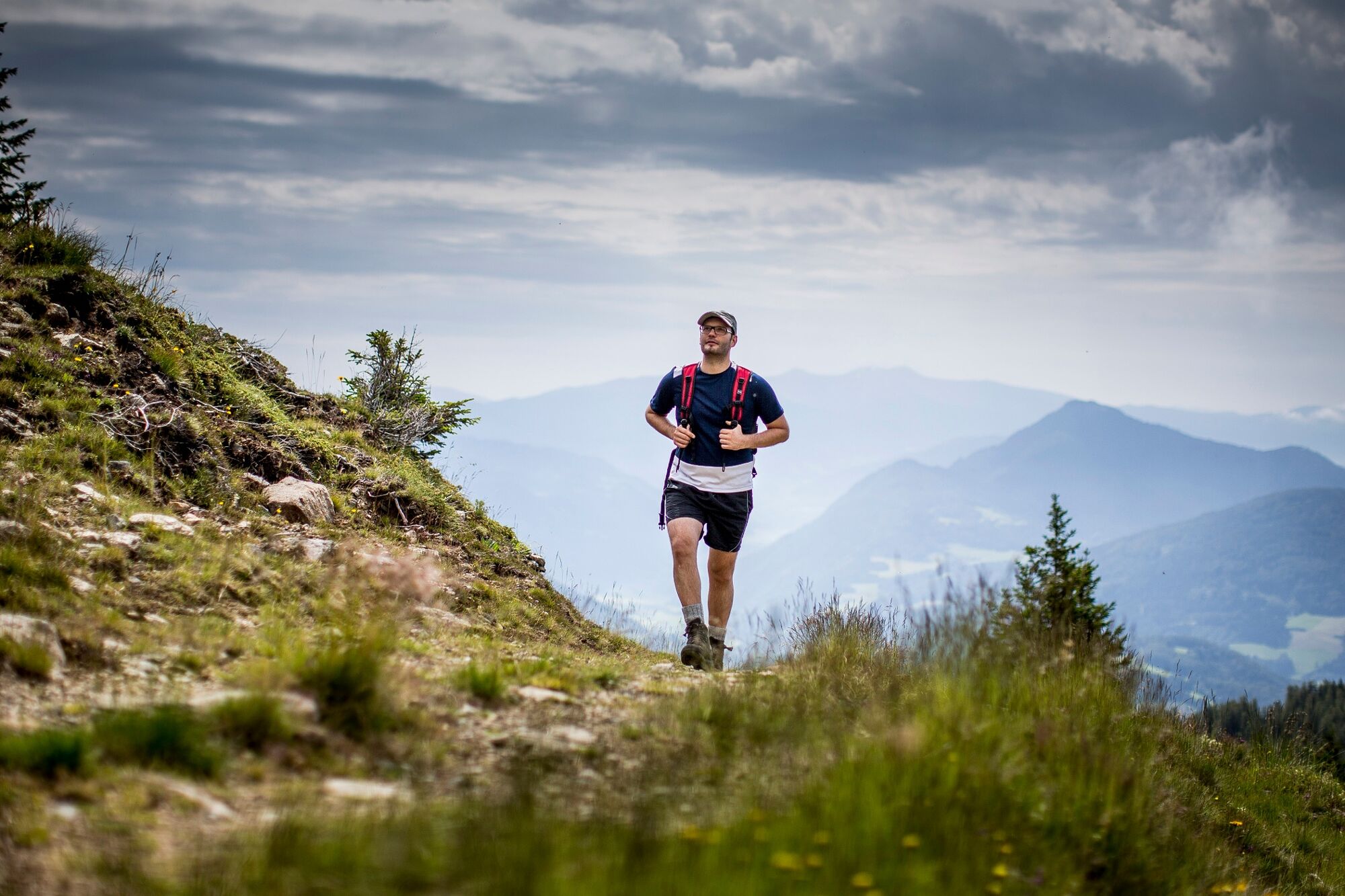
The Preber summit is a rewarding and very popular tour destination for young and old. It can be hiked from the Styrian side but also from the Salzburger side.
- Difficulty
-
difficult
- Rating
-
- Starting point
-
Klausnerberg saw
- Route
-
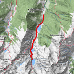
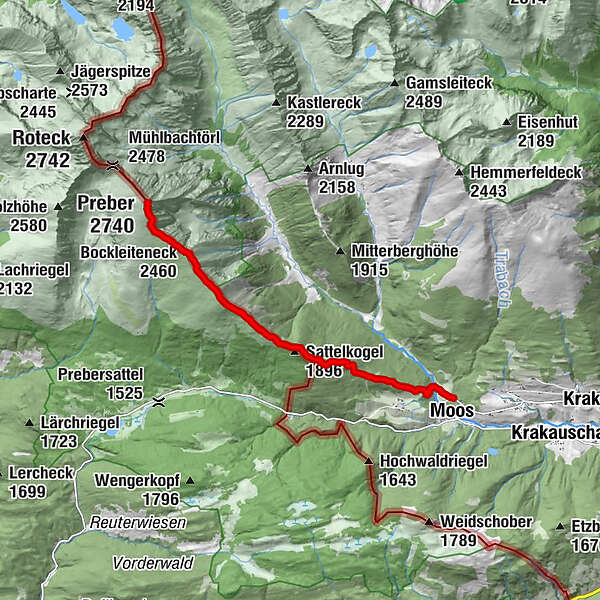
MoosGrazer Hütte3.5 kmSattelkogel (1,896 m)3.6 kmSatteleben (1,870 m)3.7 kmBockleiteneck (2,460 m)6.3 kmRossscharte6.9 kmPreber (2,740 m)7.6 km
- Best season
-
JanFebMarAprMayJunJulAugSepOctNovDec
- Description
-
However, the ascent from the Klausnerberg saw to the Grazer Hütte and over the Trogleiteck and the Bockleiteneck to the summit is particularly beautiful. Over the ridge, the tour leads from the hut in 2 hours (850 HM) to the summit. Once at the top, all efforts are rewarded by the fabulous panoramic view!
- Directions
-
From the Klausnerberg sawmill (parking possibility) after approx. 200m on the forest road turn left through a slightly ascending forest section in direction W. On the hiking trail 786 to the Grazerhütte, which we pass half left in direction Satteleben. At the fork we follow trail 787 in the direction of Bockleiteneck. Across the rather steep summit slope we finally reach the Roßscharte and the peak of the Preber, at 2,740m, which lies slightly behind it.
Characteristics: Not too difficult ascent; also suitable for families
Due to its height, there is a magnificent view over the entire Niedere Tauern, to the Dachstein, the Hohe Tauern with Hochalmspitze, Ankogel and Großglockner to the Julian Alps in the south.
On the same way back to the Klausnerberg saw.
- Highest point
- 2,726 m
- Endpoint
-
Klausnerberg saw
- Height profile
-

- Equipment
-
Good footwear
Sun protection
Sufficient food - Tips
-
Refreshment stop: Grazer Hütte
- Additional information
-
The ideal time for this tour is from June to October.
- Directions
-
East: From Vienna on the A 2 and S 6 to Leoben and St. Michael i. d. O., continue on the S 36 to Judenburg and on the B 96 to Murau. From Murau via Ranten to Krakau.
From Graz on the A 9 to St. Michael i. d. O.. Further see above.
West, north: From Bregenz/Innsbruck via the A 12, A 93 and A 8 to Salzburg. From Salzburg on the A 10 to St. Michael im Lungau. From here on the B 96 to Tamsweg and on towards Murau via Sauerfeld to Krakau.
South: From Klagenfurt on the B 83 to Scheifling. Then on the B 96 to Murau and further into the Krakau.
- Public transportation
-
With the BusBahmBim app from Verbundlinie, timetable information has never been easier: all bus, train and streetcar connections in Austria can be queried by entering locations and/or addresses, stops or important points. The app is available as a free app for smartphones (Android, iOS) - on Google Play and in the App Store.
- Parking
-
Parking is available directly at the Klausnerberg saw.

- Author
-
The tour Preber summit tour is used by outdooractive.com provided.