© TV Gesäuse - Christian Scheucher

© Tourismusverband Wildalpen - Christian Scheucher

© Tourismusverband Wildalpen - Christian Scheucher

© TV Gesäuse - Christian Scheucher

© TV Gesäuse - Christian Scheucher

© TV Gesäuse - Christian Scheucher

© TV Gesäuse - Christian Scheucher

© TV Gesäuse - Christian Scheucher

- Brief description
-
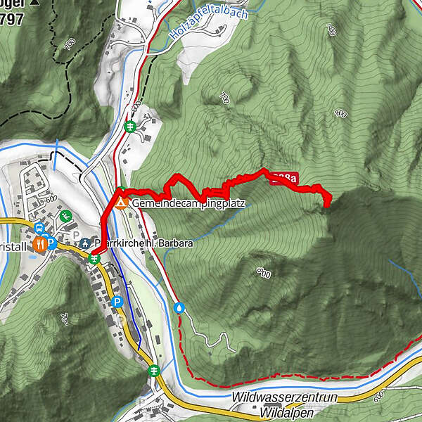
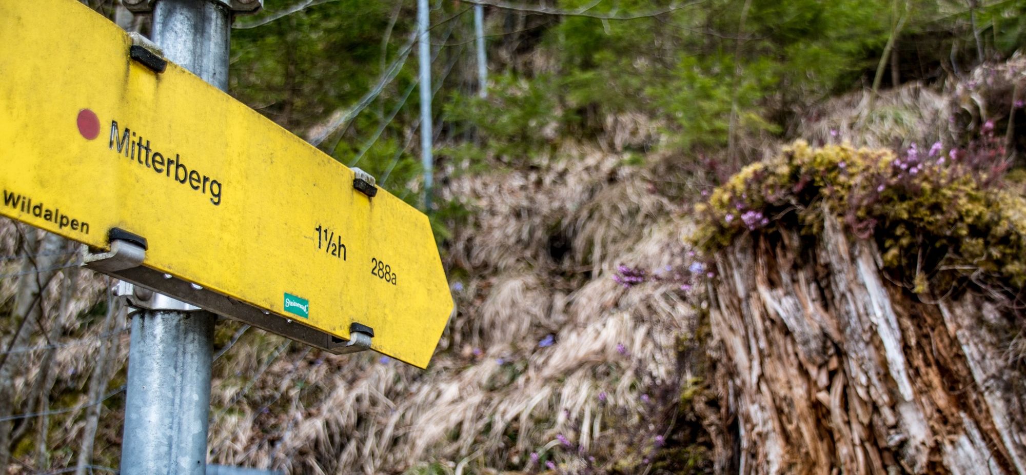
Camping-Wildalpen - moderately difficult path - summit Mitterberg - moderately difficult path - Camping-Wildalpen
- Difficulty
-
medium
- Rating
-
- Route
-
Mitterberg (978 m)1.2 kmPfarrkirche hl. Barbara2.6 kmWildalpen (609 m)2.6 km
- Best season
-
JanFebMarAprMayJunJulAugSepOctNovDec
- Description
-
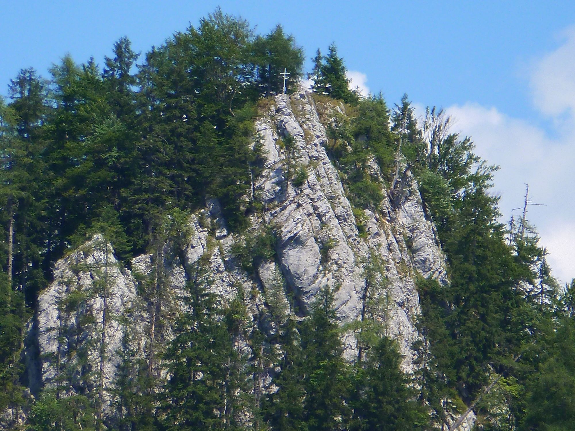
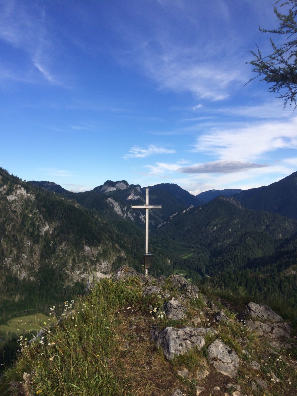
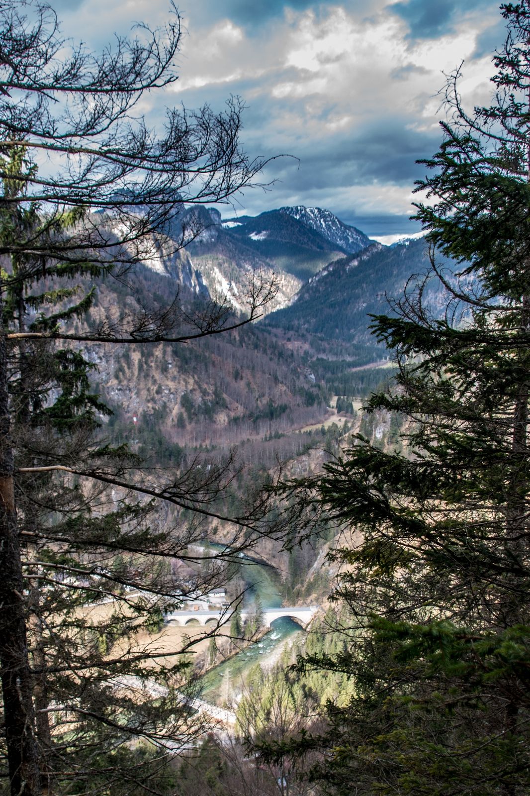
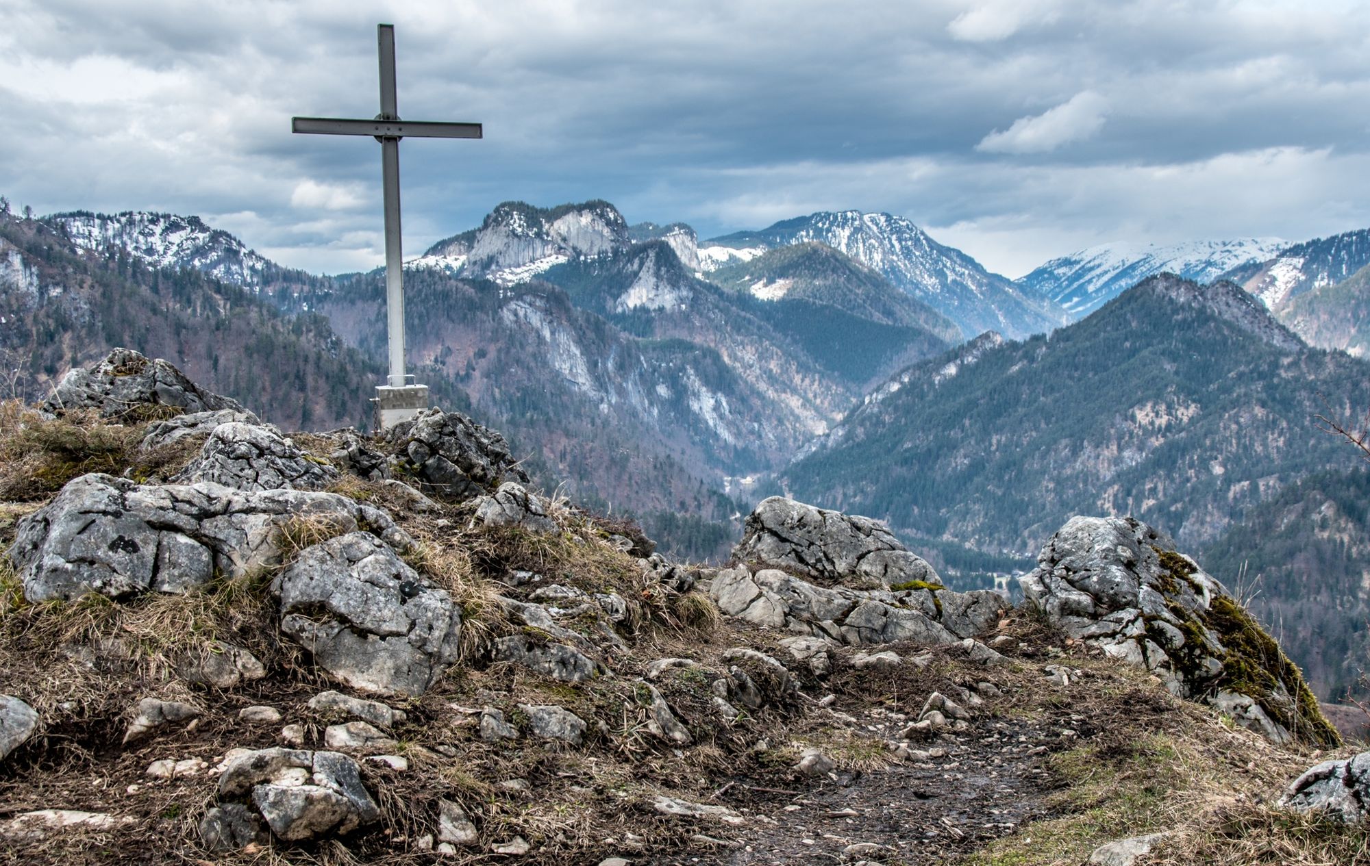
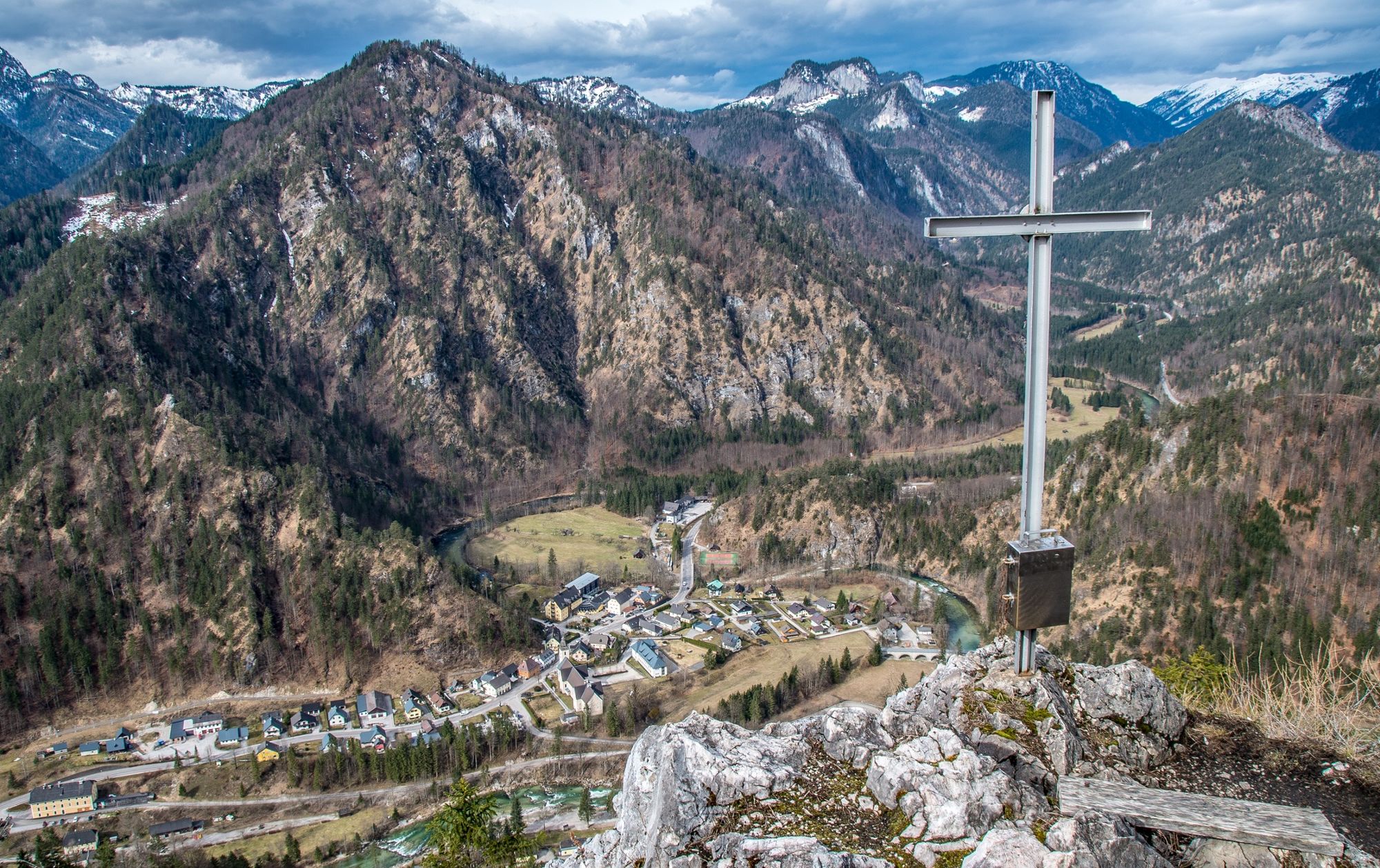
The Mitterberg offers truly one of the best views over the Village. The last meters to the summit are quite steep. At the summit there is enough area to rest.
- Directions
-
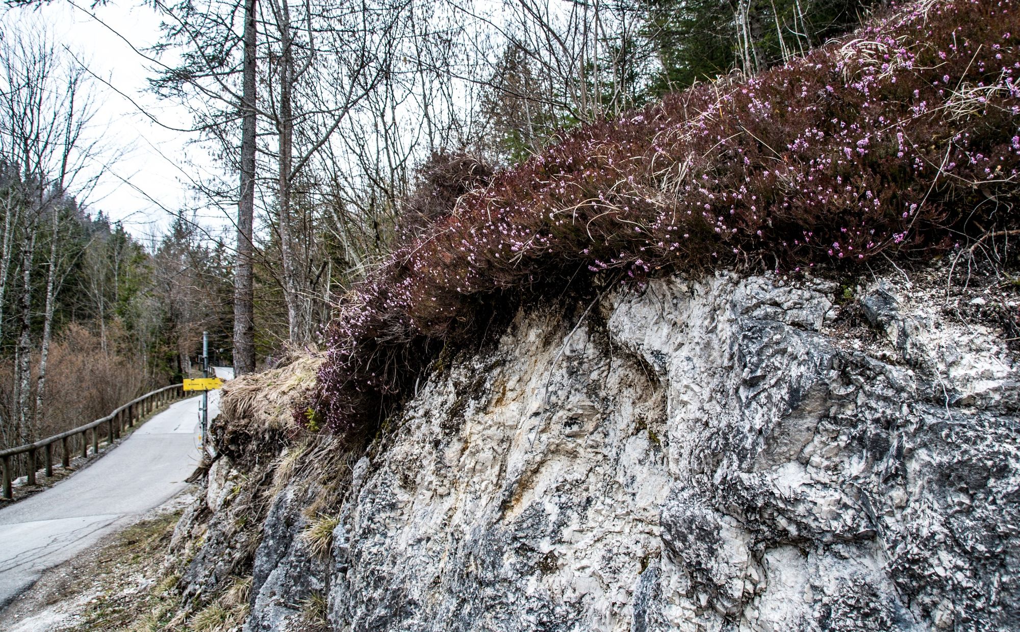
Starting from the large signpost next to the Barbarakirche Wildalpen, you go direction Salza, where you cross the old wooden bridge, above the campsite directly to the entrance of the path to the Mitterberg. Follow a steep and serpentine path and reach a ridge. In the area of the last 50 meters the path becomes very steep again. The plateau at the summit cross invites you to a well deserved rest.
1.5 hours wlak to the Summit
Refreshment tip in Wildalpen: Café Restaurant Grabner, Hotel Bergkristall or Paddler Stüberl
- Highest point
- 961 m
- Endpoint
-
Wildalpen Ort
- Height profile
-

- Equipment
-
Sturdy mountain boots or good trekking shoes, as well as a hiking rucksack with appropriate contents (water bottle, first aid, hiking map, sun protection, snack, etc.). You should also be well equipped for a change in the weather. Mobile phone for emergency calls
- Safety instructions
-
could be verry sliperry if it rains
- Tips
-
Take your time and enjoy the beautifull view
- Additional information
-
Infobüro/Salza Wildalpen
Wildalpen 91 – 8924 Wildalpen Tel. 03636/241 infosalza@gesaeuse.at
Mo und Fr. 9:00-17:00
- Parking
-
you canPark right next to the Church

-
-
AuthorThe tour Mitterberg Wildalpen is used by outdooractive.com provided.
GPS Downloads


Other tours in the regions
-
Erzberg Leoben
2529
-
Hochschwab
1273
-
Wildalpen
254